KOA Acton to Agua Dulce
|
|
|
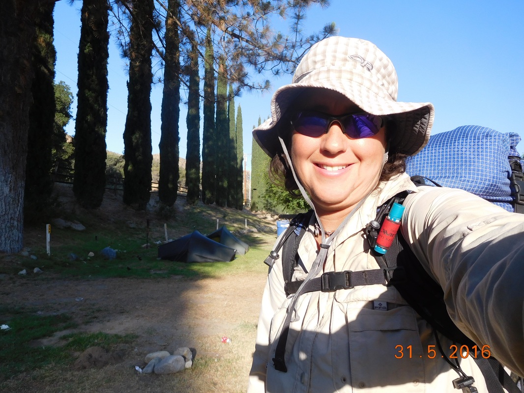
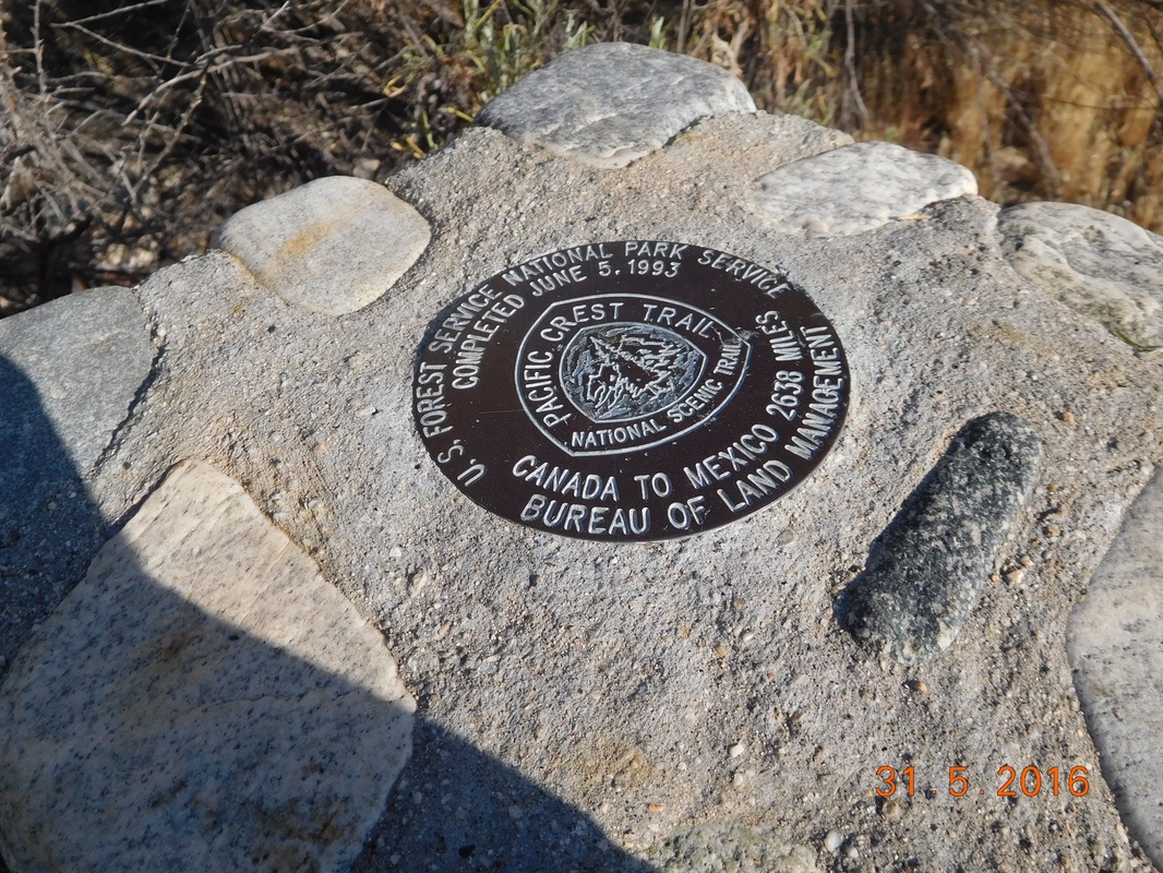
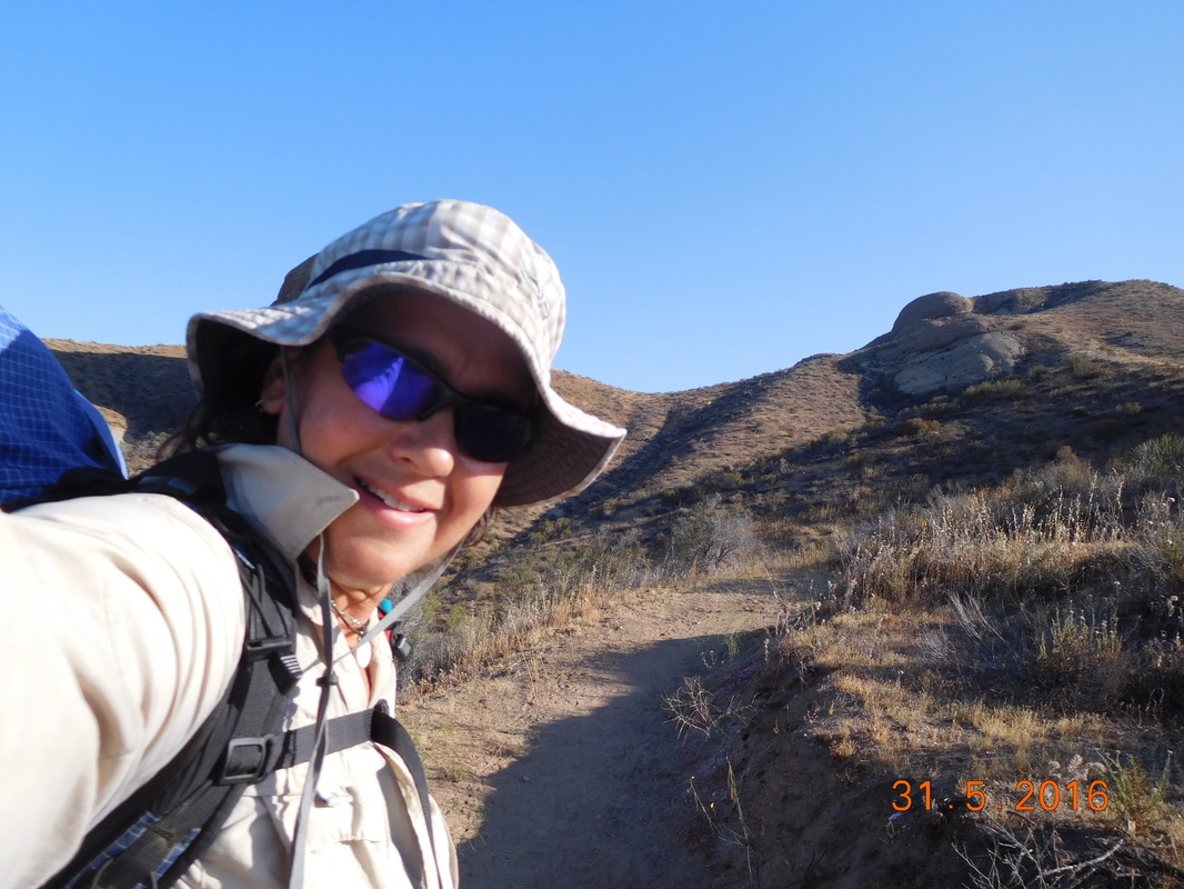
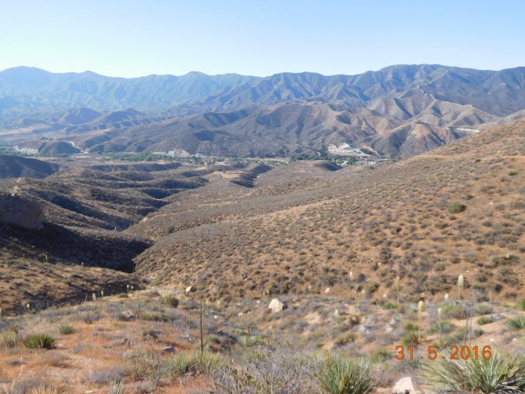
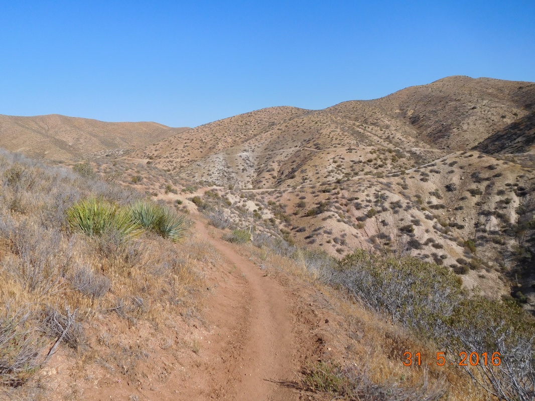
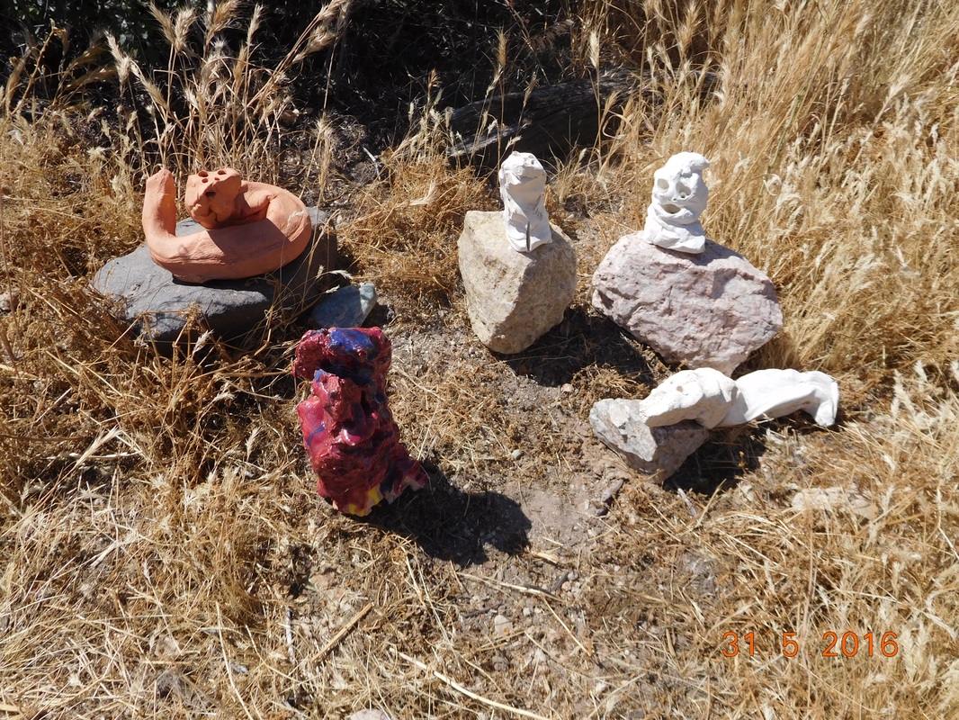
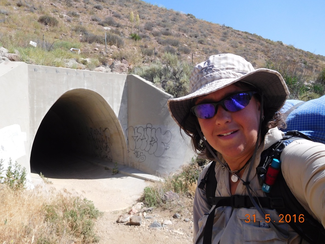
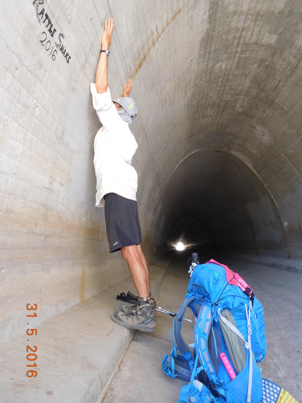
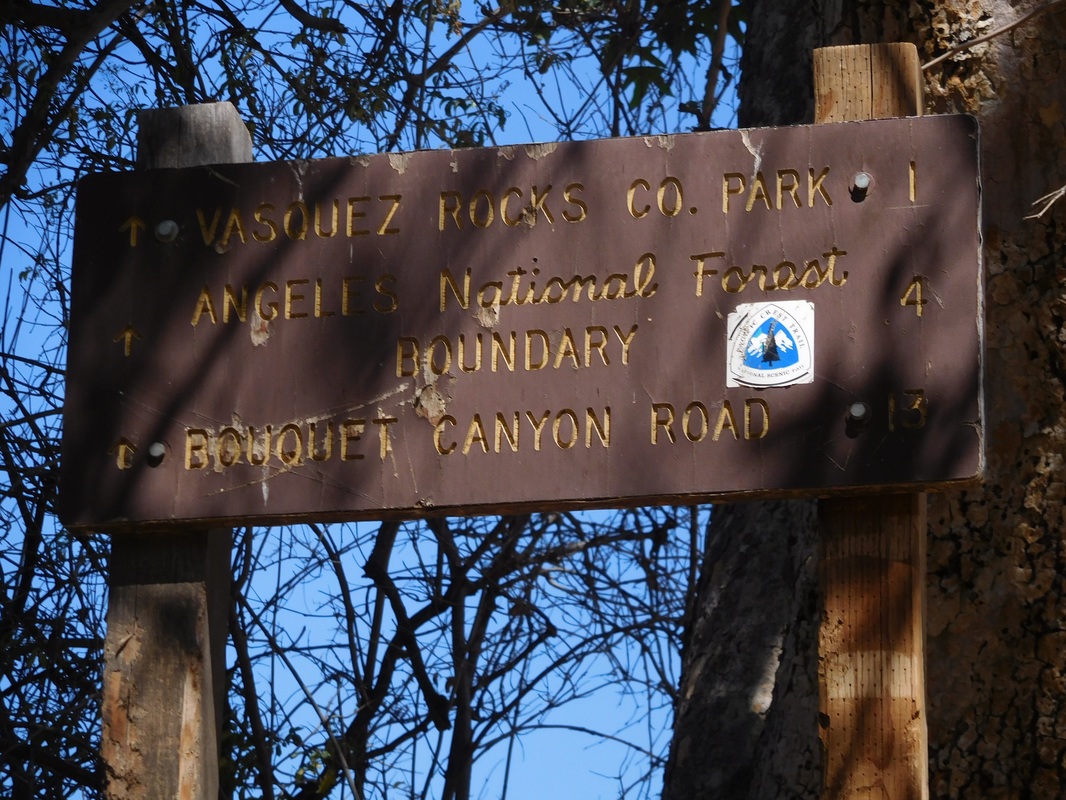
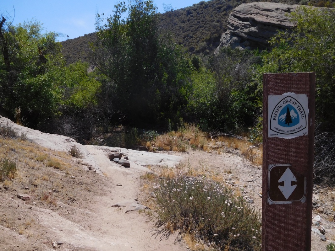
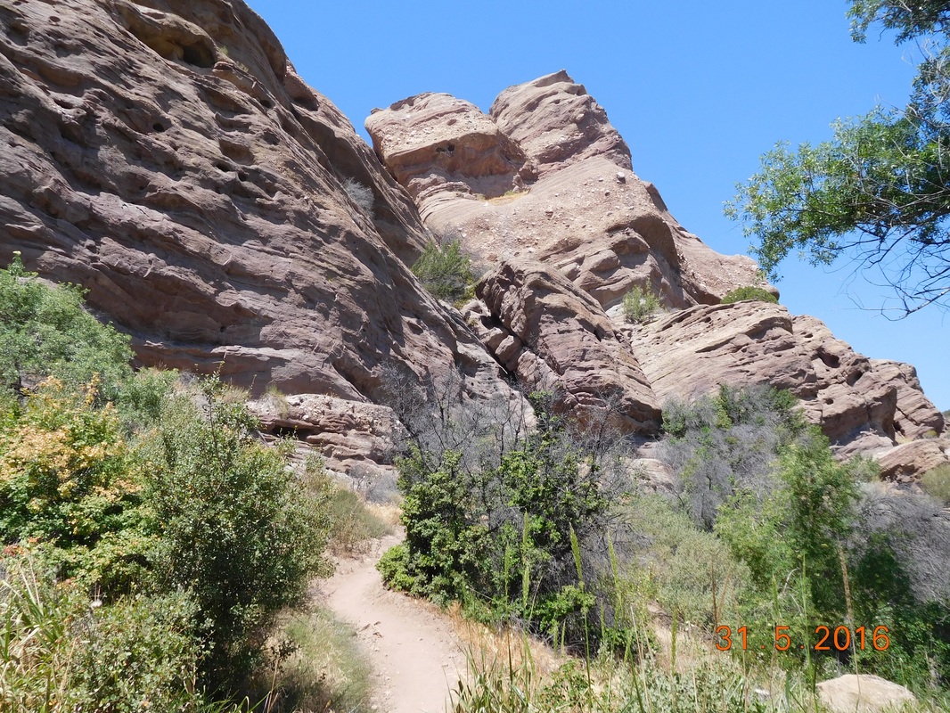
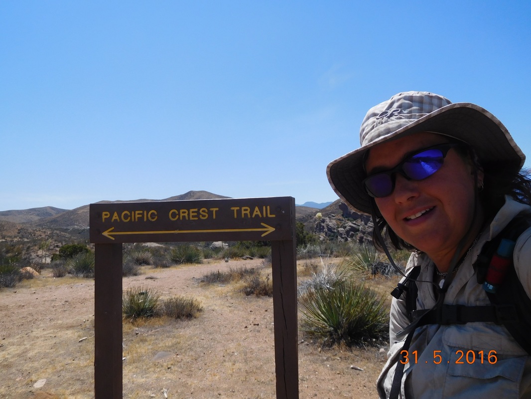
Messenger Flats Campground to KOA ActonAfter I finished the blog last night the outside noise went on until around 10:00 PM and then 3 more hikers wandered into camp. What is with these people hiking so late into the night? After everyone quieted down I slept really well. As expected, the noise started at 5:30 AM and I finally stopped trying to ignore it and woke at 5:50 AM. I got out of the tent and noticed that many people were already gone, but I got a picture of many that were still here.  Hikers, hikers everywhere. Oh...I was able to get a picture of "Neon Butt Cheeks" before he left camp.  Neon Butt Cheeks. As I was packing up I started talking to a couple, Double Puff (she carries 2 puffy jackets) and Special Ops. Of course the rattlesnake thing came up so I had to tell the story. I finally made it out of camp and was ready to hike at 7:38 AM. Wow...I'm usually not even close to being ready to hike by this time.  Getting an early start. Today's hike is not supposed to be too hard. It is 5.63 miles to the North Fork Ranger Station where there is water and picnic tables so that it is the initial goal. On the way there was some amazing wildflowers and scenery. 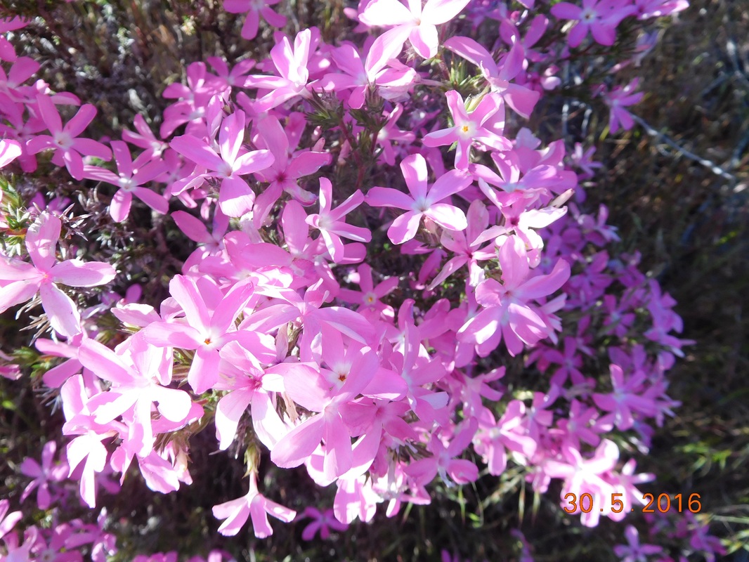 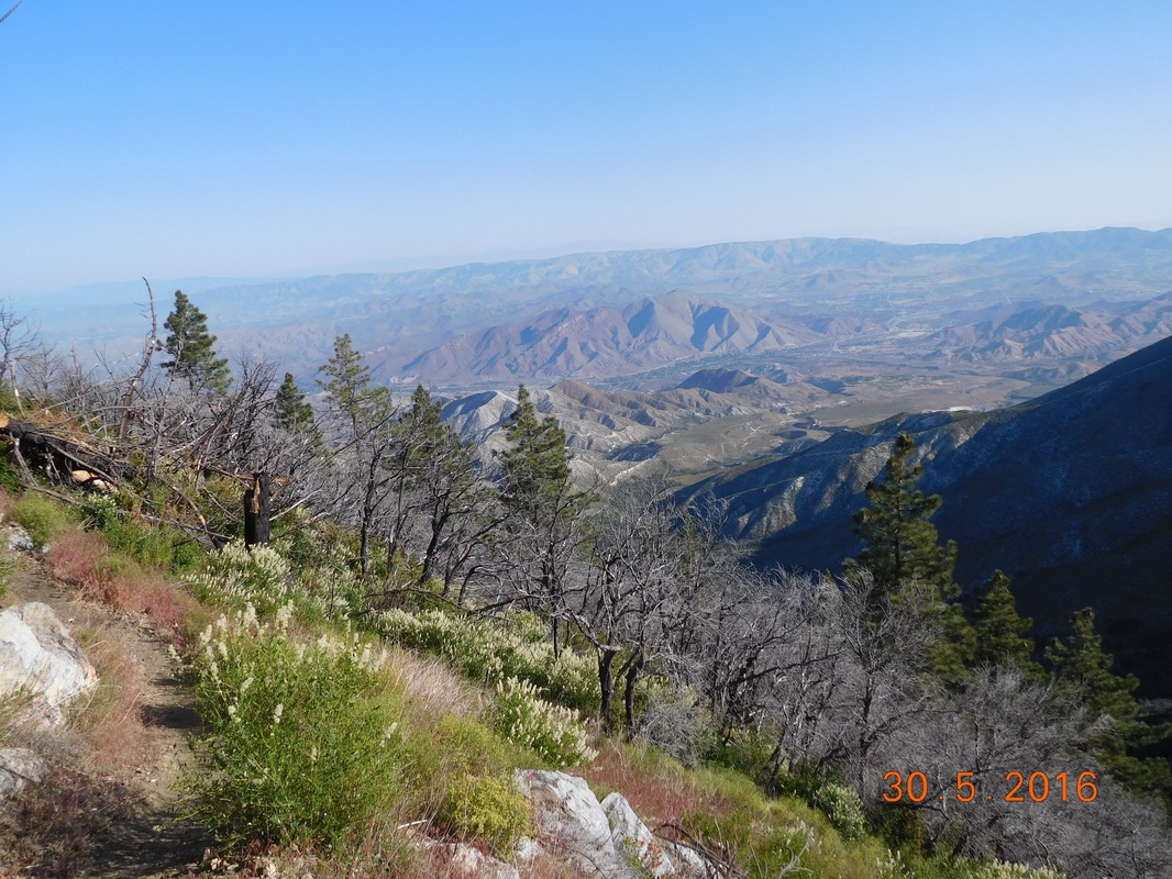 Cool mountains in the distance 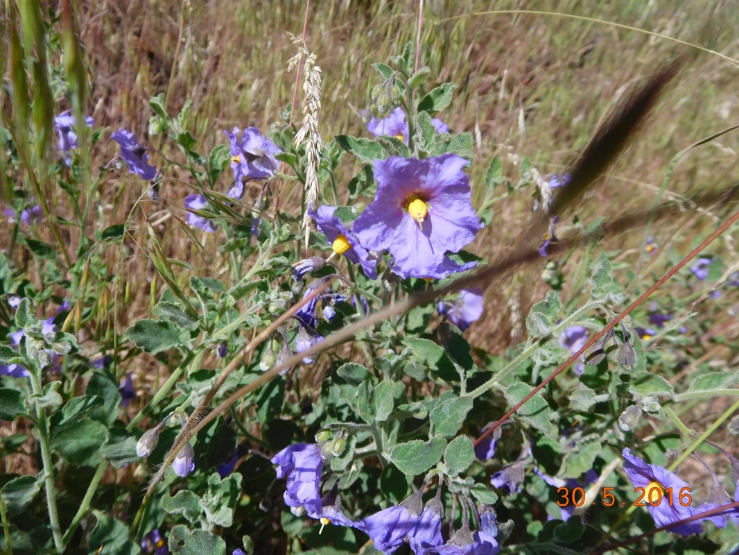 Cute purple flower The cool thing about starting early today is that I completed 3.5 miles by 9:00 AM, the time that I usually just get started. Today, not only do I have to worry about poodle dog bush, but there is a section of the PCT trail that is covered in poison oak. 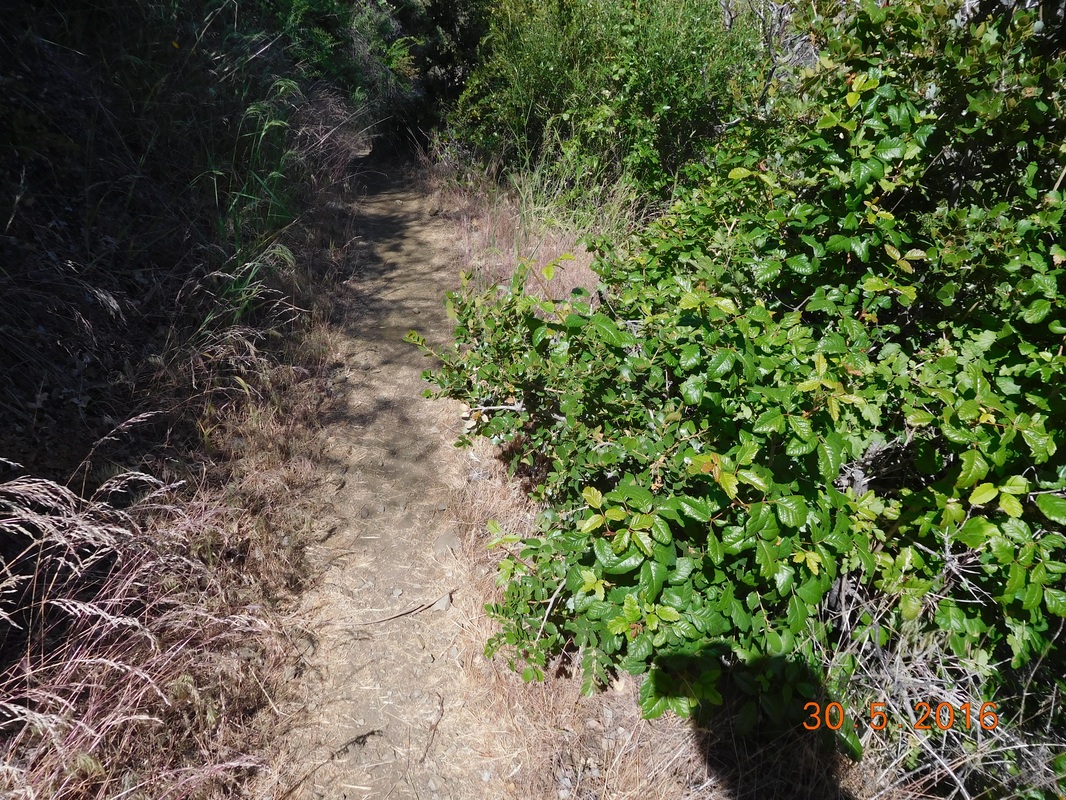 Careful of the poison oak. I made it to the North Fork Ranger Station around 10:00 AM. I filled my water bottles and hung out in the shade on a picnic bench. Double Puff and Special Ops who I met this morning was there and many other hikers came and went. Even though it was early, I was hungry since I ate breakfast very early, so I decided to take advantage of the picnic table and make lunch. "Falling" then showed up and made her lunch as well. Talk about a crazy hiker wrap...she made a salami, pepper jack cheese, flaming hot cheetos, and cheez-its. 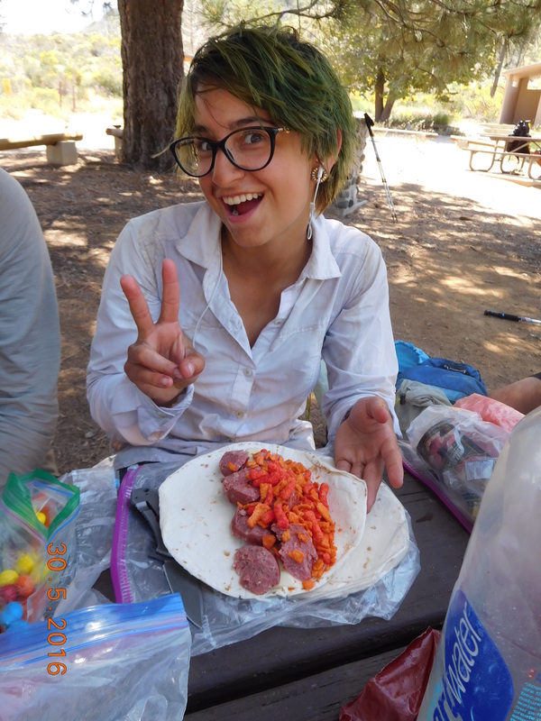 Falling's crazy wrap. Finally the vortex pull of the picnic area released me and I got back on the trail at 11:24 AM. 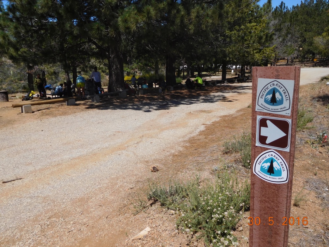 PCT sign of the day with picnic area in background The next part of the trail was hot. It had a downward trend with some steep ups, but it kept bringing us lower and lower into the valley below where the temperature kept rising. All I thought about for the next 8.24 miles is jumping in the swimming pool at the KOA that I planned on staying at tonight. Meanwhile, I had a lot of desert mountain scenery to enjoy. 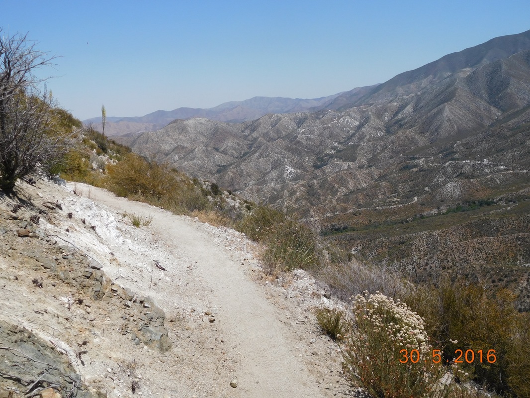 Cool mountains getting closer. 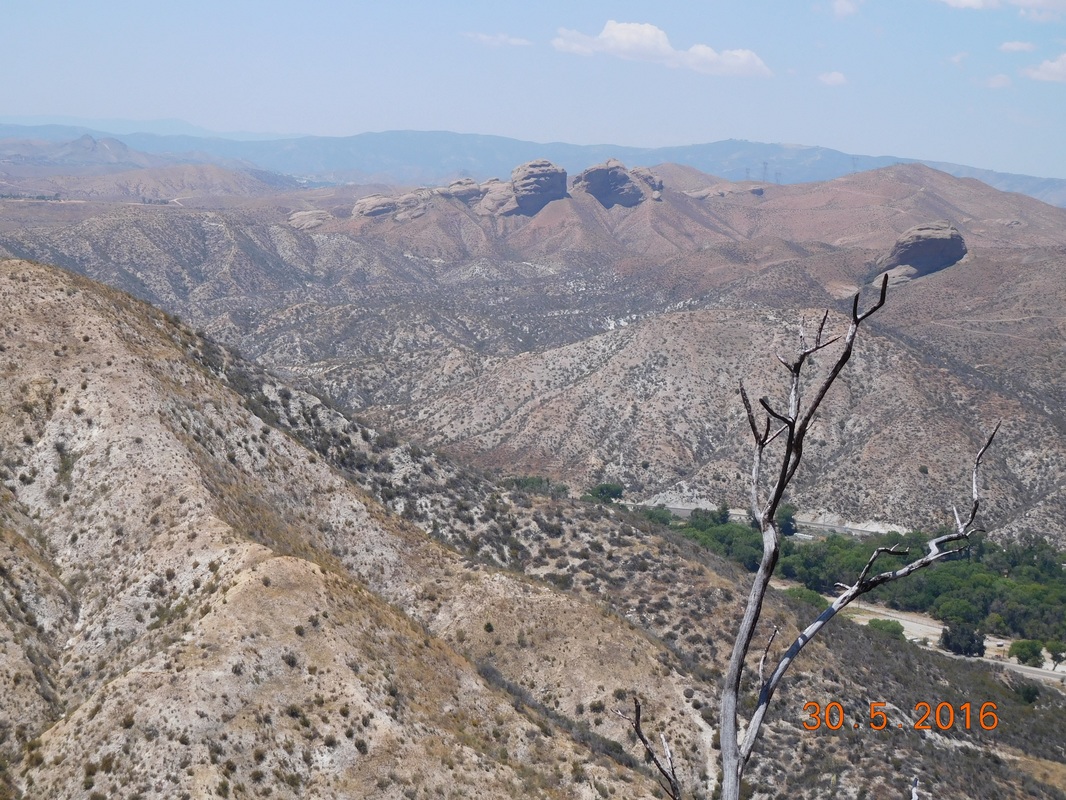 Nifty rock formations in the distance. As I was taking a bit of a break a hiker passed me and I decided to try to keep up with him for a while. He was from Denmark and unfortunately I don't remember his name because he didn't have a trail name and his real name was some weird Danish name. Anyway, he works part-time so that he can travel. He especially likes the US and has ridden his bicycle across the country 3 times. He decided to try to walk it this time by doing the PCT. He is currently doing crazy miles because he is meeting his wife in San Francisco and is behind a week because he had to take time off for blisters. I told him that I had met another Dane at lunch and he said that he had heard there is a younger guy just behind him. About and hour later while we were taking a break, the other Dane showed up. They both went on and on in Danish and was excited to meet. Now I have to try to keep up with 2 Dane's. Even though I kept falling behind, I managed to catch up time and time again. 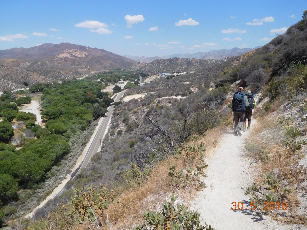 Falling behind a bit. Finally, at 2:30 PM, the KOA was within reach. 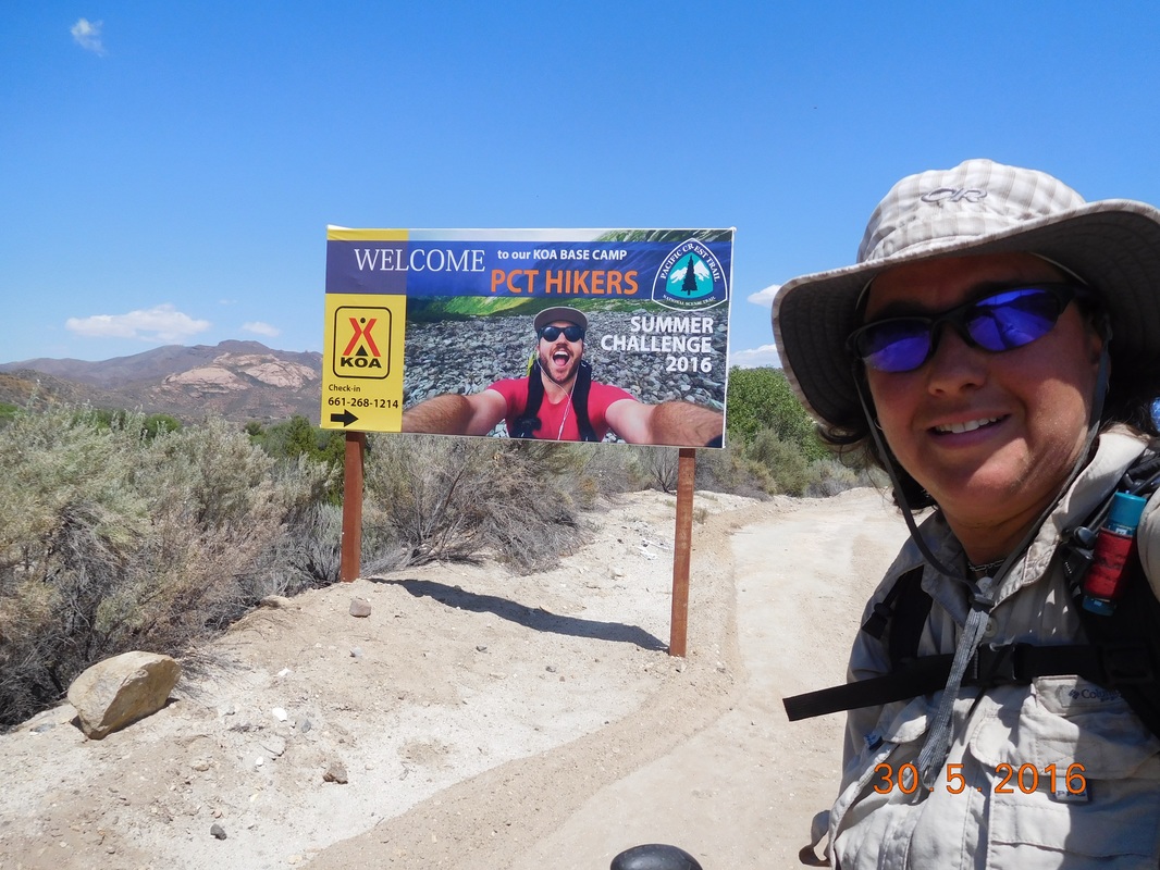 Self-portrait "Almost there" The KOA had a pretty good deal going for PCT hikers. For $15 you can pitch your tent, get a hot shower, and use the pool. I set up my tent, rested a bit, talked to and hung out with a couple from the Netherlands, and was then ready to jump in the pool. The pool was freezing and felt great. After swimming I dried off and went to the office to shop for dinner. Tonight I don't have to cook since the office had plenty of microwavable pizzas and burritos of which i had one of each. I then hung out a bit on the patio of the office with other thru-hikers. This is when we realized that all the 20-somethings were off at the gazebo partying and we "older ones" are not. I guess that is one of the differences between the young and old hikers. By 7:00 our party broke up and still there was no sign of the younger ones...another difference. 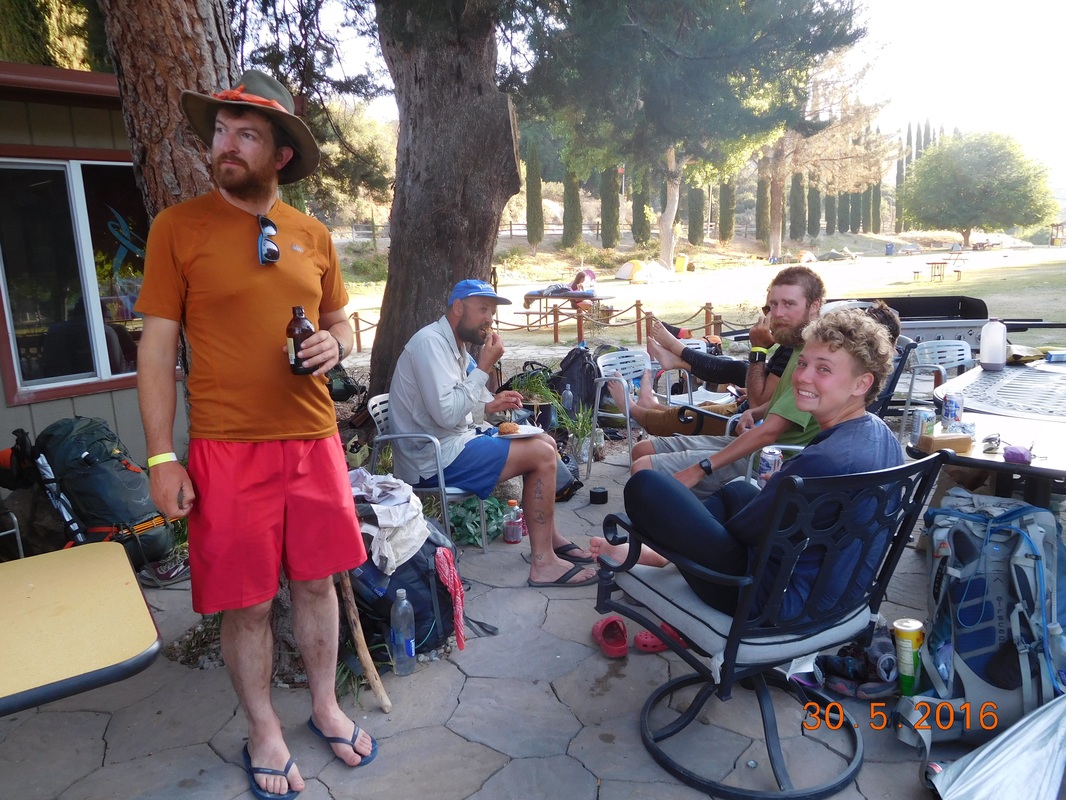 The "older" party. I climbed into my tent and everything seemed great until the sun went down and the lights came on. There was a light glaring right in my tent making it look like the middle of the day. After some frustration I figured out that I can wear my hat and pull it down over my eyes...that should work. Tomorrow I arrive at Agua Dulce and meet Tim around 1:00 PM and then take an zero-day after that. I better get to sleep since I need to start out early tomorrow. Good night. 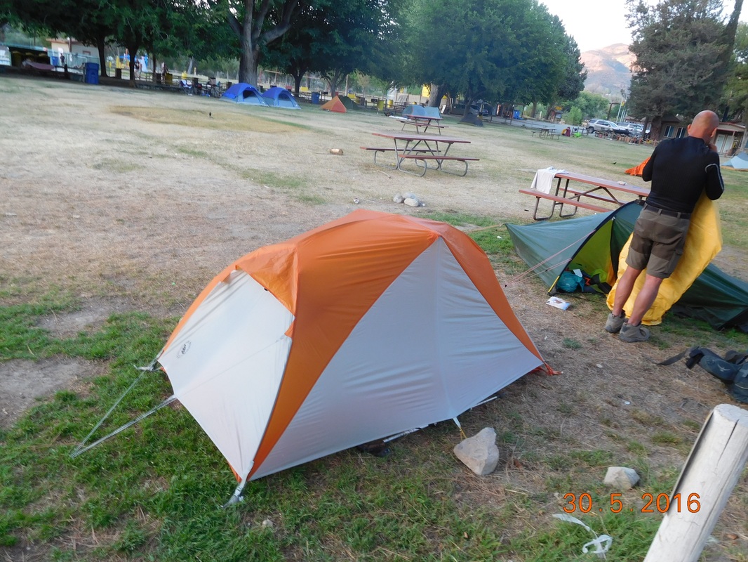 My tent at the KOA. Oh...since there was some nice lighting in my tent, I thought I'd take a picture of what I look like when I blog. Tonight it is warm enough to use the sleeping bag as a pillow while I blog. 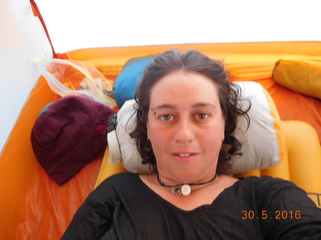 Self-portrait "Blogging in the tent" Mill Creek Picnic Area to Messenger Flats Campground Last night was one of the warmer nights so far. It wasn't hot, but it was warm enough to not sleep with a hat on. I awoke at 7:15 AM with the sun starting to beat down on my tent. I decided to pack up and head back up to the fire station to use the outhouse and to refill my water. By 8:15 AM I was ready to go. 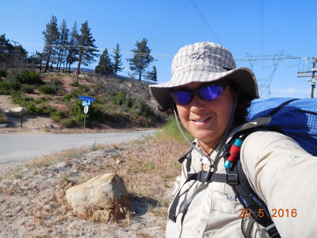 Ready to walk the 5 minutes back to the fire station. When I arrived, there were about 6 other hikers at the picnic tables. One had gotten a ride into town last night and had some extra beer left over. When offered one I had to be kind and say yes. And here is my self-portrait for the day: 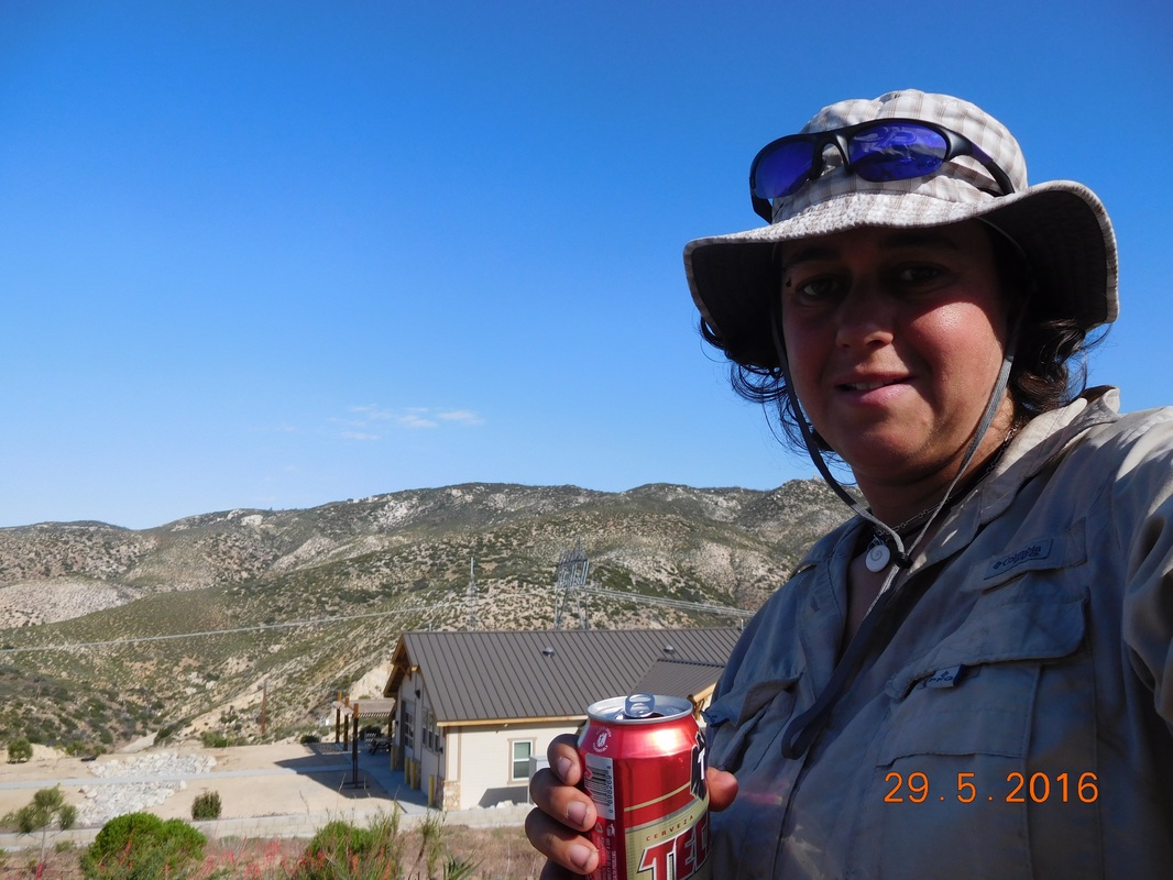 Self-portrait "Beer for breakfast" Somehow I managed to hang out there until 9:45 AM. It took that long to drink the beer, eat breakfast, use the facility, and fill my water bottles. There is no water for the next 18 miles. I plan on stopping at the 12 mile point, so I have a dry camp tonight so I need to take 5 liters of water with me...11 pounds worth. At least my food has gotten significantly lighter the past 4 days. 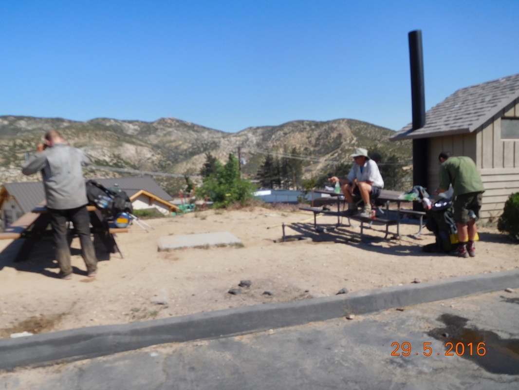 Finally leaving the picnic area. The hike today is predominantly climbing until the last mile down to the campground where I plan to stay. Oh...I guess in yesterday's blog I said that I might try to make it the 17.5 miles to the next water...well, by the morning I had talked myself out of it. The first part of the climb was just under 3 miles with about 800 feet of climbing. Not too steep, but a constant climb. Here is the view as I got higher out of the valley I stayed in last night: 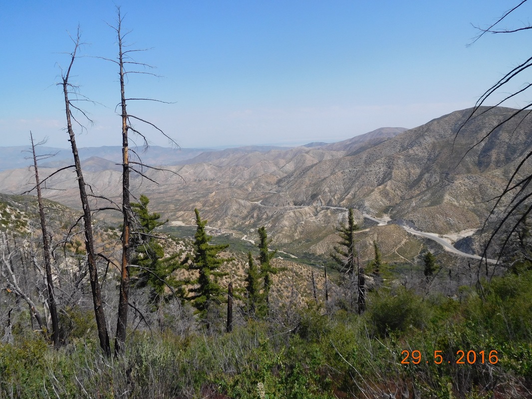 Climbing out of the valley. Today, like yesterday, poodle dog was everywhere. Here is a nice picture of some actually bloomed with their pretty, purple flowers. 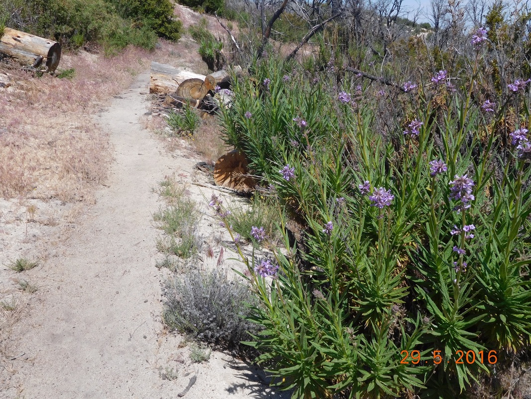 Poodle dog bush, pretty but poisonous An interesting story about poodle dog bush...I saw a local day hiker today walking thorough poodle dog bushes with shorts on not caring at all. I asked him about it and he said that all us PCT hikers are crazy...the bush isn't bad. He was telling me this as he kicked it around with his bare leg. I told him what we were told and that some years the trail actually detours in a road so hikers can avoid the bush. He told me that him and his friends used to pick the flowers and bring them home. Hum...have we all been told a lie? Is this whole poodle dog bush a folklore of the PCT? Maybe a hiker touched poison oak and the reaction was from that and not poodle dog. Anyway, I asked him to kick a bush over that was near the trail so I didn't have to worry. He looked at me like I was crazy and kicked the bush down with his bare leg. Even after this, I still dodged and snuck by the poodle dog all day long. Besides poodle dog there were lots of beautiful wildflowers all day long. 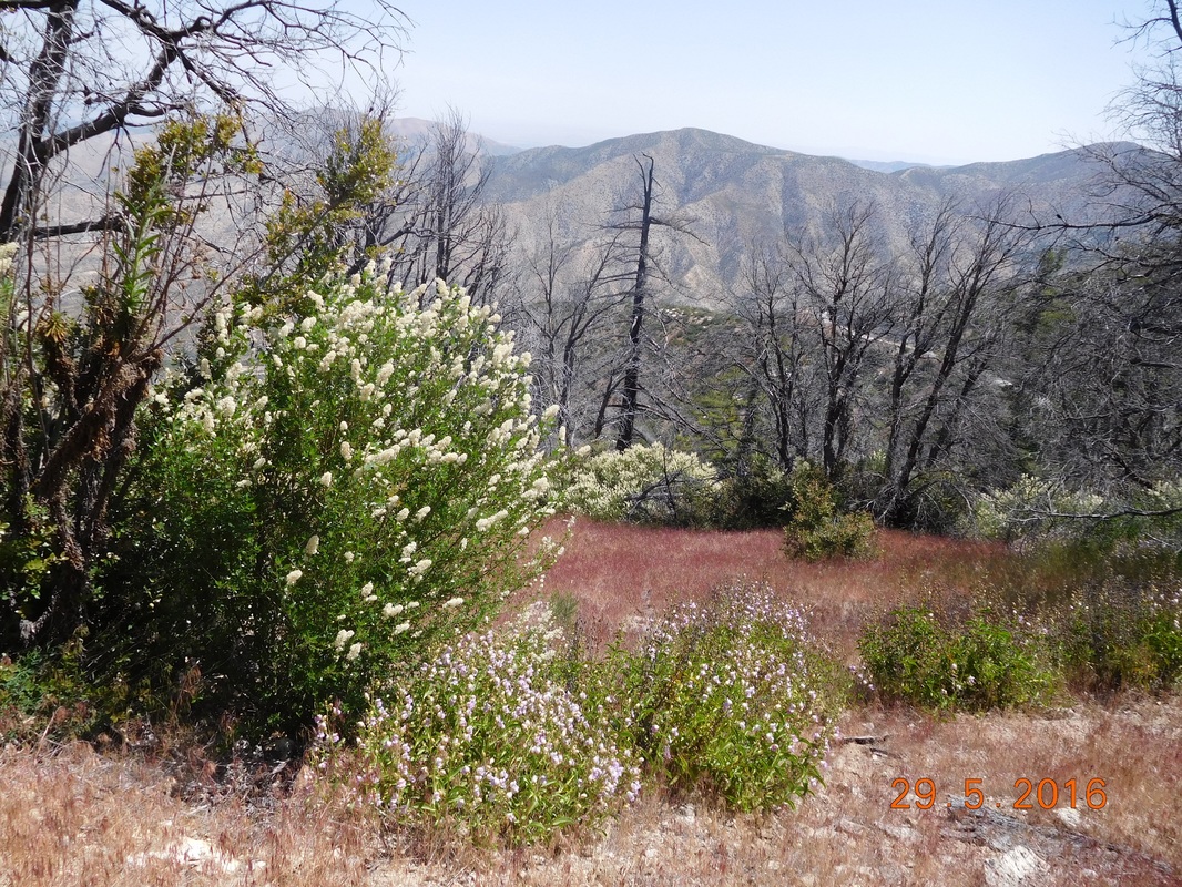 Beautiful wildflowers. I thought this was a cool view of mountains in the far distance. 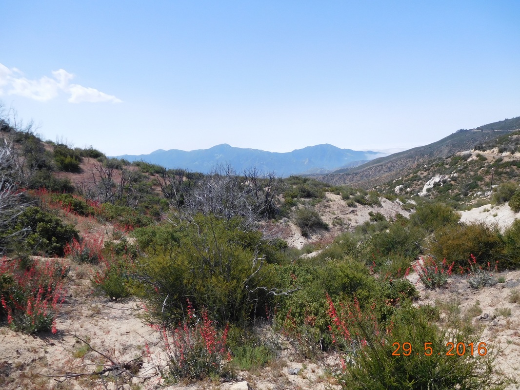 Cool mountain view. This area I'm hiking today had a huge wildfire about 5 years ago. According to the same local that laughed at poodle dog, this area was a large pine forest and the trail was totally covered with large pine trees. All day there were remnants of these trees. 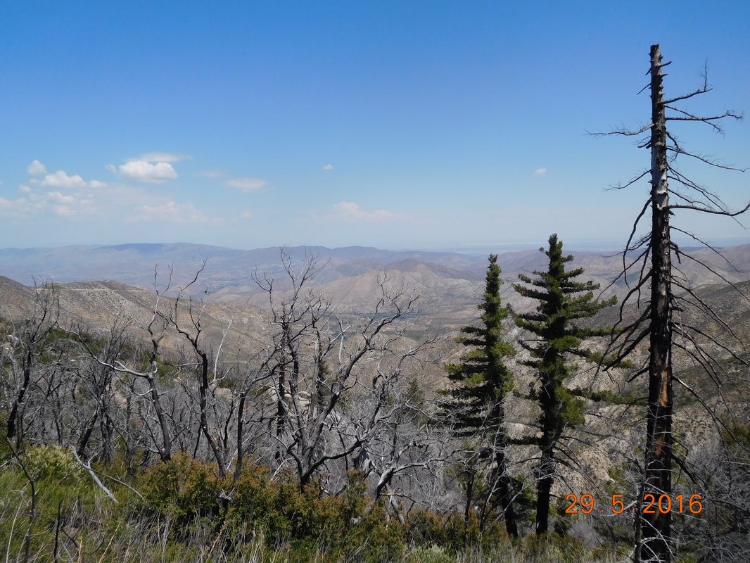 Burned pines with mountains.  PCT sign of the day with burned trees. 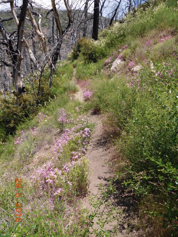 Trail lined with wildflowers. 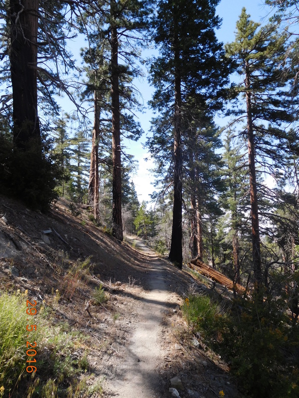 The strong pine trees that survived. 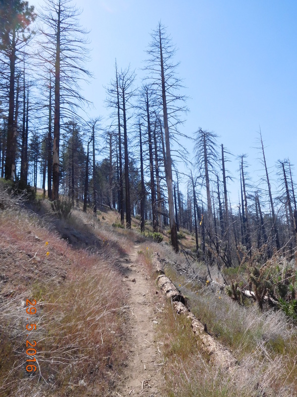 Pine tree skeletons. After 11 miles of climbing, the trail crossed a saddle and there appeared a new mountain view. This also marked my 1 mile to go to the campground. 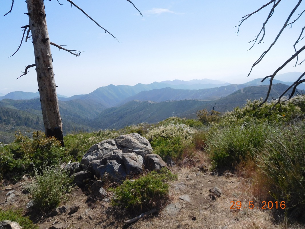 A new view. Finally, at 4:15 PM, I arrived at Messenger Flats Campground. 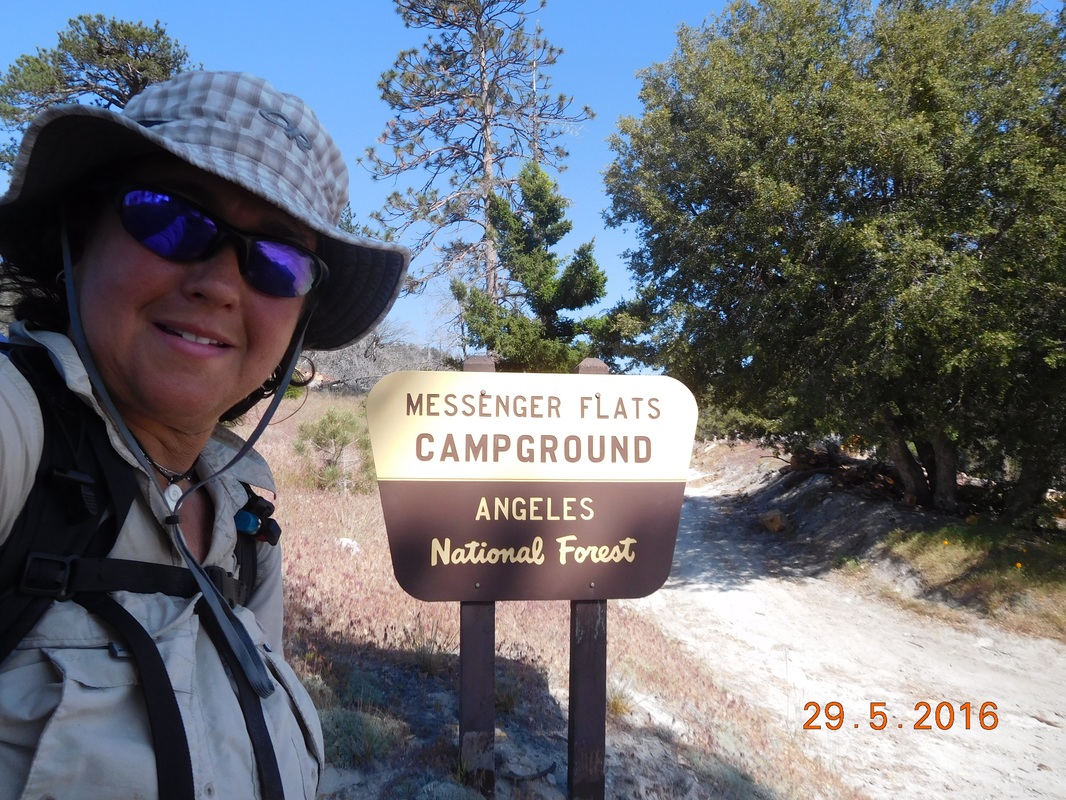 My home for the night. I was done setting up camp by 5:00 PM and was just sitting on the picnic bench watching woodpeckers and hummingbirds circling around thinking of the nice quiet night I was about to have. Then another hiker appeared, "Neon Butt Cheeks"...I have no idea. He is 57 and from Denver. Him and his brother own a landscaping company and he convinced his brother to deal with it for the summer so he could hike. We had a nice dinner and then the other hikers began to show up. Before I got in my tent I counted 14 other hikers here. And as I lie here in my tent blogging at 9:30 PM, 2 more hikers showed up. I have a feeling it is going to be a loud morning with no sleeping in I guess I better try to get to sleep now. 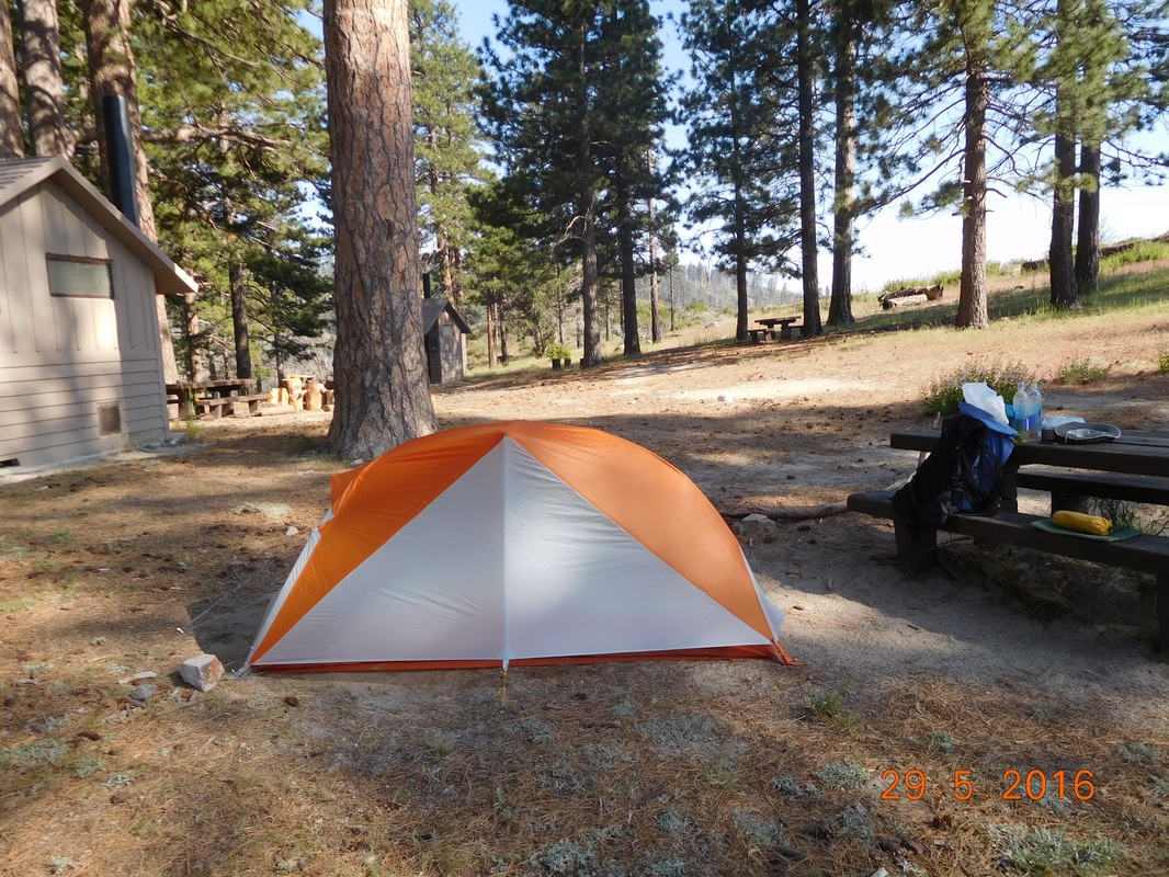 My lonely campsite before the crowd arrived. Sulphur Spring Campground to Mill Creek Picnic Area I slept pretty well last night except for worrying about animals, not necessarily about bears, getting to my food. I know last night in my blog I said I was going to sleep in. Well...it didn't work as planned and I woke just after 7:00 AM. When I got out of my tent I went straight to my food and saw that there were huge holes pecked through the garbage bag. It looks like birds tried to get to it. Luckily they weren't able to peck through my food bag inside. I took my tie this morning and broke camp at a leisurely pace eating breakfast, taking down the tent, filtering a couple of liters o water, and enjoying the pit toilet. All of this took me 2 hours and I was ready to hike at 9:12 AM. 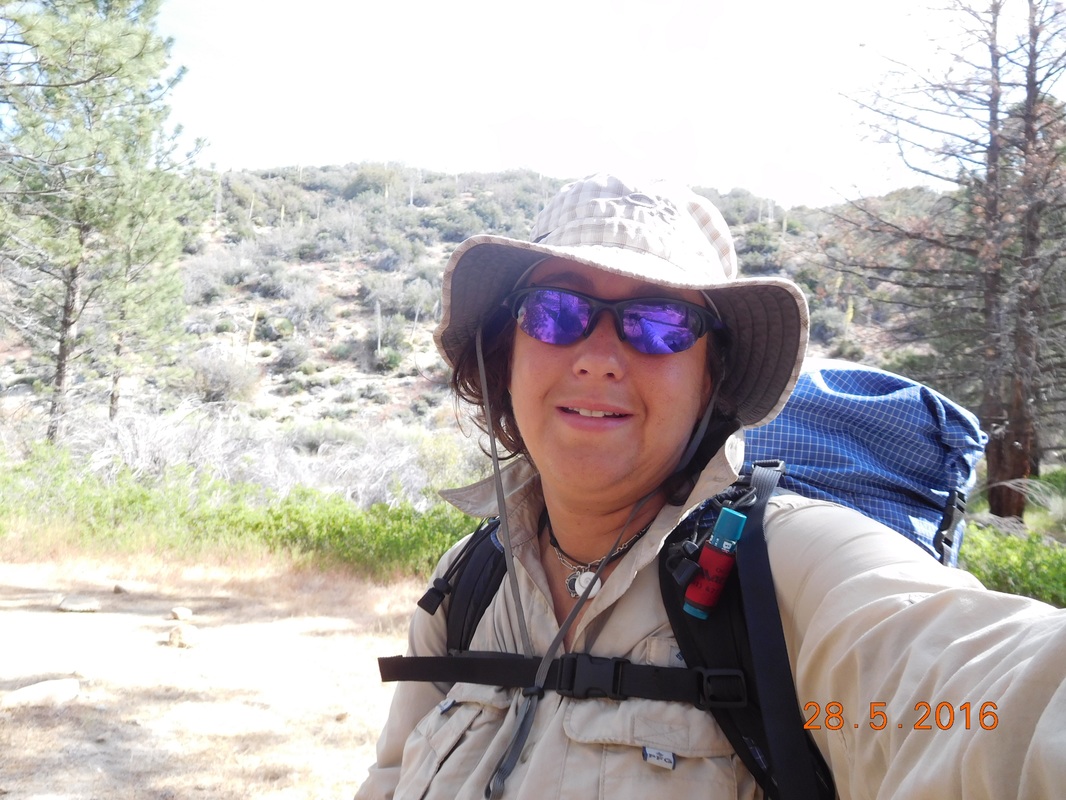 Let's get going. All in all I felt pretty good considering the number of miles I hiked yesterday. Even still, I only plan on hiking 12 miles today because I know my body can't take another long day like yesterday. Today's hike starts with a bit of a climb for the first 5 miles and then it gradually goes down for the last 7. It should be a great day...and look at the view I have to start with: 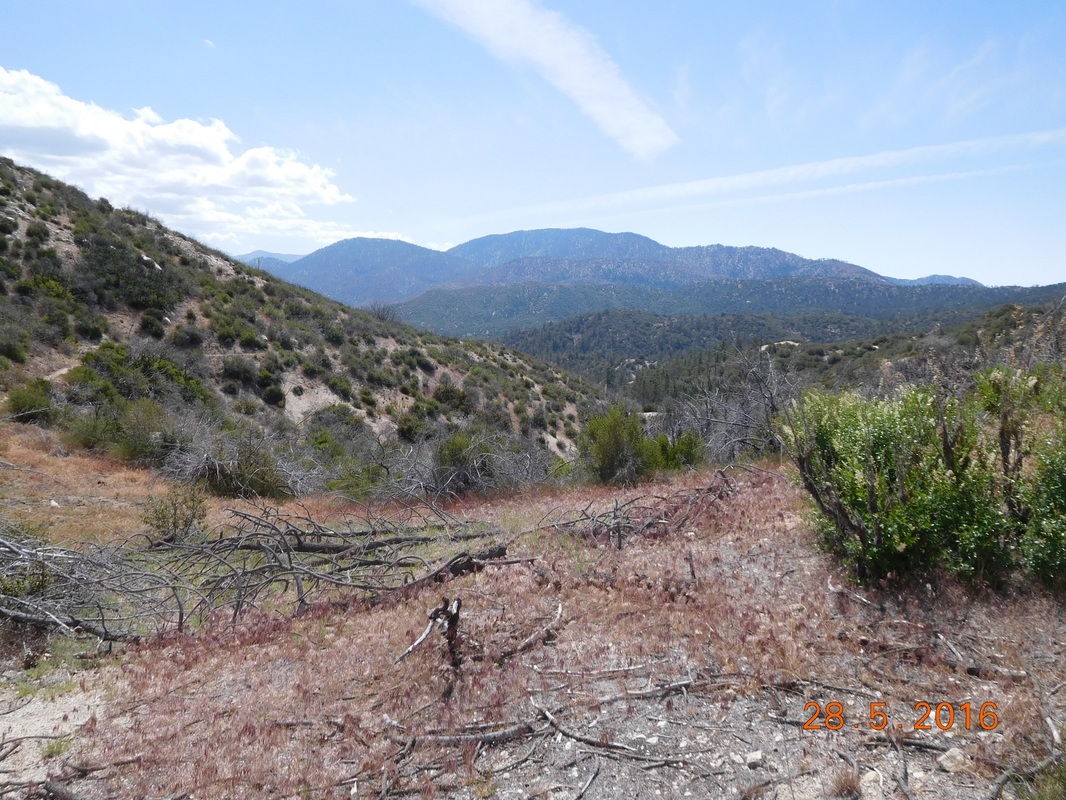 Great view to start the day. Today's number one enemy is the poodle dog bush. Actually the next 27 miles it is very prevalent. Here it is on the right with a log in front of it, and also a bit further down trail on both sides...way too close to the trail. 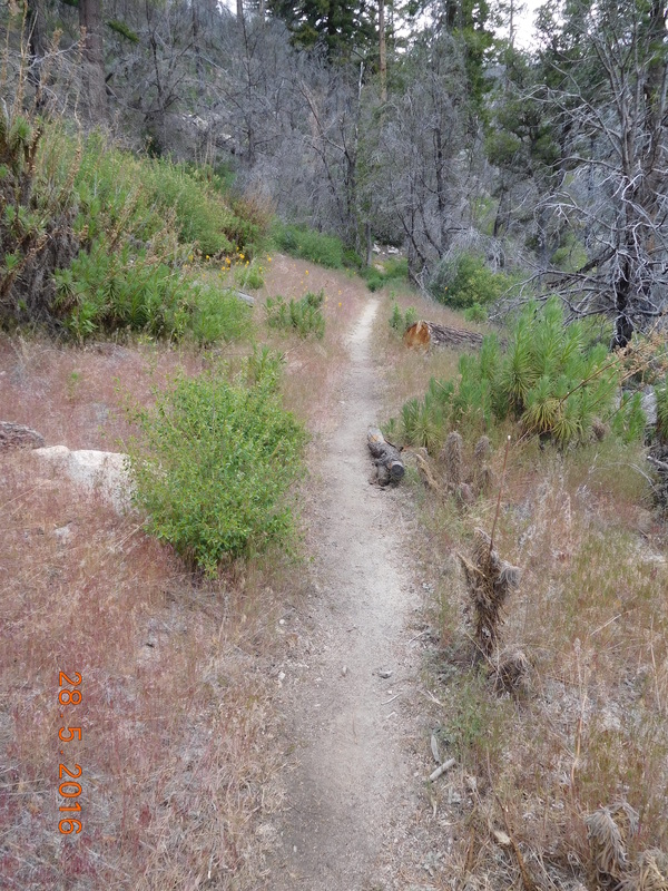 Poodle dog bush close to the trail But there was also beautiful parts of the trail today that poodle dog was nowhere in site. 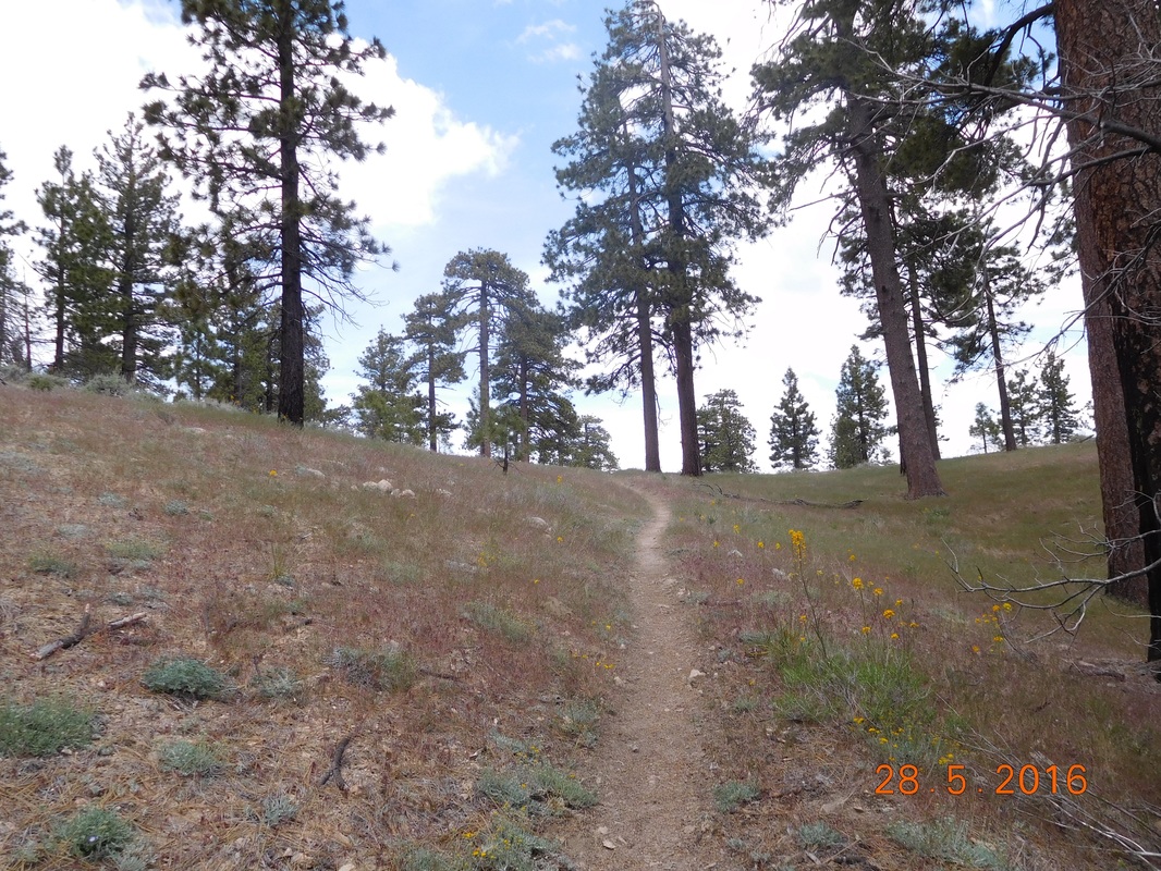 The beautiful PCT 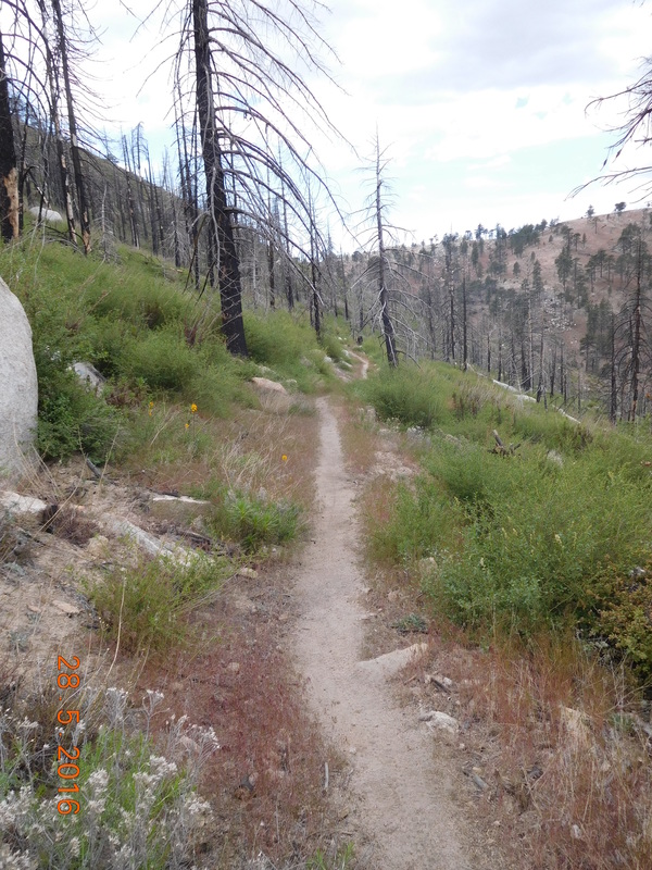 The PCT going through an old fire area. 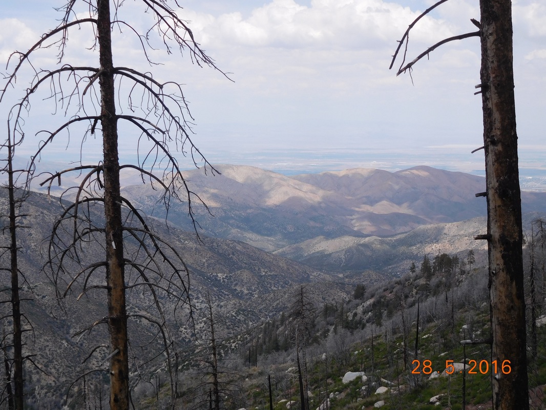 Burned trees with mountains in the background. I planned to stop for lunch at a noted campsite, but accidentally passed it. It was past 1:00 PM and I was on a ridge with nowhere to stop, but I did find a place to take a self-portrait: 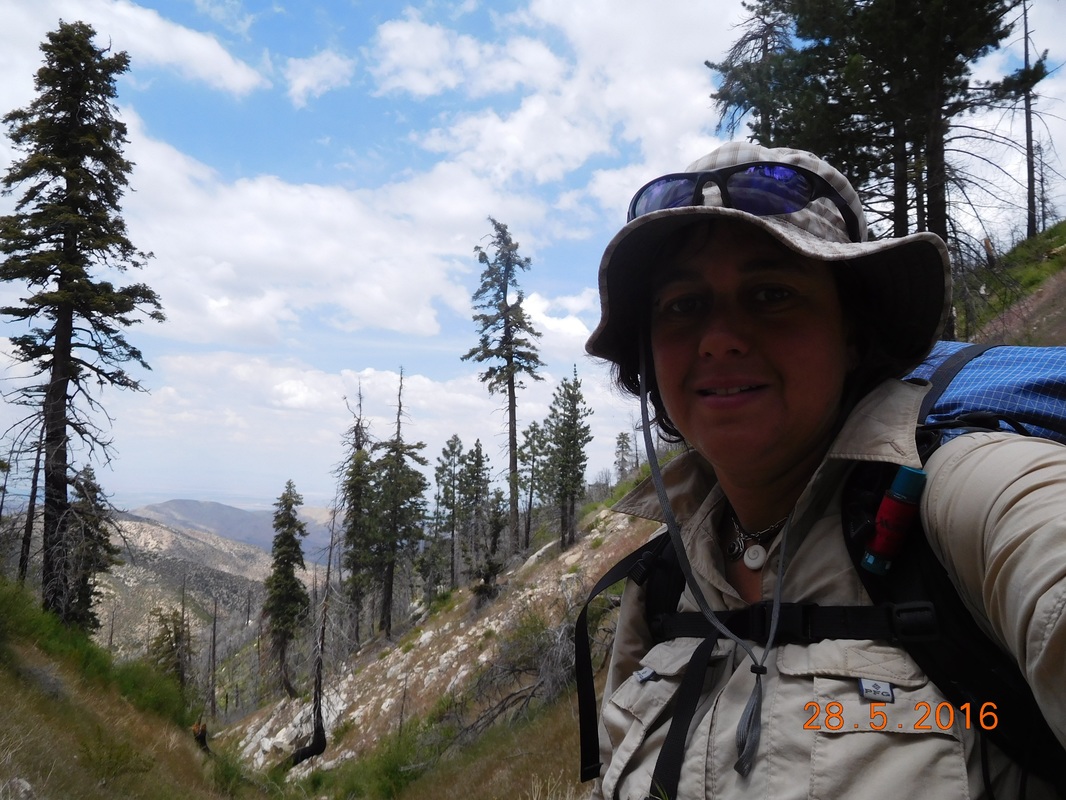 Self-portrait "Hungry hiker" The map showed a campsite about 1 mile away, so onward I hiked. The trail was leading to and going over a saddle. I love when the trail does this because we get to see a new view on the other side. 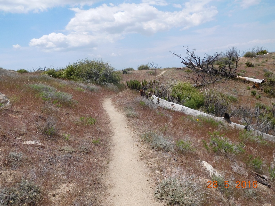 Trail going over a saddle. 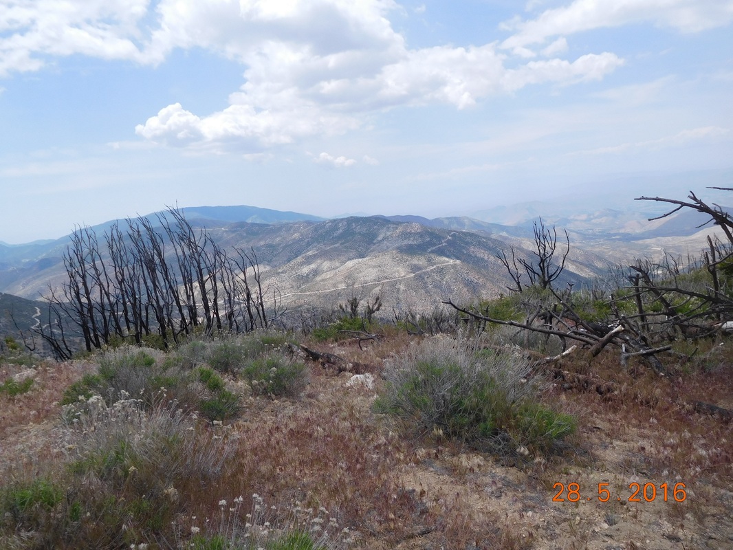 Great view on the other side. I finally stopped for lunch at 2:00 PM and actually had cell service for the first time since I left Tim 3 days ago. I gave him a call and I disturbed him at an airplane museum of some sort. I would rather be hiking! I should be able to call him again in 26 miles. While I was eating lunch, a day hiker went by and told me that he saw a rattlesnake just down the trail and I should keep an eye out. I just stared at him thinking and he continued on. Great...I have 3.5 miles to Mill Creek Fire Station where I plan to stop for the night...I just have to hike on and hope for the best. As I nervously hiked, I tried to focus on the beauty around me. 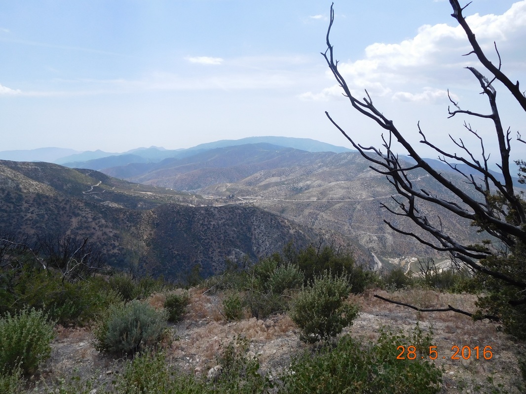 Burnt tree with a view. 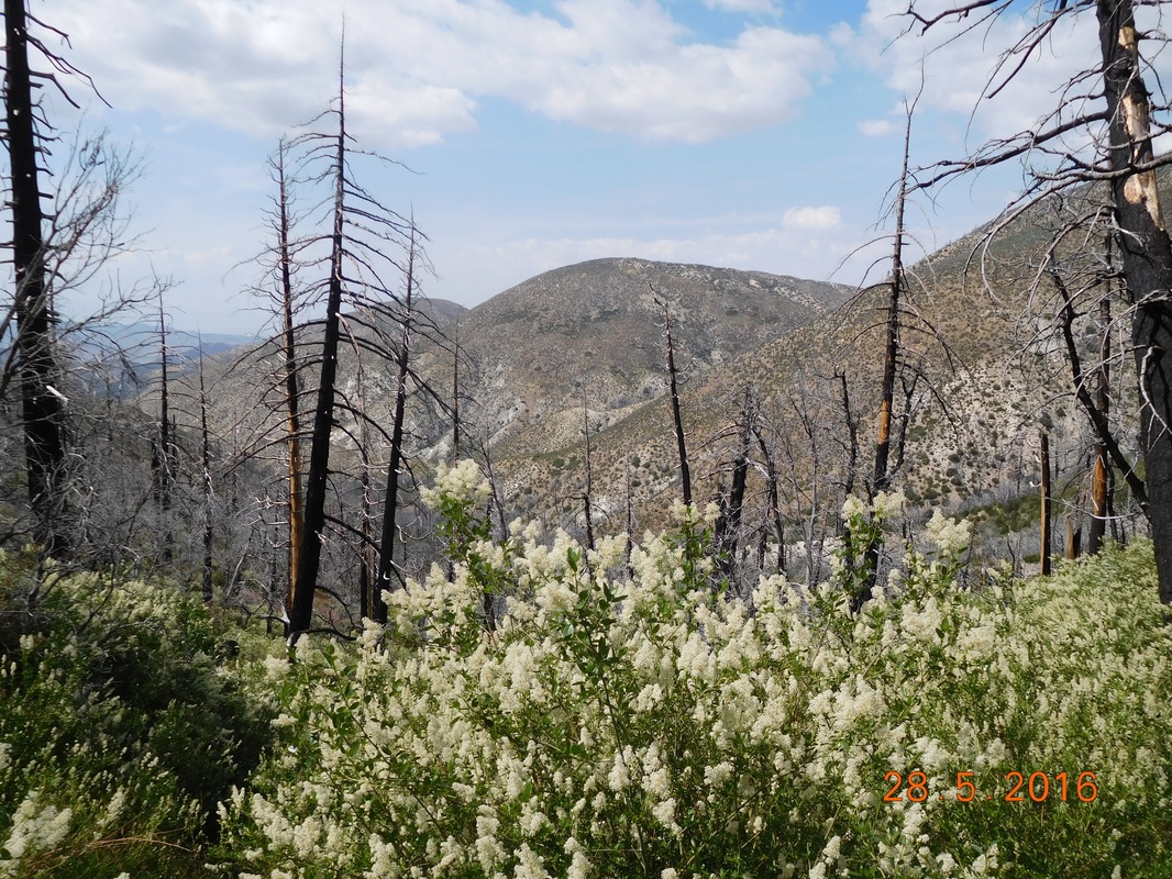 Burnt tree, white wildflowers, and a view. 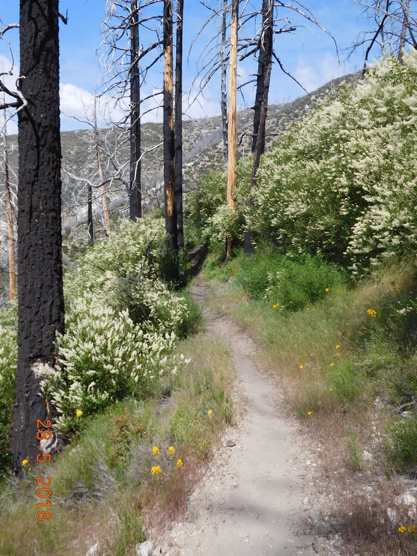 What a wonderful trail the PCT is. As I approached the Mill Creek Fire Station the following sign was on the side of the trail. The local people are so friendly to hikers, it amazes me. 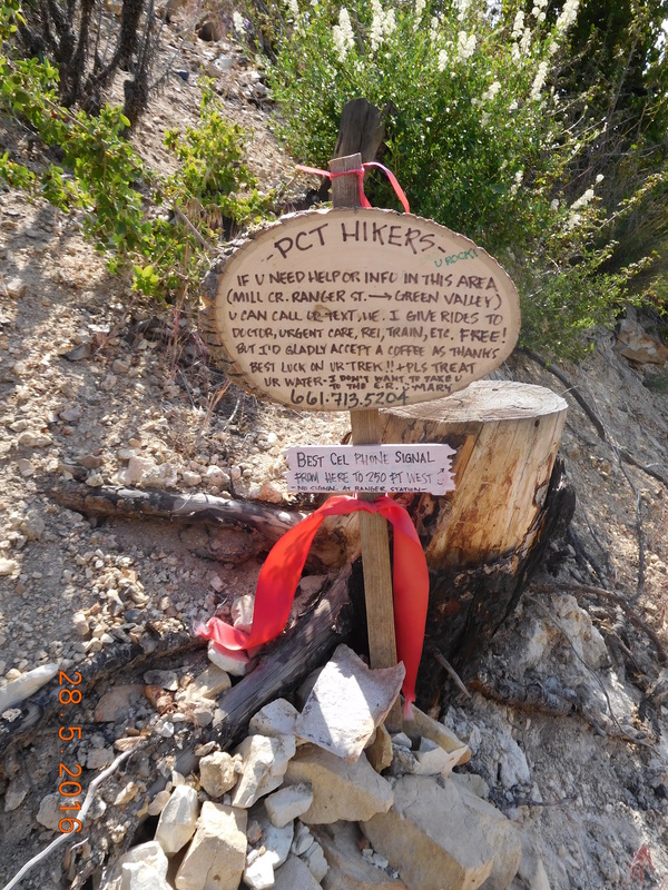 Trail angel wanting to help. Right at 4:00 PM I arrived to a sign pointing out my stop for the night by the fire station. I had a bit of a headache, probably brought on by the stress of the thought of a rattlesnake on the trail, but I made it. 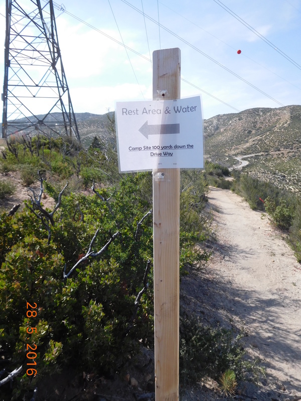 Sign posted by the friendly Mill Creek Firefighters. I got some water for the night and remembered that Brad told me that there was a picnic area just below the fire station that he stayed at. So I walked down there and saw the perfect PCT sign of the day with my picnic area in the background. 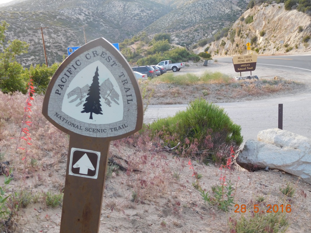 PCT sign of the day 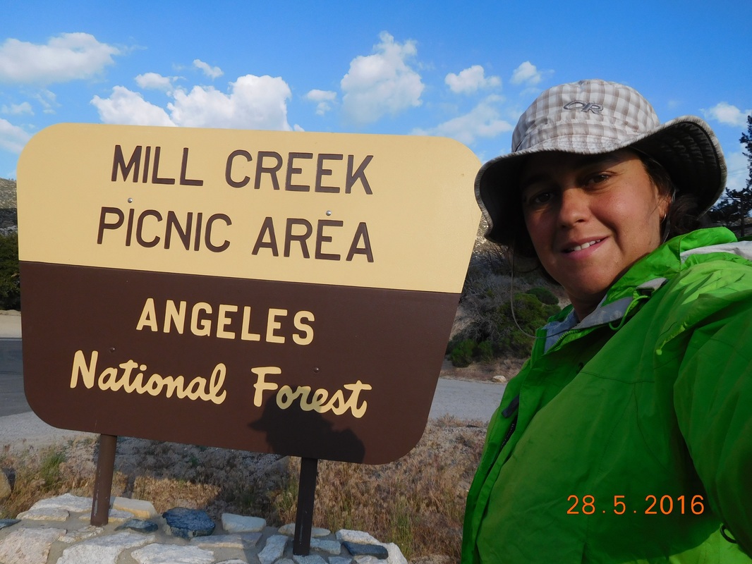 Happy to be home for the night. I got the tent set up before 5:00 PM and had nothing really to do until I was ready for dinner. I was hoping some other hikers would stop for the night, but no one did. I ate dinner around 6:30 PM and got in the tent just after 7:00 PM. Tonight will be an early night, which my body can use. I plan to hike 12 miles tomorrow, but it would be really cool if I could make it to the next water source which is 17.4 miles away. Maybe with the early stop today and a good night sleep I can do the extra 5 miles. We will see... 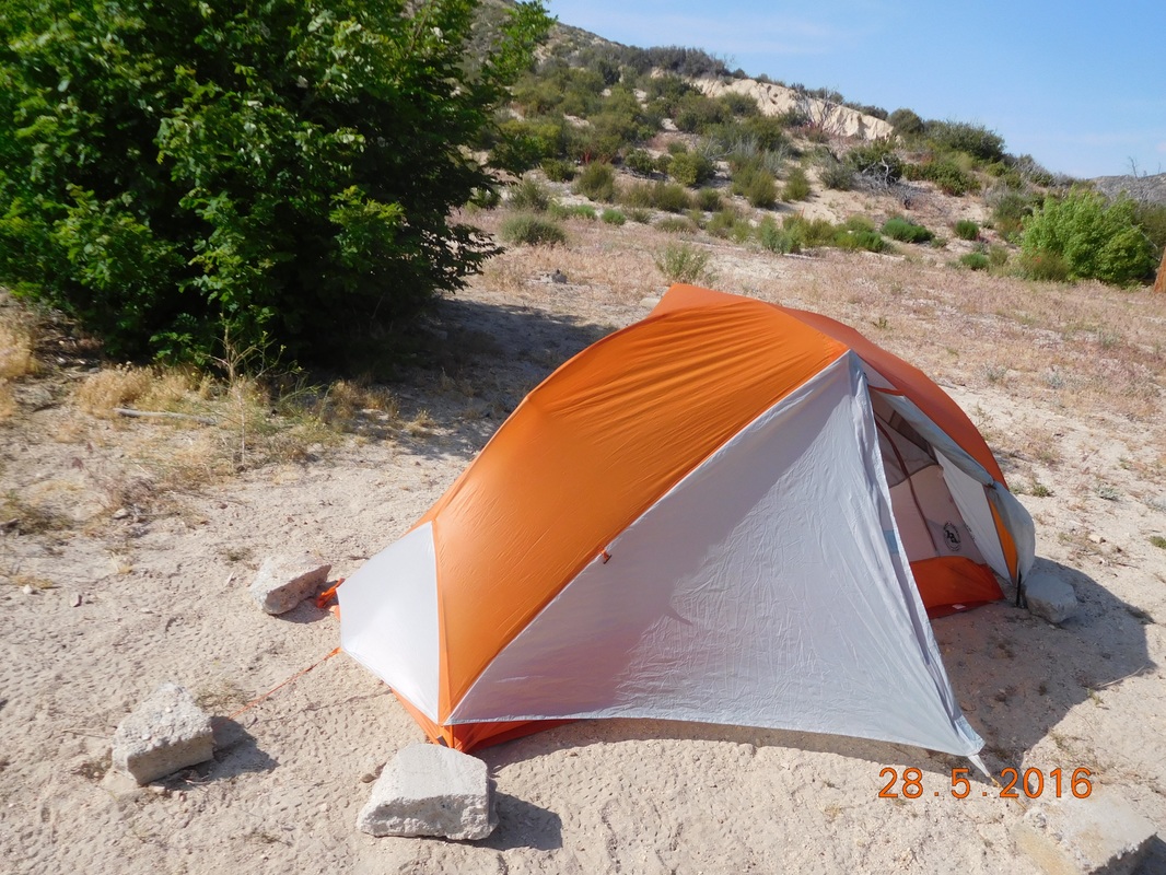 A new pitch for the night. Campsite at Mile 389.46 to Sulphur Spring Campground Wow...I got a great night sleep. The tent site was flat and the temperature was perfect. I was worried about the wind, but around 10:00 PM everything calmed down. I woke just after 6:00 AM and couldn't fight it anymore, so I got up at 6:30 AM. There is a picnic area with an outhouse and picnic tables just 0.73 miles ahead, so I decided to just pack up and eat breakfast there. I can't believe it still took me 1 hour to break camp, pack my bag, and be ready to hike. What the heck?!? Anyway, I was ready to hike at 7:30 AM for a short 20 minutes. 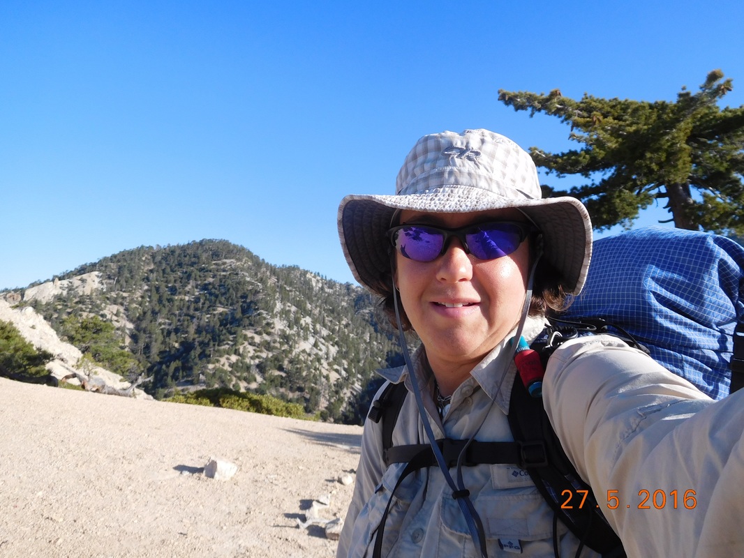 Let's get to the picnic area As I was leaving, I looked back at where I camped last night and thought I'd share. While hiking along the trail, if you see a circle of rocks as you see below, it is where someone pitched a tent. The tent was in the middle of the circle and the rocks are used to weigh down the stakes in case of wind gusts. 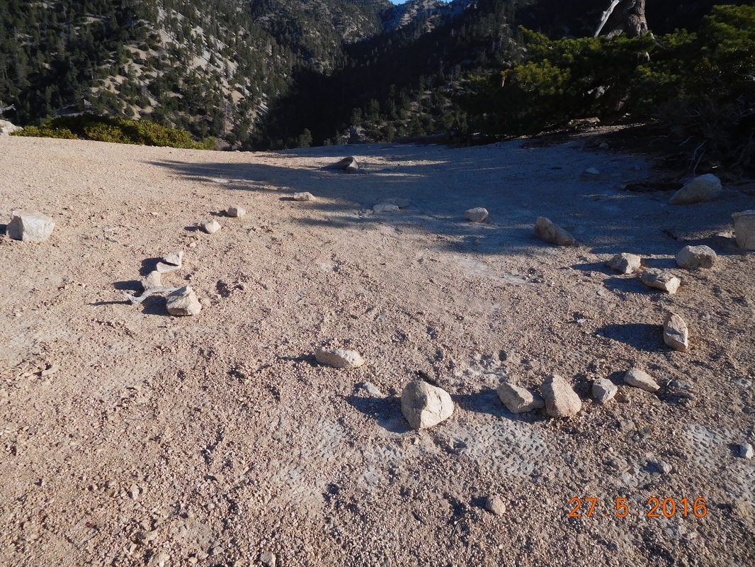 A tent was pitched here. The day started with this incredible view. Can it get any better?!? 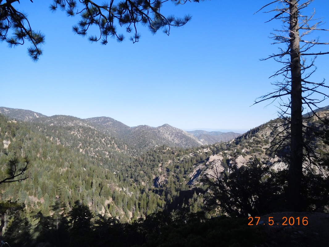 Great view to start the day When I got to the picnic area there was this sign posted across the PCT. 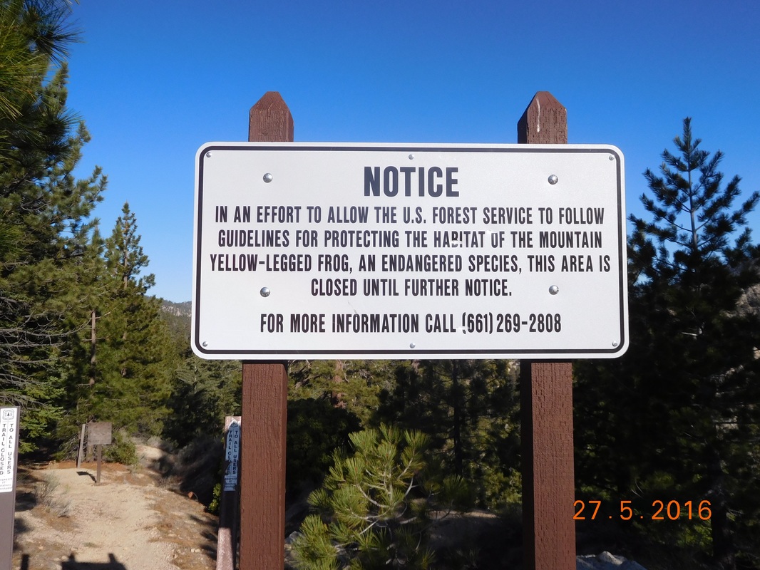 Endangered species closure of the PCT I knew about this closure in advance. There is a short detour in place that requires a 2.63 mile road walk along Highway 2 and then hits the Burkhart Trail that leads back to the PCT. Overall it is 4.81 mile detour that skips 3.80 miles of the closed portion of the PCT. Not too bad considering the detour I made earlier in the hike required 35 miles of road walking plus 15 miles of trail. Before hitting the detour, I hit the picnic area for outhouse use and breakfast. Soon after I arrived a group of 3 young men showed up and we started talking. A few minutes later a utility truck stopped on the road and asked if anyone wanted a ride up the road to avoid the road walk.. I said, "No thank you," since I want to keep continuous footsteps to Canada. Would you believe that all 3 guys agreed to it. Oh well...hike your own hike as they say. 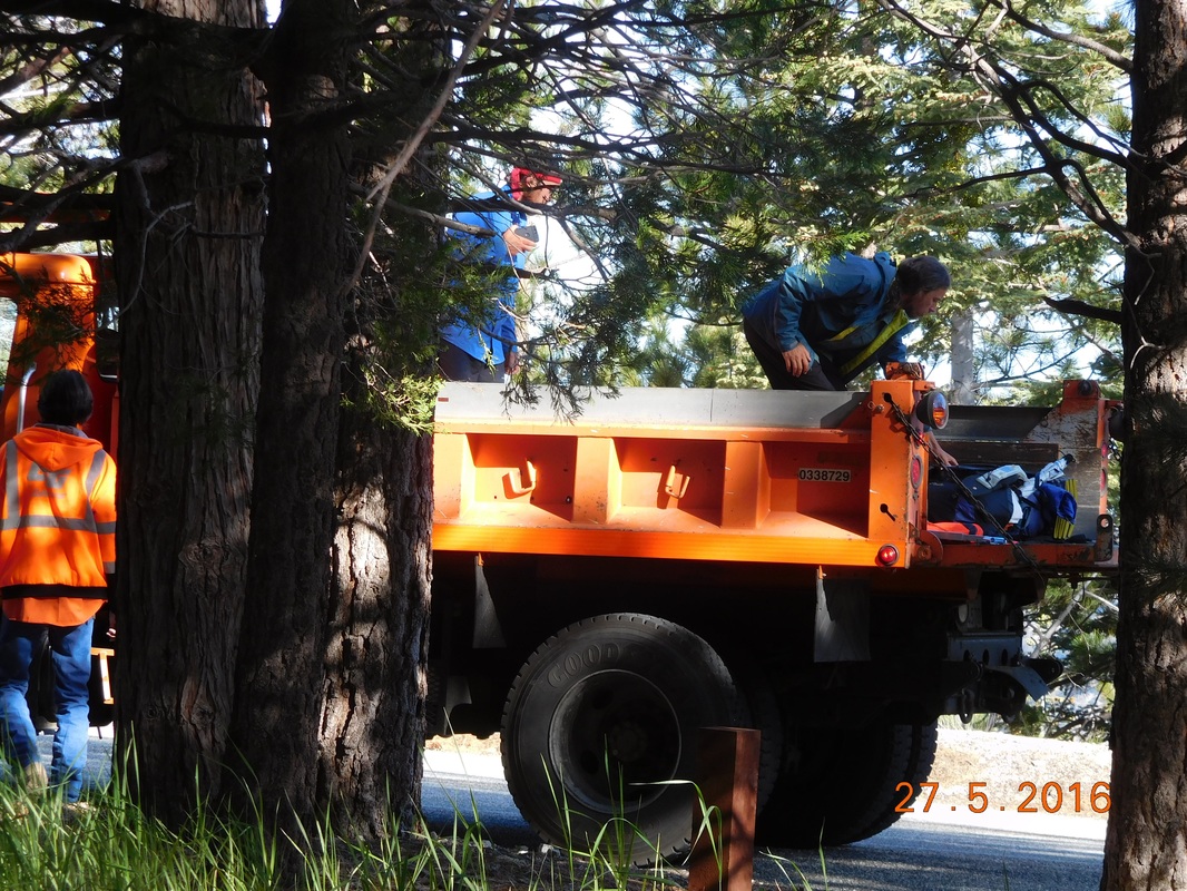 3 young guys taking the easy way. To me, even better than taking a free ride, I had a picnic table to eat my Powerbar and Carnation Instant Breakfast on. 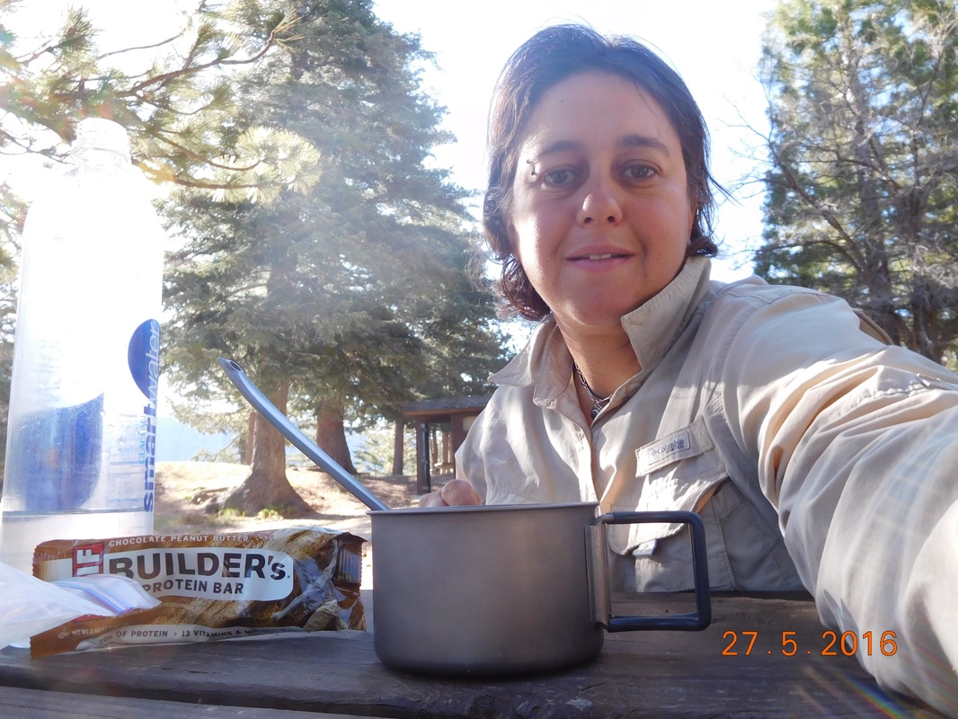 Breakfast on a table...life is good At 8:39 AM I started the road walk. 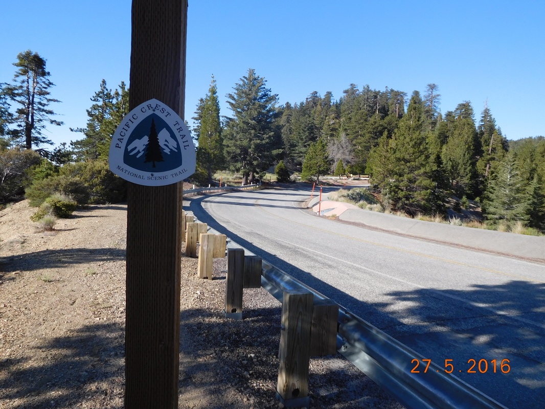 PCT sign of the day along Highway 2 The road walk wasn't too bad. To get to Burkhart Trail you have to walk through Buckhorn Campground where there was running water that didn't have to be filtered, so I loaded up with 5 liters of water (there isn't a reliable water source for 18 miles), and walked to the trailhead. I arrived at the trailhead at 10:15 AM and started the hike down into a canyon. 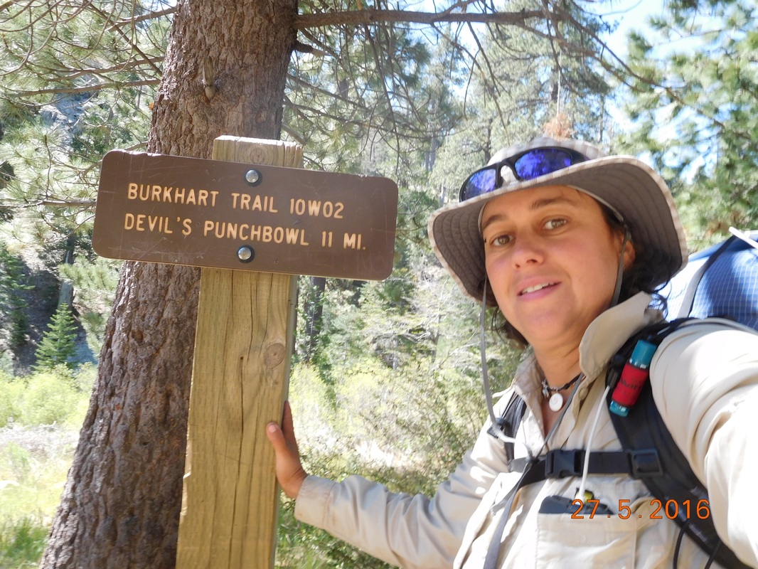 The start of Burkhart Trail The trail continued down and wound up at a stream. It was so nice down there. I don't remember the last time the trail crossed a stream where everything was so bright and green. 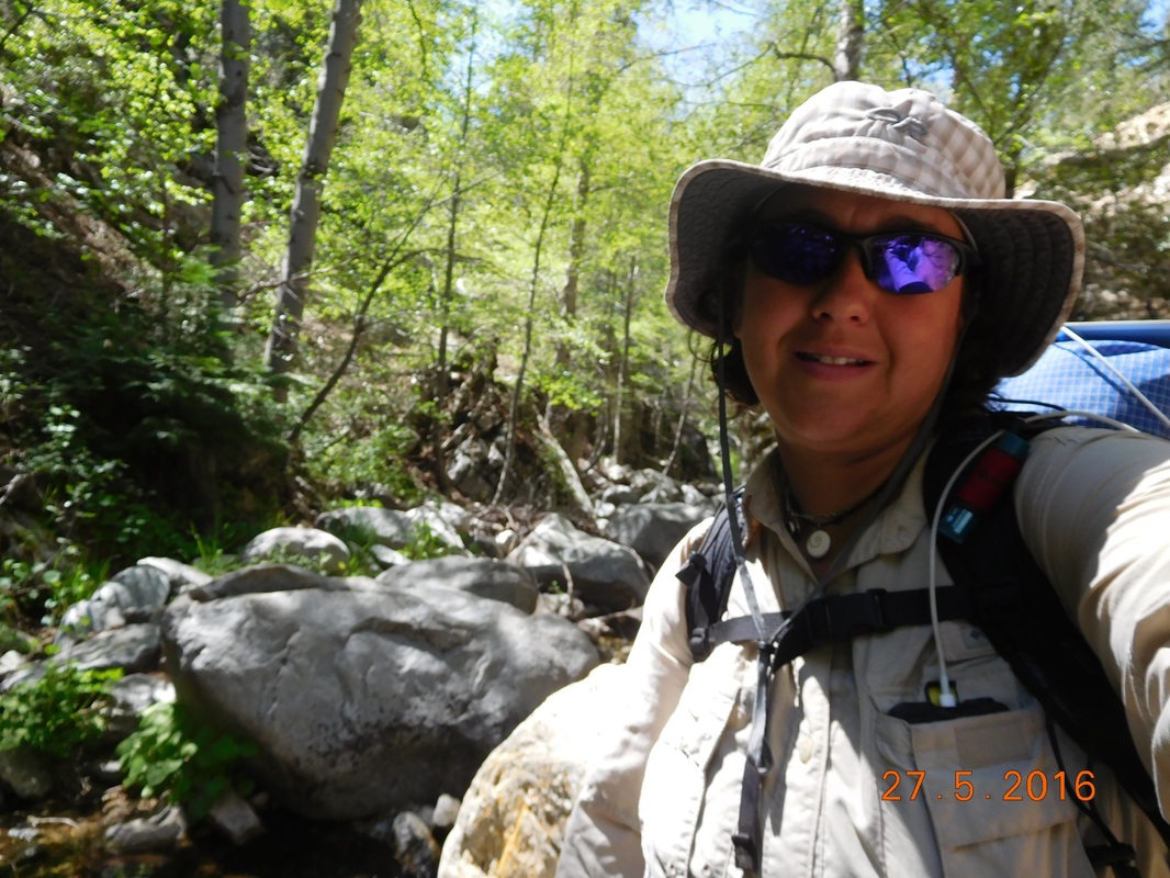 Self-portrait "Copper Creek" The Burkhart trail ended at the PCT, but which way do you go? No need to question since there is an arrow and smiley face pointing the way. 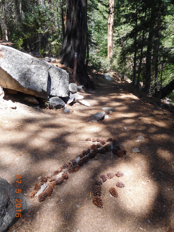 Go this way This part of the PCT was very difficult with 4 miles of steep climbing to get out of the canyon, but at least the scenery was beautiful. 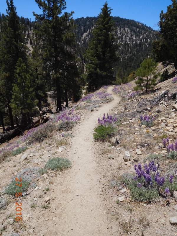 Purple wildflowers lining the trail 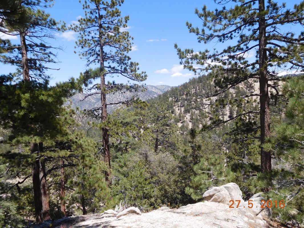 I hiked up from the bottom of that canyon Finally after all that climbing, the trail crossed Highway 2...again...and then the hike became a nice meandering one with no real steep ups or downs. 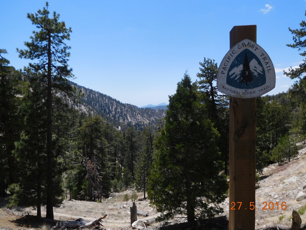 PCT sign of the day 2 - the trail is nice from here. I even had time for a pleasant self-portrait. 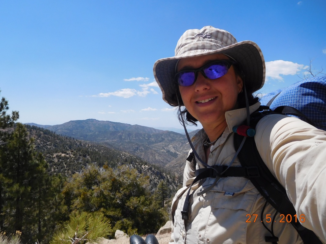 Self-portrait "The climbing is done for a while" Today another milestone was hit. I made it to mile 400!!! 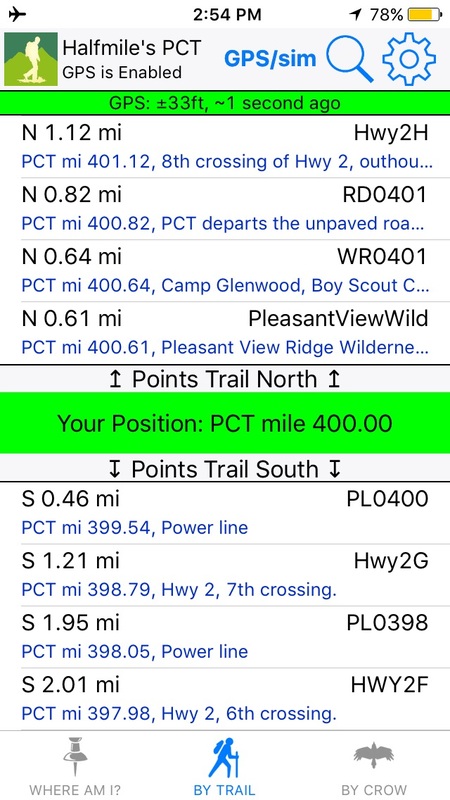 Proof I'm standing at PCT mile 400 Unfortunately my photographer Brad is not with me, so I struggled getting a picture of myself with the 400. This is as good as I could do. 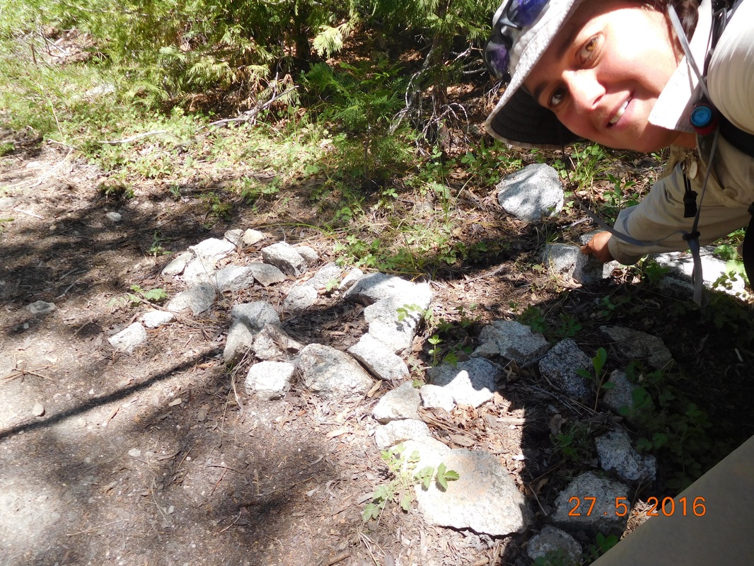 Mile 400 I really didn't like how that picture came out because it is hard to read the 400, so I tried a different technique and took a picture of my shadow with a thumbs-up and the 400. 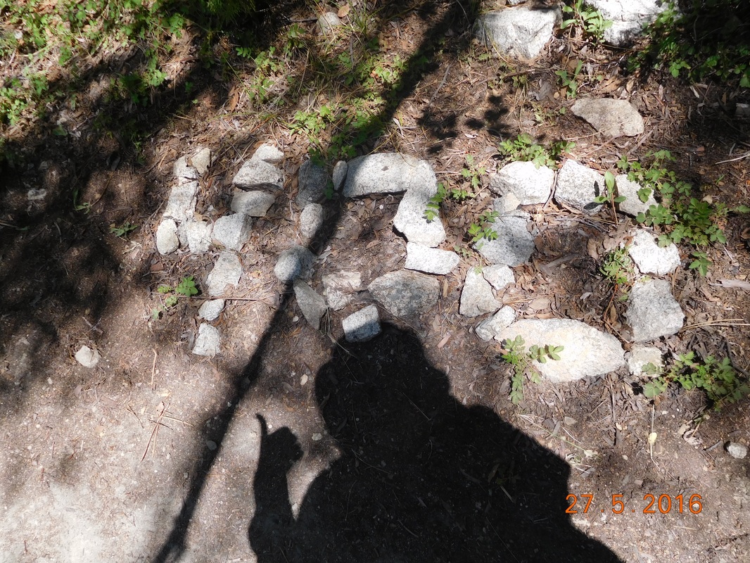 Shadow 400 mile thumbs-up After wasting 5 minutes to get the perfect shot, I hiked on and arrived at Camp Glenwood where I met up with 4 other hikers who I had seen a couple of days ago at the base of Mount Baden-Powell. They seemed cool, so I decided to try to hike with them. But first, I saw this cool sign that gives that mileages to Canada and Mexico. I love signs that give you this information. 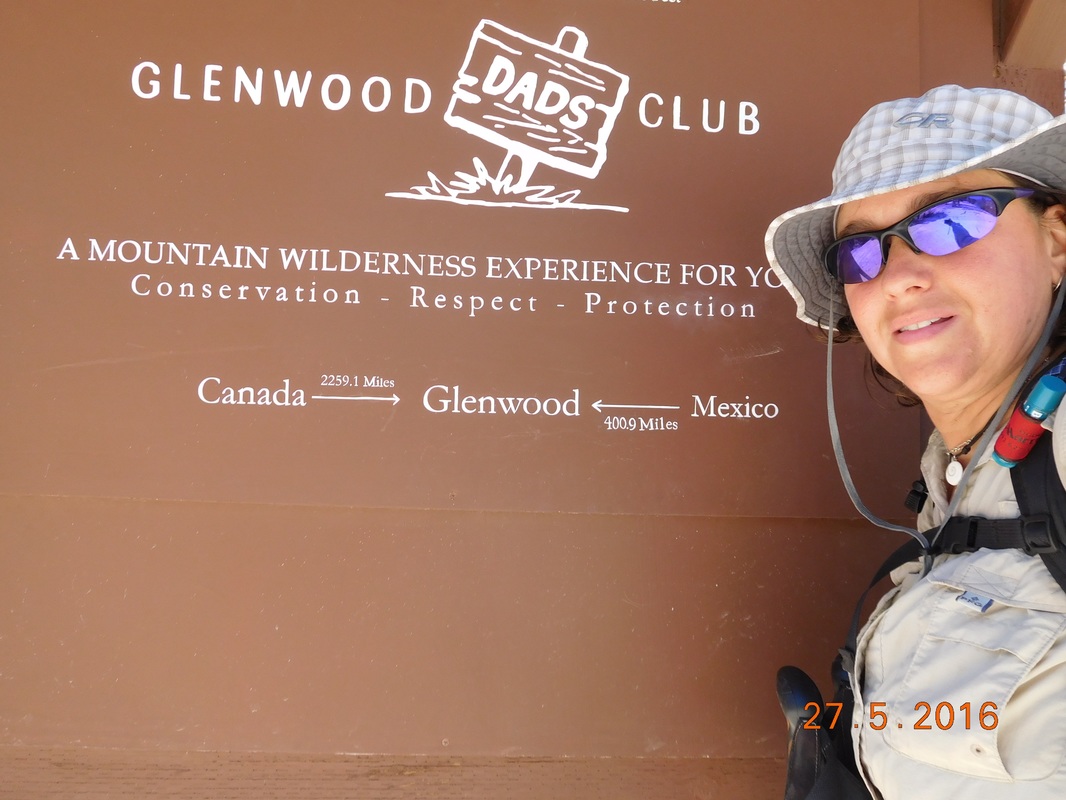 2,259.1 miles to Canada I kept up a bit and then fell behind and then they stopped for a break so I caught up again. The issue is that I have been off the trail for 3 weeks loosing conditioning and all these other people have been continuously hiking and are in great shape. Plus, the oldest person in this group is around 30. 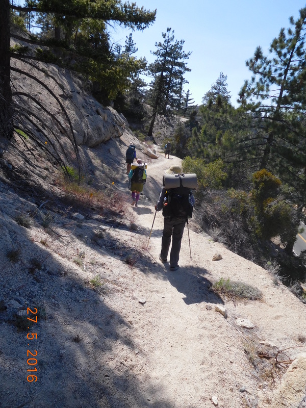 Falling behind. Oh...this part of the trail is lined with live poodle dog bushes. These ones smell pretty bad. you can actually smell them before you see them. Luckily there were all easy to avoid since they were all off the trail 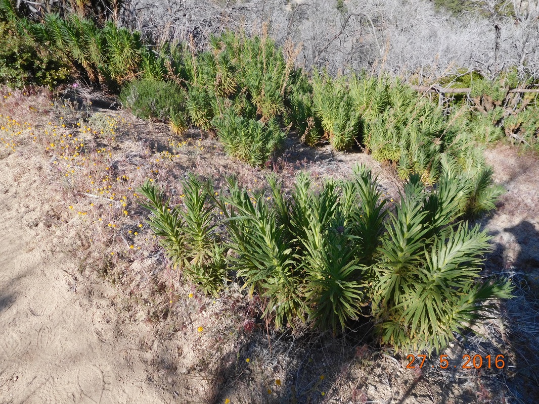 Lots of poodle dog bush Before I knew it, I had hiked almost 2.5 miles with these people. I knew that there was a campground that Brad stayed at just 3.5 more miles ahead. The past few hours the trail has been fairly easy, so I figured I could make it. I continued hiking with them, and with 1 mile left to the campground, I was loosing steam. Then, when I finally arrived at my turnoff, I noticed the group stopped and waited to say goodbye. So cool of them. I was so tired when I got to Sulphur Spring Campground that I didn't notice the time, but it was somewhere between 5:30 and 6:00 PM. Today I hiked for 10 hours and covered 17.18 miles plus an extra mile on the detour. That is 18.18 miles! Wow. I am tired ad plan to sleep in as long as I can...my feet and legs really need the rest. 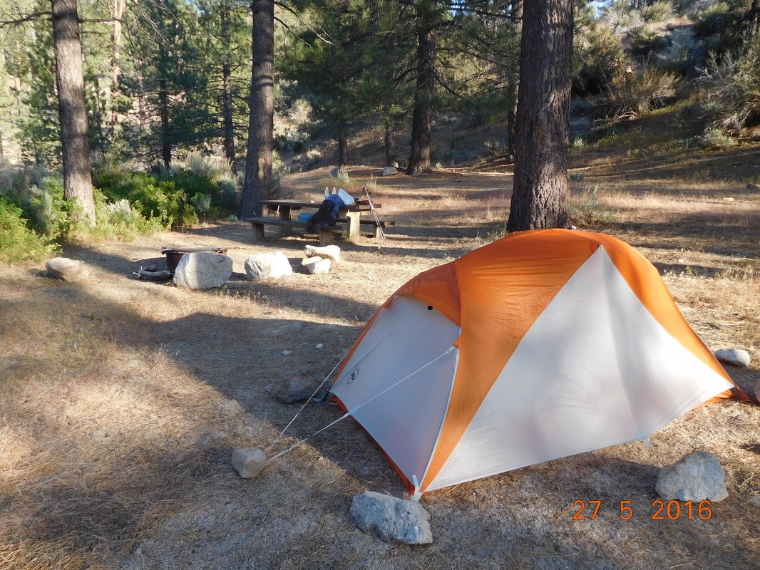 Great spot with picnic table included. Campsite at Mile 377.01 to Campsite at Mile 389.46 Somehow I was able to stay warm last night. I heard a breeze all night, but it must have been up the other side of the mountain because the tent didn't flap. I did wear pretty much all the warm clothes I have including hat, gloves, and puffy jacket. Plus, I go deep inside the sleeping bag so I am totally covered...whatever works..right? I woke before 7:00 AM but stayed in the tent waiting for it to warm up a bit. Finally, at 7:15 AM I got up. When I exited the tent I was happy to see blue skies. Today I will summit Mount Balden-Powell so I was hoping for blue skies so I could take in the view. I took my time getting ready and was ready to hike just before 9:00 AM. 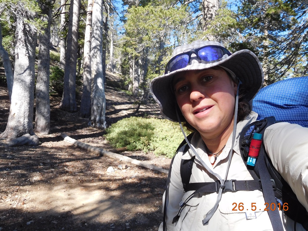 Ready to go. Today's hike is going to be challenging. It starts by going up to the peak of Mount Baden-Powell, the highest point of the day, and goes down and up and down and up...I don't know how many times. At least the views promise to be amazing. First for the climb up to the peak of Mount Baden-Powell. From the campsite I have to climb 753 feet in just 1 mile. Luckily part of it is through a pine forest..my favorite. 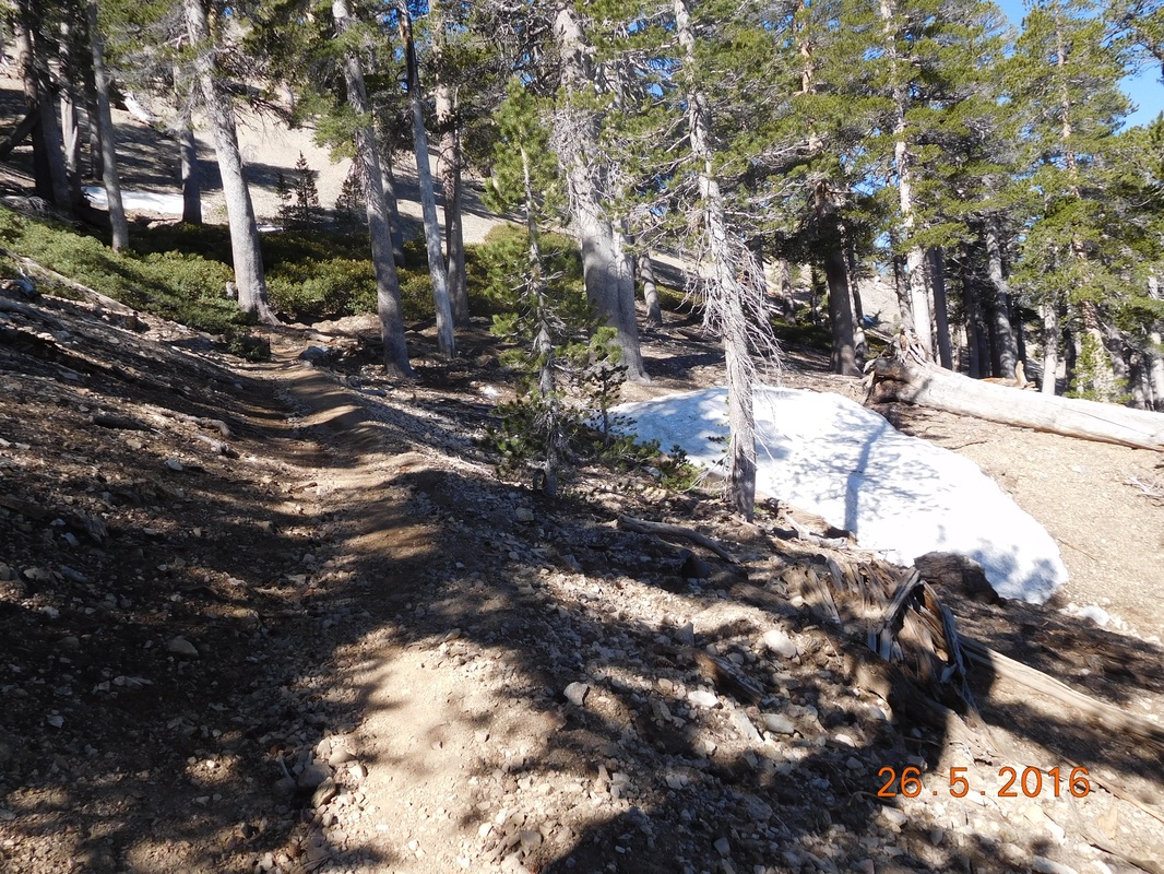 Woohoo...pine trees. At the trailhead going to the peak of Mount Baden-Powell was a Waldron Tree believed to be over 1,500 years old. 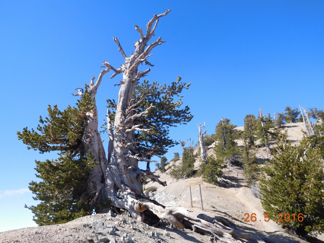 A Waldron Tree Just a short climb later, I summited the 9,399 foot Mount Baden-Powell. To those of you that think the name is familiar, it is because it was named for the founder of the Boy Scouts. 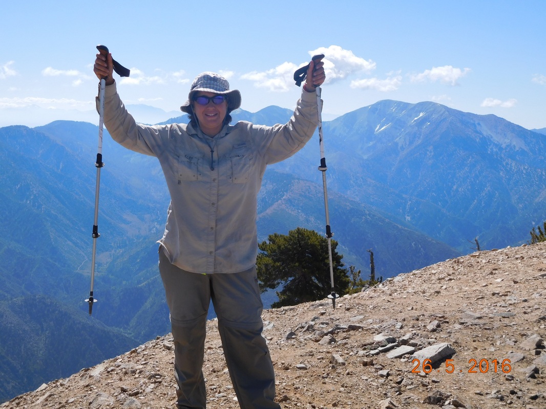 Traditional summit pose. I bet you were wondering who took that awesome summit picture. Well, Alex, who I camped with last night was on the summit when I got there. I was pretty happy since I didn't get a picture of him last night. 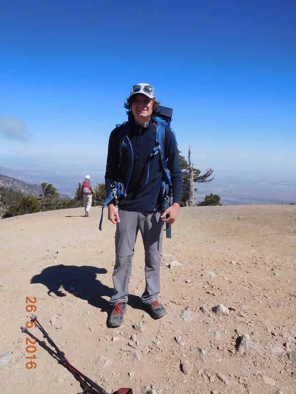 PCT hiker Alex I figured at this point the hike would mostly be down, but I was wrong. It climbed and dropped. On the way down I met a couple of men in their 70's who were out for a training hike. Their hobby is to bag as may peaks as they can in California. They especially like climbing snow covered peaks. I hop I am like them in 15 years when I am in my 70's! I also talked to another couple out for a morning hike who regularly hike this area instead of going to the gym. From the peak the trail did go down for a while with an amazing view. 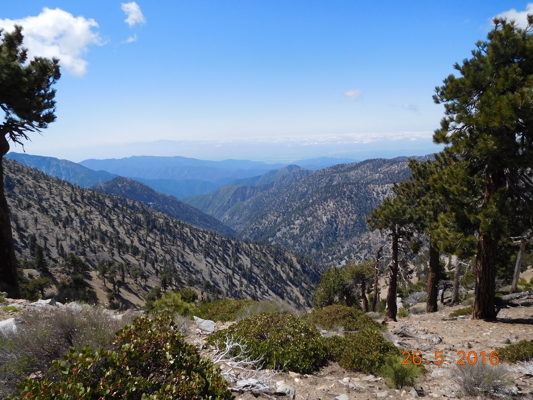 Spectacular ...but then it climbed sharply for a bit. For some reason I have more time to take nature pictures while climbing. 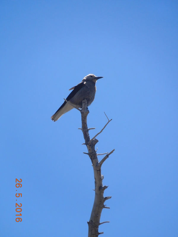 Cool bird. Finally, at 11:37 AM, I made it up to Dawson Saddle trail junction, 3.5 miles where I started today. It has been a difficult hike so far. 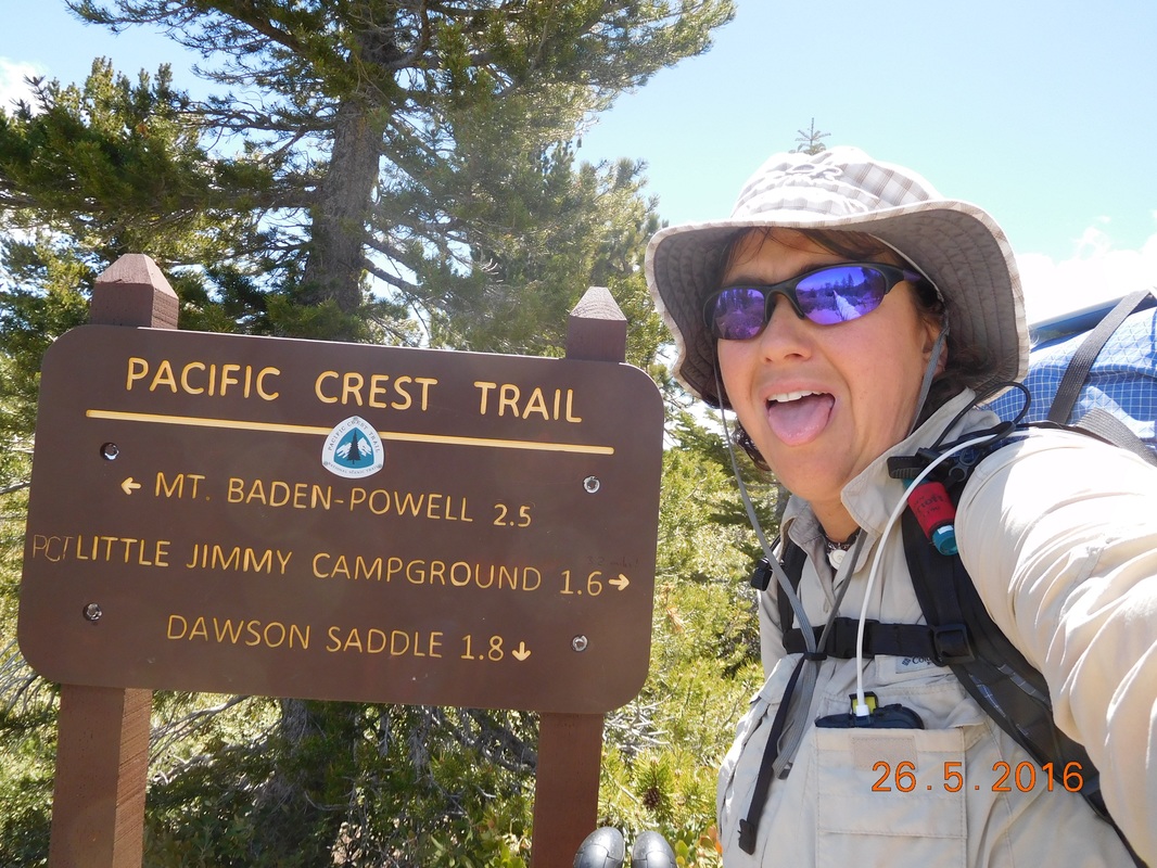 Tired after the climb At this point the trail drops 2,389 feet in 5.52 miles. Sound fun, right? Actually down is very hard on the feet and knees and hips and back. Plus, my snake bitten ankle is still not 100% and hurts some when it lands uneven. Oh well...I have all day to hike, so I can take my time. While I took my time, I stopped to take a self-portrait. 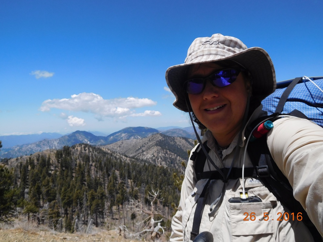 Self-portrait "Mountain smile" While heading down I met Goaltech who was hiking southbound on the PCT. He has section hiked over 700 miles of the trail with the goal to eventually complete the entire trail. While he hikes southbound he provides trail magic to northbound hikers offering them their choice of Starbucks Via, a bag of chips, or caramel candy. Check out the 2 extra bags he is carrying for the "magic!" Oh...by the way...I chose the chips. 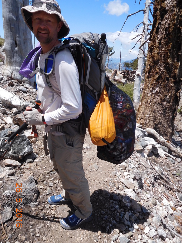 Goaltech providing trail magic on trail At 1:40 AM I arrived at the much needed Little Jimmy Spring. I was down to 2 liters of water and will probably need to dry camp tonight, so I need 2 more liters to make it to the next water source tomorrow. After filtering (even though the forest ranger said it isn't necessary) the water was cold and delicious. 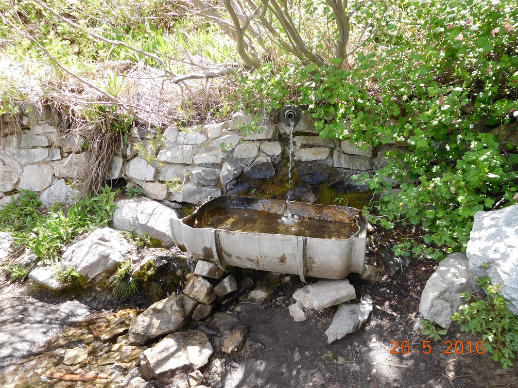 Little Jimmy Spring Just up from the spring was Little Jimmy Campground equipped with picnic tables and outhouses. What more do you need for a perfect lunch stop?  PCT sign of the day with picnic area in background 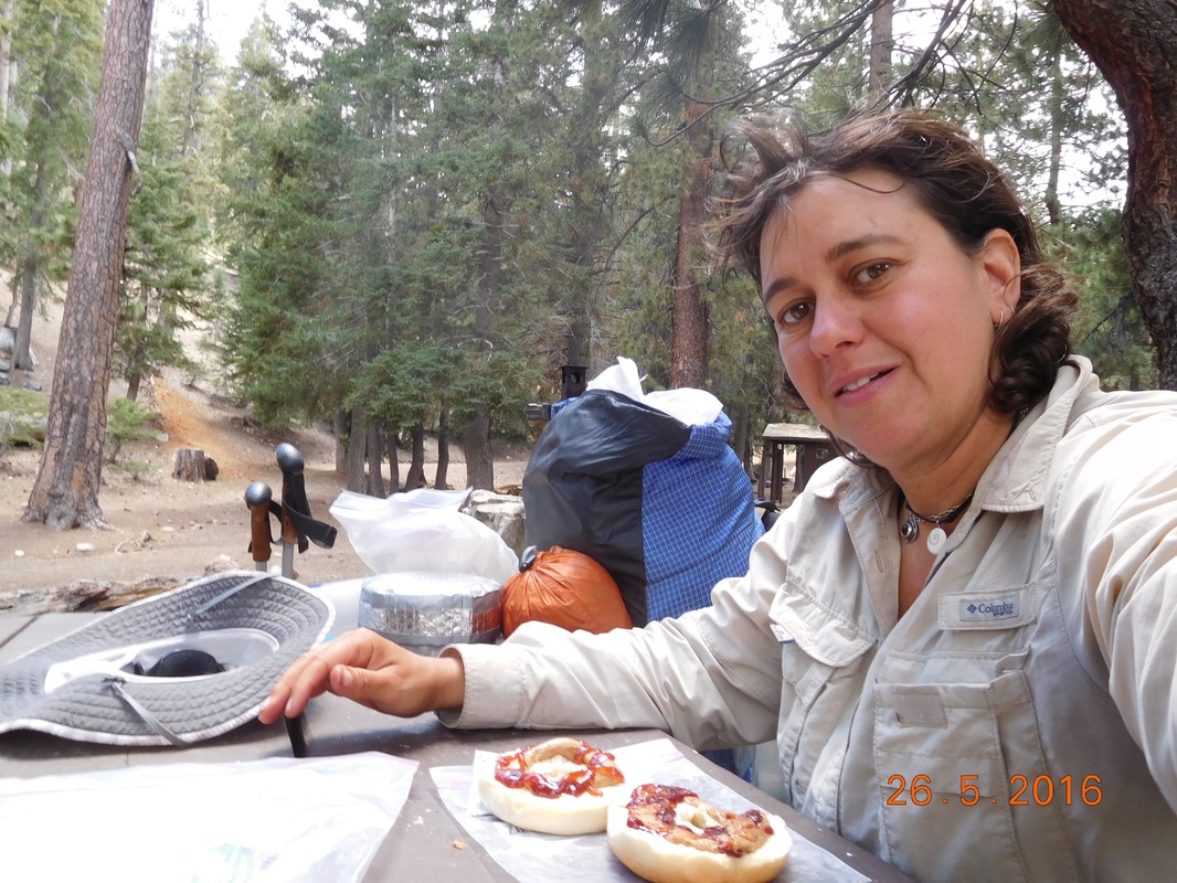 Lunch break with PB&J on bagel I stayed at the campground for about 1 hour and left at 2:47 PM. I haven't really figured out how far I am going today. I would love to make it to the Buckhorn Campground that I heard is beautiful, but at this point it is 9 miles away which seems pretty impossible. I should at least get within striking distance to it since it is the next water source. So onward I hike through this incredible scenery where for the next 2.16 miles the trail went down. 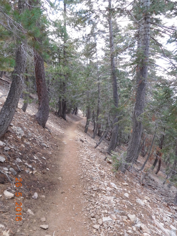 PCT through pines. 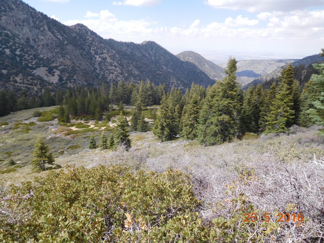 Incredible views. And then, after crossing Highway 2 at Islip Saddle, the trail climbed for the next hour. At least the views were still amazing. 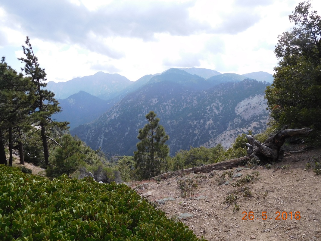 Breathtaking 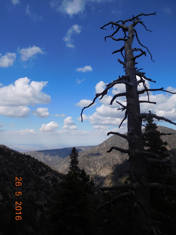 Cool dead tree. 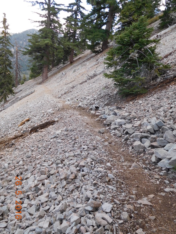 Very difficult climb At 5:00 PM I reached the top of the climb and had a view of where I started 1 hour and 1,232 feet of climbing ago. 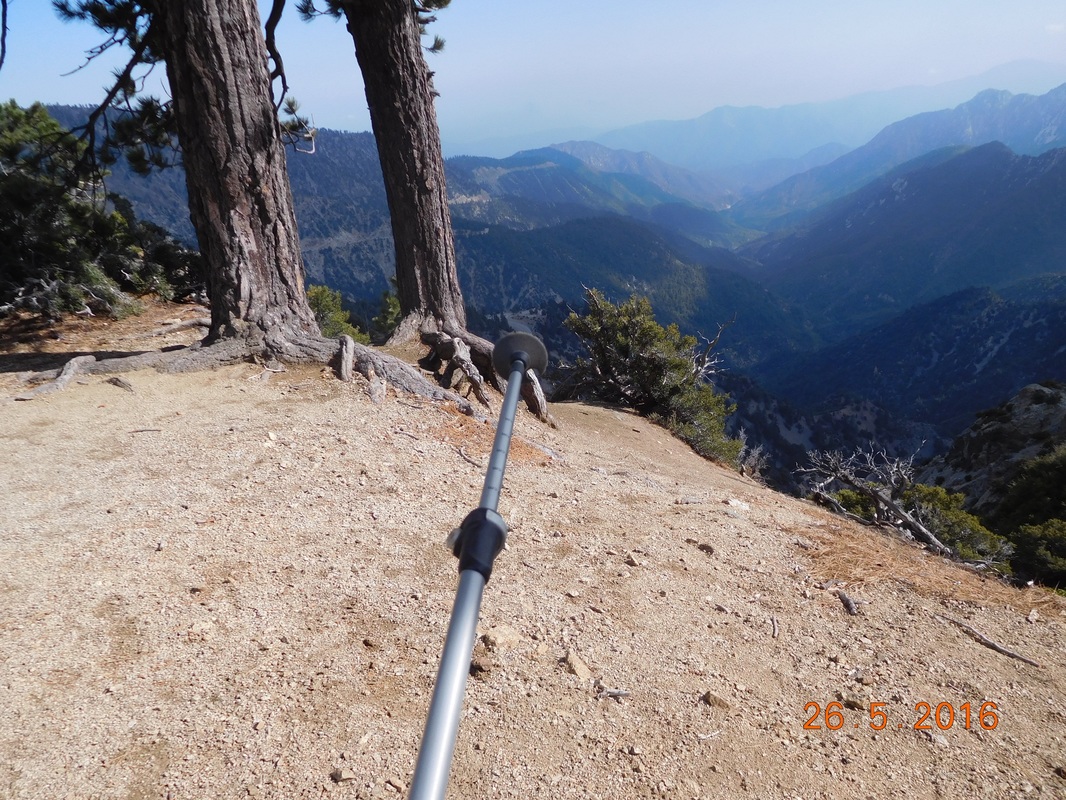 I was way down there. It was 5:45 PM when I made it to the next Highway 2 crossing. There is a picnic area less than 1 mile away that has an outhouse and picnic tables. I thought I could camp there, but that would be on the side of the road. I decided to head up that way and stop earlier if there is a nice campsite. Just 0.14 miles up the trail I found what I was looking for...a spectacular place to stop for the night. I am at 6,806 feet, almost 2,000 feet lower than last night, so I'm hoping it isn't as cold. And now that I'm laying in the tent blogging and hearing the wind, I'm hoping the wind doesn't get any worse since this site is a little exposed. Either way, I am pretty tired from today's challenging hike, so I should sleep pretty well. All together I hiked almost 12.5 miles with 4,651 feet of climbing and 2,730 feet of declining. So, goodnight for now. 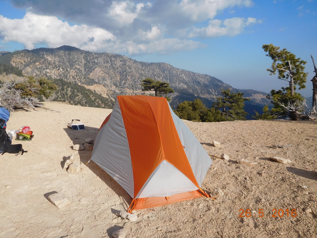 Nice campsite. Guffy Campground to Campsite at Mile 377.01 Last night was freezing, even sleeping in the 4Runner. Although it was cold, it was surprisingly comfortable. In the future, I would consider sleeping there instead of pitching a tent. We waited a bit till seeing the sun peeking through the trees, so we didn't leave the truck until around 7:30 AM. There was another thru-hiker that showed up last night, so I invited him over for a cinnamon roll and fresh fruit for breakfast which he accepted. "Hero" said that he has been hiking extremely long days and his body was exhausted. I suggested to him that he listens to his body and slow down and smell the flowers. He said that he agreed and would try. I have little hope he will. Today I am able to slack pack the entire day. I don't even have to carry meals since Tim is going to meet me for lunch and dinner. I left for the hike at 9:15 AM. I have 5.04 miles to get to Inspiration Point where we are supposed to eat lunch. Since I was slack packing I figured I could average 2.5 miles an hour, so I told Tim to meet me there around 11:15 AM. 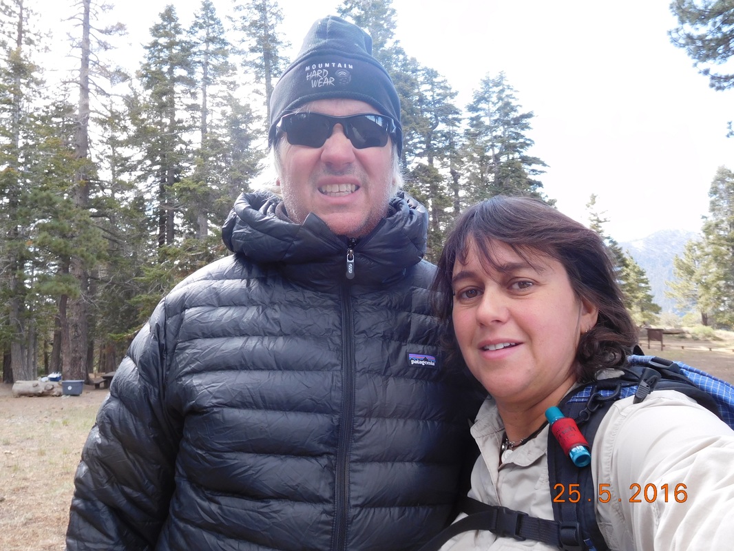 Ready for the day The day started out with blue skies, but I didn't expect it to last since there were low clouds in the valley below. 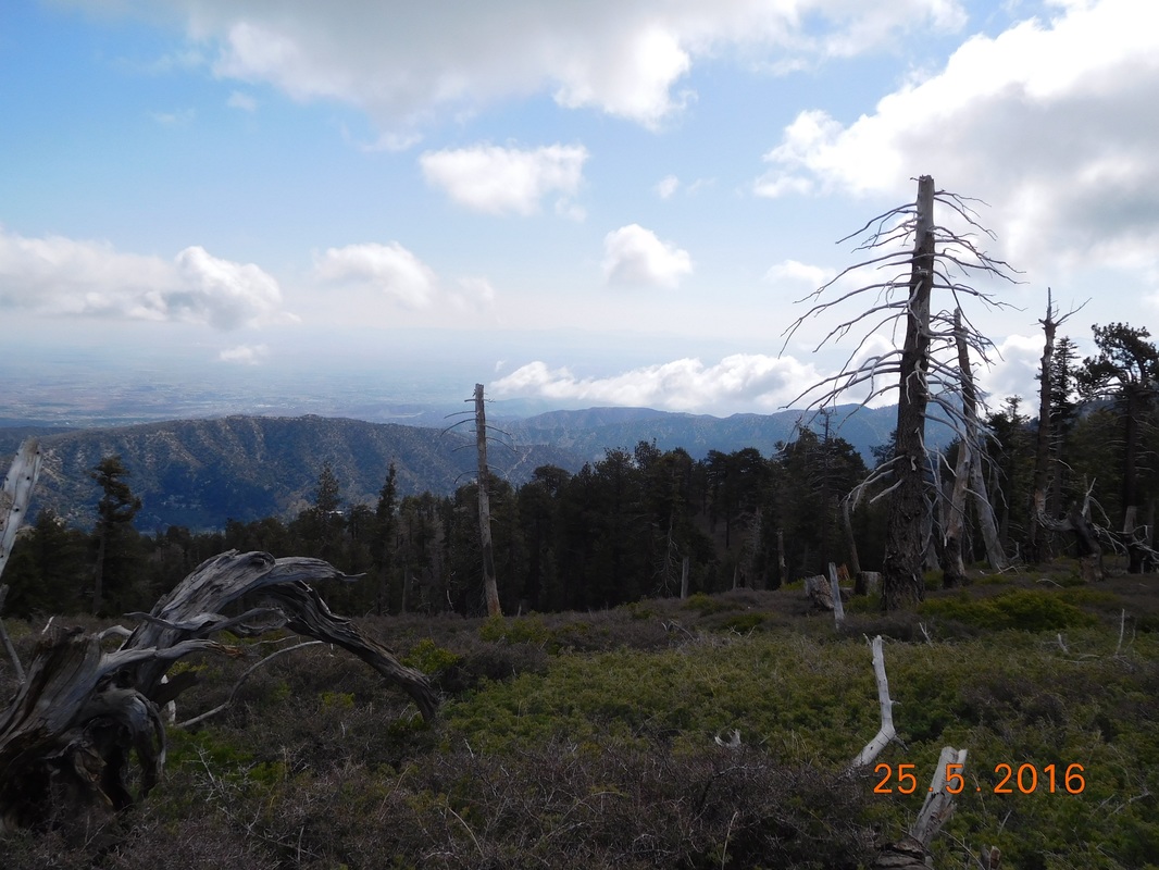 Beautiful blue skies to start the day After hiking through a clearing, I entered a pine forest...my favorite. 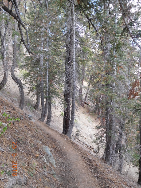 Passing through a pine forest. Here are those low clouds I was talking about: 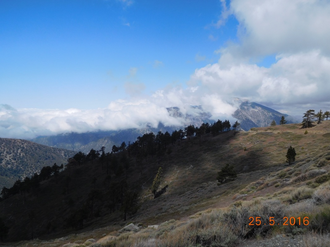 Clouds over the valley The trail went a little ways and i noticed a ski lift in the distance. It winds up that the PCT cuts right across Mountain High Ski Resort. 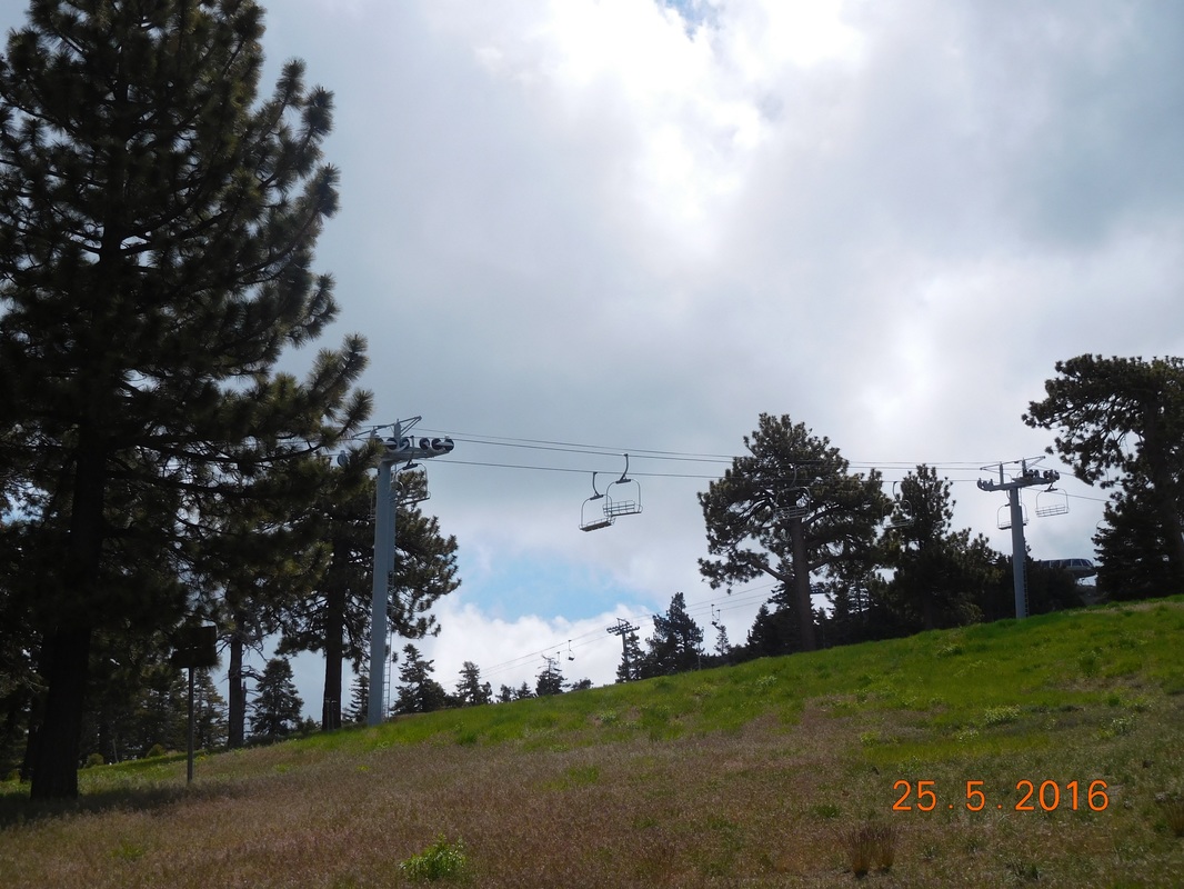 Ski lift above the PCT. 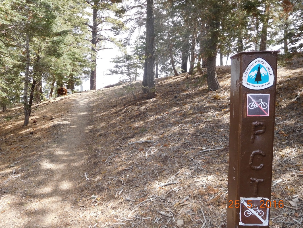 PCT sign of the day with chair lift in the background Luckily this time I didn't have to hike down the ski hill like I had to in Big Bear. There was a trail that cut through and around the hill. Finally, as predicted, as I hiked lower, the mist appeared. 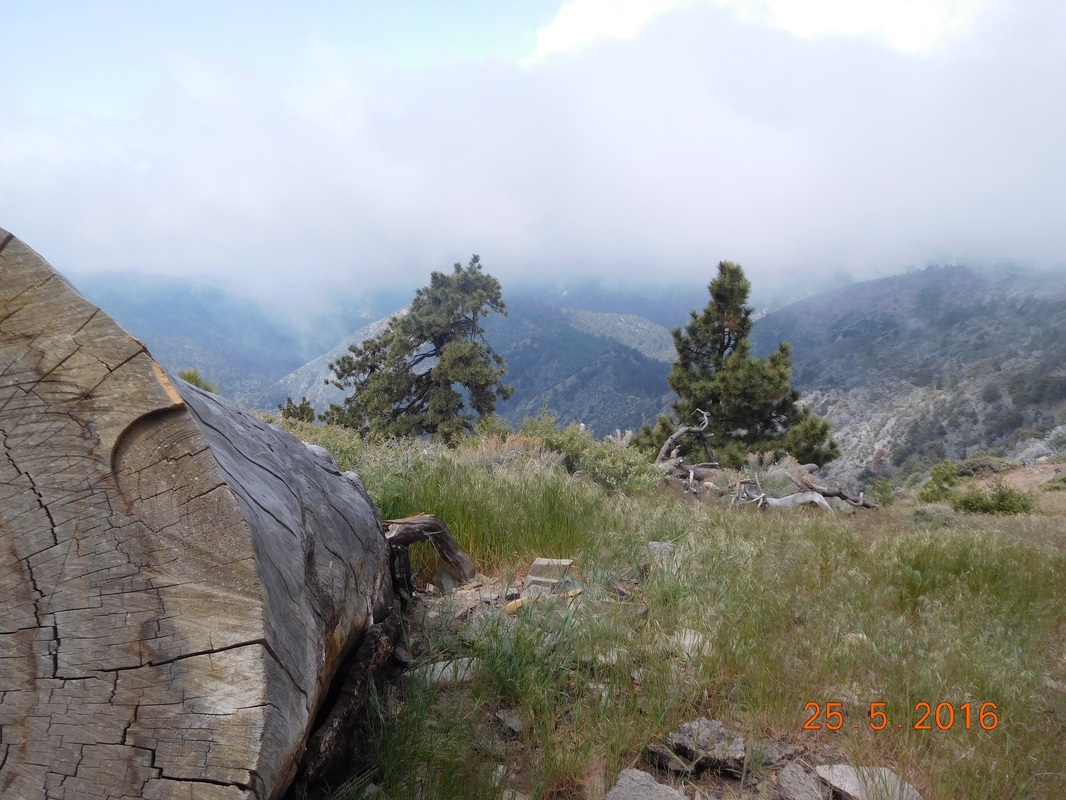 Misty mountains. The trail surprisingly took me to the top of the ski resort: 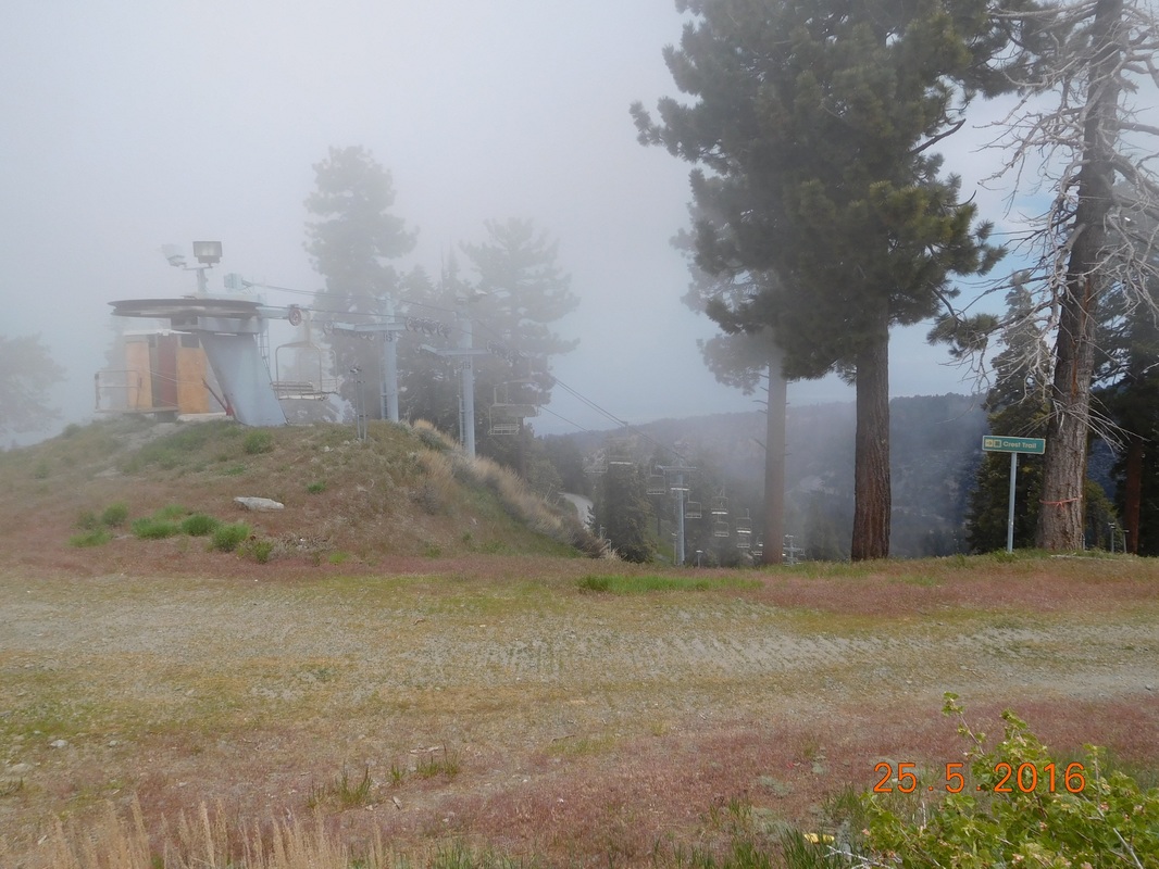 Top of Mountain High Ski Resort My ankle actually feels pretty good today. The only tough part I have is when the trail gets rocky and I have to step on unsteady rocks. That side-to-side motion of the foot hurts a little. But, the joy of being back overpowers the little pain, so I endure. 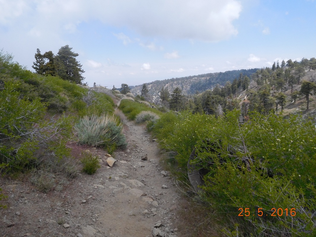 Yucky rocky trail Right on schedule, I arrived at Inspiration Point at 11:15 AM. This is the point where most hikers hitchhike into Wrightwood to resupply or take a day off. 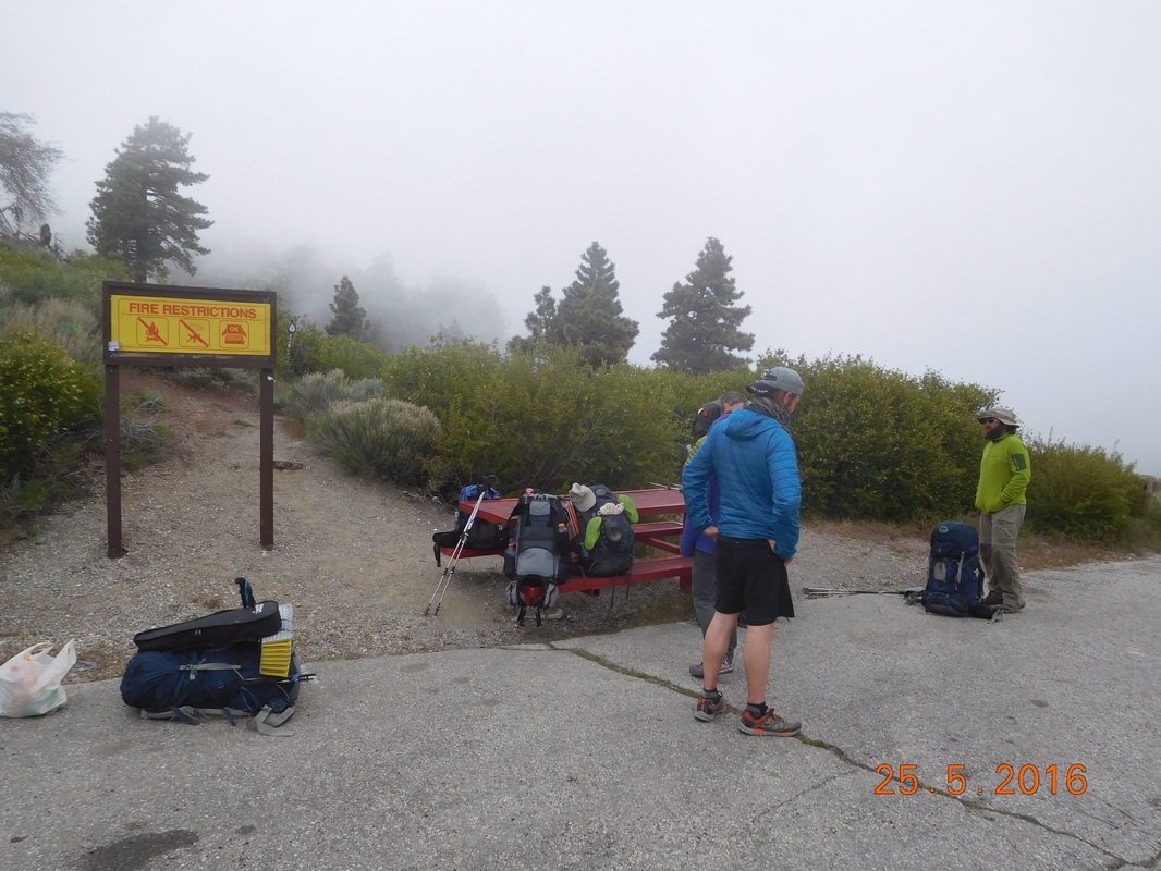 Hikers just getting back from Wrightwood Tim wasn't here, so I suspected that he gave some hikers a ride into town. Sure enough, he arrived about 10 minutes later with 2 hikers int he truck that needed a ride from town. He found them after he dropped off 2 other hikers in town. We were supposed to eat lunch here, but the mist rolled in and it was freezing. There is another picnic area less than 1 mile up the road, so we decided to try that one instead. As Tim was about to drive off and I was about to hike on, 3 hikers appeared and began to hitchhike. Tim decided to offer them a ride into town, so I hung out at Inspiration Point to watch some gear that had to come out of the truck so 3 other people could fit. Tim left, and 15 minutes later appeared with 3 other hikers that needed a ride from town back to the trail. Tim really could have driven back an forth all day, be he is here to support me, so off he drove and off I hiked to the next picnic area. I made it to Grassy Hollow Visitors Center pretty quickly and Tim and I had lunch. They had this really cool PCT right on the trail there: 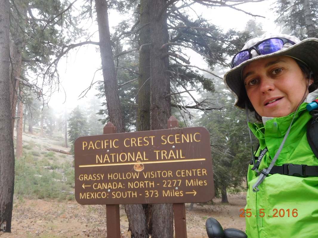 Slowly but surely After lunch the plan was to meet 3.66 miles up the trail at Vincent Gap where there is a parking lot for day hikers hiking up Mount Baden-Powell. This is also where we plan on eating dinner and spend the night. I told Tim that I will see him in a couple of hours and headed back out into a misty pine forest. 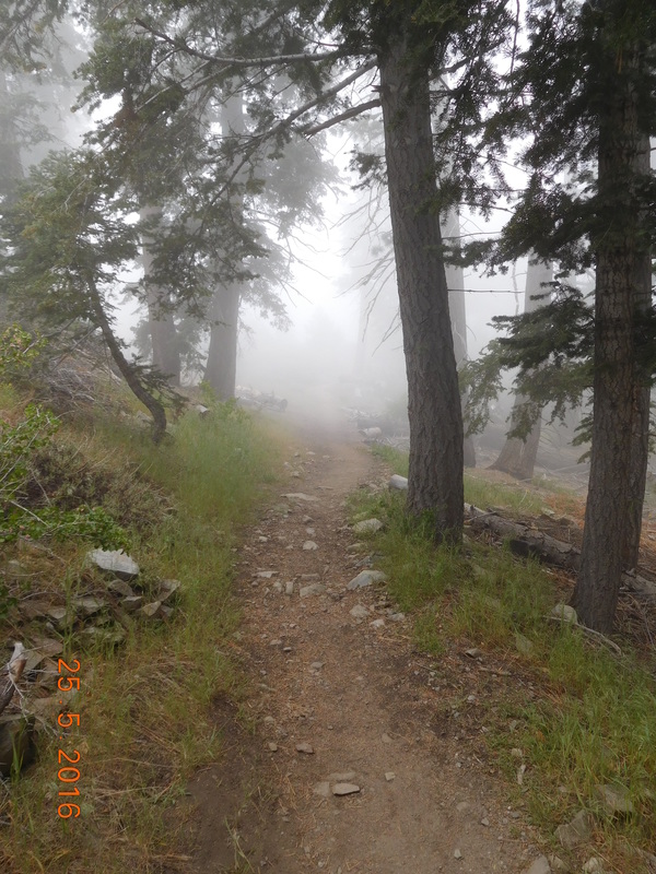 Misty pines. The trail went down, down, down into a forest of these really cool trees. 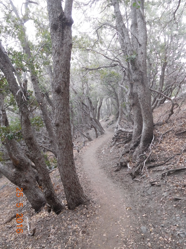 Interesting trees. And then I came across the perfect place for a self-portrait. 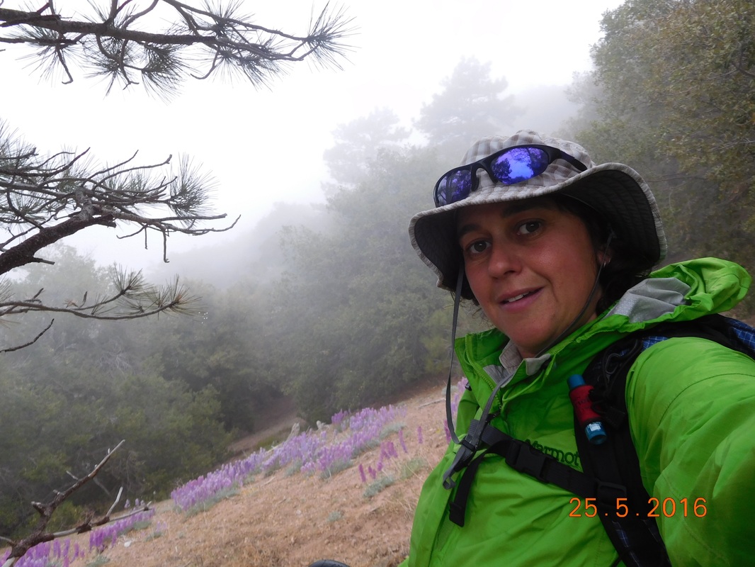 Self-portrait "Purple flowers with mist" Finally, at 3:00 PM I made it to Vincent Gap. It was only 3:00 and I was feeling like I had more hike in me, so I decided to continue on. The other decision I made is that I wasn't going to rely on Tim meeting me in 5 days to resupply and that I was going to carry 7 days worth of food. My reasoning is that I didn't want to be stuck to a schedule. If I'm feeling good, then I want to be able to hike on and not worry that I had to be at a specific place in 5 days from now. The trail is about to go into a remote area and I don't know if I will be able to contact Tim to change the plan. It took me about 30 minutes to pack my bag for the 7-day stretch. 7 days of food weighting about 18 pounds plus 4 liters of water weighing almost 9 pounds, plus all my gear...my bag must weigh around 45 pounds...OY!! My plan is to hike up 3 miles to a marked campsite. Tim decided to hike halfway up with me and he was kind enough to carry 2 liters of my water which felt huge when he took them off my back. These 3 miles will take me up 2,058 feet to an altitude of 8.638 feet. 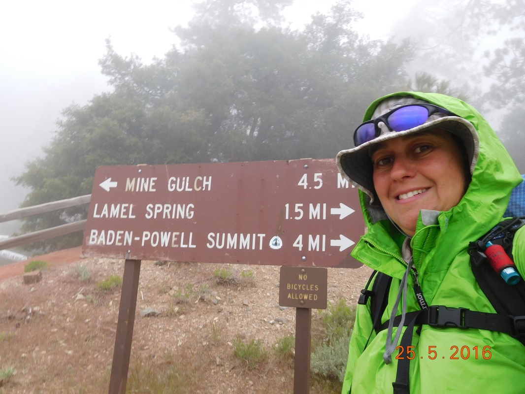 Ready for the climb up Baden-Powell Wow...the climb was steep and kind of chilly, and the mist continued.  Mist rolling in Finally, just over 1 hour later, 1.7 miles, and 1,189 feet of climbing, we made it to Tim's turnaround point.  Tim's successful hike. We said goodbye. It will be 7 days until I see him again. I think this is the longest stretch I will be on the trail without meeting up with him. I got my 4.4 pounds of water back and continued to climb. I have 1.32 miles and 869 feet of climbing left. It also seemed that we climbed above the clouds.  Above the clouds That 1.32 miles were really hard. Between my heavy pack, getting tired, and starting to feel hungry, it was difficult. I finally pulled into camp right at 5:30...2 hours after leaving the parking lot. All in all I managed to average 1.5 miles an hour which I feel is pretty good considering the terrain and my pack weight. When I got here there were 2 guys that we met yesterday at Guffy Campground and then Alex, who I met 2 days ago decided to stop here as well. I had dinner with Alex. He is an Aeronautical Engineering student at Purdue University. He hopes to work for Space X when he graduates. I was so happy to finally meet a young hiker who has ambitious goals. We pretty much ate dinner and then had to get into our tents since it was really cold. I guess 8,638 feet is pretty high. It is actually really cold right now. I don't know how I continue this blog with frozen fingers, but I am glad that I am done. Tomorrow I summit Mount Baden-Powell in only 1 more mile and then it should be downhill from there. Until tomorrow...  Tonight's cold campsite. Campsite at Mile 353.89 to Guffy Campground I felt like I slept really well last night. I think my body is happy to be active and back to hiking again. I woke just after 7:00 AM. By the time I got out of my tent MAGA and the Australian were both gone. These other hikers sure like getting on the trail early. Tim was supposed to meet me just 2 miles more up trail this morning to resupply me with food and water, but after studying the maps yesterday I noticed a campground 10 miles ahead that he should be able to drive to. Luckily I actually had cell service last night, so we were able to talk and change the plans. Now I can look forward to not just meeting up with Tim today, but spending the night with him. He thinks he will be able to get up to the campground around 2:00 PM, so I better get going. 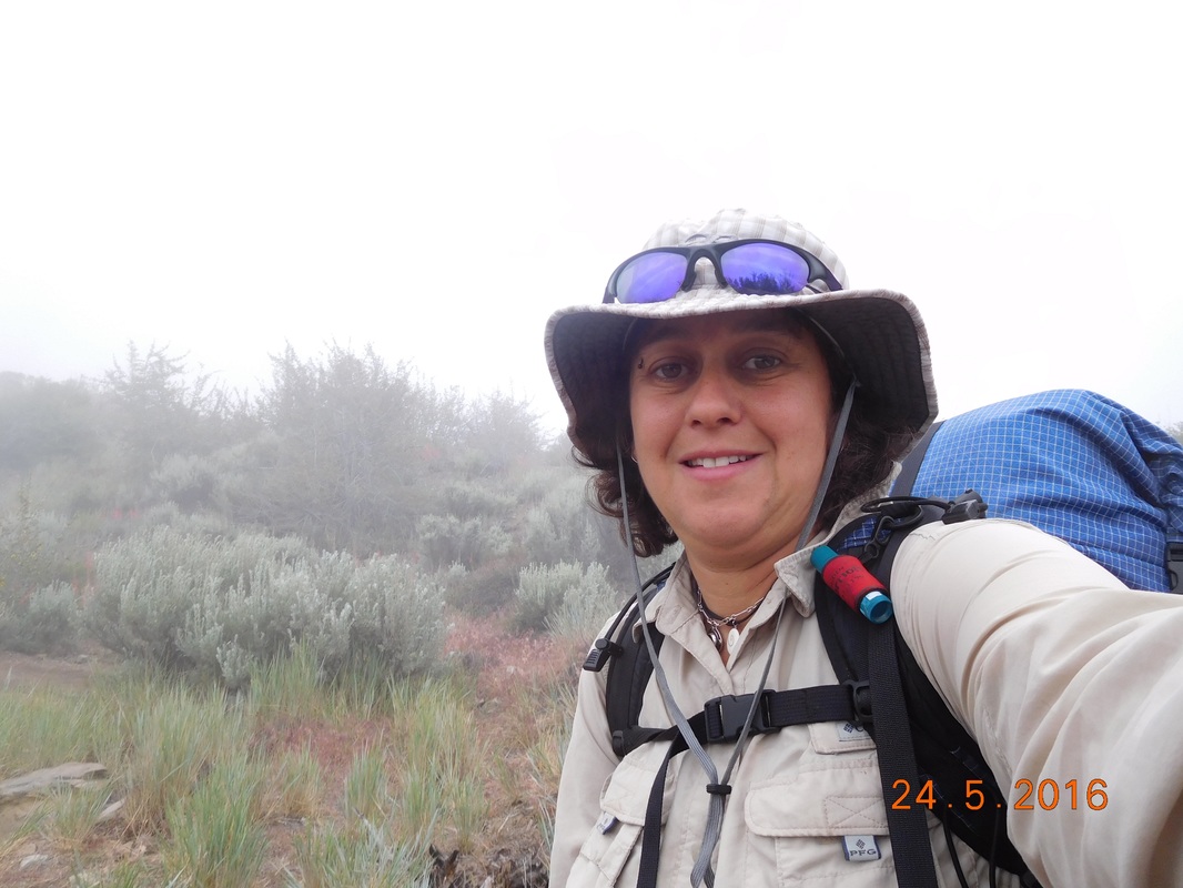 Ready to start today's hike. I started hiking today right at 8:30 AM, so it took me just under 1.5 hours to get going. I started today hiking through mist. Today I have lots of climbing (4,023 feet) and will gain 2,752 feet in elevation, so the coolness in the air is good, but it is doubtful that it will clear up. However, the mist makes for nice pictures. 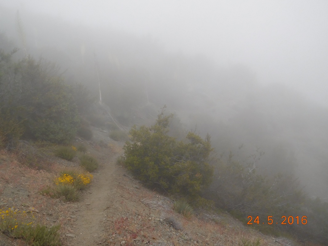 Misty PCT 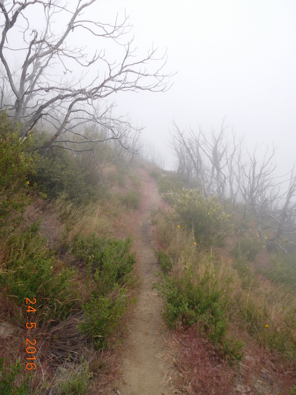 Mist on the trail 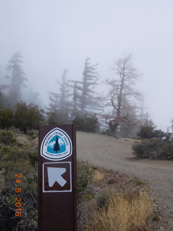 PCT sign of the day with mist Not only do I have to look out for snakes today, I also have to look out for the poodle dog bush. This bush is supposed to be worse than poison ivy, oak, and sumac. It causes itchy, painful blisters that can last 2 weeks. Luckily, someone was nice enough to leave a note pointing out the first poodle dog bush we came across on the trail. 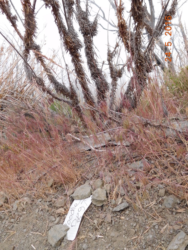 Poodle dog bush warning note. Luckily most of the poodle dog bushes I came across today was dead, but this one pictured below has some live leaves on it: 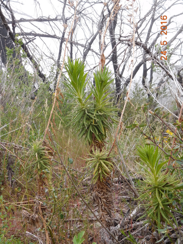 Live poodle dog bush At mile 2.34 today was where Tim was supposed to meet me originally with food and water. I have plenty of food, but could use 1 liter of water. Luckily there was a water cache here where I can fill up. This cache is maintained by residents of the very hiker friendly town of Wrightwood. 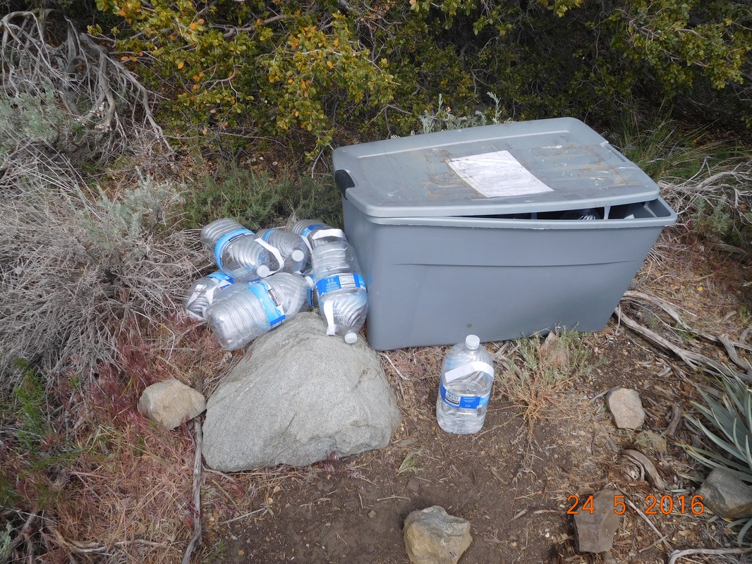 Thanks for the water! I crossed a forest road to the other side of the ridge and this is where the incredible mountain views began. 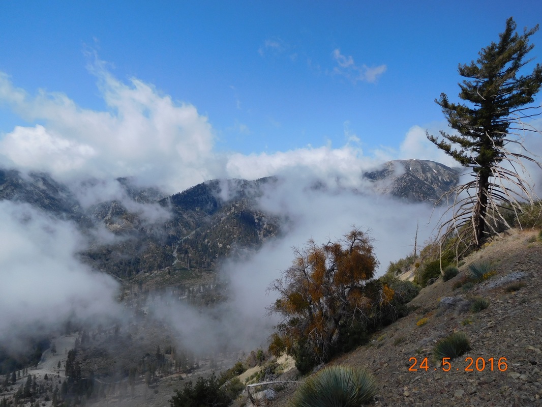 Wow!! 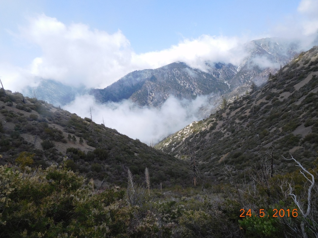 Amazing. I was lucky to get there when I did, because soon after taking these pictures the mountains were covered by clouds. As the trail continued to climb I felt the need for a break...I mean self-portrait: 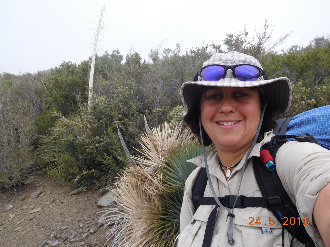 Self-portrait "Taking a breather" Right around 11:30 AM I felt a twinge of hunger. The trail I had been on was narrow and climbing so I doubted I would find a nice place to eat lunch and take a break. Would you believe that not more than 2 minutes later I came across this awesome place to stop?!? 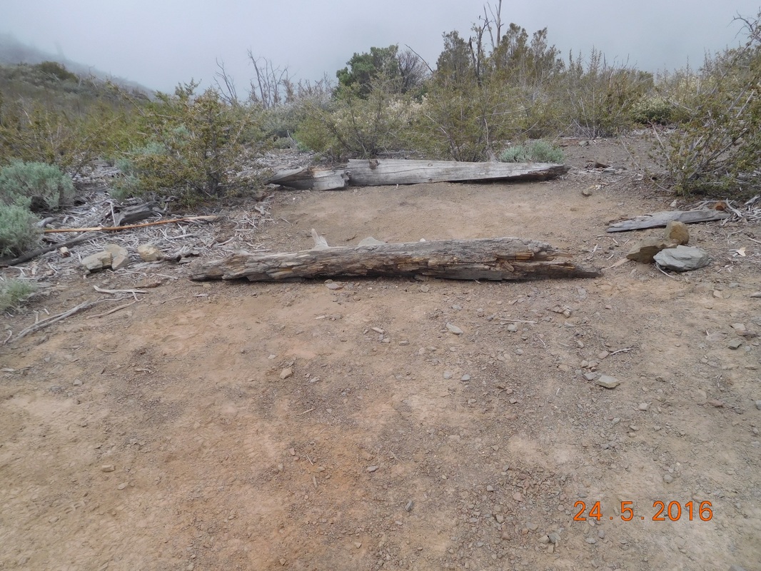 Just what I needed. 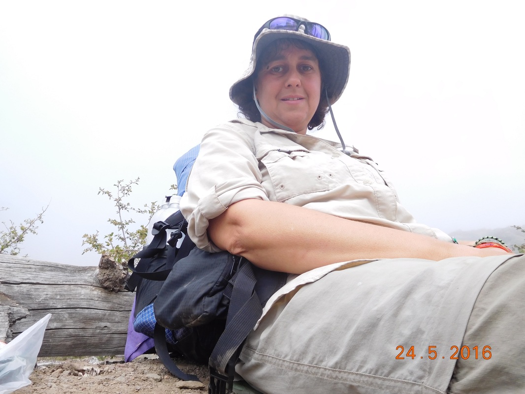 Comfortable place to lounge. After a nice 1 hour break at 7,044 feet, I continued on my way. 30 minutes later the trail was cutting through a pine forest. I love the look and smell of pine trees. 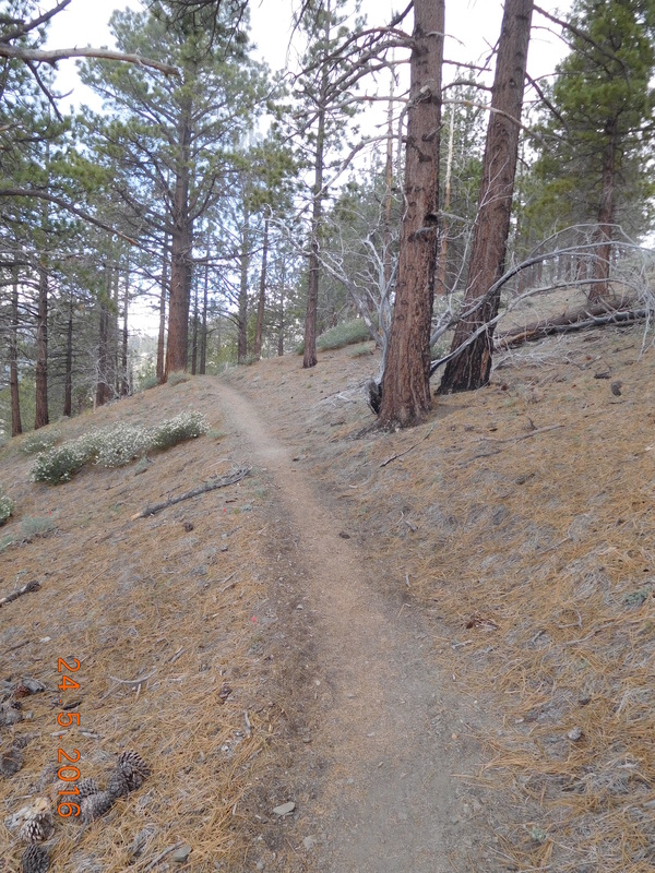 PCT through some pines. Wow...another break in the clouds allowing for some beautiful mountain and valley pictures. 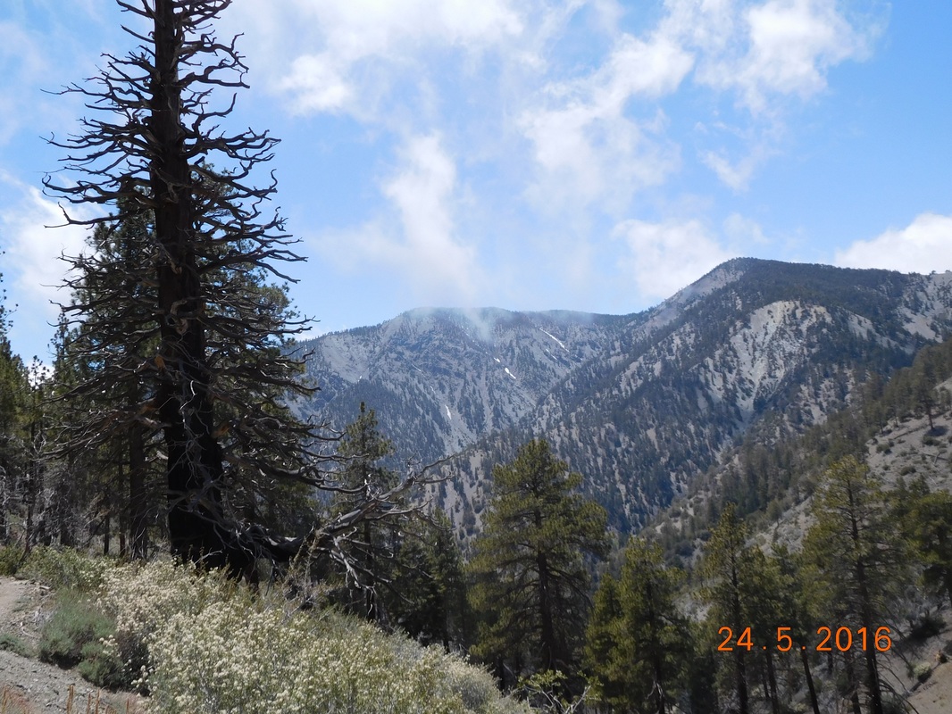 Beautiful mountains 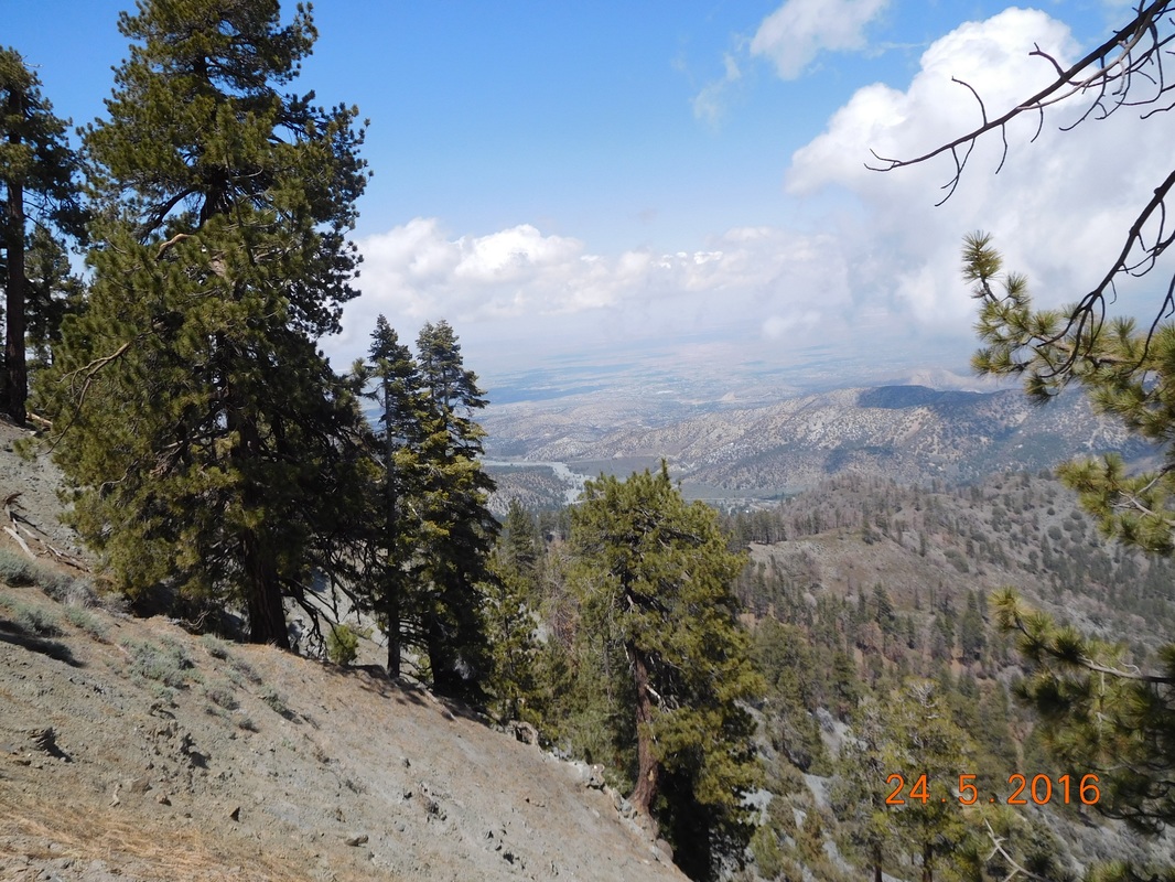 Beautiful valley What an incredibly beautiful day of hiking! 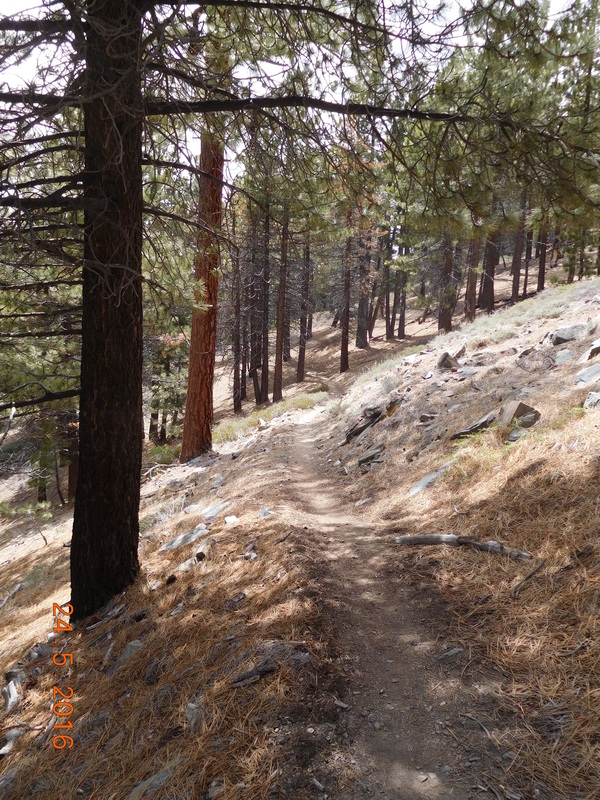 Another pine forest. 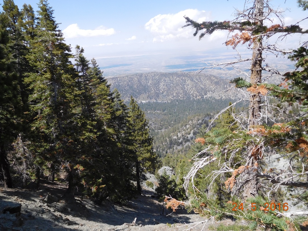 Looking down on Wrightwood. Finally, at 2:39 PM, I had only 1 mile to go to get to Guffy Campground and Tim. 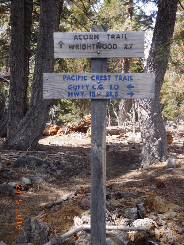 Almost to Tim. I arrived at the campground 30 minutes later and found Tim being a trail angel. He purchased fresh fruit, water, cinnamon buns, and beer to share with other hikers coming through. He had 2 "customers" when I got there and had a few others before I got there, including MAGA who I camped with last night. 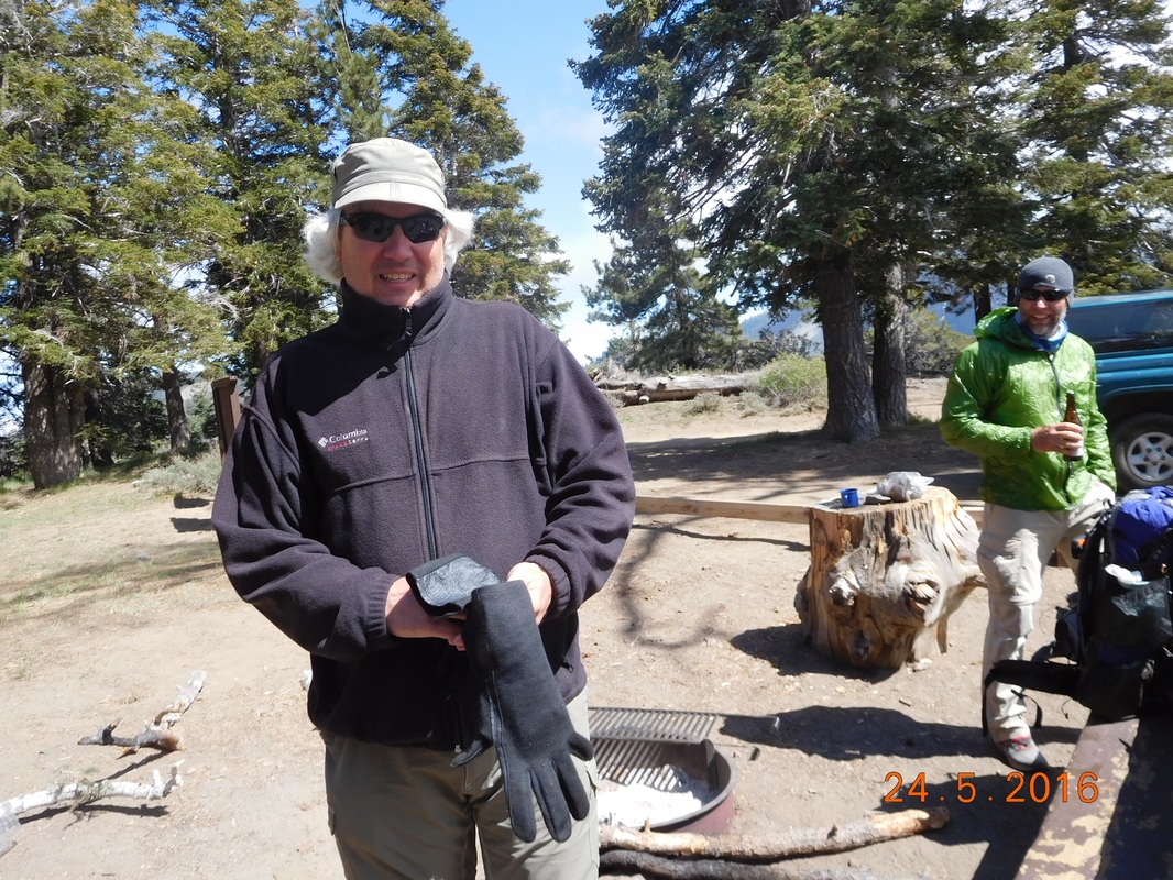 Trail angel Tim Tim also purchased for me some salads and cheese so I didn't have to cook dinner which was awesome because it was freezing here. The truck said it was 39 degrees and that's not taking into account the constant wind. Oh...we are up at 8,264 feet, so I guess that explains some of it. We decided it was too cold and windy to pitch a tent, so we cleaned out the back of the 4Runner and set up our sleeping pads and bags in the back. It is still pretty cold, but at least there is no wind. Tomorrow Tim is meeting me at lunch and dinner, so I will be able to slack pack which I am so looking forward to. Until then... 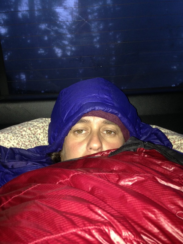 Sleeping in the back of the Toyota 4Runner. Cajon Pass to Campsite at Mile 353.89 I was excited last night knowing that I will be hitting the trail today, but at the same time I was sad knowing it was my last night sleeping in the way comfortable bed in the Wilson's home. What incredible hosts they have been for me. I wouldn't even know where to start to thank them. We woke at 7:00 AM and got on the road by 8:30 AM. Tim is driving me to Cajon Pass to restart the trail. As we got closer I was feeling kind of nervous. My stomach was in knots or something. Some of the nerves are because I wasn't sure how I would do back on the trail with a full pack. Would my ankle feel OK? How much of my conditioning have I lost after 3 weeks sitting on the couch? How will it be hiking alone, without Brad? Oh...and what if I come across snakes?!? I knew that once I got started I would feel better, so let's go.  Let's get going! Tim decided to hike the first mile with me, so that was cool. We started out at just after 9:30 AM. The temperature was a cool 55 degrees...perfect for hiking. The hike started out going under I-15.  About to go under I-15. Soon after crossing under the interstate, there was a cute wooden bridge crossing a dry creek bed.  Nice little bridge. I was really looking forward to today's hike. Not just because I am finally back on the trail, but because this is the day that I get to hike in a new area. At the 5.38 mile point of today's hike is where Tim and I came off the trail 2 years ago when we attempted a thru-hike. That means that I will finally be hiking the part of the PCT that I haven't hike before. No more saying things like "I remember this." Or "Two years ago..." The next 28 mile of the trail is dry, meaning there is no water source available. For most hikers this means that they would have to carry anywhere from 6-8 liters of water with them. I am lucky. Tim is going to meet me tomorrow at the 15 mile point, so I am only carrying 5 liters. It's not just the dryness of the trail that makes the next 28 miles challenging. It is also the climbing that we have to do. From Cajon Pass tot the exit for Wrightwood we have to climb 8,729 feet. This will really let me know how I'm doing. Not far into the day, a lizard greeted me on a signpost.  Hi little fellow. We then walked through this cool pipe tunnel. 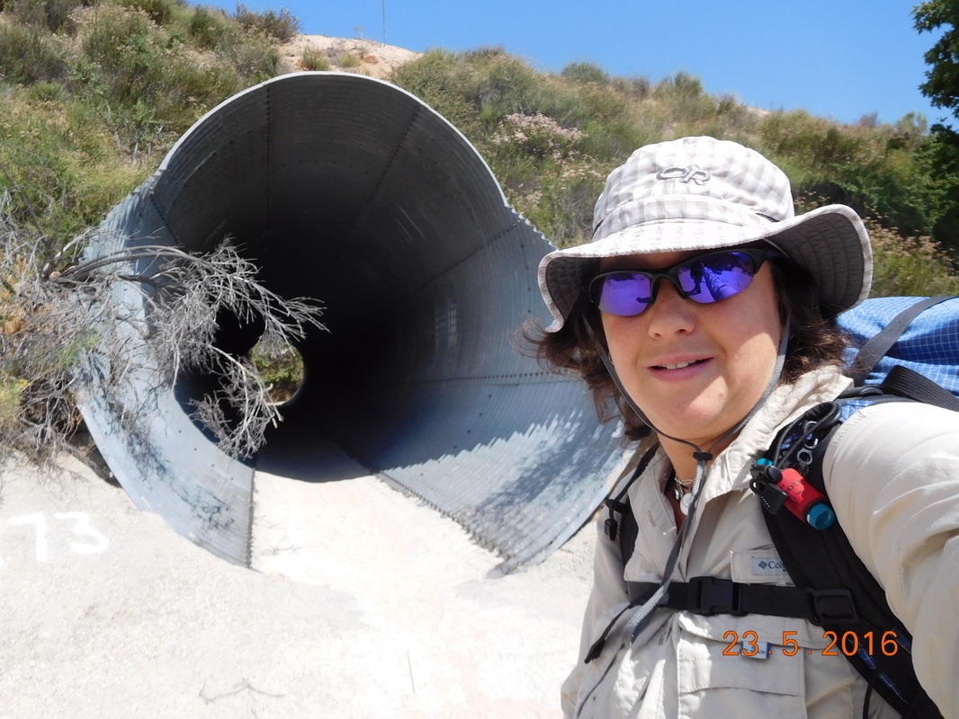 Nifty tunnel. Then, 1.27 miles into the hike, the trail crossed over railroad tracks. 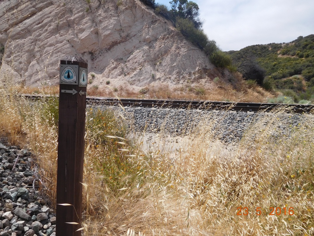 RR crossing. Check out the beautiful scenery of this mornings hike: 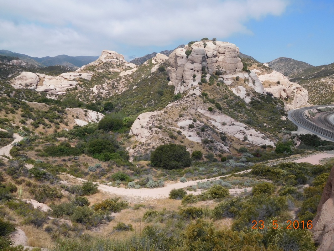 Cool rock formations. 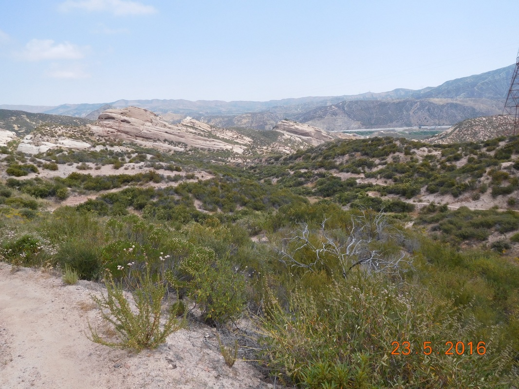 A long view from the trail. Of course, the thoughts of a snake hidden on the side of the trail was freaking me out a bit today. The parts of the trail like this, wide open and easy to see things was pleasant. 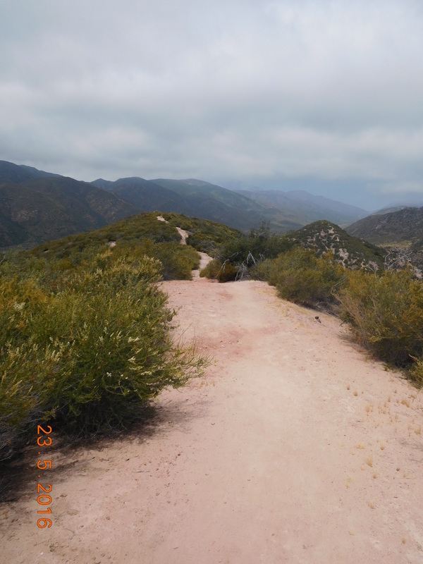 Nice, wide, snake-free trail. Unfortunately, there were more parts of the trail like this, where the trail is narrow and it is hard to see if a snake is lurking on the side. 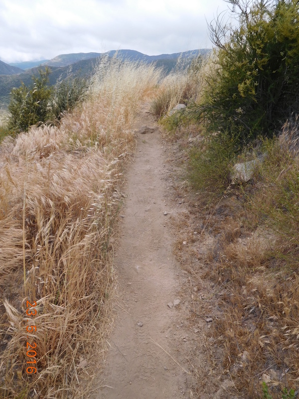 Snake-free trail??? I did keep my eyes open, but I tried not to think about it too much. I tried to focus on the beauty around me. 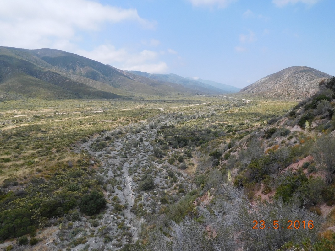 Peaceful, beautiful scenery. I made it to the unpaved Swathout Canyon Road, mile 5.38, just after noon. I knew that I needed a break, so I took off my shoes and socks and leaned against my bag to chill. There was another guy there that started talking to me and one thing led to another and I was telling him my rattlesnake story, As the story was ending, a group of 3 hikers were walking by and the girl asked if I was Geraldine. She recognized me from the rattlesnake post I made on Facebook. I guess I'm a celebrity! She told me that as she hikes she thinks about me and she looks for rattlesnakes. I then told here them the abbreviated story. They all took off and I started eating lunch when a young guy, Alex, stopped by and asked if I was Mighty Mouse, the hiker that was bit by a rattlesnake. He said that he read my story and actually looked up information about rattlesnakes in case he came across one. I ate lunch and relaxed there for over an hour and knew it was time to go. The next part of the trail starts climbing with a 2,000 foot gain in 4 miles. But first I have to cross Swathout Canyon Road into new PCT territory for me.  Self-portrait "Entering a new experiance" By the way, this road runs right along the San Andreas Fault! Just after crossing the road I had a wonderful view of the new trail accompanied by a PCT sign. 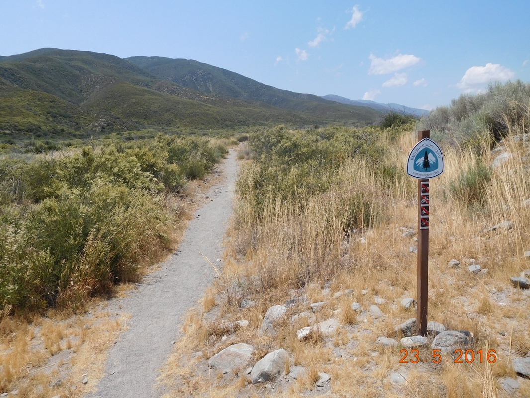 PCT sign of the day The next 6.64 miles was difficult. I climbed almost 2,500 feet and was getting pretty tired towards the end. I have only 1 picture I took during this climb: 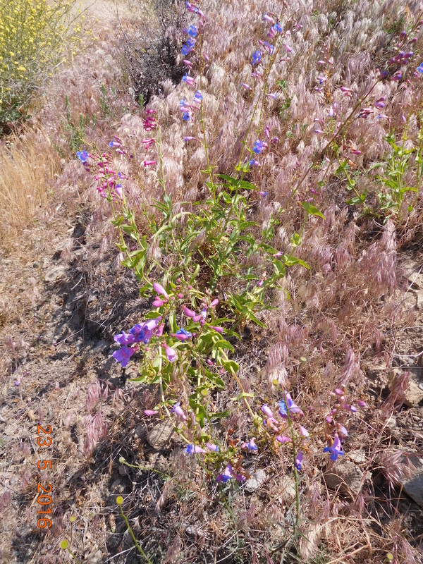 Stopped to smell the flowers. I mad it to camp around 4:30 PM after hiking 12 miles. I am pretty satisfied with being able to hike 12 miles considering the weight of my pack and the climbing I did. After setting up camp, a guy from Australia joined me. He wasn't very talkative since he was beat after hiking 18 miles today, 25 miles the day before, and 20 miles the day before that. A little later, MAGA rolled in for the night. I actually saw him earlier in the day when he passed Tim and I in the first mile of the day. I guess he stopped for a break earlier and fell asleep. That's how I got ahead of him. Anyway, MAGA is from Eugene, Oregon. He has a degree in accounting, but has spent 3 years teaching English in China. His plan after the PCT is to get a seasonal accounting job so he can hike as much as he can. He also wants to move out of Eugene to Wyoming or Utah where there are more conservatives. Oh...MAGA, his trail name, stands for "Make America Great Again." 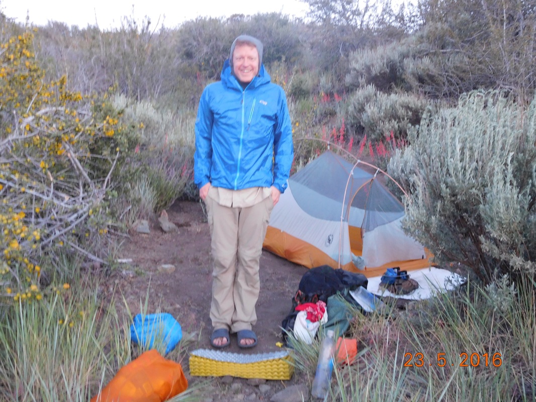 MAGA Here is my wonderful home for the night. I am at 5,554 feet, so it should be a chilly night. While off the trail I bought warmer pants to sleep in. Tonight will be their first test. 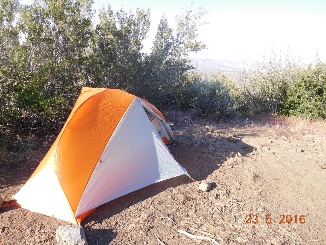 Home for the night. RATTLESNAKE to Cajon Pass I have been looking forward to this day for the past 3 weeks. I am finally heading back to the Pacific Crest Trail to hike from the site of my excavation due to the rattlesnake bite to Cajon Pass. It is only a 6 mile hike, but it will confirm (or not) that I am read to get back on the trail. I am still not at 100%. My ankle still aches and stiffens up when I sit for a while. However, I am done sitting...I need to get back on the trail. Tim drove Mary (Brad's mother) and I to a point about 0.5 miles from the excavation point. From here we have to hike in 0.5 miles or so to mile 337 and then hike back and beyond to Cajon Pass. Here we are ready to get going: 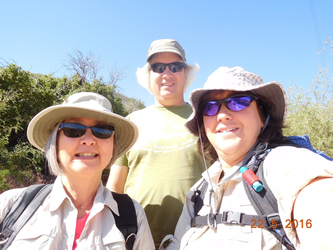 Mary, Tim, and I ready for the day back on trail. Tim didn't start the hike with us, but is planning on hiking in from Cajon Pass and meeting us for the last mile or two of the day. So, Mary and I took off to go back to the location the helicopter airlifted me out. Mary asked me if I was nervous about being back on trail. I guess I was jumping at anything that sounded or looked like a snake. I know that I can't worry too much about getting bit by a rattlesnake again because the chance is slim that it will happen again, but it is hard to not. We arrived at the site and stood there contemplating what happened 19 days ago. 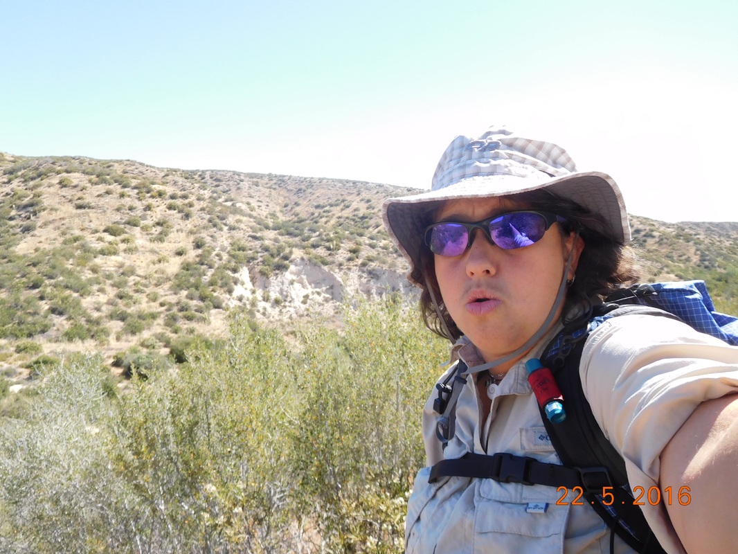 Contemplating the past events. OK. Time to get over this and move on...so move on we did. 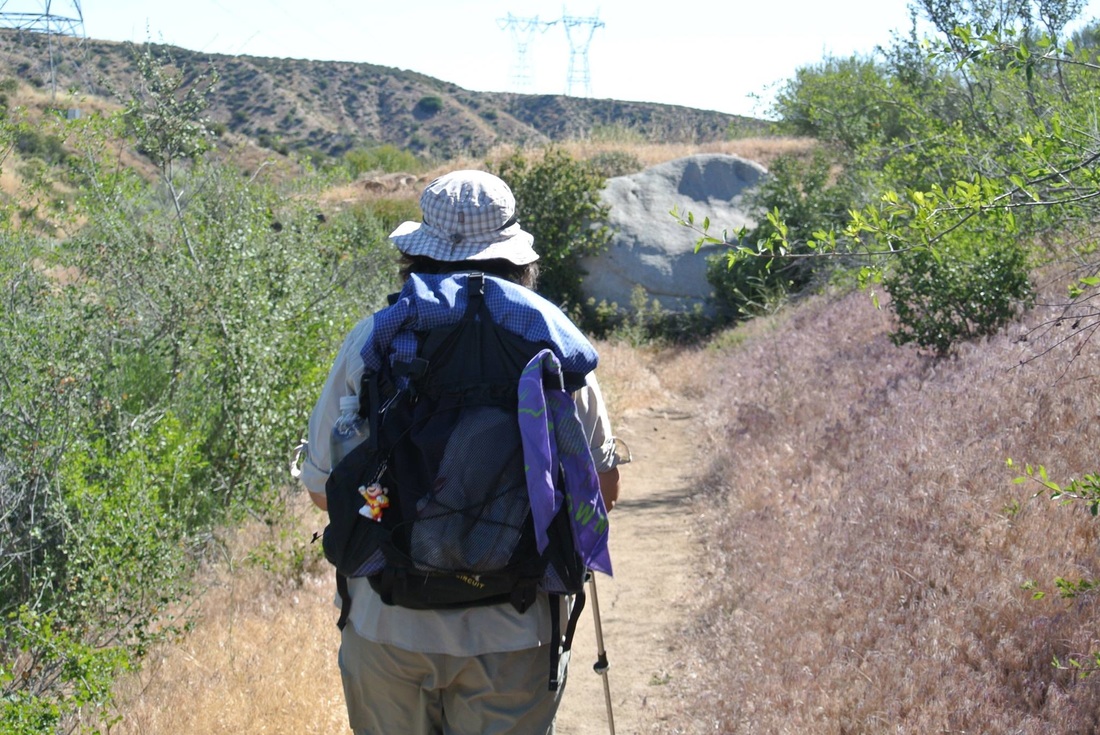 Leaving the past behind. (Photo courtesy of Mary Wilson) Check out this incredible scenery we hiked through today: 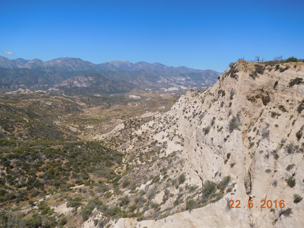 WOW! 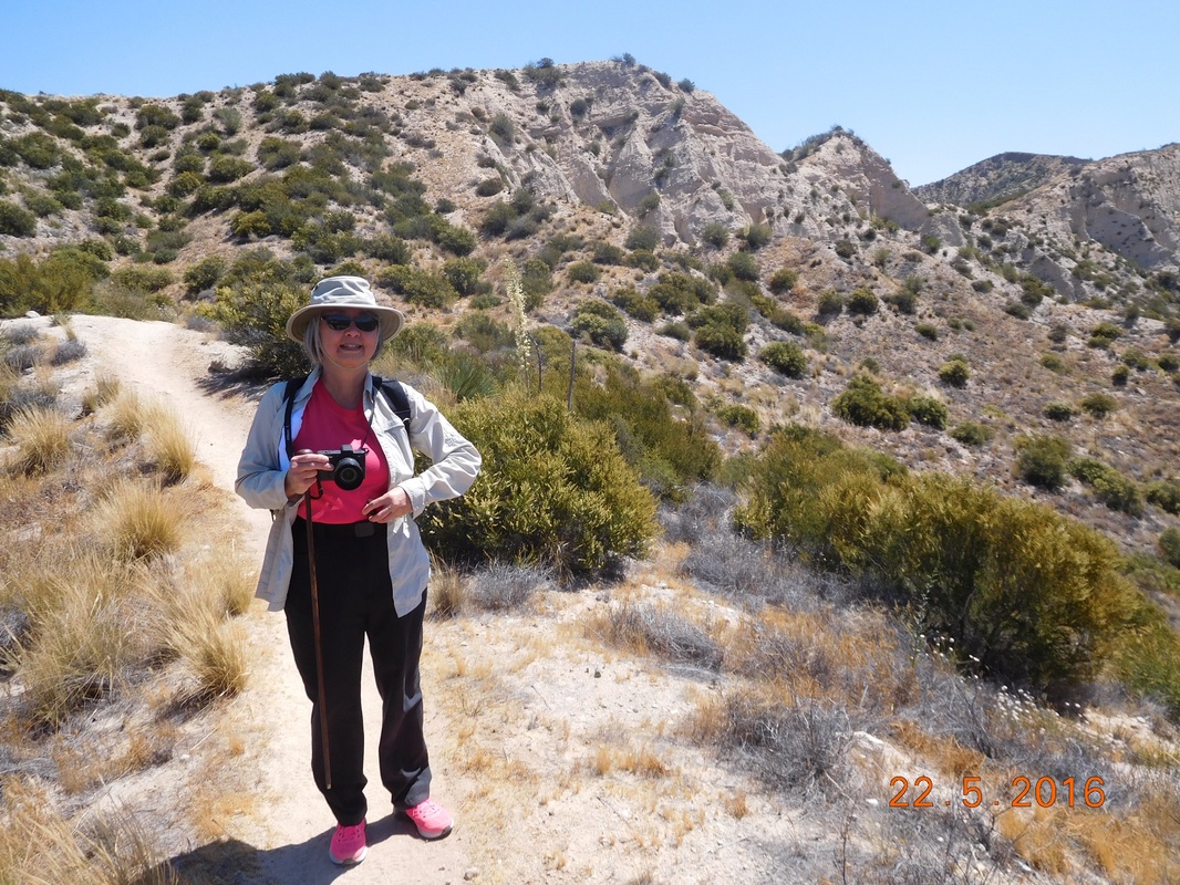 Mary at awe with the views. 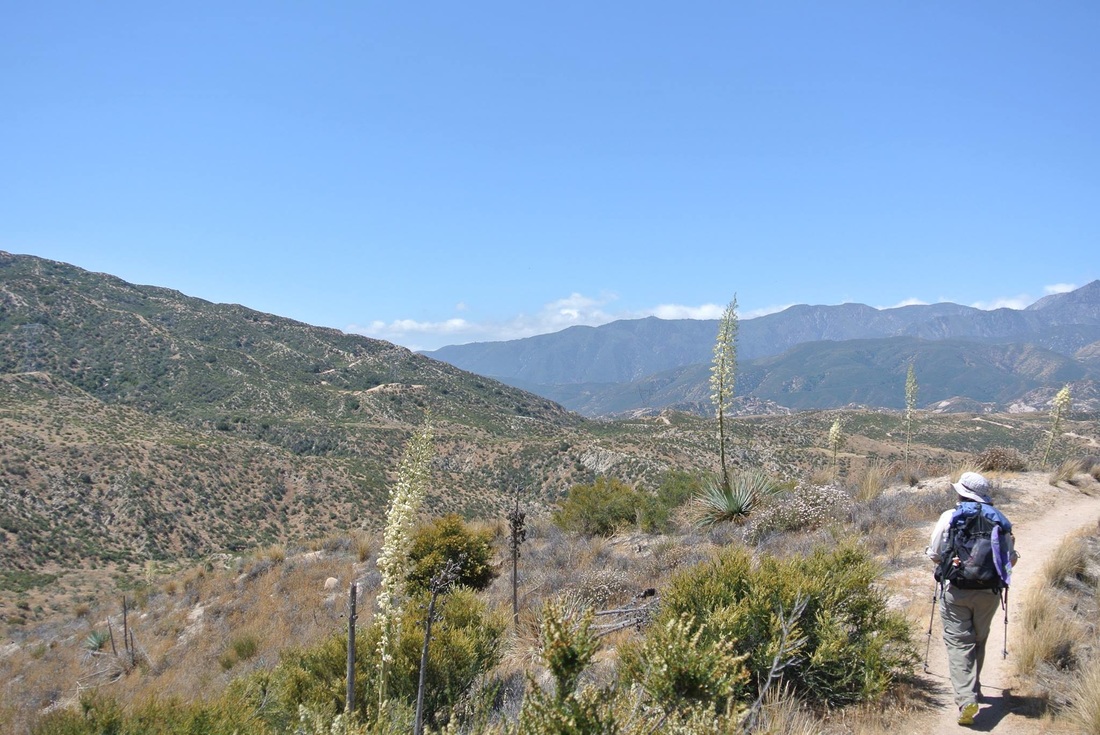 Walking through incredible landscape. (Photo courtesy of Mary Wilson) Usually I try to take a daily picture of a PCT sign standing on its own, but today I was so happy to be back that I had to include myself. 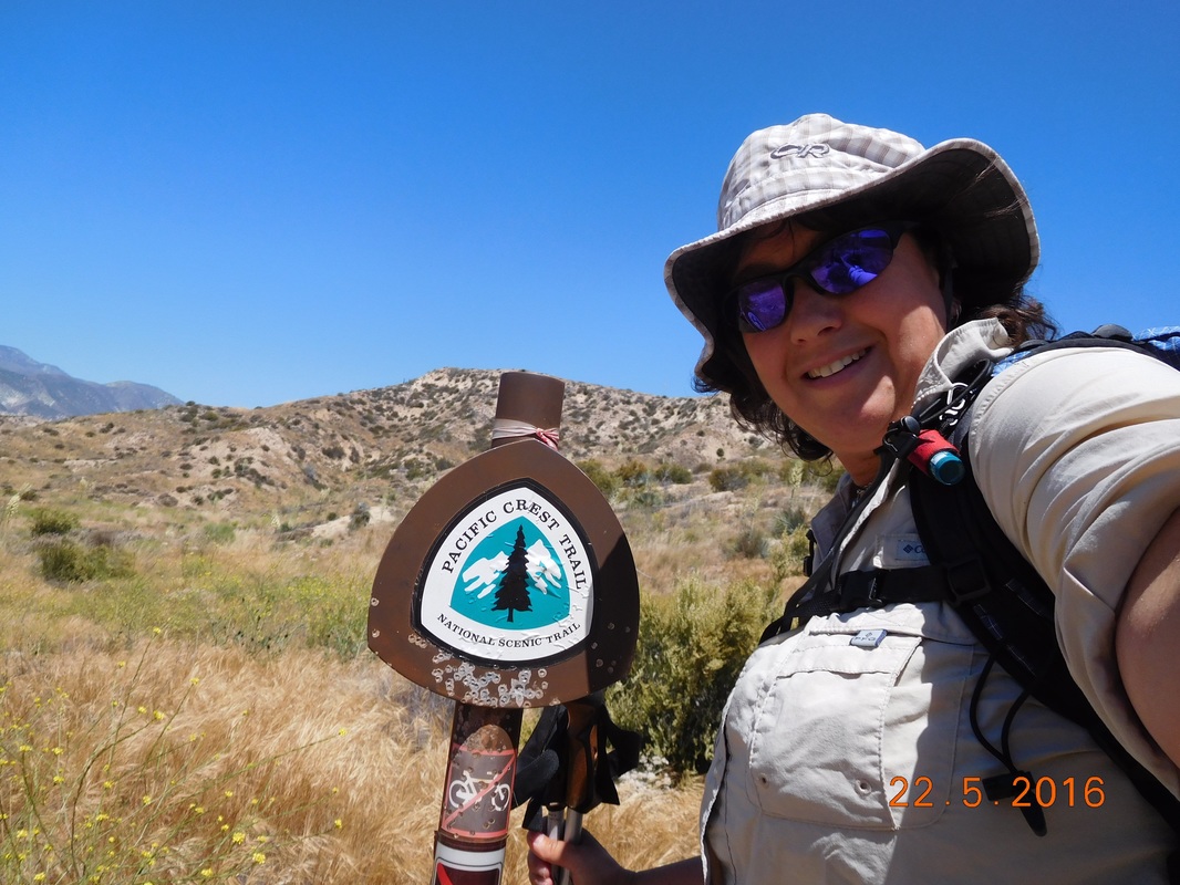 It's great to be back. Wow...the time sure went by fast today. Before we knew it we met up with Tim about 1.5 miles out from the end. 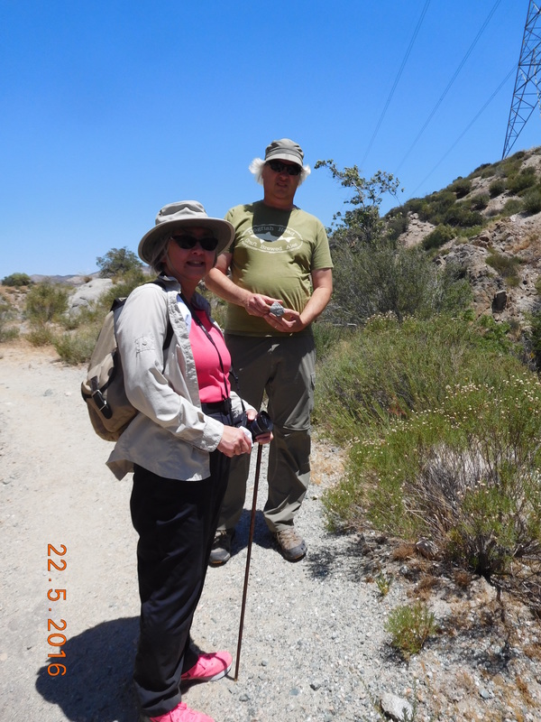 Tim joins the hike. Right at 12:00 PM we made it to I-15, Cajon Pass. Welcoming us was a sign letting us know that Canada was just up the trail...2,296 miles up the trail! 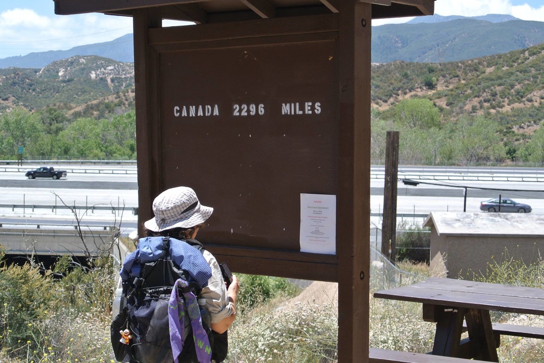 Not really almost there. (Photo courtesy of Mary Wilson) The good news was on the other side of the sign that let us know that I have hiked 341 miles from Mexico. That's not too shabby. 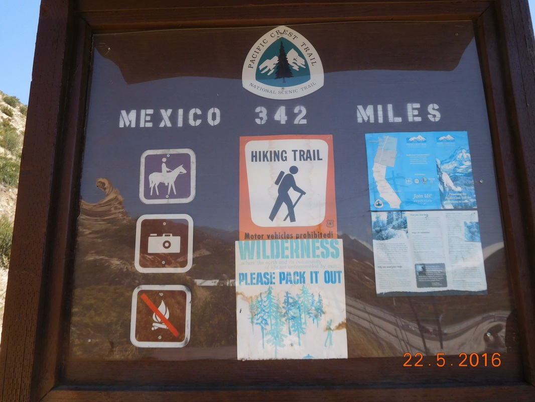 Pretty good accomplishment. The good news of today's hike is that I completed it and feel that I am ready to rejoin the trail tomorrow. The not so good news is that I was pretty tired at the end of the 6 miles. After sitting on the couch for 3 weeks I seem to have lost some of my conditioning. Also, my ankle was tired and hurt a bit after the hike. The ankle definitely is not at 100%...probably more like 90%, but I won't let this stop me.
Tomorrow I have to hike uphill 10-12 miles. This will really be a test. I figure that if my ankle starts hurting or gets tired, then I can stop and rest for a hour or so. I will still be able to make the miles and set up camp before sunset. I'm figuring that I will be so excited to be back on the trail that anything will be possible. |
 RSS Feed
