Tim & Gerri's Wild Ride
Email & Facebook Gerri:
  • Home
  • Worldwide Travel
    • Everest 2025 >
      • 2025 Everest Packing List
      • Everest Blog Summary
    • 2024 Europe Tour >
      • 2024 Europe Tour Packing List
      • Europe 2024 Blog Summary
    • Asia 2023 >
      • Asia 2022 Packing List
      • Asia 2023 Blog Summary
    • Eastern Europe 2022 >
      • Eastern Europe 2022 Blog Summary
      • Eastern Europe 2022 Packing List
    • Narrowboat Holiday 2022 >
      • Narrowboat 2022 Blog
      • Narrowboat 2022 Packing List
    • Ireland & UK 2019 >
      • Ireland & UK Itineray
      • Ireland & UK Blog Summary
      • Ireland & UK Packing List
    • France 2018 >
      • France Itinerary
      • Blog Summary
    • European Tour 2017 >
      • European Vacation Blog
      • Blog Summary
    • Southeast Asia 2014-15 >
      • Southeast Asia Blog
      • Packing List
      • Blog Summary
    • Afghanistan 2011-12
  • United States Travel
    • Great Lakes Sail 2020 >
      • Great Lakes Sail 2020 Blog
      • Blog Summary
    • Trans-America Bicycle Ride >
      • Blog Summary
      • Our Team
      • Equipment
      • Breweries Along Route
    • Pacific Crest Trail >
      • Pacific Crest Trail 2016 >
        • What is the PCT? - 2016
        • Why Hike the PCT? - 2016
        • Gear - 2016
        • Itinerary - 2016
        • PCT Blog Summary - 2016
        • Where are we now? - 2016
      • Pacific Crest Trail 2014 >
        • What is the PCT?
        • Why Hike the PCT?
        • Gear
        • Food
        • Itinerary
        • Blog Summary
        • Where are we now?
    • Motorcycle Ride 2014 >
      • Motorcycle Blog
  • Brewery Visits
    • 2025 Breweries
    • 2024 Breweries
    • 2023 Breweries
    • 2022 Breweries
    • 2021 Breweries
    • 2020 Breweries
    • 2019 Breweries
    • 2018 Breweries
    • 2017 Breweries
    • 2016 Breweries
    • 2015 Breweries
    • 2014 Breweries
    • 2013 Breweries
    • 2012 Breweries
    • 2011 Breweries
    • 2010 Breweries
    • 2009 Breweries
    • 2008 Breweries
    • 2007 Breweries
    • 2006 Breweries
    • 2005 Breweries
    • 2004 Breweries
    • 2003 Breweries
    • 2002 Breweries

Day 103 (31 July) - Mile 1195.42 - 1206.18

7/31/2016

2 Comments


 Portola, CA to Campsite at mile 1206.18

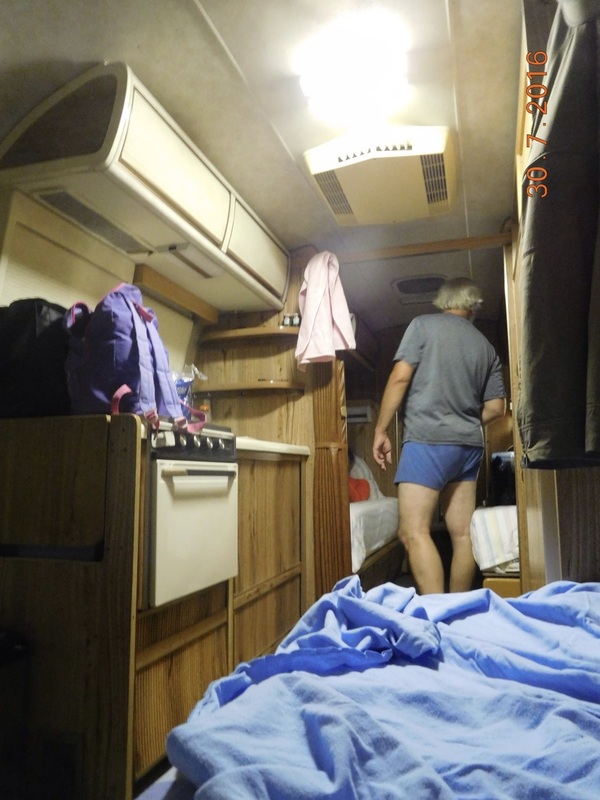
I slept really well in the Airstream and woke around 7:30 AM. The plan for the day is to get our food and bags ready for 4.5 days of hiking to Belden, CA and then go into town to do laundry and eat breakfast.

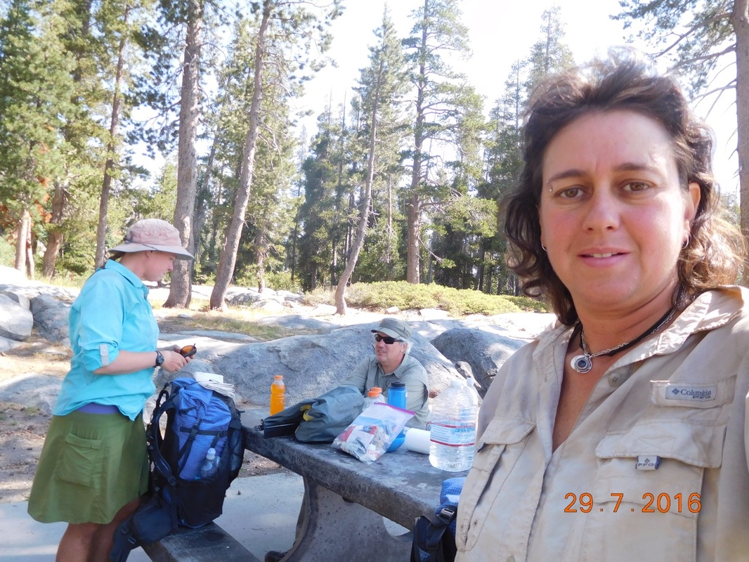
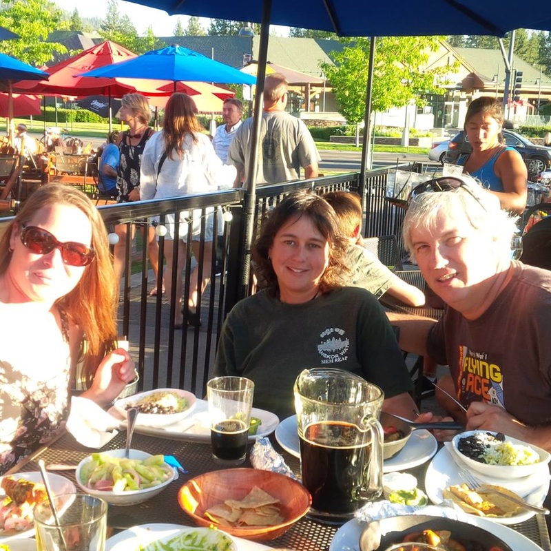
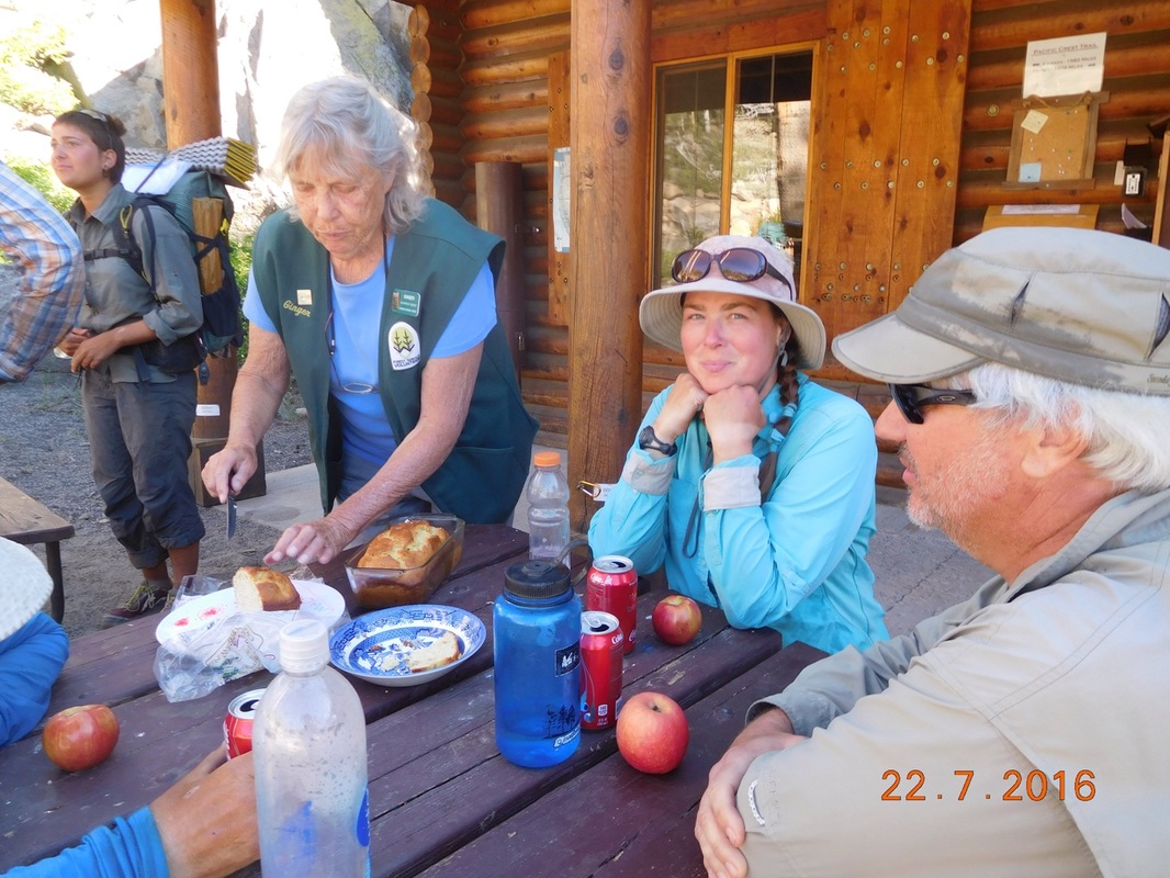
By 10:00 AM we were on our way into town. We found the laundromat and a cafe just down the street...perfect!

With laundry done and our bellies fed, we headed back to the trail. Oh, I forgot to mention earlier that Brad is getting back on trail today. He is feeling totally better and is ready to get back to hiking after missing the last 2 weeks. Woohoo!

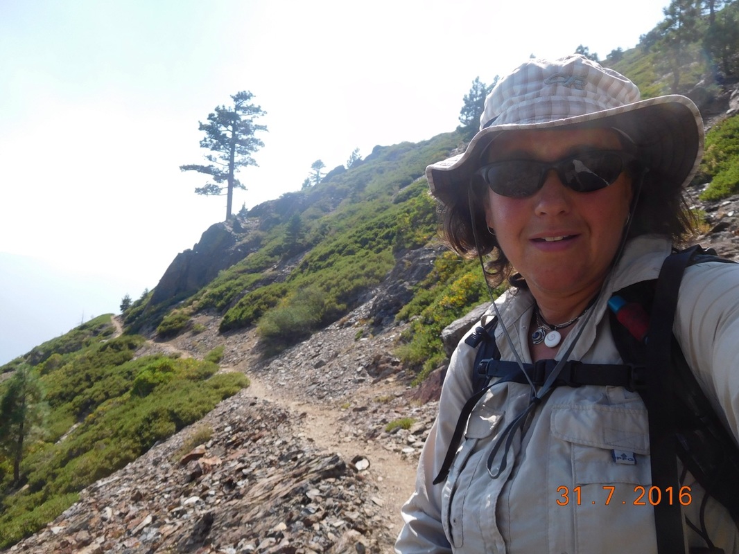
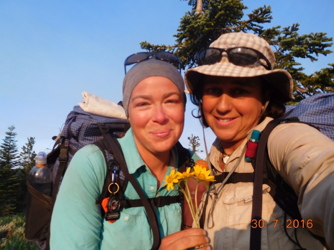
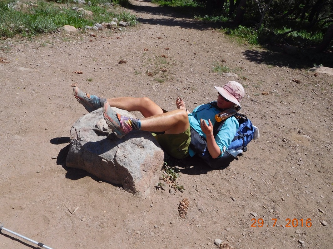
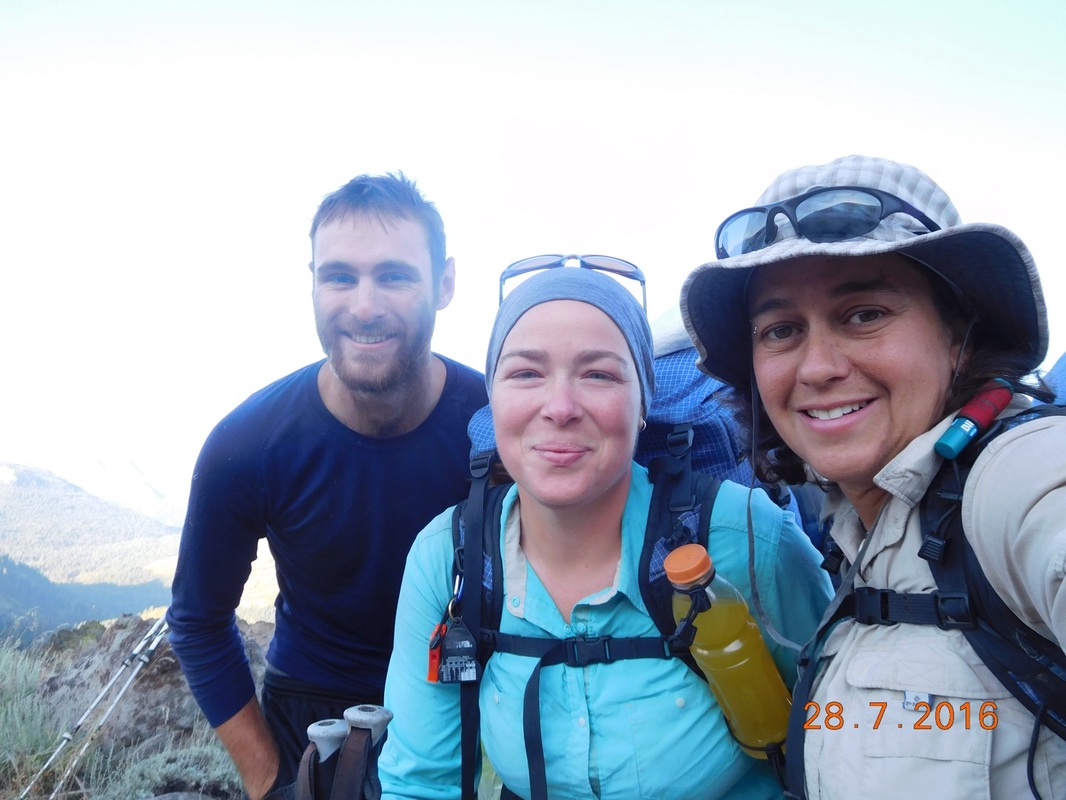
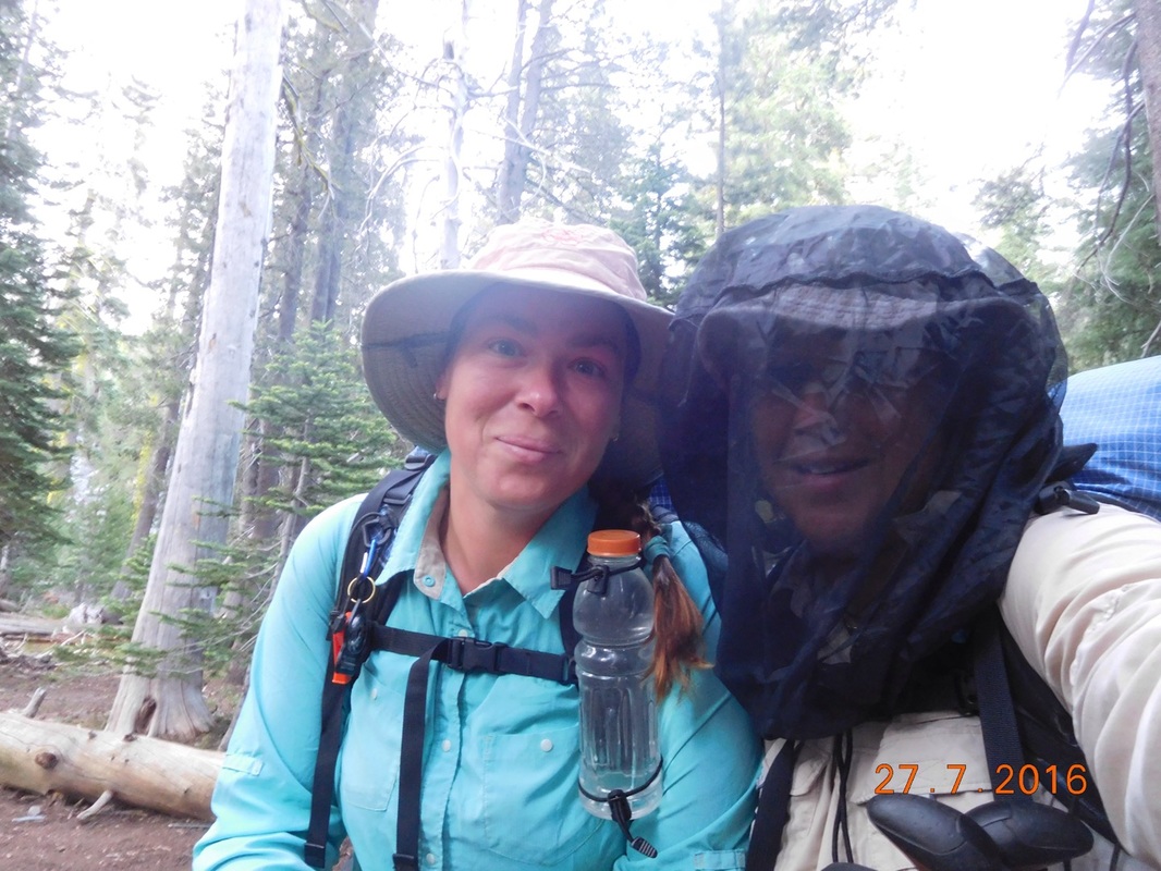
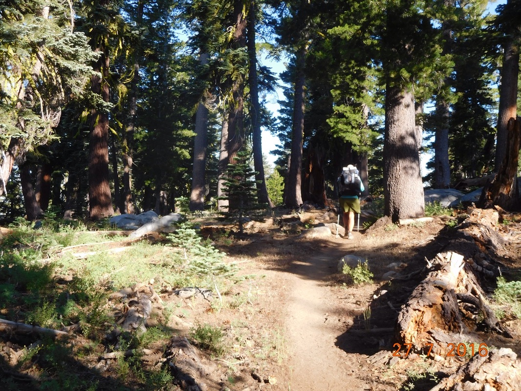
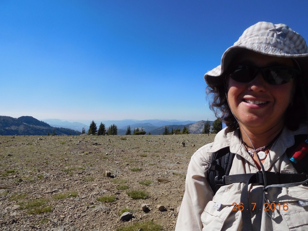
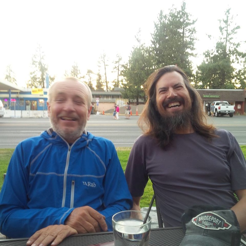
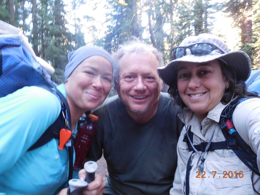
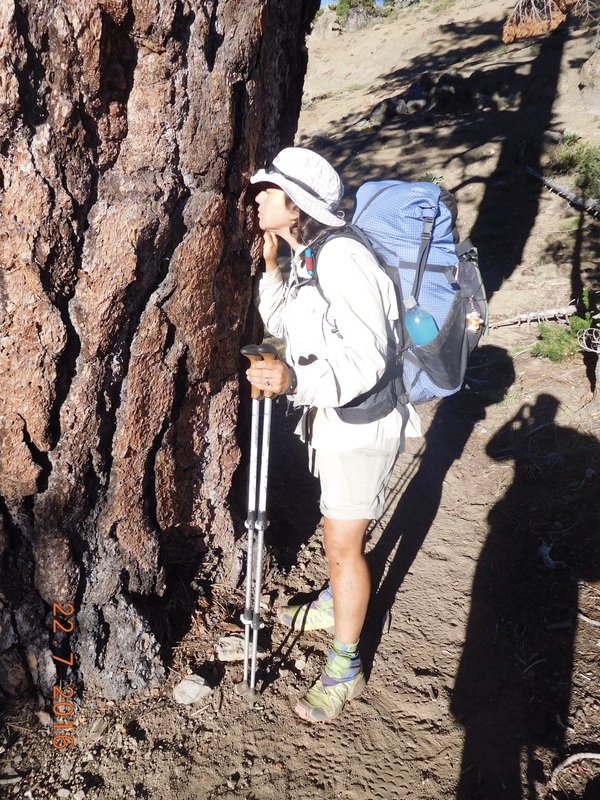
We were all ready to hike at 1:19 PM...including Tim who is going to hike in with us a couple of miles.
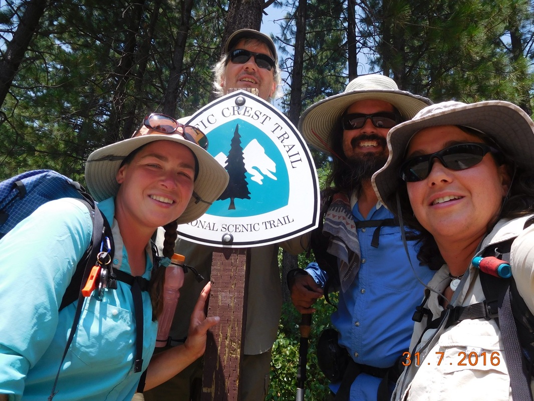
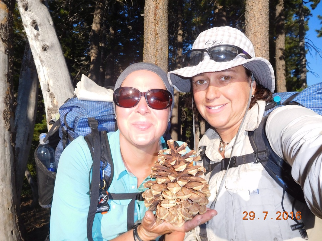
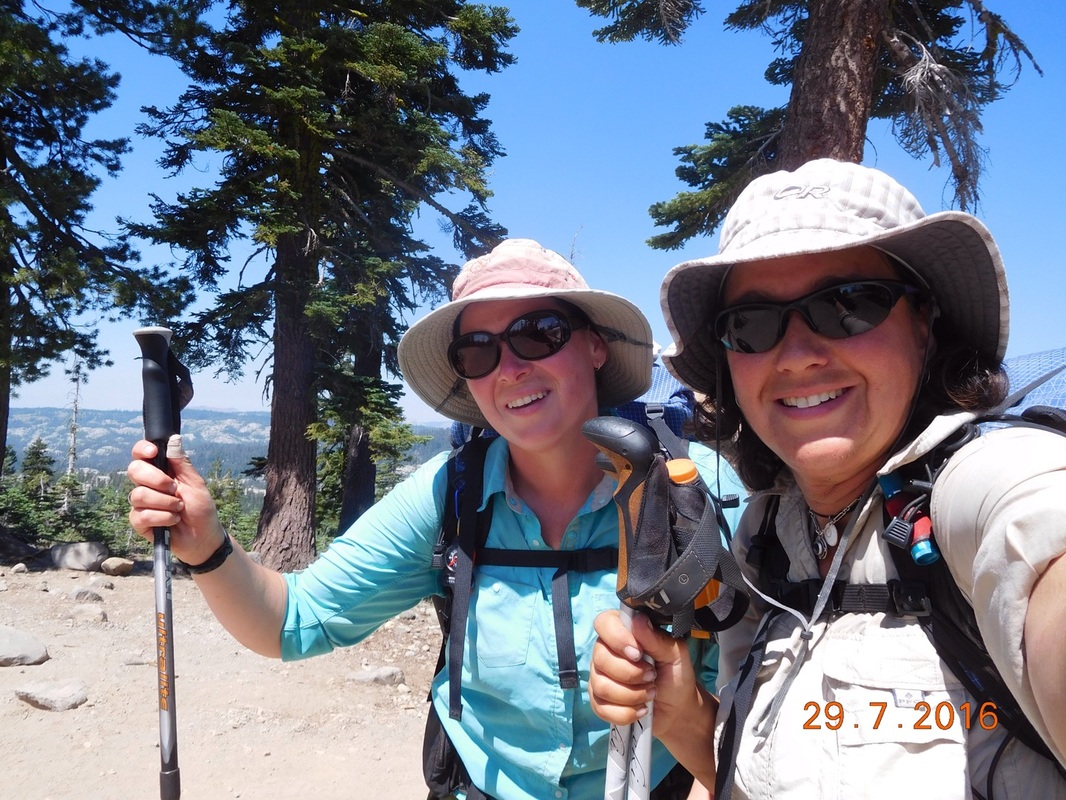
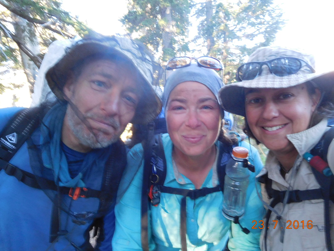
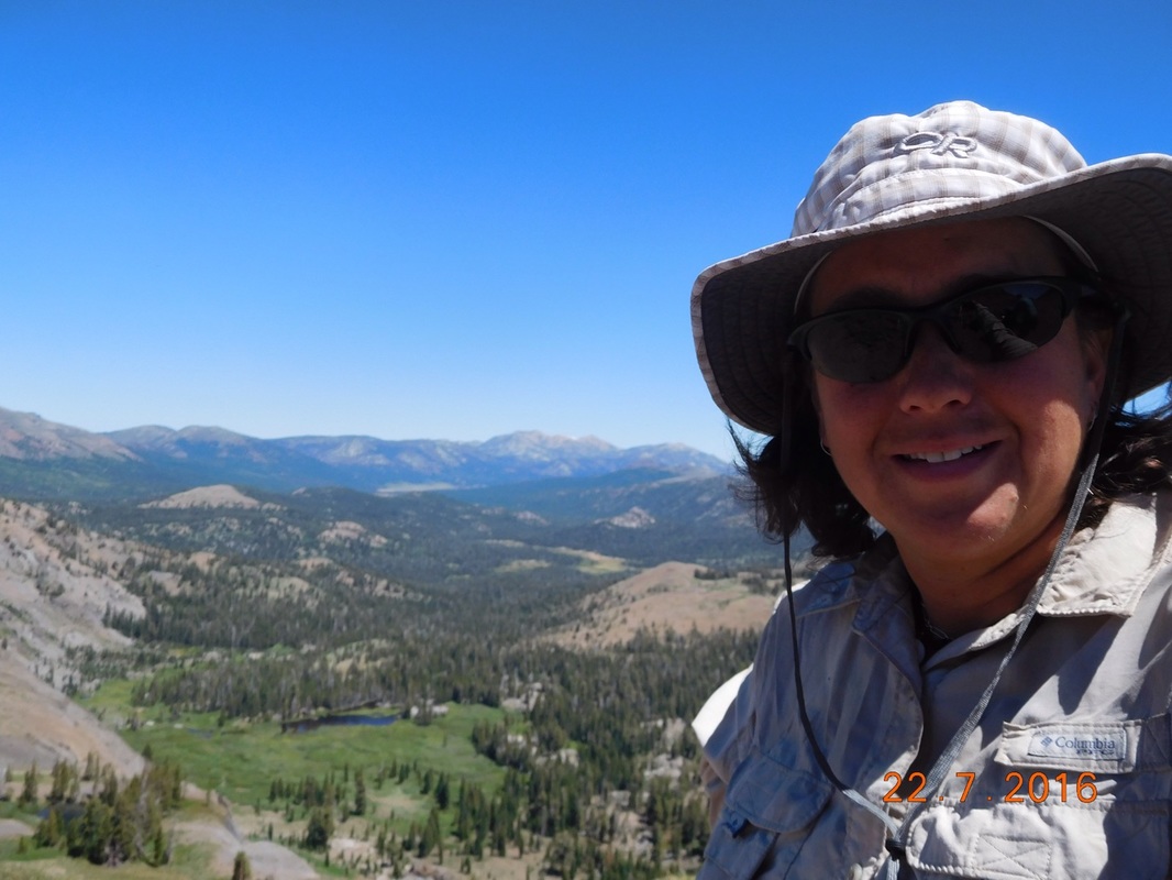
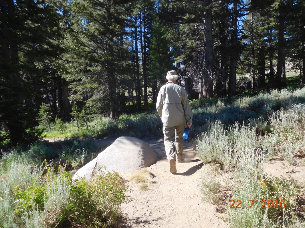
Picture
Ready to hike
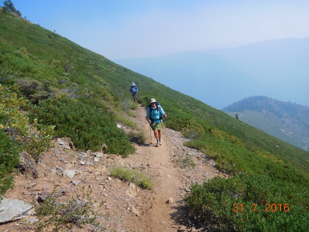
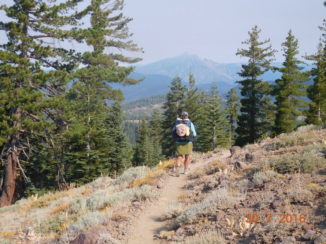
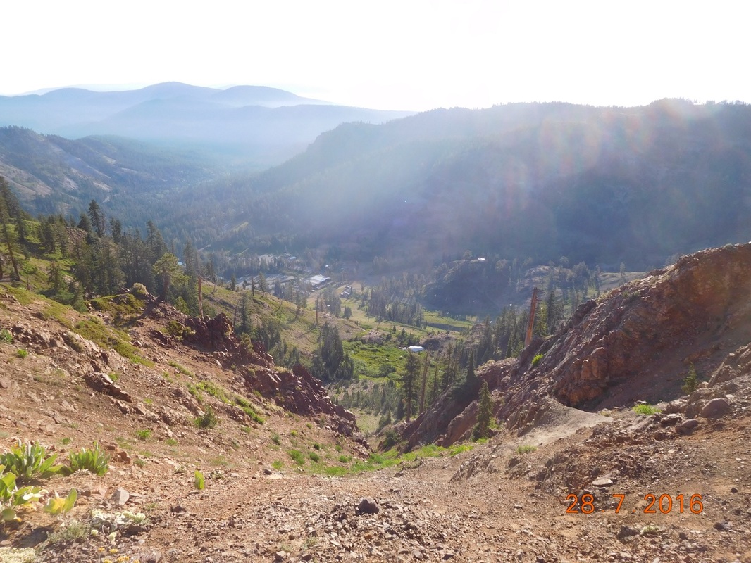
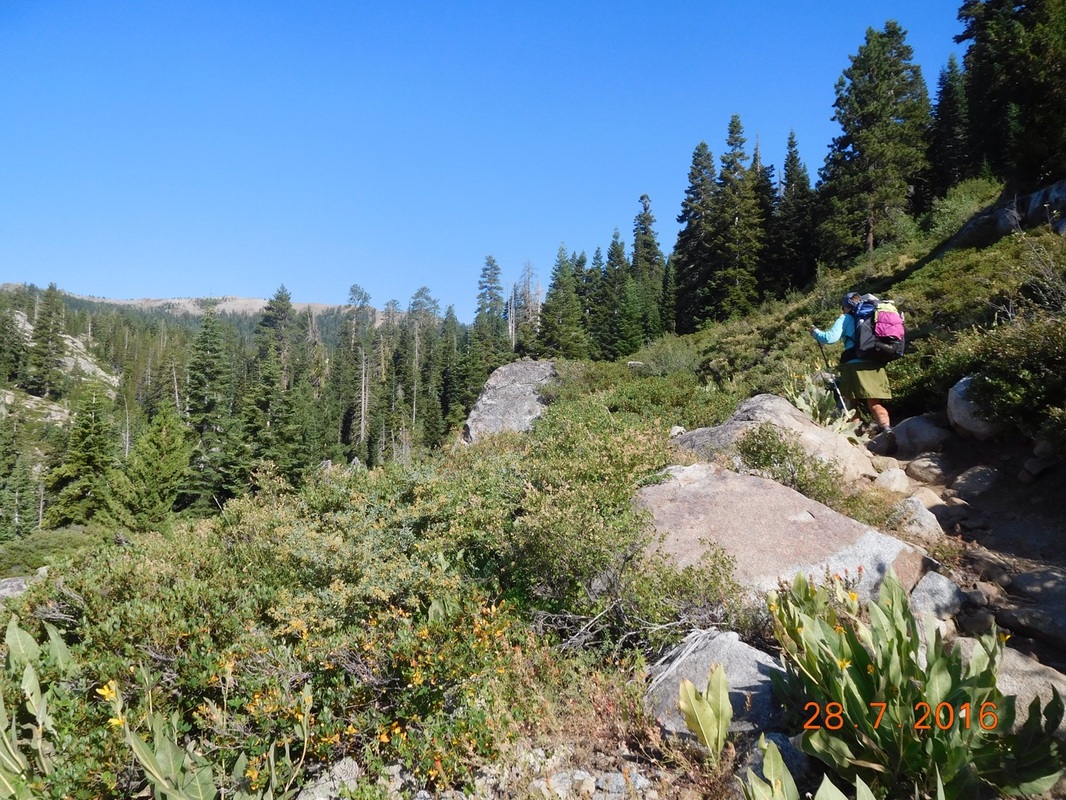
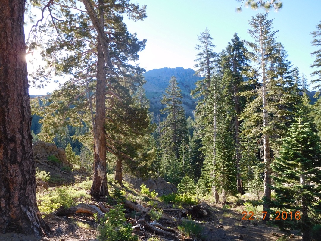
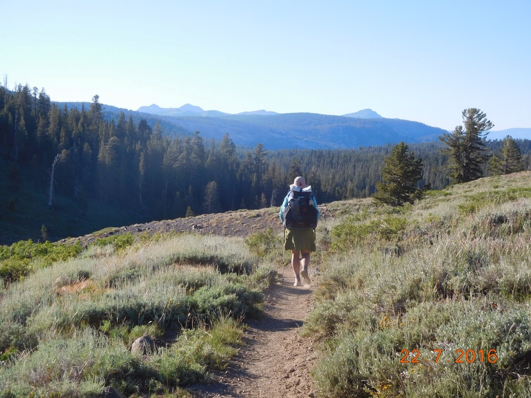
Oh...Tim is going to meet us at the 9.5 mile point today, so we are able to slack pack again today which is so cool since the first 10 miles or so of today is a climb. It is 3,177 feet of climbing in the first 10 miles...crazy.

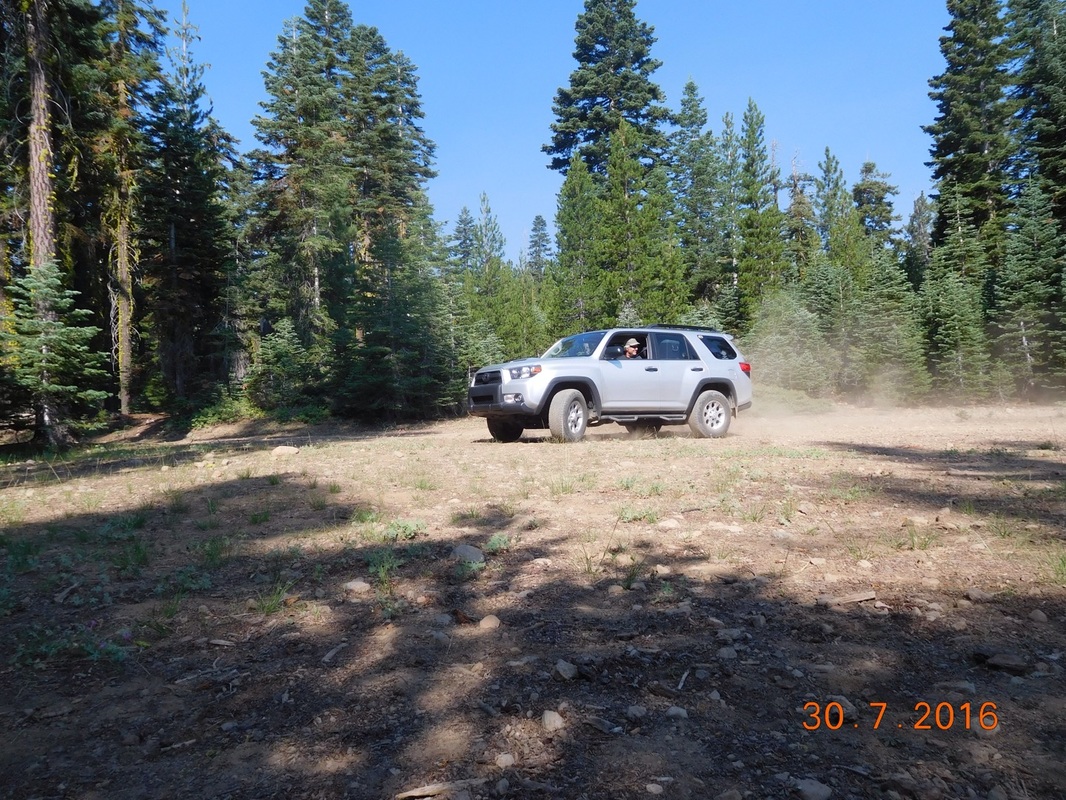
Tim climbed with us for about 2 miles then headed back to the 4Runner to then drive to where the trail intercepts another road 9 miles ahead. Meanwhile, Share Bear, Brad, and I kept climbing. We met 2 guys from South Korea hiking the trail, Jay and Chen. We continued to see them throughout the rest of the day.
Picture
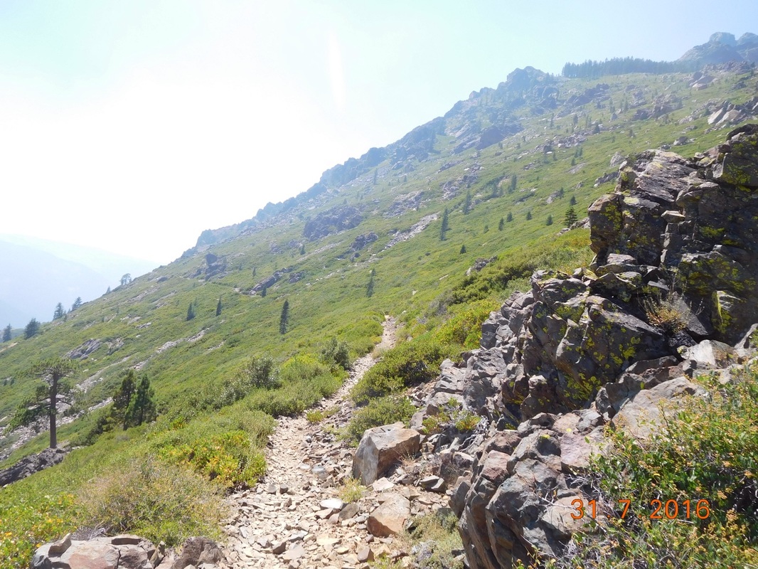
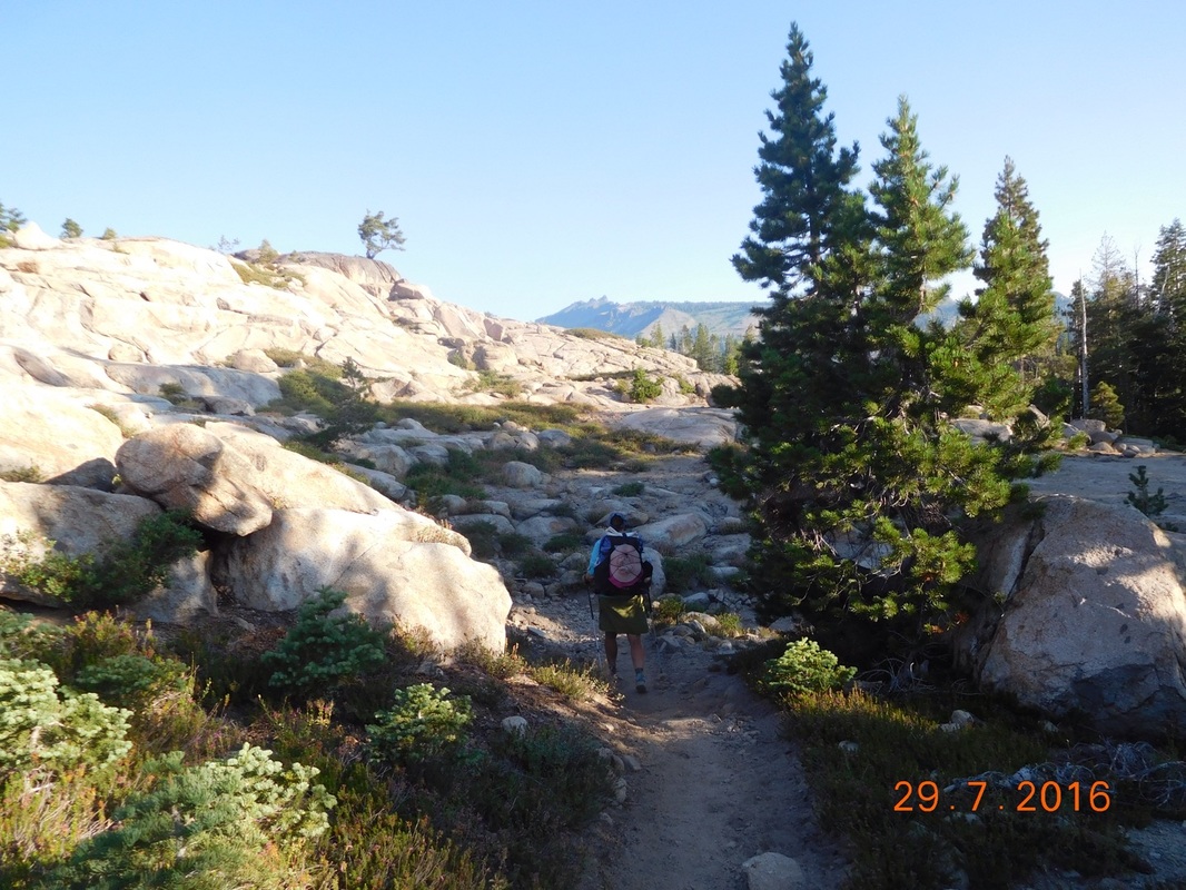
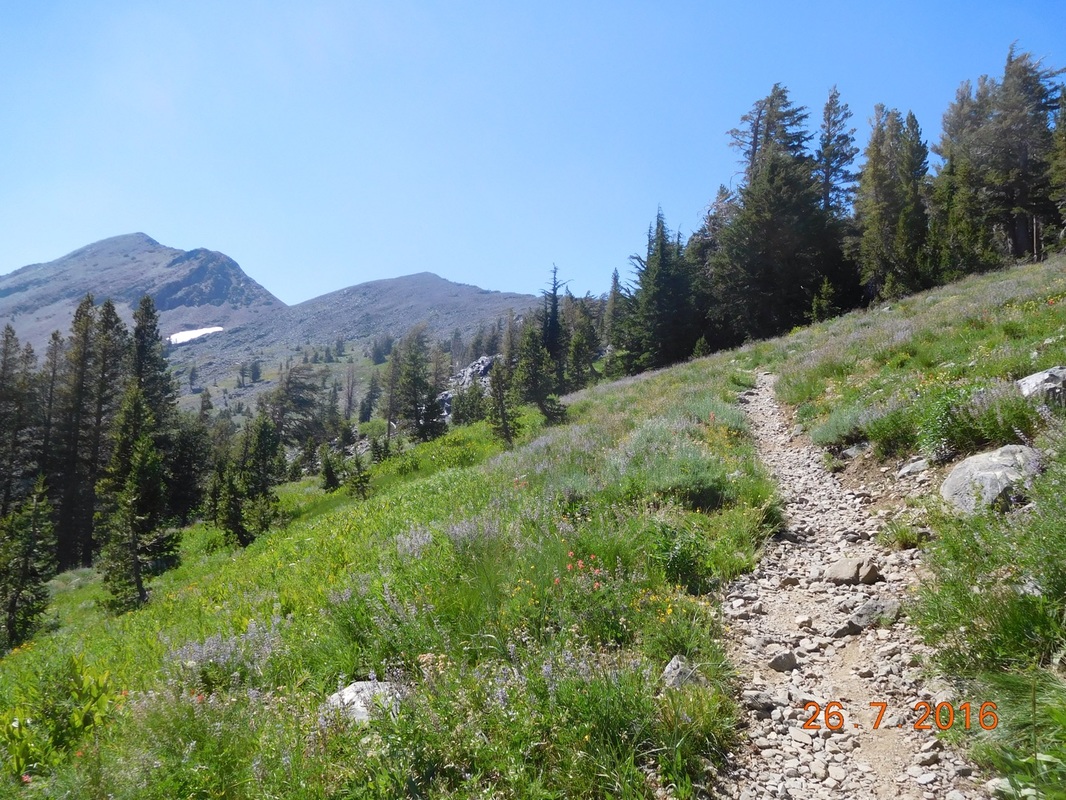
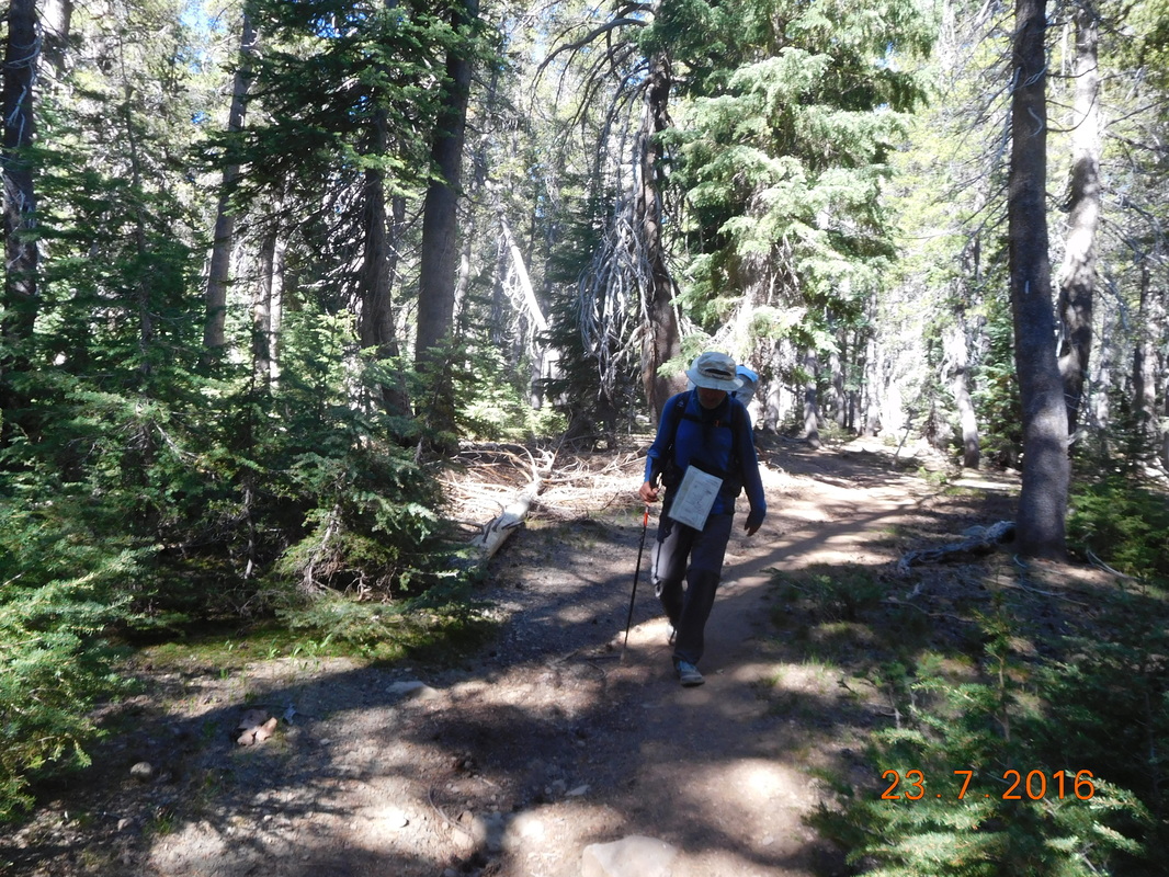
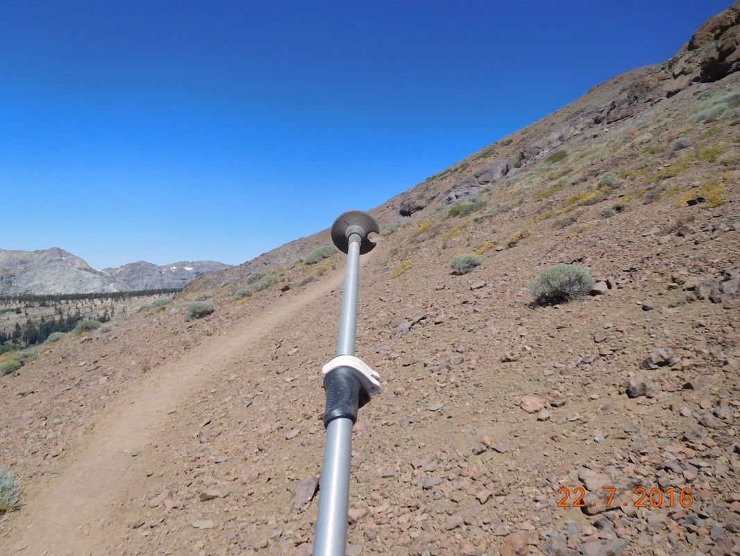
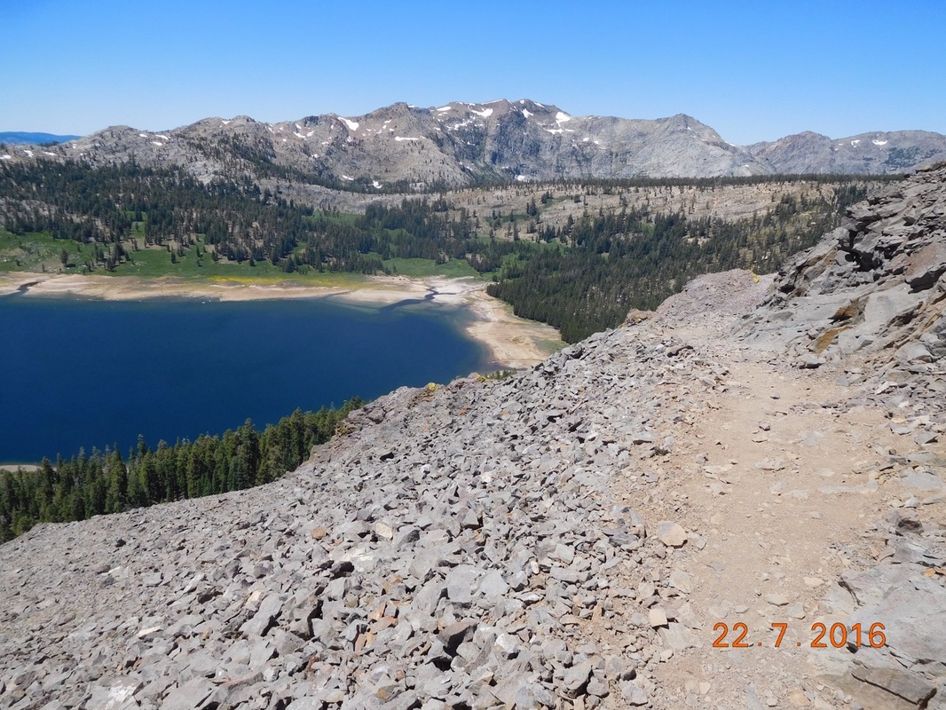
The trail is climbing up there.
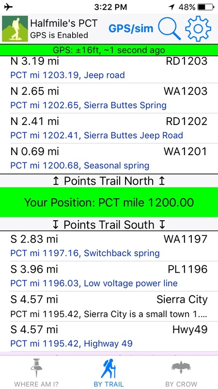
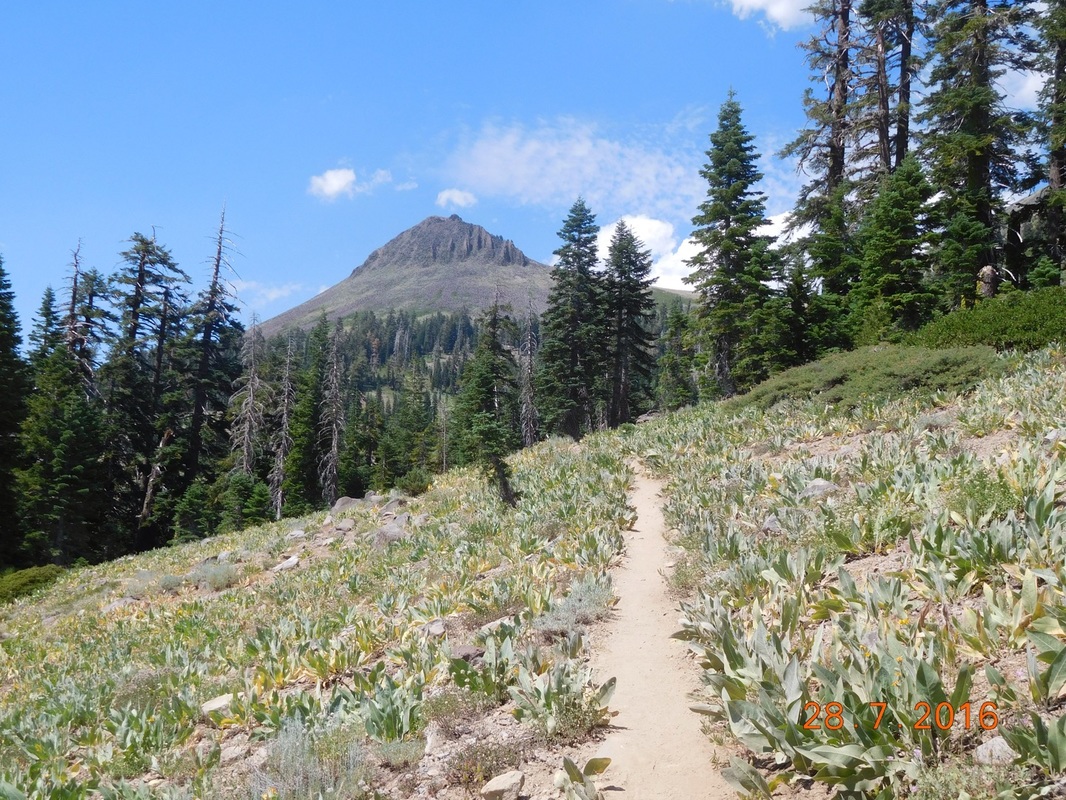
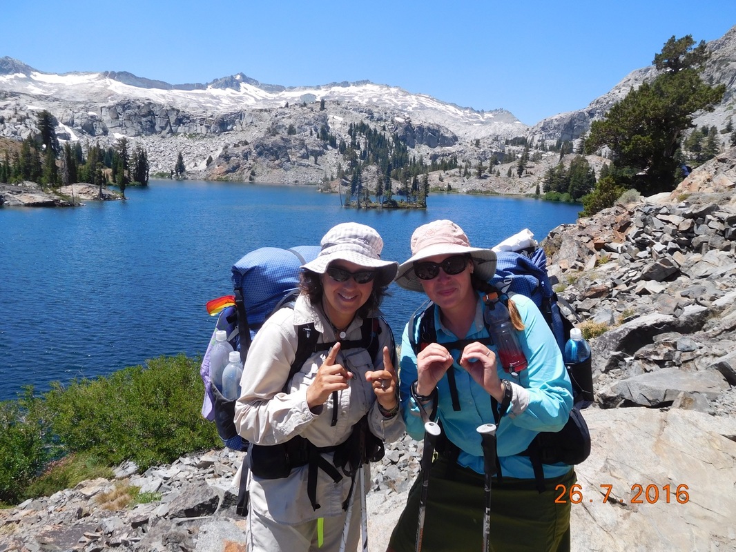
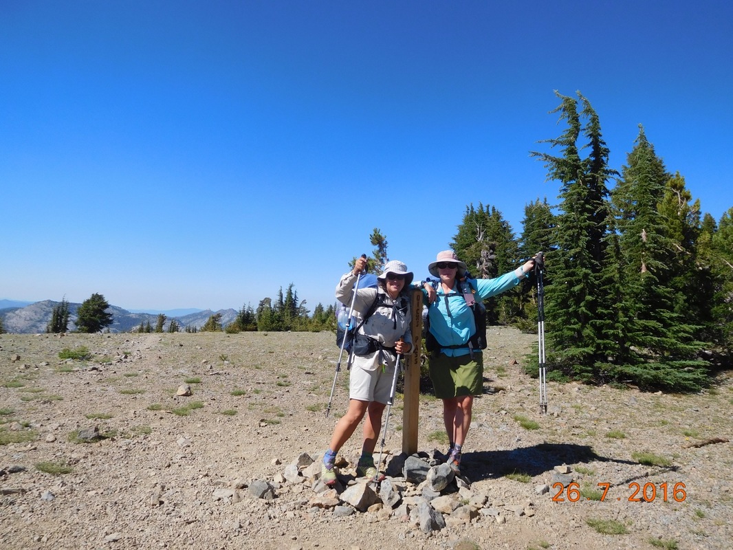
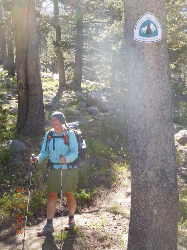
4.5 miles later we came to the 1,200 mile point on the PCT.
Picture
Proof I'm standing at 1,200 PCT mile.
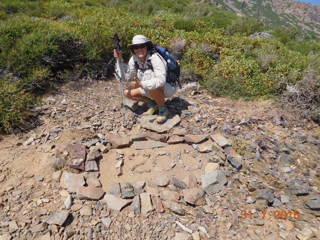
Picture
1,200 mile pose.
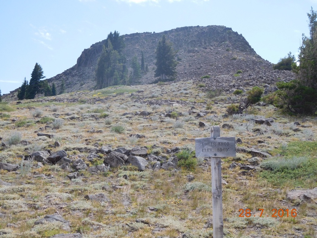
Even though we have come this far, I still love the milestone miles we come to.

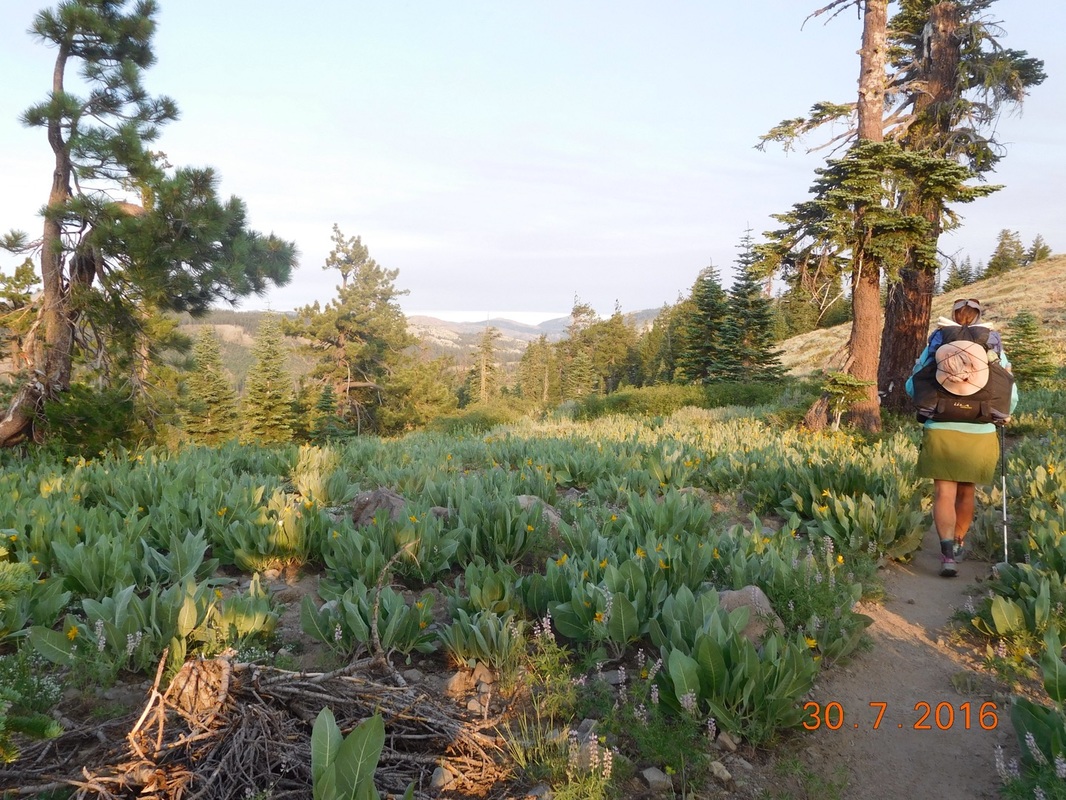
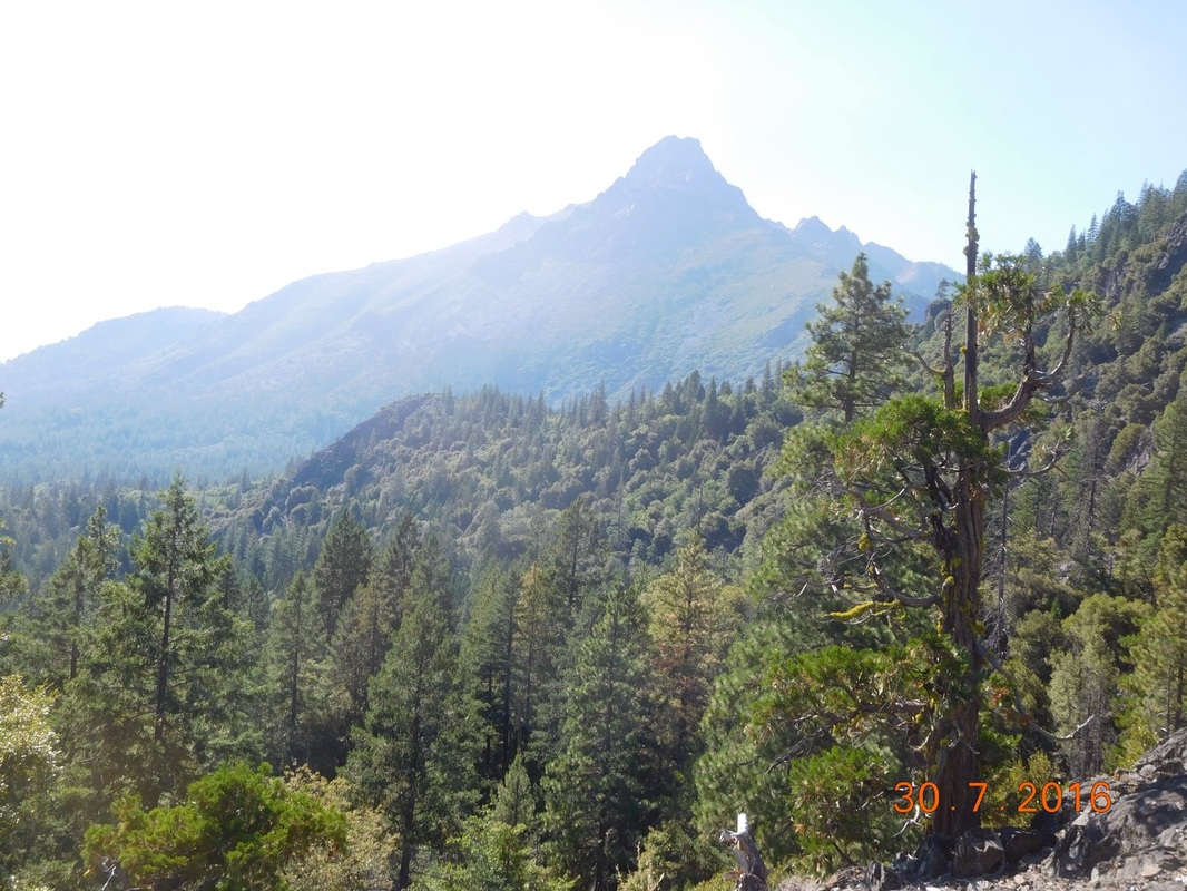
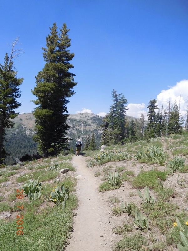
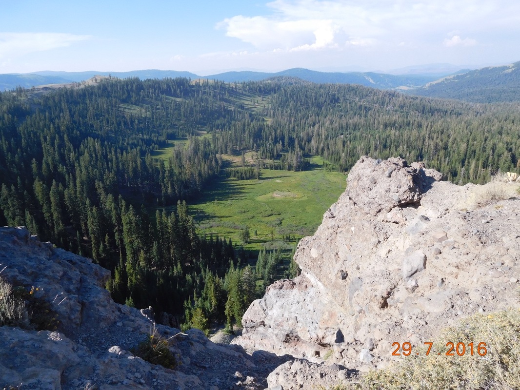
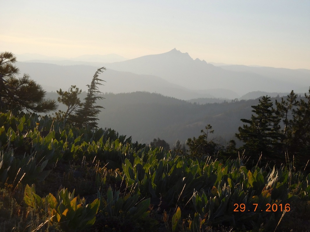
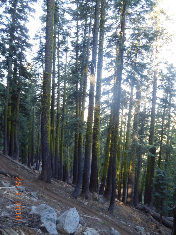
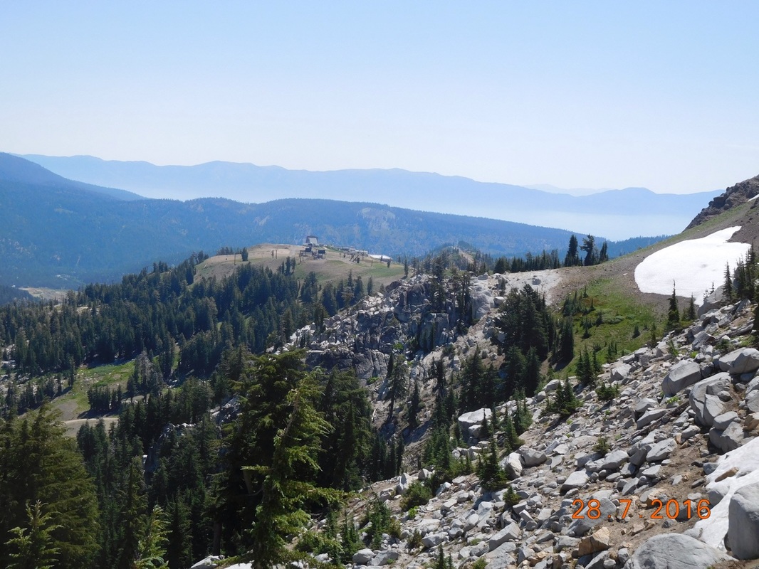
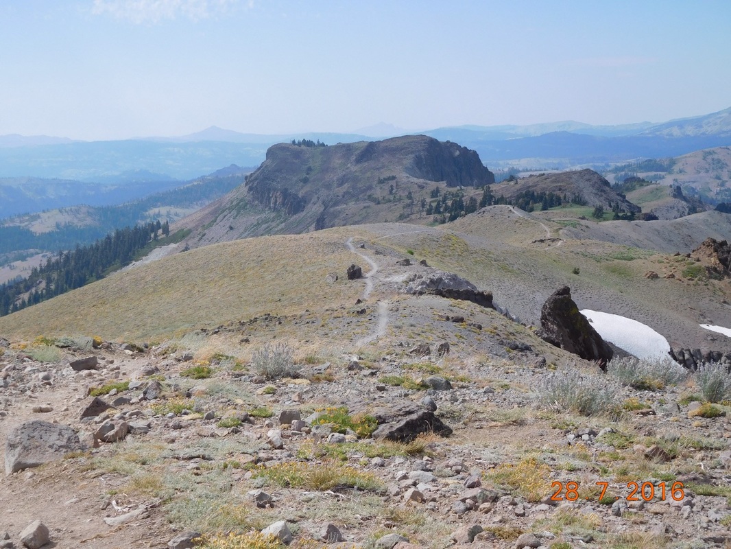
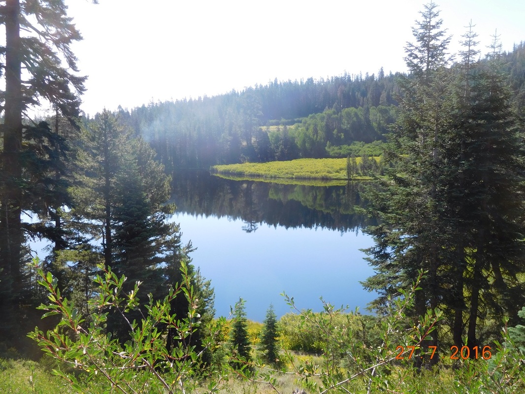
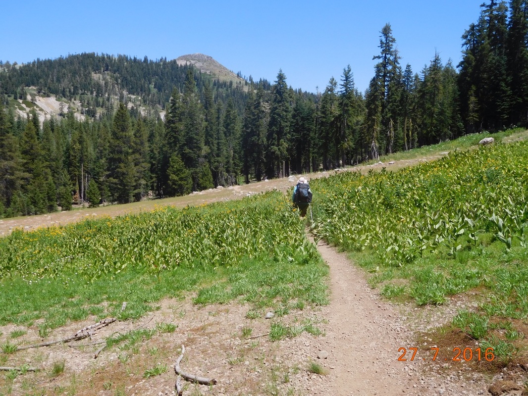
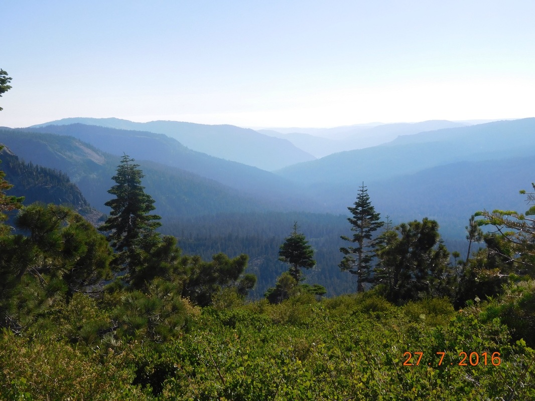
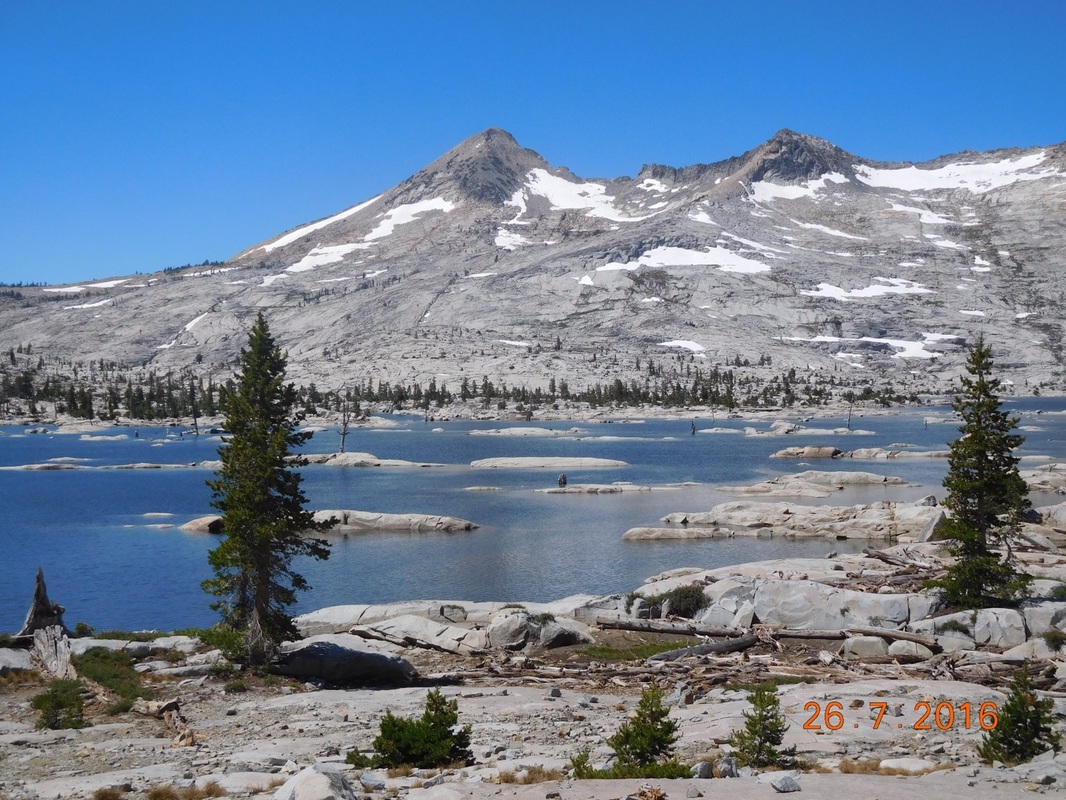
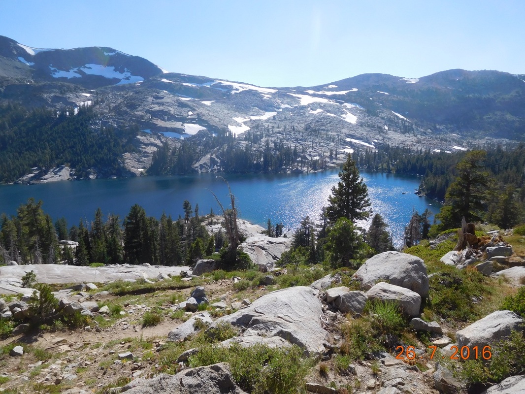
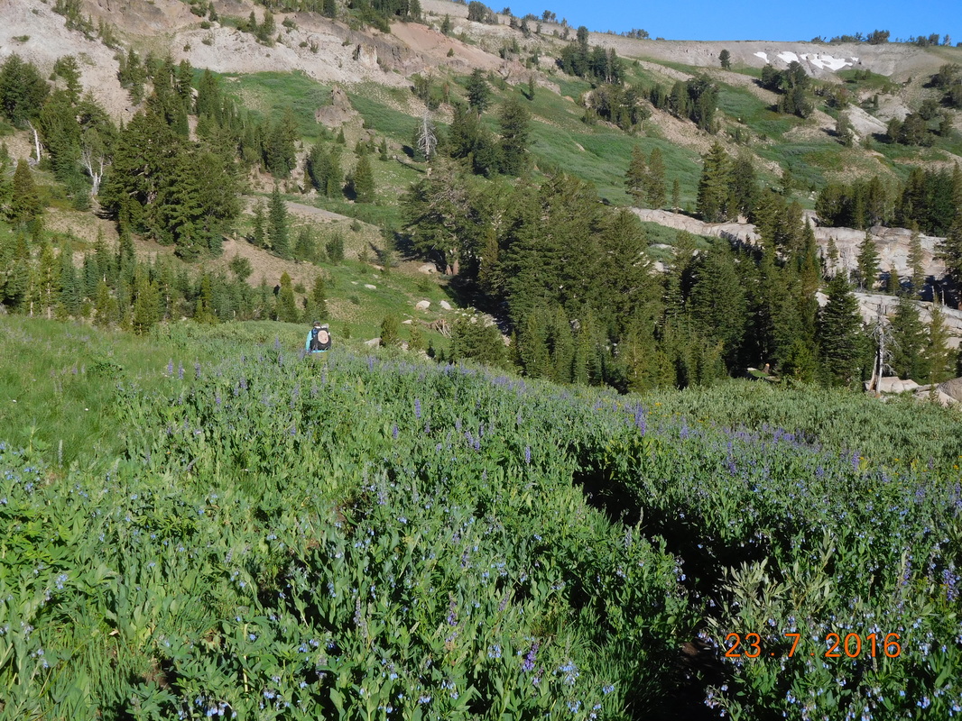
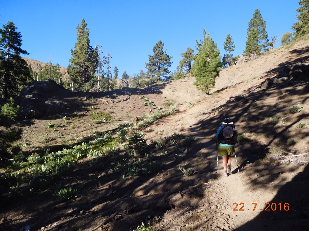
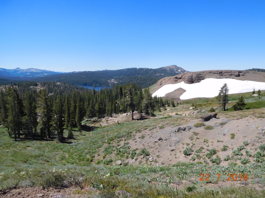
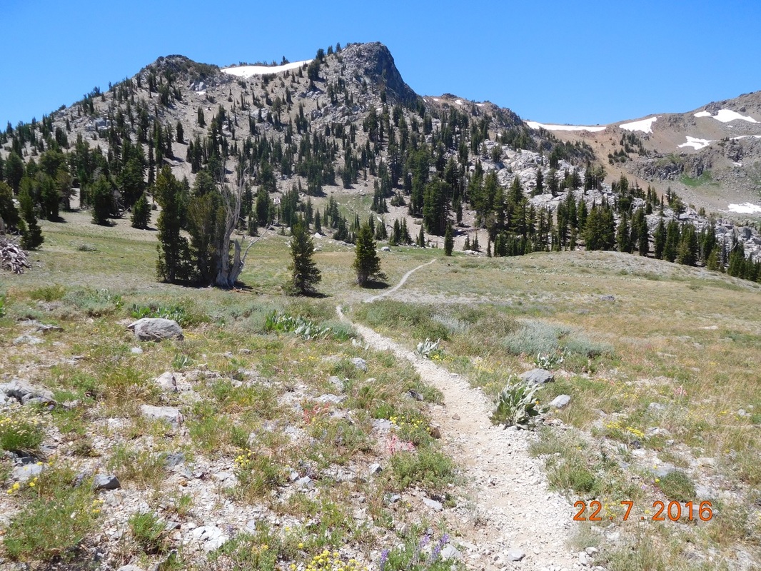
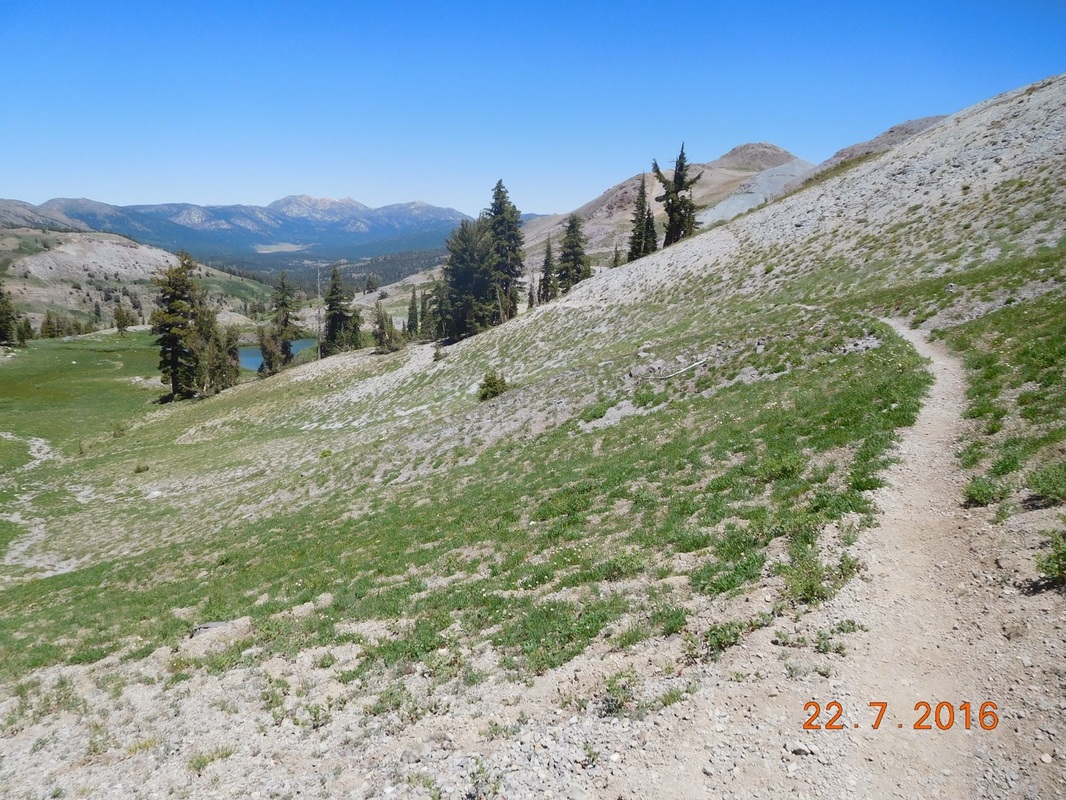
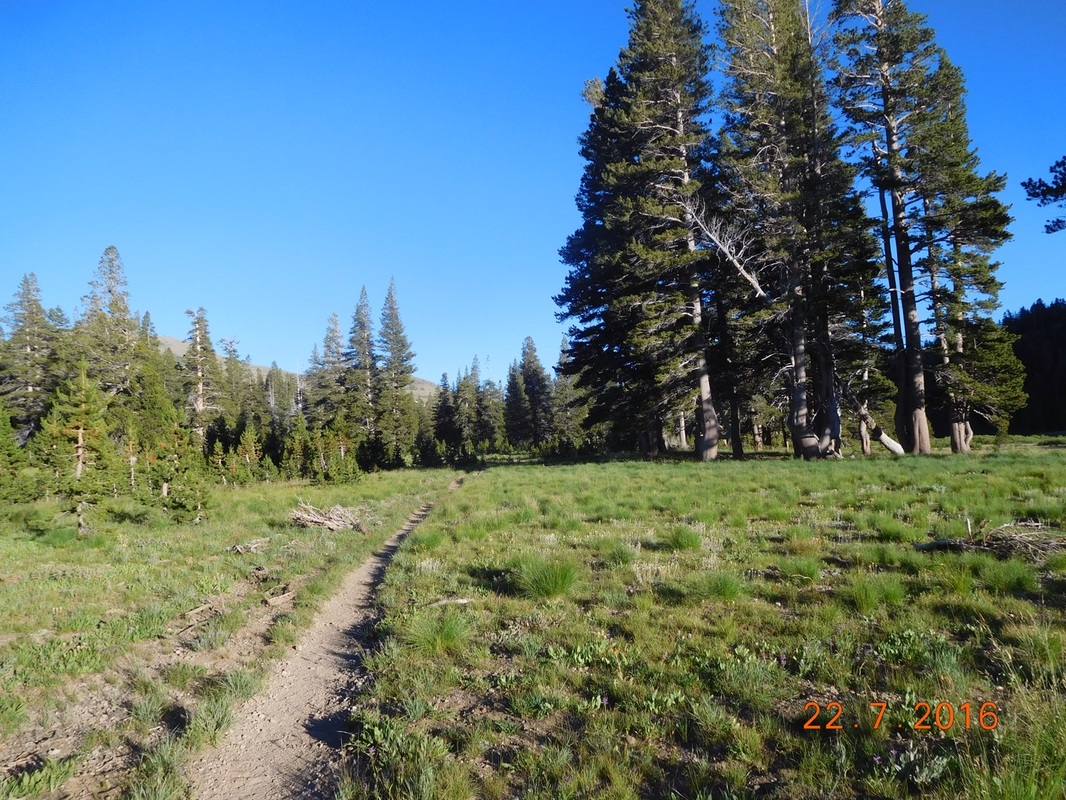
We spent at least 2 hours walking up this ridge. It was tiring, but beautiful.
Picture
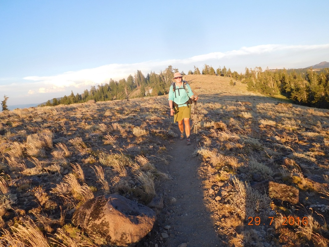
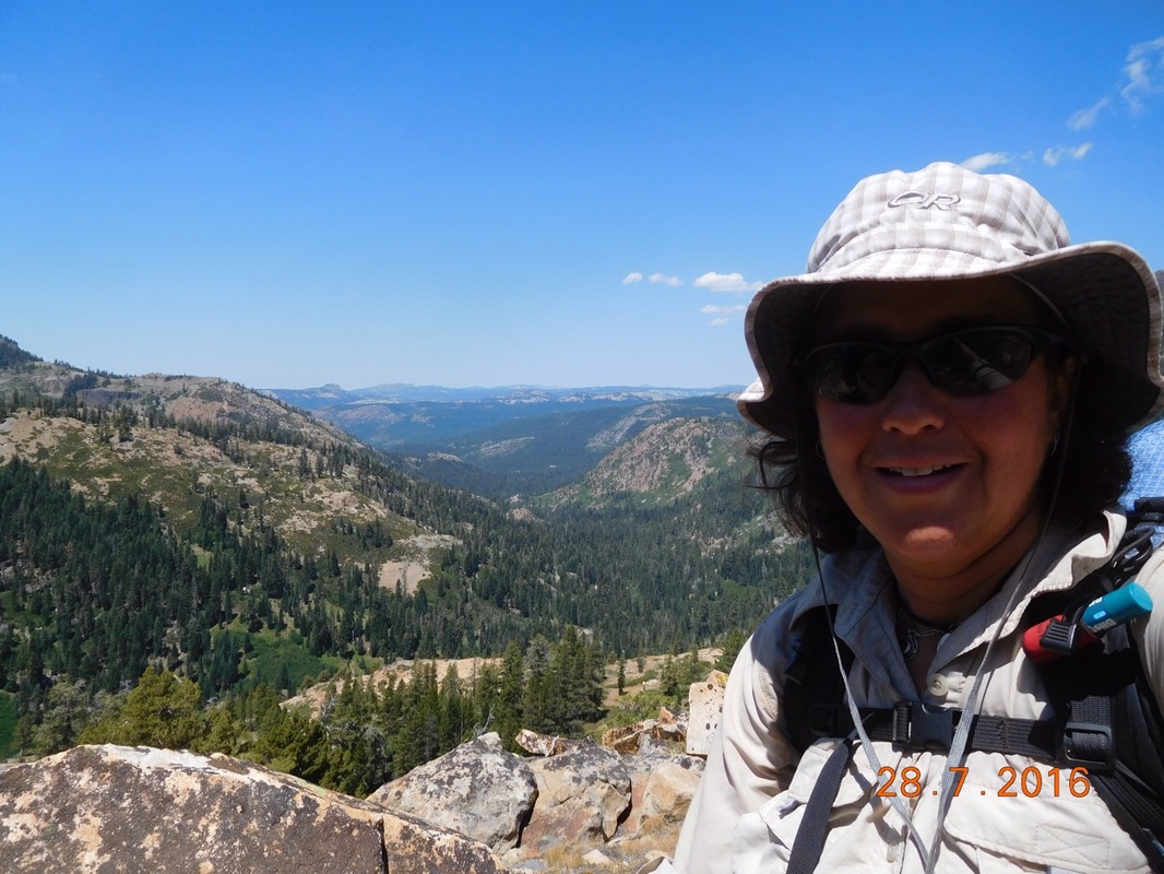
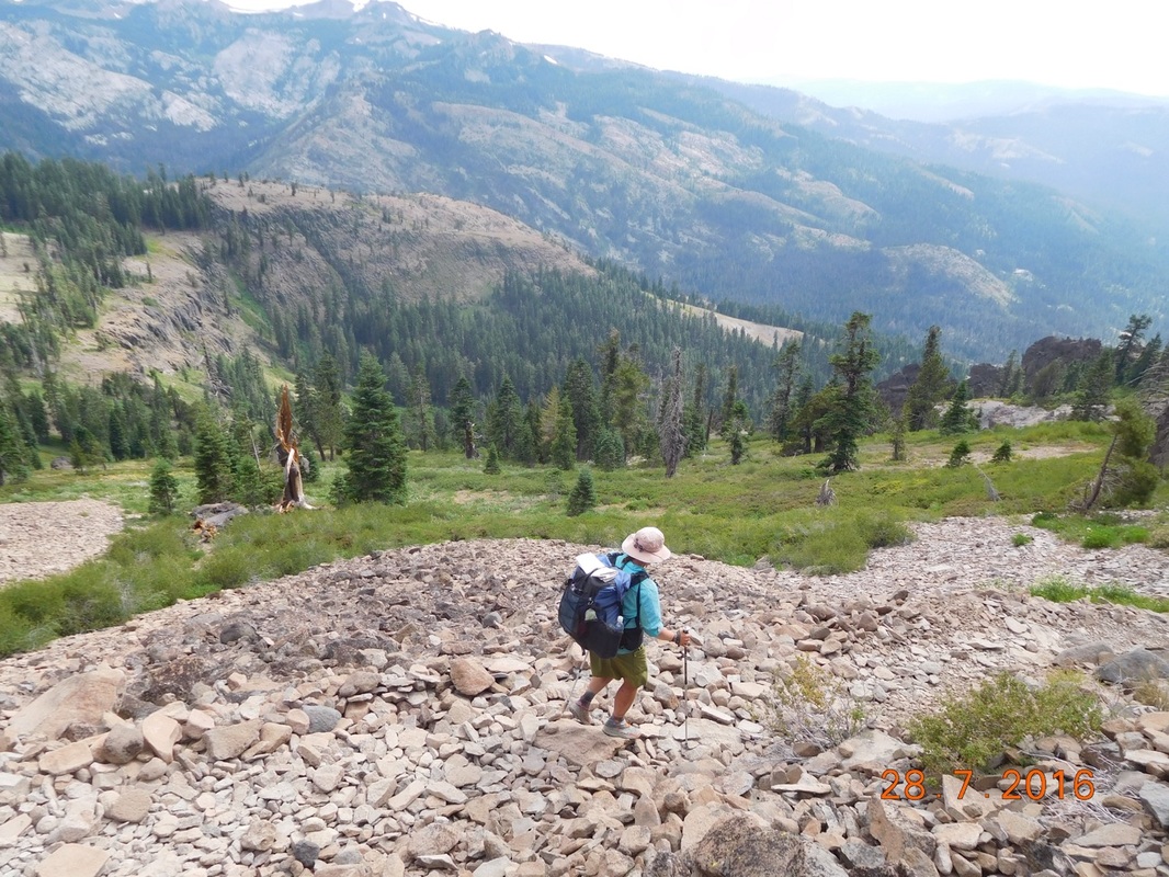
Self-portrait "Ridge hiking"
Picture
Share Bear catching up.
We were finally off the ridge and hiking on more of a roller coaster type trail when we saw Tim just ahead with 1.5 miles to go to get to the 4Runner.

While hiking toward us he walked over this shadow and couldn't wait for me to take a photo with him and the shadow:
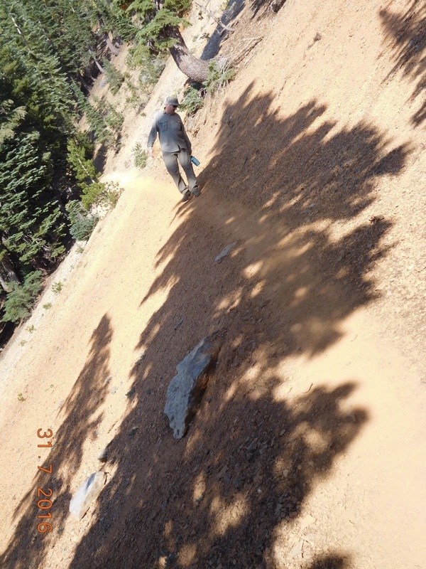
Picture
Tilty Tim
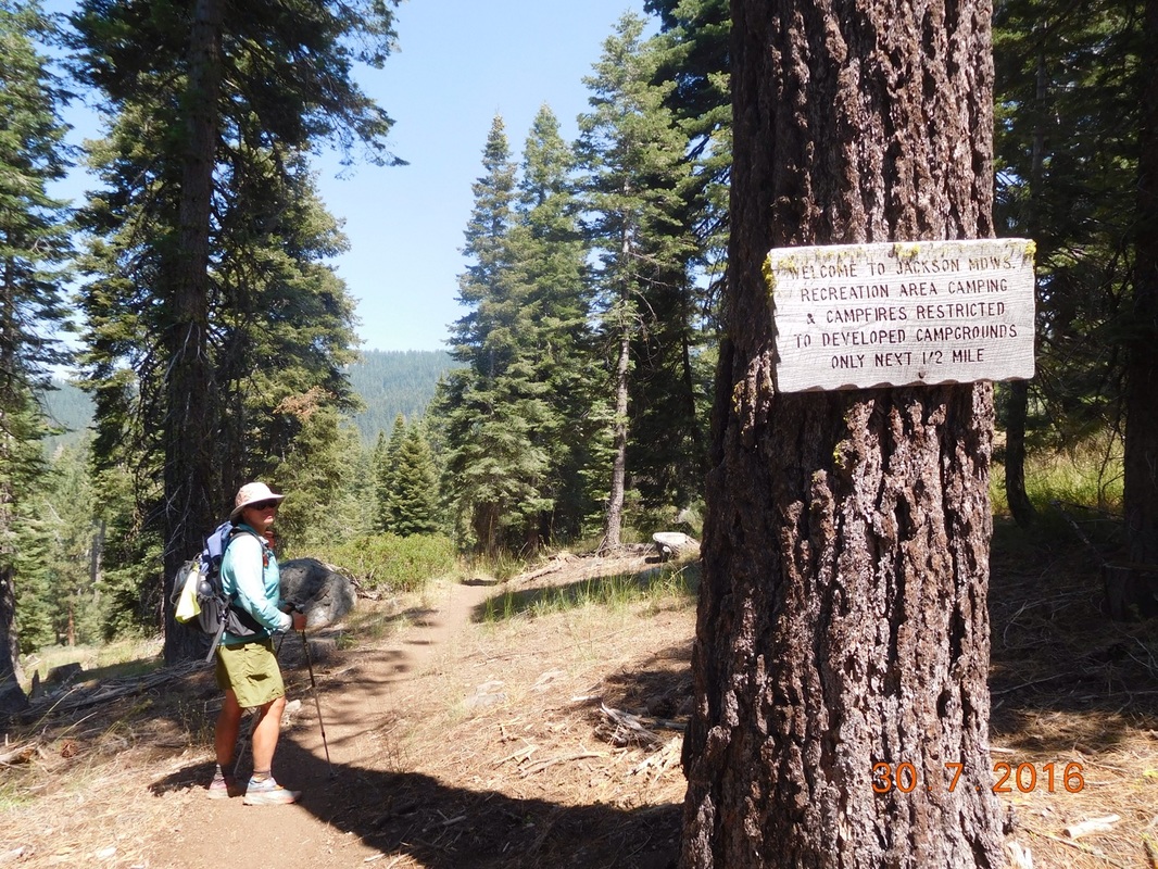
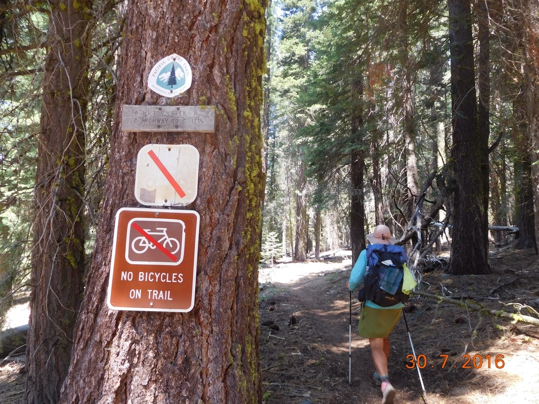
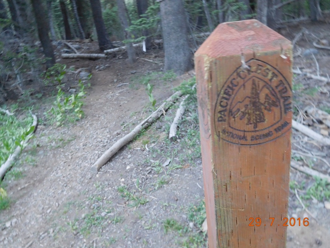
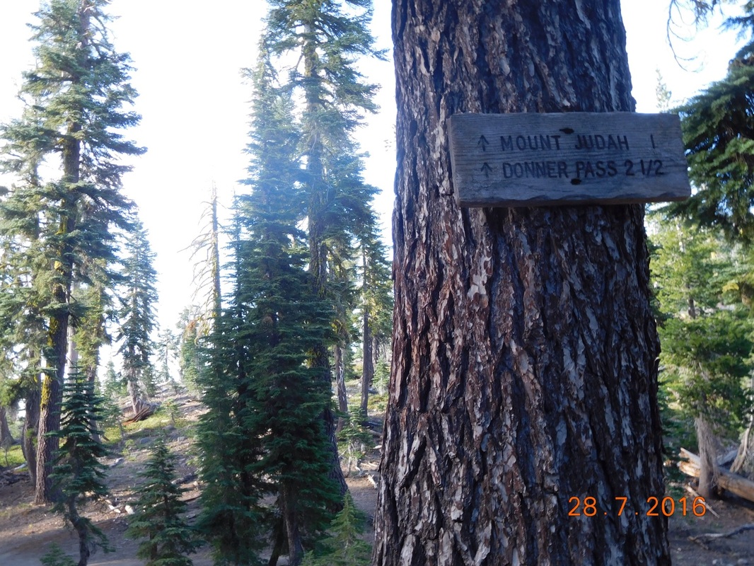
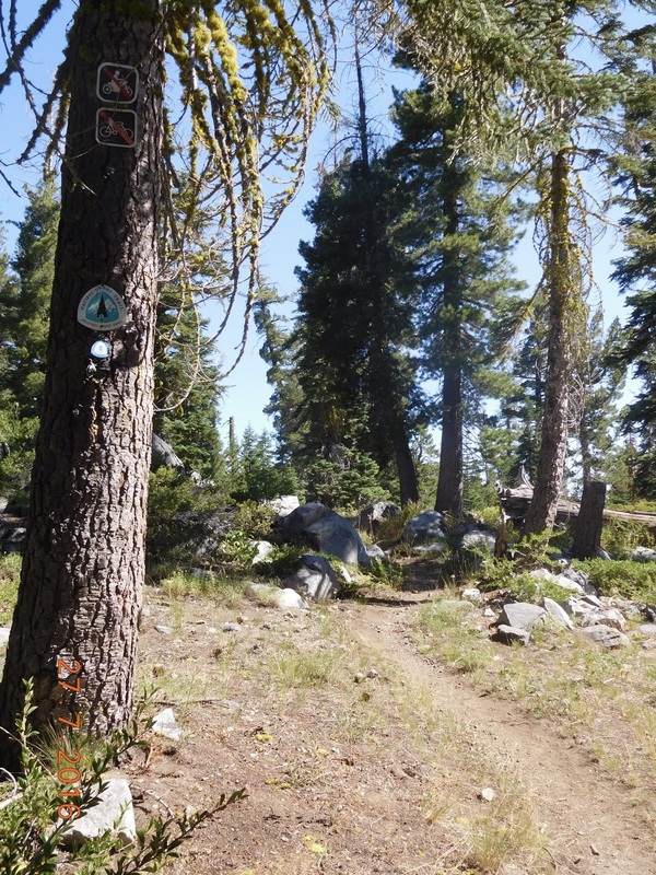
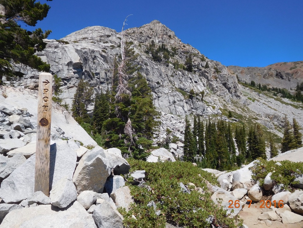
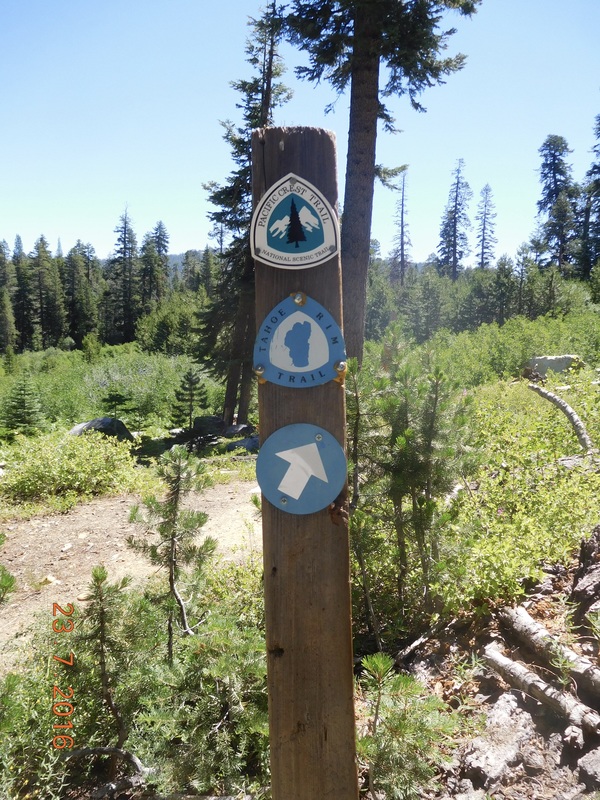
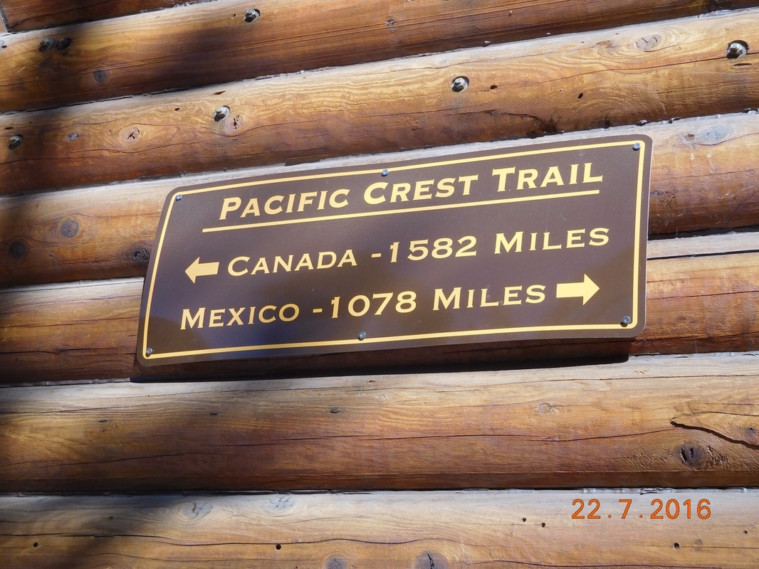
We came to a trailhead and saw this awesome tree with a PCT and trailhead sign:
Picture
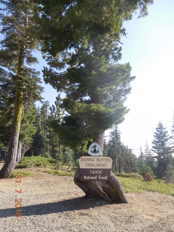
PCT sign of the day with Sierr Buttes Trailhead sign.
We arrived at the 4Runner around 5:45 PM and somehow managed to hang out there until 7:20 PM.  I guess we are not getting the 15 miles in that we planned. We saw that there was a campsite just over 1 mile up the trail, so we said goodbye to Tim (we may see him at a road crossing in 2 days) and hiked up the hill to our campsite. Wow...my bag felt really heavy after being able to slack pack the last 30 miles of trail.

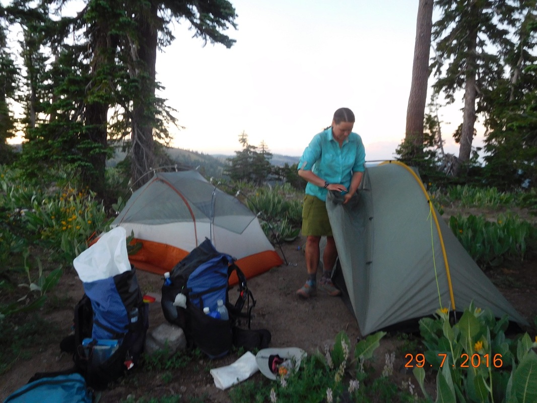
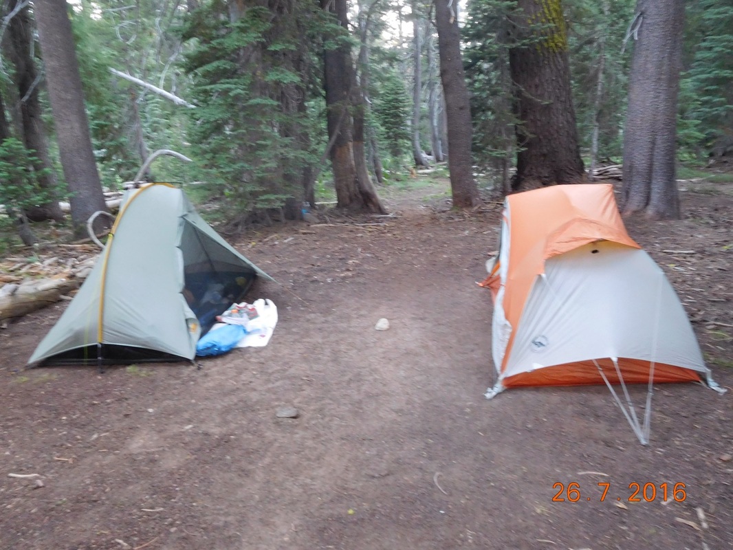
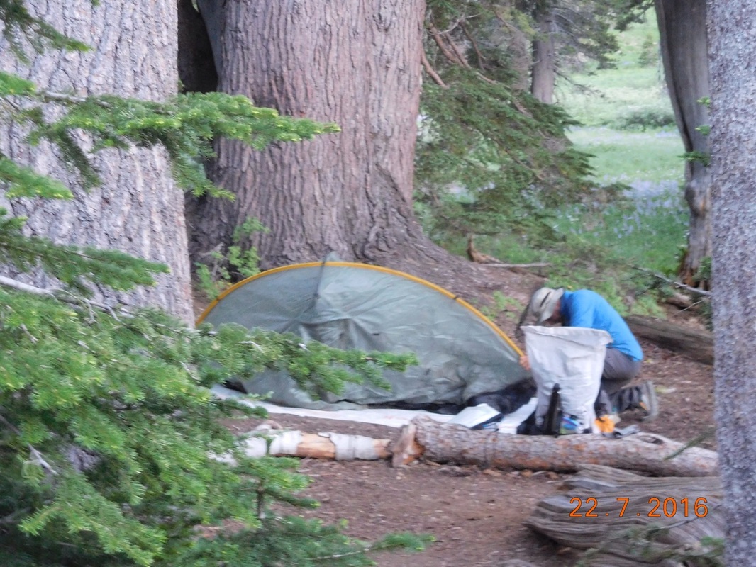
We made it to camp just before 8:00 PM and quickly set up our tents. Mine and Share Bear's were up, but Brad was still working on his.  I think he is a bit rusty after his 16 day break.
Picture
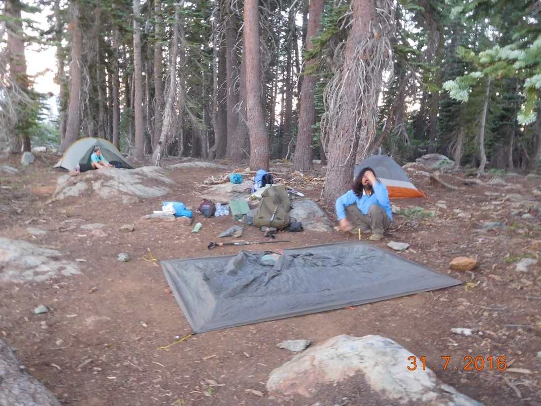
Brad still working on his tent
Finally, Brad was setup and we all ate dinner. While finishing up, Painter from Tasmania walked by and we invited him to join us for the night. He gladly agreed since the sun has set and he was pretty much ready to stop for the night.

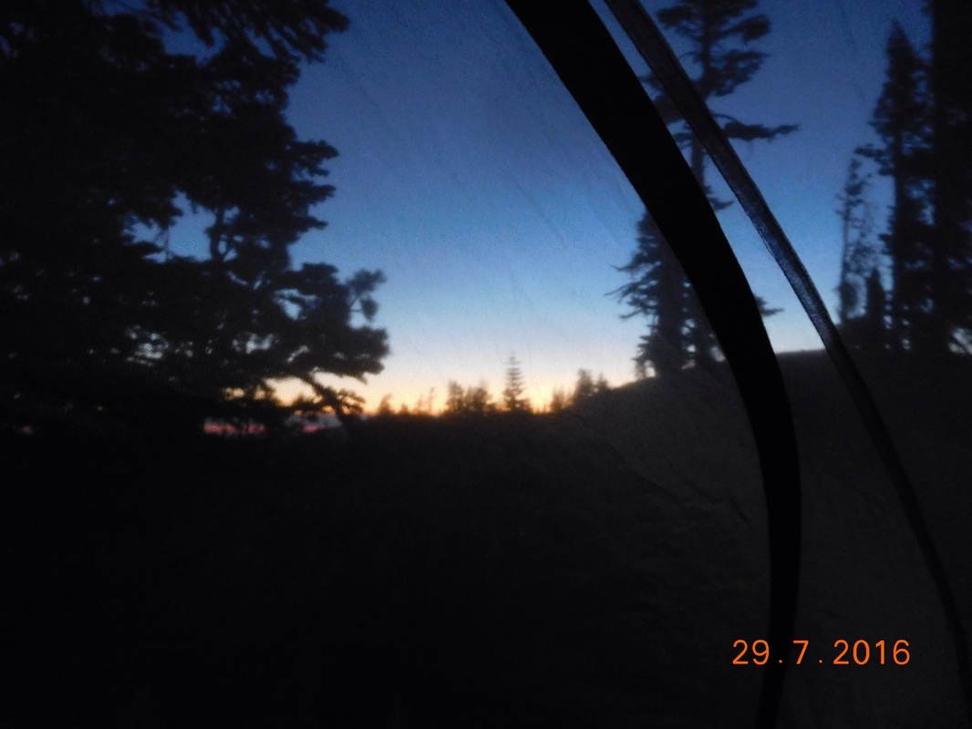
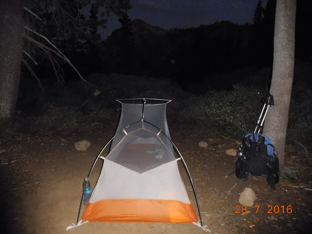
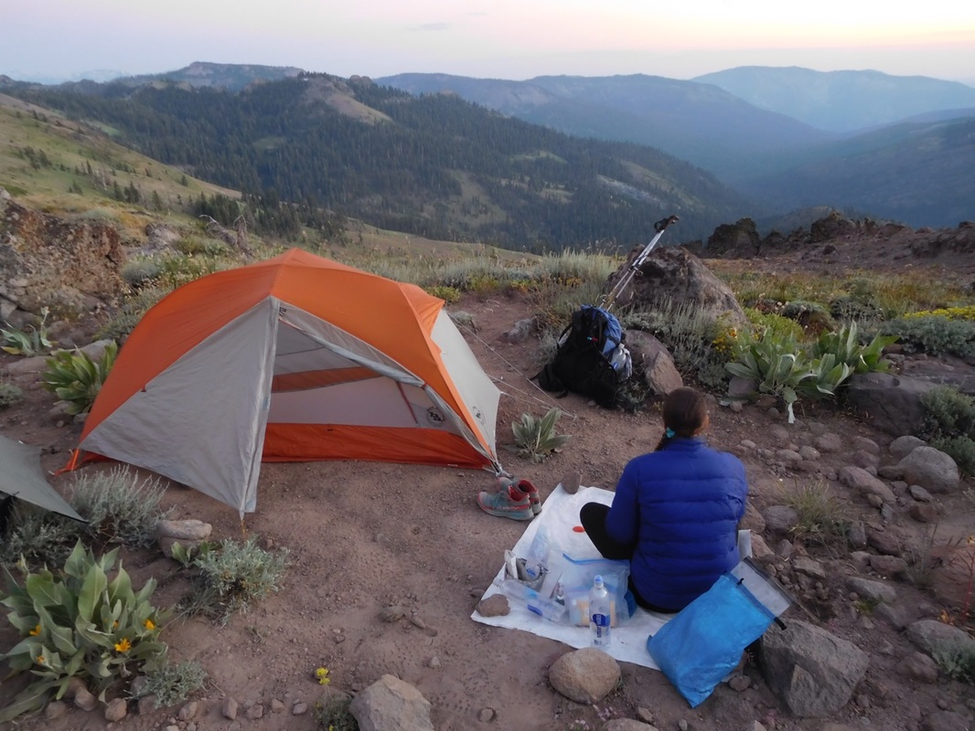
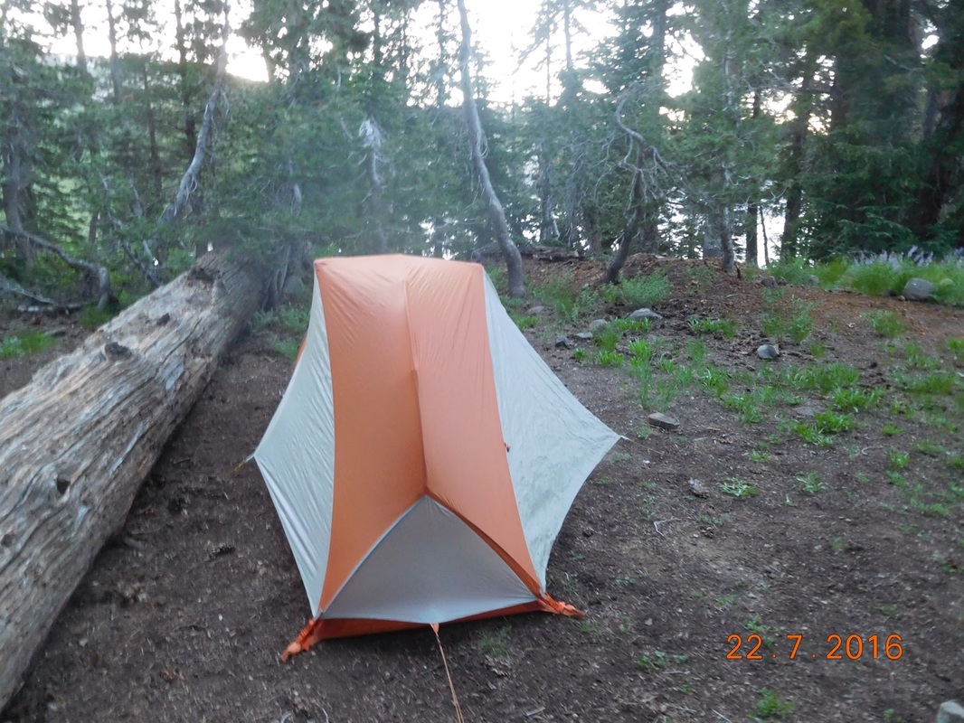
It's another warmer night so I didn't put on the wind flap. It should be a perfect for a good nights sleep.
Picture
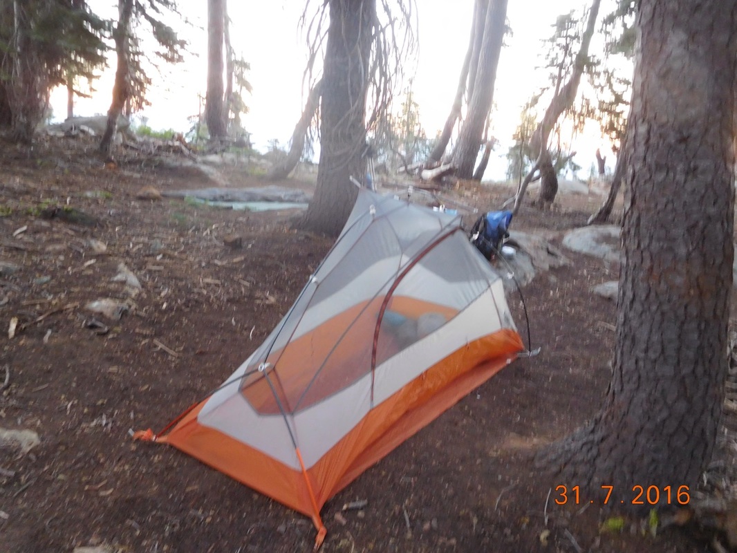
My home for the night.
2 Comments

Day 102 (30 July) - Mile 1174.46 - 1195.42

7/30/2016

0 Comments


Campsite at mile 1174.46 to Portola, CA

We woke up in our awesome campsite to the sound of birds flying around...quite nice.

Tim and Brad are meeting us in 5 miles at 9:30 AM, so we quickly broke camp, ate breakfast, and got on the trail at 7:20 AM.
Picture
Ready to hike...but leave the flowers
The area around out campsite was so beautiful, I had to take a picture this morning. Actually...this was much of our scenery this morning.
Picture
Morning scenery
As what is always the case, the hike started climbing.
Picture
Share Bear leading up the hill
We arrived at the rendezvous point at 9:15 AM, 15 minutes early, so we found a place in the shade and relaxed. 30 minutes later they arrived.
Picture
Tim and Brad arrive
After somehow wasting almost 1 hour with Tim and Brad, we emptied out our backpacks leaving only what we needed for the next 15 miles and left very happy with our ultralight backpacks. Today we are able to slack pack because we will see Tim and Brad at Highway 49 where we will be spending the night in town.

Starting out with our light packs was awesome. We felt light on our feet and that we could hike faster and longer. It seemed we were able to enjoy the scenery more with the lighter weight.
Picture
Beautiful reservoir
Picture
Entering Jackson Meadows Recreation Area
We were feeling great, and then we came to this sign that told us we were still 11.5 miles from the highway and it was after noon.
Picture
11.5 still left to go...oy!
This is when some frustration starting sinking into me. Even with the lighter bag, my feet and back still ached. How am I going to finish this trail when I can't even slack pack without aches and pains. All these crazy thoughts run through your head and then you realize that we are so lucky to be out here hiking and that we can do anything we put our minds to and that it is only 3 more miles to get down this awful hill and so on and so on until we reached a beautiful river that we couldn't pass up without putting our feet in to finally clean our disgustingly filthy legs and soak our aching feet.
Picture
Our legs and feet before river washing
Ah...so much better...now let's get this last 4.70 miles done and get into town.  About 1 mile later we were totally surprised to see Tim hiking towards us. Wow...he hiked in over 3.5 miles...so awesome.

He told us that when they got to the highway they saw a hiker hitching into town, so they decided to pick him up. It was Free Lunch!  I was happy he got to meet Brad and Tim.
Picture
Cool mountain view
Picture
Steel bridge over North Yuba River
It's nice to have Tim hiking with me so I can get nice photos like this:
Picture
Self-portrait "With Tim over North Yuba River"
We finally made it to the highway at 6:20 PM. We went to Portola and immediately stopped for Mexican food that was so good.

We then went to the Airbnb Airstream that Tim rented for the week. We made ourselves comfortable and Share Bear and I took short showers. We were all in bed by 9:00 PM and decided to sleep in a bit till at least 7:00 AM.

Here's hoping for a good nights sleep in this vintage '80s Airstream.
Picture
Our home for the night
0 Comments

Day 101 (29 July) - Mile 1153.87 - 1174.46

7/29/2016

0 Comments


Campsite under power lines to Campsite at mile 1174.46

I slept so well last night. I didn't put the rain flap on my tent and the temperature was perfect for sleeping. The only annoyance was a darn bird that perched on the power line above us and let off a crazy caw at 5:45 AM, 15 minutes before I had to wake.

I laid there for 15 minutes till 6:00 AM and then laid there longer waiting to hear Share Bear start moving first.

After finally getting up and moving we were ready to hike at 7:18 AM.
Picture
Ready to hike...but leave that pine cone behind!
Today we are meeting Tim and Brad at a rest stop on I-80 to get our food for the next 2 days. The rest area is 3.44 miles away and they plan on being there at 9:00, so we better get going.

Of course today's hike starts out by climbing a hill.
Picture
Share Bear leads the way up the hill
How exciting...another interstate crossing. It's been a while since we crossed one of these.
Picture
Tunnel under I-80
Besides our food for the next 2 days, Tim also brought us hard-boiled eggs, cold Gatorade, and some fruit. We hung out at that rest area for almost 2 hours...way to long, especially since we plan on hiking 20 miles today and it was already 10:40 AM and we still had 17.20 miles to hike.
Picture
Hanging at the I-80 rest stop
We were finally able to leave. Right out of the rest stop we had Castle Pass to climb. At 11:38 PM we arrived at the top.
Picture
Castle Pass celebration, 7,928 feet
Less than one mile after leaving the top of Castle Pass we came across Peter Grubb Hut, a shelter supported by the Sierra Club, that hikers and cross-county skiers can use.
Picture
As I was taking my photo, Share Bear tried to take one as well. She decided she had to back up to get the entire hut in the photo. Well, she backed right into a rock and fell backwards over it. Since my camera was out to take a photo of the hut, it was out and ready to take a photo of Share Bear on her back:
Picture
Sorry Share Bear
By the way, she was fine. The backpack broke the fall.

After getting up and stuff, we entered the hut to check it out. To enter, you climb the ladder and enter through the top door. This photo that was hanging on a wall shows why the door is way up high:
Picture
That's a lot of snow
After wasting time hanging in the hut, we were really falling behind schedule, so we continued on. We stopped for lunch at 1:15 PM and stayed put for 1.5 hours. It was now 2:45 PM and we still had 10.5 miles to hike. Are we going to make it?!?  At least the scenery was nice:
Picture
Share Bear ahead on the beautiful PCT
After another climb we wound up here:
Picture
Wonderful
And then at 5:40 PM. 3 hours after our lunch break, we still had over 5 miles to hike.  We thought that by 8:30 PM we should make it to camp.

Three miles later we stopped to collect water. This is supposedly the last water for 7 mile. Since we are camping in just over 2 miles, we will have a dry camp, so we need water. A leaving with 2 more liters of water, we crossed a dirt road and came across this cool PCT sign. The emblem is stamped into the wooden post:
Picture
PCT sign of the day
The next 1.5 miles was up almost 650 feet...just what we need at the end of this long day. Even though the climb was hard, the view when we got to the top was well worth it.
Picture
View from the top
Picture
Share Bear arriving at the top
Finally, just before 8:00 PM we made it to our campsite. We quickly set up our tents and ate dinner. All I wanted to do at that time was get in my tent and lay down. I was so done after today's hike.

Tomorrow Tim and Brad are meeting us 5 miles in at a dirt road crossing which will allow us to slack pack the last 15 miles tomorrow into Sierra City. If this works out I will be so grateful to Tim and Brad. So, until tomorrow...
Picture
Our home for the night is close quarters
Picture
The view from inside my tent
0 Comments

Day 100 (28 July) - Mile 1133.08 - 1153.87

7/28/2016

0 Comments


Campsite at mile 1133.08 to Campsite under power lines

What an exhausting day. We did our 20+ miles as we have the past few days, but at the end of today I was totally done. My feet are tired and a sharp pain on my right foot seems to flare up now and then. I'm lying here in my tent with my sleeping bag under my feet to elevate them hoping it will help. My foot raising is time limited until I get cold and need to get into my sleeping bag, so I'm hoping for a warm next hour while I blog.

I slept really well last night at woke right at 6:00 AM. Share Bear announced that she needed 10 more minutes...no problem here, I can always use more time to sleep in.

Even with the extra 10 minutes, we were ready to hike by 7:17 AM. We invited Free Lunch to join in the photo even though he wasn't ready to hike yet.
Picture
Free Lunch and us are ready to hike
Last night's camp was dry, so we both needed water badly. We had 2.80 miles to get to Five Lakes Creek.  On the way we saw some beautiful scenery:
Picture
Morning view
Picture
Moss on trees
We arrived at the water source and Candyman from last night's sunset photo was there filtering water as well as three other hikers. It's weird that it feels like we hadn't seen many other PCT hikers on trail, now we are seeing a bunch.

We filtered and drank and filtered some more and was ready to hike on. Our goal is to go 8.82 miles to another creek for lunch, but there is over 2,000 feet of climbing to get there, so I am a bit skeptical, but we will try.

We hiked another couple of miles before taking our five mile break.
Picture
Share Bear leading us to our break spot
While breaking we saw Footprint who we met when we were going up Kearsarge Pass and she was going down with Audible, Bear Bait, and Princess Mountain Man...that was a long time ago. As we were ready to get back on trail, Wild Child came upon us. We met her back on one of the passes in the Sierra Mountains.

We wound up hiking with Wild Child for the rest of the morning which includes hiking past a ski resort:
Picture
At the top of a ski resort
Picture
Self-portrait "Getting pretty hungry"
We made it 1.28 miles from our planned lunch stop, but there was a nice looking spot, so we stopped there instead. Plus, the 1.28 miles included a 438 foot climb that I felt I needed food to accomplish. Wild Child stopped with us and we enjoyed a 1.5 hour lunch.  Actually, Wild Child took off a bit earlier than us, but she is trying to hike 25 miles today, so she needs some extra time.

After lunch, we started the climb up to the creek for much needed water.
Picture
We got there pretty quickly and Wild Child and Free Lunch were there filtering water. This is the last advertised water source for 10 miles, so everyone is going to need to stop here for a fill-up.

While we were filtering, Swede and Irish showed up. We hadn't seen them since Tuolumne Meadows. It's crazy how many people we are seeing today.

After filtering water we still had over 9 miles to hike and it was around 3:00 PM already. We had heard of a bar & grill at Donner Pass that gives PCT hikers a free beer, so we had a thought of going there and eating dinner before hiking the last 0.5 miles to our planned campsite. With all this in mind we got back on trail and climbed the last major hill of the day

When we got to the top we were greeted by Tinker Knob:
Picture
Tinker Knob
And then we were greeted by this awesome view of the upcoming trail:
Picture
The incredible PCT
Picture
Share Bear headed down the trail
The trail at this point got really rocky and we got really tired. We now has about 6.5 miles to go, which seemed like a lot, but we pushed on.

We tiredly climbed up to another ski resort and then headed down. We arrived at this sign at 6:17 stating we had 2.5 miles to go to get to Donner Pass. Cool...now we are getting there.
Picture
Only 2.5 to go
Onward we hiked and arrived at another ski resort. The trail took us right under a ski lift.
Picture
PCT sign of the day with ski lift
Finally, after a really rocky and steep last mile we made it to Donner Pass. 
Picture
Arrived at Donner Pass
Before walking up the road to that bar & grill we heard of, I gave them a call to see if they were opened. A machine answered that said they were only opened on the weekends...there goes that.

We cross the road and continued up trail and saw a woman and her son. After talking with them for a bit, they offered us their water which we gladly took since we have another dry camp tonight. People are so generous out here.

Ten minutes later we found our camp. We set up our tents and ate lunch for dinner since again we are dinner for lunch today. I was pretty glad that I didn't have to cook since I was quite tired and just wanted to get into my tent, but I knew that I had to eat first.

Tomorrow morning we meet Tim and Brad at a rest stop on I-80 for resupply. It's 3.4 miles to there, so we should be there around 8:45 AM...something to look forward to.

I am now at the end of the blog and I do need to get into my sleeping bag. So, until tomorrow...
Picture
Home for the night
0 Comments

Day 99 (27 July) - Mile 1112.59 - 1133.08

7/27/2016

0 Comments


Seasonal Phipps Creek to Campsite at mile 1133.08

I slept really well last night, but woke up still pretty tired. I packed up my stuff and exited the tent and the mosquitoes were right on me. Darn it. They usually stay away in the morning, but not today. We quickly got our stuff together and decided to hike some before eating breakfast to find a place without mosquitoes.  We left the mosquito infested campsite at 6:47 AM.
Picture
Ready to get away from the mosquitoes
We hiked for a good hour before stopping for breakfast. Unfortunately the mosquitoes were still bad, but I had to tolerate them since I was starving. We are quickly and were back on trail.

Oh...I forgot to mention that we saw Smiles on the trail this morning. I met here way back in Acton at the KOA, like 2 months ago. Her father is on the trail with her for 5 days, so she was hiking slower than us, but it was cool to see her again.

This is what most of our morning was like. A wonderful pine forest infested with mosquitoes:
Picture
Our morning view
Exactly 6 miles into the hike we arrived at Richardson Lake where we took our morning break.
Picture
Richardson Lake
When we arrived we saw Camel Sock who we met at the start of the Sierra Mountains like 4 weeks ago. She has decided to turn her thru-hike into a section hike and travel to India and Bali in August and September.  We get it...this trail is really difficult and doesn't seem to get any easier, especially mentally.

After breaking for about 30 minutes we continued on. By the way...the PCT and the Tahoe Rim Trail are still combined as can be seen in this photo:
Picture
PCT sign of the day - combined with Tahoe Rim Trail
I love the way these moss covered trees look:
Picture
Moss-covered trees
After the break we hit a 4 mile climb. It wasn't too steep, so it wasn't too bad, but it seemed to go on forever. Share Bear was more energetic than me this morning, so she led up the climb:
Picture
We finally made it to our lunch place goal of Barker Pass Trailhead right at 1:00 PM. 
Picture
Self-portrait "Barker Pass"
We were so happy to find a picnic table there along with Camel Sock and Fox. We joined them and decided to cook dinner for lunch since we had a picnic bench and there were no mosquitoes. While cooking lunch, Free Lunch showed up and joined us. We wound up staying there till 3:00 PM which wasn't good since we had 11 more miles to hike to our planned campsite...OY!

The climb from before lunch continued for 1 more mile. At the top we finally had a view of Lake Tahoe:
Picture
Self-portrait "Lake Tahoe admired by Share Bear"
And then another climb started and went on for a while. At the top of this one the PCT and Tahoe Rim Trail split after being together for 50 miles.
Picture
The splitting of two trails
Right after the split we started hiking on a crest for a while with beautiful views:
Picture
Amazing
After hiking for a while we still had 4.5 miles to go to our planned campsite and it was 6:30 PM. We knew we could make it if we had to, but we didn't really want to, so we started hoping to see a campsite earlier. As long as we hike at least 20 miles today we are good. In our guidebook there is mention of a ski hill, but not a campsite, but we hoped there would be one.

We hiked on and arrived at the ski hill, but the trail remained on a ridge so we had little hope of finding a place to camp.

Just 2.8 miles from the planned campsite I noticed a site and we quickly decided to make it our home for the night. As we were setting up camp, Free Lunch was hiking by and decided to join us. This site is so cool being right on the side of the mountain.
Picture
Free Lunch cowboy camping
And then, the sunset was amazing and Candyman walked by just in time for this shot:
Picture
Candyman passing by at sunset
Tomorrow we plan on hiking another 20 miles. This will be our fifth 20 mile day in a row. It looks like 20 miles is becoming a habit, but my feet still ache at the end of the day. The good of hiking 20 miles is that I seem to sleep a lot deeper, which I think I will get to now. Until tomorrow...
Picture
Our amazing home for the night
0 Comments

Day 98 (26 July) - Mile 1092.27 - 1112.59

7/26/2016

0 Comments


Echo Lake to Seasonal Phipps Creek

I hate waking to an alarm, especially when I'm in town and sleeping in a bed. The alarm went off at 5:50 AM because we wanted to get back on the trail by 7:30. I got out of bed and took my last shower for at least 5 days and went downstairs. I'm excited about getting back on the trail, but I'm going to miss this rental house in Tahoe.

We wound up leaving the house around 7:30 AM, the time we wanted to be back on trail, but it was expected. Every time we leave town it is very hard.  At 8:10 AM we were all out of the 4Runner and ready to hike. Tim, Brad, and Mary decided to join us for the first mile or so of the hike.
Picture
Everyone is ready to hike.
The trail started out beautiful, climbing above Echo Lake a bit and then following a rim around it. About 20 minutes after starting up the trail Mary twisted her ankle and fell. She did the same thing last time she hiked with us. The problem is she is busy looking around at the scenery and not paying attention to the trail...I am quite familiar since I am really good at that too. After the fall, she was ok by the way, Mary and Brad turned around, but Tim continued for about 15 minutes more before calling it quits.
Picture
Tim's turnaround point.
We said our goodbyes to Tim. We will see him in 3 days when he resupplies us on I-80.

Share Bear and I continued on. The trail went around the backside of Echo Lake where I took this awesome picture:
Picture
Echo Lake
A bit further and we entered Desolation Wilderness:
Picture
Entering Desolation Wilderness
Today was a day of rocky trails that were challenging to hike, and multiple beautiful alpine lakes. Here is Aloha Lake...how incredible is this?!?
Picture
Aloha Lake
This area is just amazing.
Picture
PCT sign of the day
We were just hiking along when we met up with a family out on a day hike. When we told them that we were PCT hikers they were amazed and asked how many miles we had hiked so far. I took out my phone to check and noticed that we missed mile 1,100 by 0.71 miles. There was no way we were going to hike back, so we took our picture here at mile 1,100.71.
Picture
Proof we just passed PCT mile 1,100
Picture
1,100 mile pose
Three miles later we stopped for lunch. There were these pesky yellow horse flies around and I swatted one before it could bite me. It barely survived. I got it on a stick and managed to get this pretty cool close-up of it:
Picture
Yellow horse fly
After lunch we had our one big climb of the day, a 2.5 mile, 1,148 foot climb up Dicks Pass:
Picture
Sign indicating our direction up Dicks Pass
As usually, as we climbed we had no idea where Dicks Pass was.
Picture
Somewhere up there is Dicks Pass
Seventy-five minutes later and we were standing at the top of Dicks Pass:
Picture
Dicks Pass, 9,377 feet
This photo was taken by Poppins, a PCT hiker we met as we climbed up to the pass. She calls herself a LASHer (Long Ass Section Hiker).

The top of the pass seemed like a great place to take a self-portrait.
Picture
Self-portrait "Dicks Pass"
Of course below Dicks Pass is Dicks Lake:
Picture
Dicks Lake
We continued hiking strong. We want to hike at least 20 miles today even though we started 1 hour late today. We were at the top of Dicks Pass at 4:20 PM and still had almost 7 miles to hike to reach our goal. After a few breaks we stopped at Middle Velma Lake, our possible last water source before our planned campsite 2.67 miles further. 
Picture
Middle Velma Lake
It was now 6:30 PM. Both Share Bear and I were anxious to make it to camp. We were both tired from going to sleep too late yesterday. Plus, the rocky trail today made our feet and ankles tired. Plus, we were both pretty hungry. We pushed up our speed for the last hour and managed to hike the 2.67 miles in exactly one hour. Pretty impressive considering we had to climb over 250 feet. We were also motivated by the crazy amount of mosquitoes that appeared right at 7:00 PM. It was as bad as it has ever been.

We finally arrived at our campsite at 7:30 PM and the mosquitoes were relentless. We put on our bug nets and setup camp. We both cooked dinner outside, but had to eat in our tents to escape the wrath of the mosquitoes. As I lie here typing the blog, all I hear is buzzing outside the tent from said mosquitoes.

What a day, we hit 1,100 mile and managed to hike 20.31 miles even though we started 1 hour later than usual. Tomorrow we plan on hiking another 20 miles, but we will see how that goes. Until then...
Picture
Our mosquito infested home for the night
0 Comments

Day 97 (25 July) - Mile 1092.28

7/25/2016

0 Comments


Echo Lake (Staying in Lake Tahoe, CA)

We had another perfect day off from hiking.  The following was done:
  • Slept in till 10:00 PM
  • Had another awesome breakfast prepared by Mary
  • Relaxed on the couch
  • Ate a sandwich
  • Ate a wonderful salad created by Mary
  • Relaxed on the couch
  • Prepared food for the next 5 days on the trail
  • Grocery shopped
  • Ate large bowl of pasta with mushroom sauce
  • Relaxed on couch
  • Laundry
  • Bed by 10:00 PM

We want to be back on the trail by 7:30 AM since we plan on hiking 20 miles tomorrow.  It will be 5 days / 103 miles until we make it to the next city, Sierra City.  Hopefully I'll have time to update the blog then.
0 Comments

Day 96 (24 July) - Mile 1092.28

7/24/2016

0 Comments


Echo Lake (Staying in Lake Tahoe, CA)

We had a perfect day off from hiking.  The following was done:
  • Slept in
  • Had an awesome breakfast prepared by Mary
  • Relaxed on the couch
  • Ate sriracha flavored potato chips while drinking a really good pale ale
  • Relaxed more on the couch
  • Finally left the house to do some shopping
    • Stopped at the local outfitter
    • Grocery shopped at a discount grocery store
  • Met One Pole Czech at Patagonia store
  • Ate at a great Mexican Restaurant and drank a pitcher of an awesome Chocolate Hazelnut Porter
  • Returned to house way full
  • Soaked in the hot tub
  • Relaxed on the couch
  • Went to bed around 11:30 PM
Picture
Picture
Picture
0 Comments

Day 95 (23 July) - Mile 1081.73 - 1092.28

7/23/2016

0 Comments


Showers Lake to Echo Lake (Staying in Lake Tahoe, CA)

The temperature was perfect for sleeping last night.  I woke at 6:01 AM and immediately packed my stuff and left the tent.  We only have 10 miles to hike today to get to Echo Lake where Tim and Brad will pick us up and take us to Lake Tahoe for a 2.5 day break.  Share Bear and I were obviously both excited because we were ready to go before 7:15 AM.
Picture
One Pole Czech, Share Bear, & Mighty Mouse ready to get to Lake Tahoe.
Karal, now known as One Pole Czech, joined us for our hike today when we told him we could give him a ride to Tahoe.  I thought I was anxious to get to town until we started hiking and Share Bear took off.  I had to almost jog to keep up with her.  Luckily it did make for a nice picture as she walked through a field of wildflowers.
Picture
Share Bear hiking through wildflowers.
The hike was not too difficult, but there were a few pretty steep hills we had to climb.  Even worse, there was a long, steep downhill, granite steps included.

Throughout the day One Pole Czech kept up with us:
Picture
One Pole Czech keeping us
I forgot to mention that yesterday the Pacific Crest Trail joined with the Tahoe Rim Trail:
Picture
PCT / Tahoe Rim Trail
Since we joined the Tahoe Rim Trail and we are closer to a large city (Lake Tahoe) we are seeing more people on the trail.  As we hiked today we caught up to two young men whose packs were both leaning way to one side.  As we were passing them I had to say something.  They said that they were backpacking for 7 days now and that they can't figure out their bags.  They agreed to let us help them try to figure it out.  After adjusting some straps on one of the guys he put the bag on and said that it felt 10 times better.  Share Bear helped the other guy unload and reload his bag to make the load more even.  He said his bag felt much lighter and more comfortable  They then asked if we were angels...awe...I said that we were just fellow backpackers who care about other backpackers.  Good deed of the day complete!

We made it to Echo Lake just after noon where Tim and Brad were waiting for us.  There were many other backpackers there, so we hung out for about 1 hour chatting with others until we were ready to leave about 1:00 PM.  We all piled into the 4Runner for the drive to Tahoe.  We dropped One Pole Czech at the hostel and then we went to our rental house.  What a great house.  Just after we arrived, Mary, Brad's mom, arrived as well.  Share Bear and I took showers and we were ready to go out for dinner.

It has been one of my big goals to make it to Lake Tahoe because there is an All-you-can-eat made to order sushi restaurant.  So we headed out to Sushi Pier and literally ate all we could:
Picture
Special scallop hand roll with other first round sushi in background.
After sushi we returned back to the house to pretty much pass out.  We have the next 2 day to relax and prepare to get back on the trail.  Sound great to me.
Picture
Our home for the next 2 days.
0 Comments

Day 94 (22 July) - Mile 1060.49 - 1081.73

7/22/2016

0 Comments


Tributary of Pleasant Valley Creek to Showers Lake

I slept OK last night. I woke up pretty warm and unzipped my flap for some fresh air and then I had trouble falling back asleep. I eventually did, but woke around 5:30 AM and stayed awake till Share Bear "woke" me up just after 6:00 AM.

We know we have another long day ahead of us, so we both quickly got ready to hike. We said goodbye to the two guys that we shared a camp when they left before us, then Boston Scott showed up. He woke early and started hiking at 6:15 AM and made it to our camp one hour later. He actually made it just in time to get into our morning photo at 7:23 AM.
Picture
Ready to hike
Share Bear and I started our hike while Scott stayed behind to eat some breakfast.  The trail started climbing immediately before we even had time to warm up.
Picture
Share Bear leading the morning climb.
Today's hike shouldn't be too bad except for the distance of 21.25 miles we plan on hiking. It should actually be close to the same difficulty as yesterday's hike when we were able to hike the same 21.25, so we feel pretty confident that we will make it.
Picture
Our morning view.
While climbing we saw and smelled a pine tree that we thought might be a ponderosa pine.  We smelled the bark and it smelled like vanilla, so maybe this is a ponderosa pine and not the tree I smelled a few days ago.
Picture
Ponderosa pine?
We completed the first 5 miles of the day by 9:30 AM and took our "shoes off" break on the side of Blue Lakes Road. While sitting there, we met and talked to Yard Sale and Flying By, both PCT thru-hikers.
Picture
PCT sign of the day just before Blue Lakes Road.
After the break we continued on. Our plan was to make it another 7 miles before stopping for lunch. The thought was that we wanted to have less miles to go after lunch than we hiked before.

We started hiking and the trail went to the right of a large hill. I joked to Share Bear that the trail will probably then turn left and go up and around this huge hill. We both laughed and said, "Yeah right."
Picture
View as trail went right.
We both stopped laughing when the trail did turn left and started climbing that huge hill. The trail went up to what we thought was the top, but it wasn't. Again it did the same thing and went over a false peak. Finally, on the third peak looking climb we actually made it to the top.
Picture
The actual top of the climb is right ahead.
Picture
Self-portrait "View from the top"
Of course after that climb we were both pretty hungry and we still had 1.5 hours till we arrived at our lunch goal, so we took a little break at the top and had a snack.
Picture
Another view from the top.
Picture
View coming down from the top.
Finally, just after 1:00 PM we saw a valley of trees that we knew was where we were going to stop for lunch.
Picture
Lunch will be in those trees.
The lunch spot was close to a river and really comfortable. There was a nice breeze keeping the mosquitos away, so we decided to cook and eat dinner for lunch. It only because of the bugs, but we figured we would be getting into camp late, so it would be easier to just eat a sandwich for dinner and not bother cooking. Plus, yesterday when we hiked over 20 miles we arrived at our camp famished. Since our dinners have more calories than our lunches, it makes sense to have the higher calorie meal to help us get through the hike.

While eating we met Drew, a day hiker, who is working for a non-profit that finds land to turn into Wilderness Areas. After filtering water, cooking and eating lunch, washing the pot, and talking to Drew, 2 hours had past. Wow. That's a long lunch, especially since it is now 3:17 PM and we still have 9.37 miles to hike today.

We started back up after lunch and had another big climb to do up to Carson Pass. About halfway up the climb I spotted Tim ahead on the trail. He parked at the Carson Pass Visitors Center and hiked in 3 miles. He was hoping to see us sooner, but we decided to take a 2 hour lunch, so he had to hike in further. His 3 mile hike was pretty difficult having to climb up from the parking lot and cross a couple of snowfields before starting down the other side where he finally met us.
Picture
Tim hiking ahead of me.
By 5:00 PM we made it to the Carson Pass Visitors Center on Highway 88. We caught it just as they were preparing to close. When the volunteers who work the center realized we were PCT thru-hikers they filled our water bottles and provided us sodas, strawberries, apples, grapes, and chips. Best of all, Ginger offered us some of her homemade banana bread.
Picture
Ginger serving up banana bread
We hung there too long, especially since Brad was in the car waiting for us down at the next parking lot.

Before leaving we noticed this cool Canada / Mexico distance sign.  We still have a long way to go!
Picture
Still not almost to Canada.
We walked the 0.14 miles to the lower parking lot and met up with Brad. He is feeling much better, but needs more time to heal completely. We hung out there for way too long and finally got back on trail at 6:00 PM with just over 5 miles to still hike to make it to our planned campsite. 5 miles used to be half of my total miles for the day. Now I'm hiking 5 miles after 6:00 PM...it's amazing how far I have come.

We climbed up a bit from Highway 88 and then settled into a meadow for many glorious, flat miles. 
Picture
Share Bear in the meadow.
Picture
The beautiful PCT.
Of course the calmness ended when we had 0.8 miles and 367 feet to climb. To make the climb even worse, mosquitos were swarming all around us for the entire climb. We finally made it to our campsite at 7:41 PM meaning we averaged 2.93 miles per hour for the last 5 miles of the day which included 2 pretty big climbs. Wow...we have come a long way!

We were so glad we are dinner for lunch since the mosquitos continued to drive us crazy as we pitched our tents. After my tent was up and quickly got in and didn't leave it. I did eat some Cheetos and a cheese stick inside my tent which is a big no-no, but I didn't have a choice.

Oh, I forgot to mention that Karel form Czech Republic has been hiking with us since after lunch and decided to camp with us tonight. Here he is setting up his tent:
Picture
Karel setting up camp.
Tomorrow we have just 10 miles to hike to meet Tim at Echo Lake which is close to Lake Tahoe. We are then going to spend 2.5 days there relaxing before getting back on the trail and continue hitting it hard. We can't wait for the break and for all the food.
Picture
Campsite for the night. Showers Lake is down behind those trees.
0 Comments
<<Previous

    Archives

    October 2016
    September 2016
    August 2016
    July 2016
    June 2016
    May 2016
    April 2016

    RSS Feed

Powered by Create your own unique website with customizable templates.