Tim & Gerri's Wild Ride
Email & Facebook Gerri:
  • Home
  • Worldwide Travel
    • Everest 2025 >
      • 2025 Everest Packing List
      • Everest Blog Summary
    • 2024 Europe Tour >
      • 2024 Europe Tour Packing List
      • Europe 2024 Blog Summary
    • Asia 2023 >
      • Asia 2022 Packing List
      • Asia 2023 Blog Summary
    • Eastern Europe 2022 >
      • Eastern Europe 2022 Blog Summary
      • Eastern Europe 2022 Packing List
    • Narrowboat Holiday 2022 >
      • Narrowboat 2022 Blog
      • Narrowboat 2022 Packing List
    • Ireland & UK 2019 >
      • Ireland & UK Itineray
      • Ireland & UK Blog Summary
      • Ireland & UK Packing List
    • France 2018 >
      • France Itinerary
      • Blog Summary
    • European Tour 2017 >
      • European Vacation Blog
      • Blog Summary
    • Southeast Asia 2014-15 >
      • Southeast Asia Blog
      • Packing List
      • Blog Summary
    • Afghanistan 2011-12
  • United States Travel
    • Great Lakes Sail 2020 >
      • Great Lakes Sail 2020 Blog
      • Blog Summary
    • Trans-America Bicycle Ride >
      • Blog Summary
      • Our Team
      • Equipment
      • Breweries Along Route
    • Pacific Crest Trail >
      • Pacific Crest Trail 2016 >
        • What is the PCT? - 2016
        • Why Hike the PCT? - 2016
        • Gear - 2016
        • Itinerary - 2016
        • PCT Blog Summary - 2016
        • Where are we now? - 2016
      • Pacific Crest Trail 2014 >
        • What is the PCT?
        • Why Hike the PCT?
        • Gear
        • Food
        • Itinerary
        • Blog Summary
        • Where are we now?
    • Motorcycle Ride 2014 >
      • Motorcycle Blog
  • Brewery Visits
    • 2025 Breweries
    • 2024 Breweries
    • 2023 Breweries
    • 2022 Breweries
    • 2021 Breweries
    • 2020 Breweries
    • 2019 Breweries
    • 2018 Breweries
    • 2017 Breweries
    • 2016 Breweries
    • 2015 Breweries
    • 2014 Breweries
    • 2013 Breweries
    • 2012 Breweries
    • 2011 Breweries
    • 2010 Breweries
    • 2009 Breweries
    • 2008 Breweries
    • 2007 Breweries
    • 2006 Breweries
    • 2005 Breweries
    • 2004 Breweries
    • 2003 Breweries
    • 2002 Breweries

Day 29 (30 April) - Mile 301.19 - 309.97

4/30/2016

0 Comments


Deep Creek Campsite to Campsite Under Rainbow Bridge

Even with 9 people camping in the same area it was a peaceful, quiet night.  My tent site felt perfectly level making for a great night of sleep.  Plus, the temperature was cool, but pleasant.  I got out of the tent around 7:00 AM to gray skies.  Within 5 minutes it started raining.  It is quite a bummer trying to keep all your stuff dry while breaking camp in the rain.  Plus, you now have to put away a wet tent which is also a bummer.  Brad decided to stay i the tent as long as he could.  i tried to do little things between rain showers.  One of the things was to filter water.

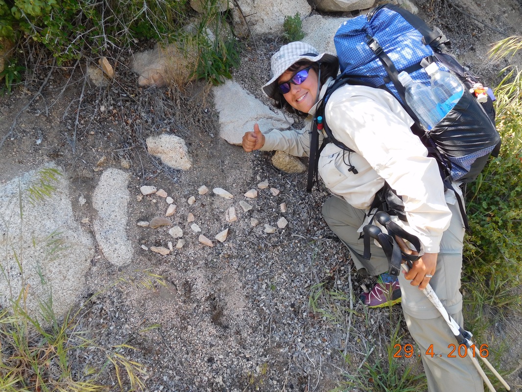
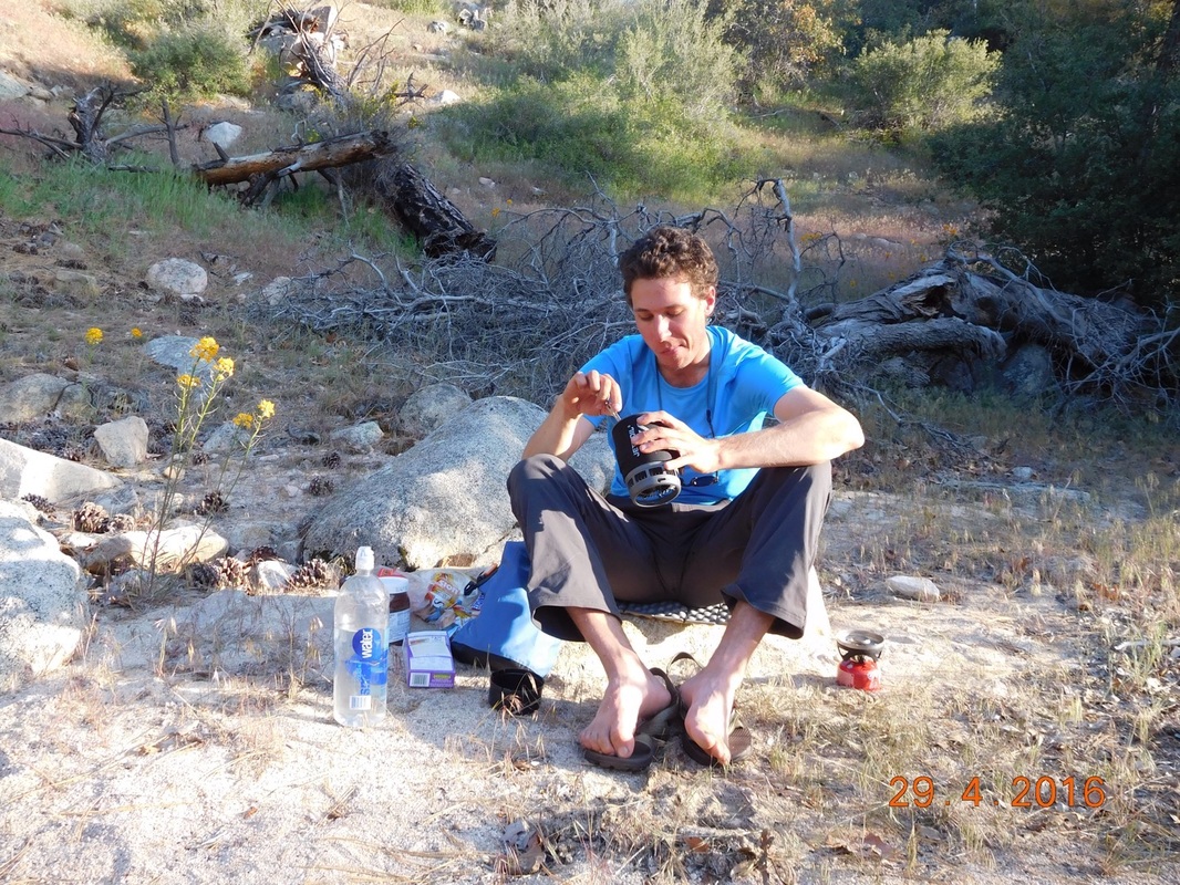
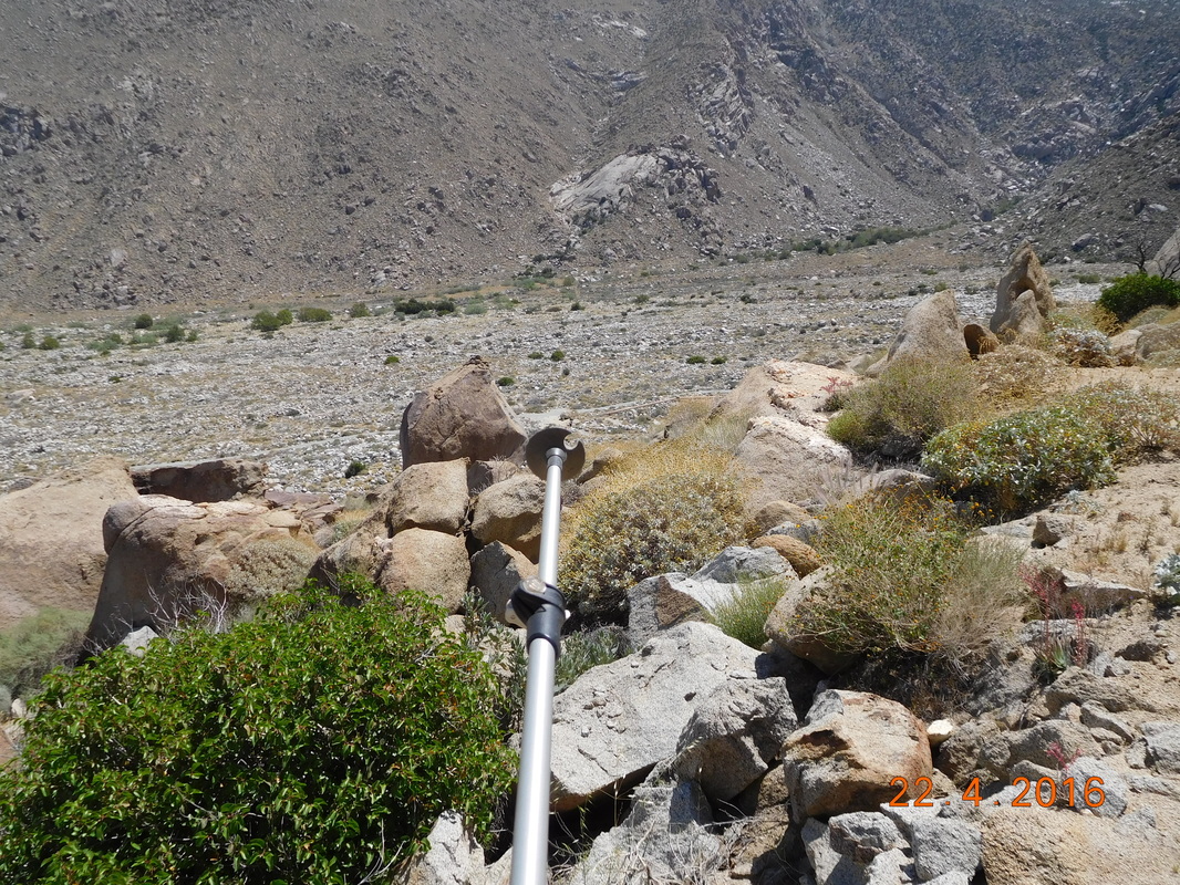
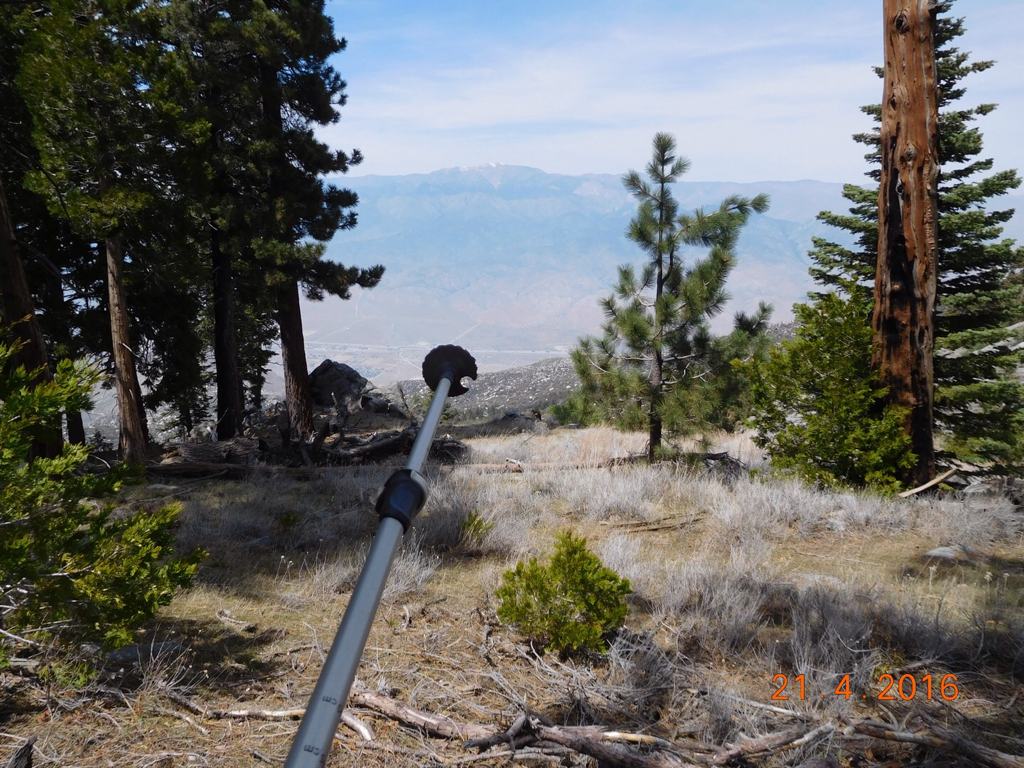
My friend Dave Grassie helped me figure out this water filtering system that works pretty well.  Cheers Dave!
Picture
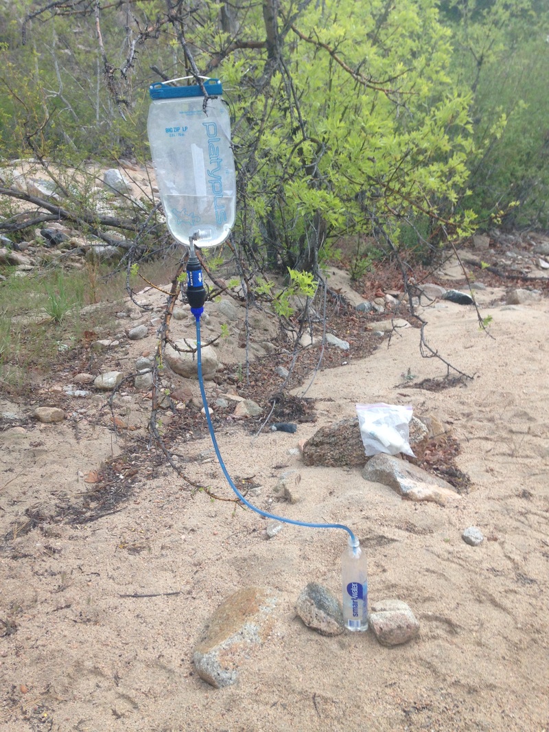
Grassie-Kail water filtration system
After filtering water it stopped raining long enough to pull down the tent and get my bag packed.  By this time Brad finally decided to leave his tent and pack up as well.

Throughout the morning we said goodby to David, Jason, and the Grist Family until we were the only ones left.  It took us 2.5 hours to leave for today's hike...maybe a new long record.  I'm sure we will beat in one day.

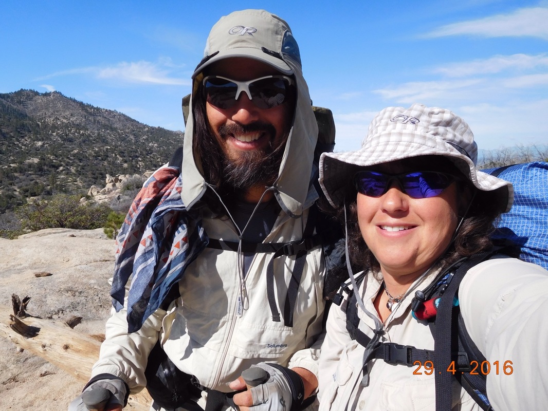
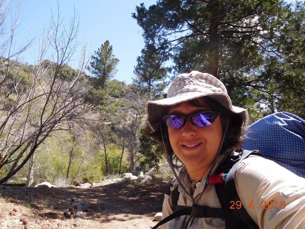
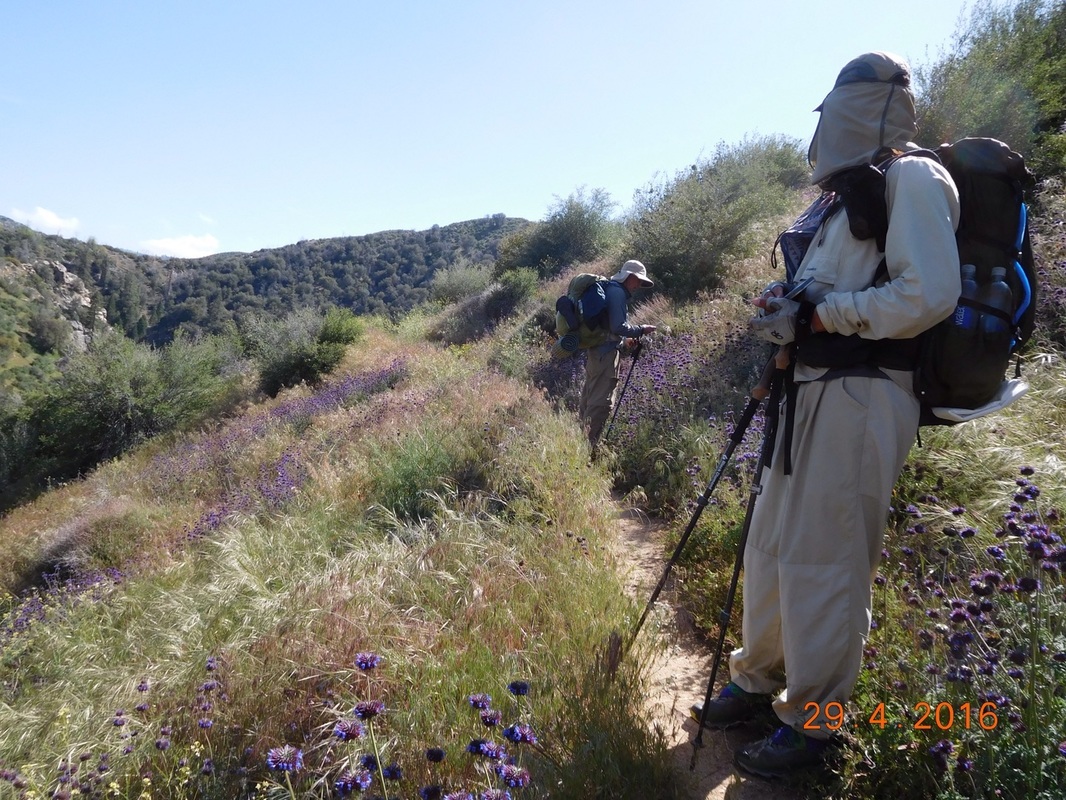
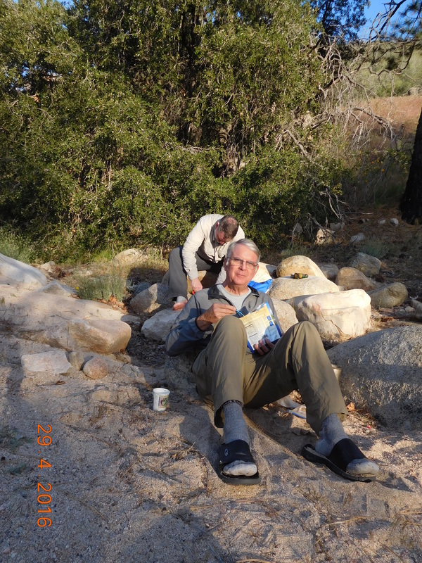
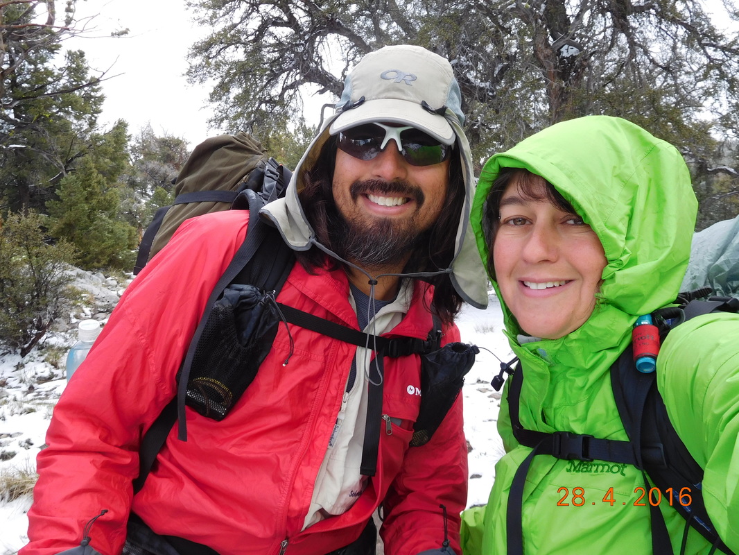
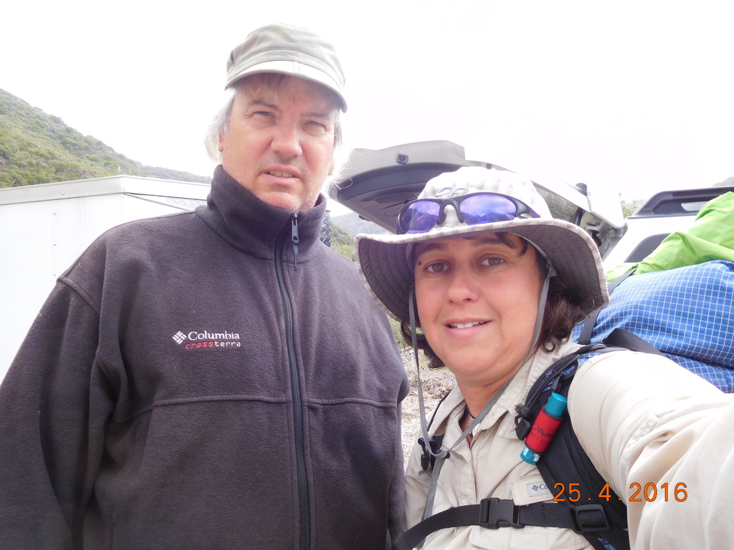
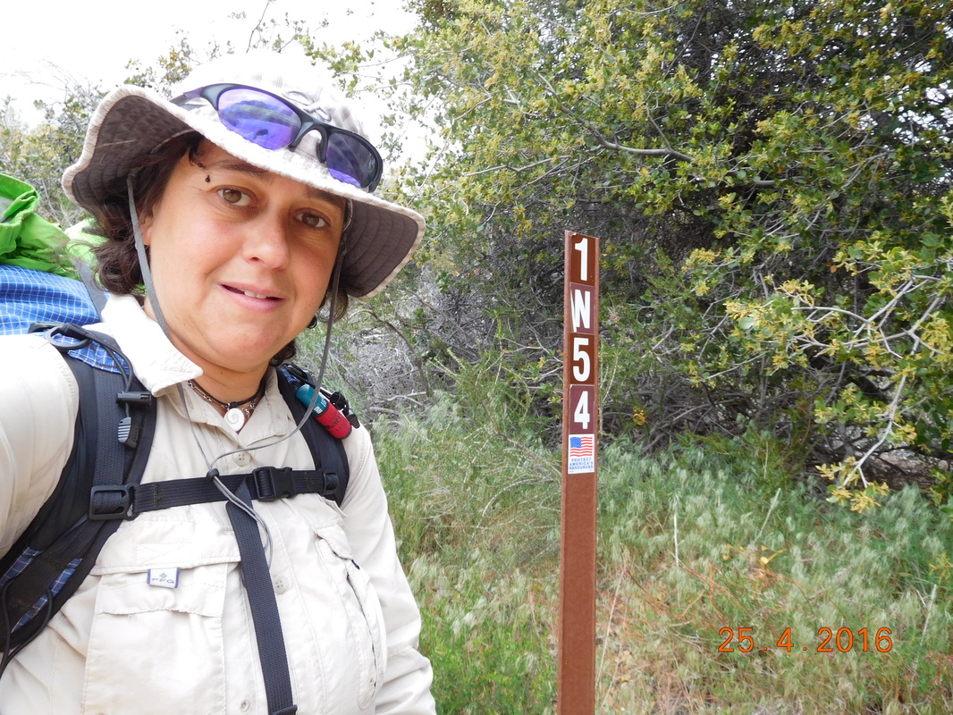
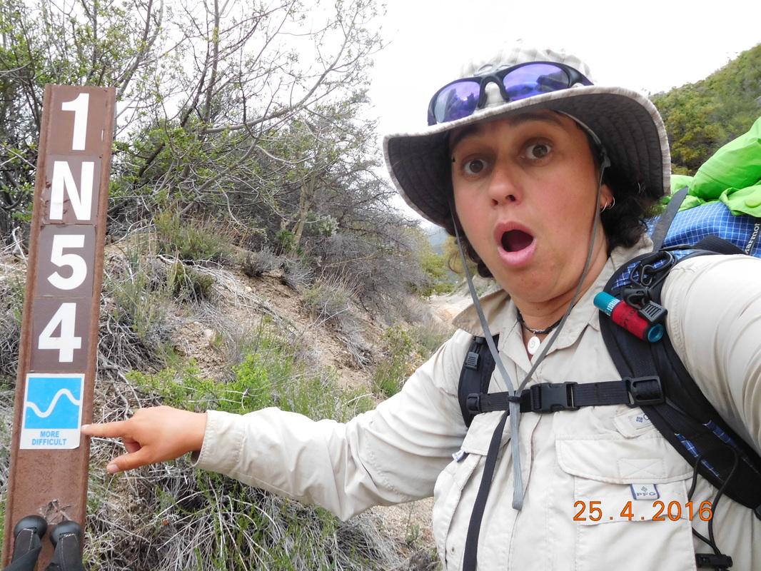
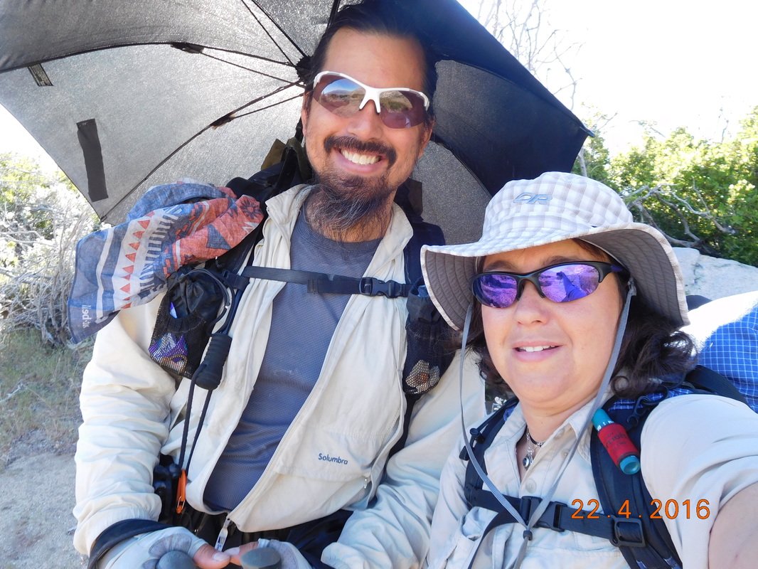
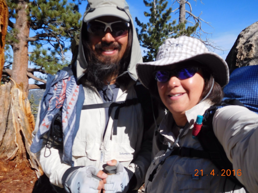
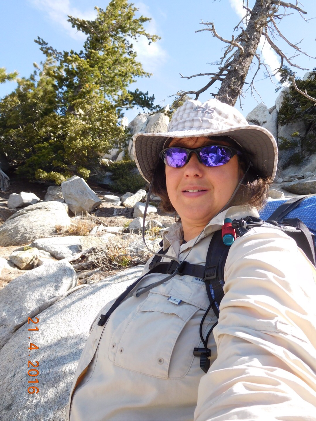
As usual, here is the pre-hike picture.  Not usual, we have Wildcard and Ron joining in on it.
Picture
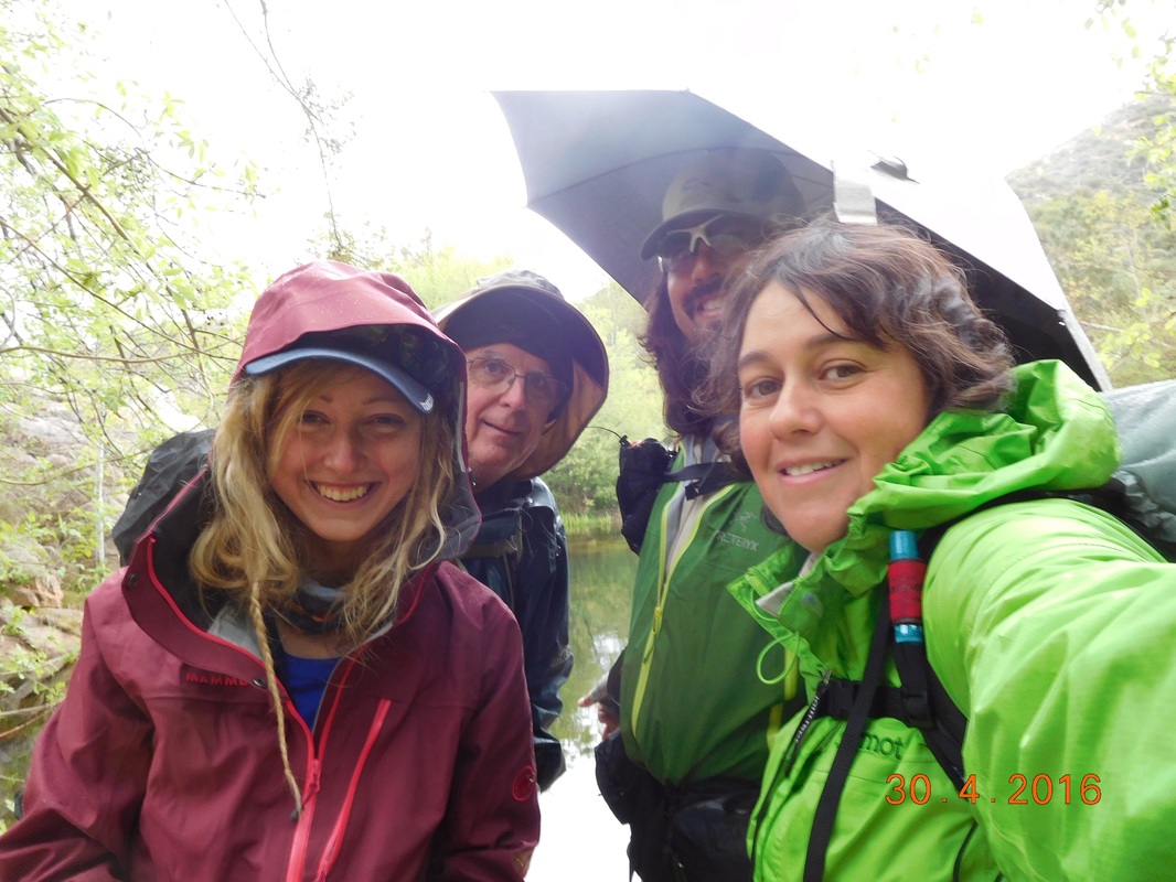
Wildcard, Ron, Brad, & I ready to hike
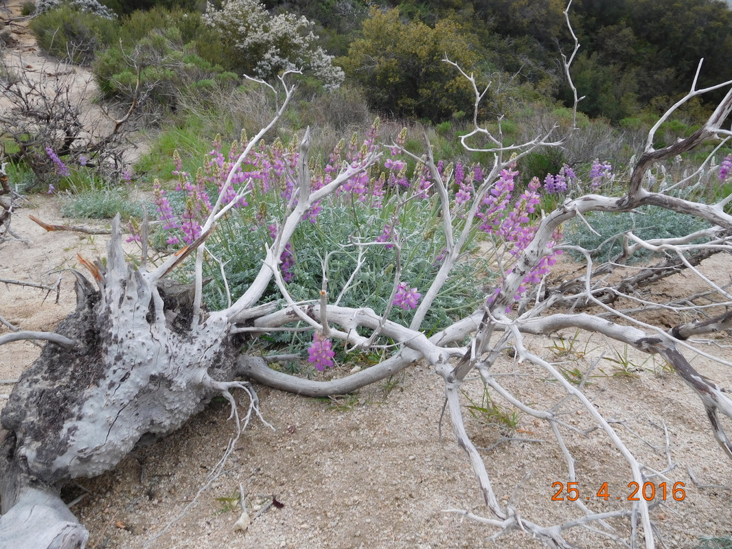
As I stated yesterday, hiking with Ron is very interesting since he points out all the wild flowers.  Today i was inspired to take a couple of flower pictures.
Picture
Beautiful flower on the PCT
Picture
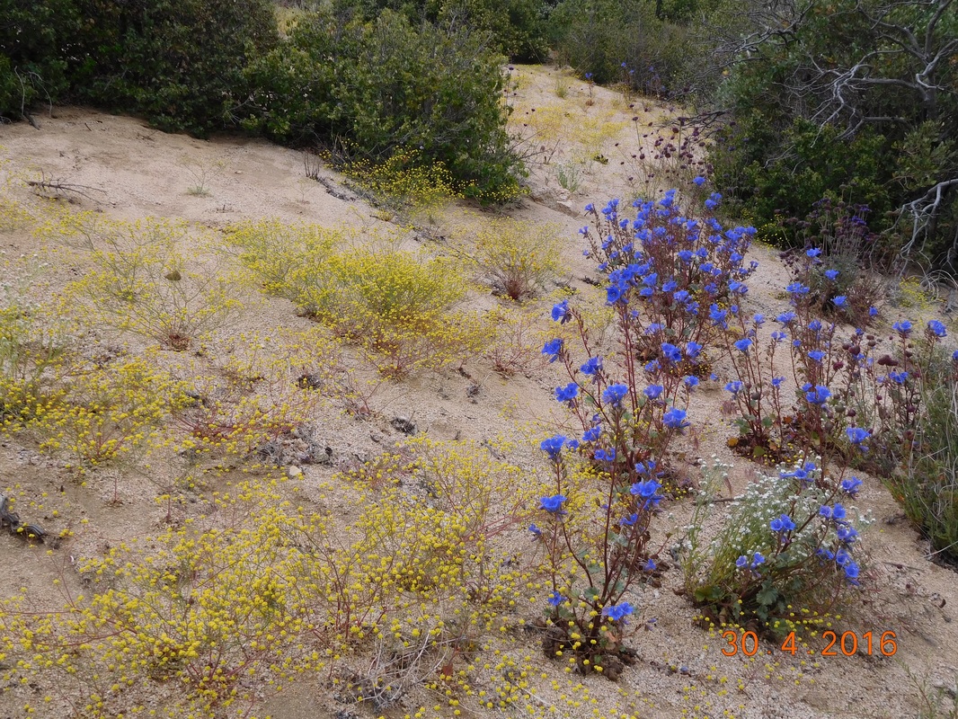
Hillside of purple and yellow flowers.
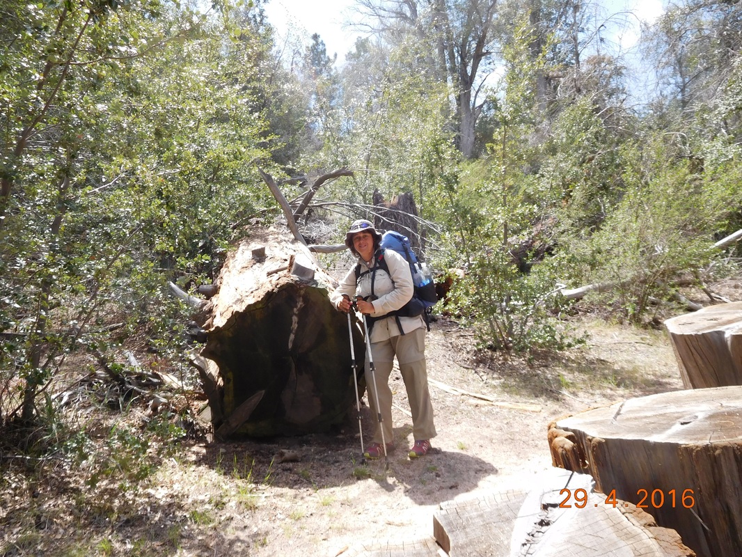
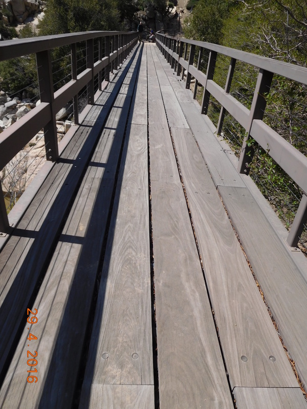
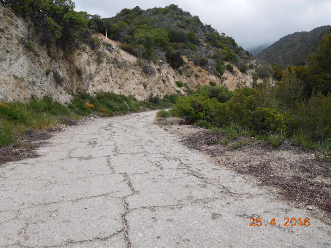
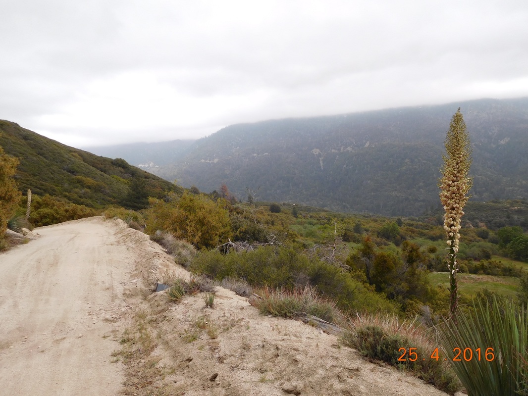
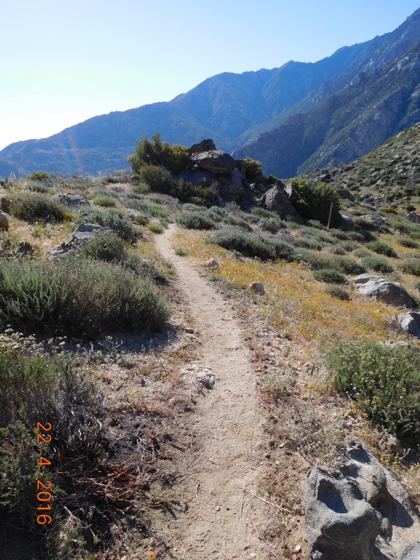
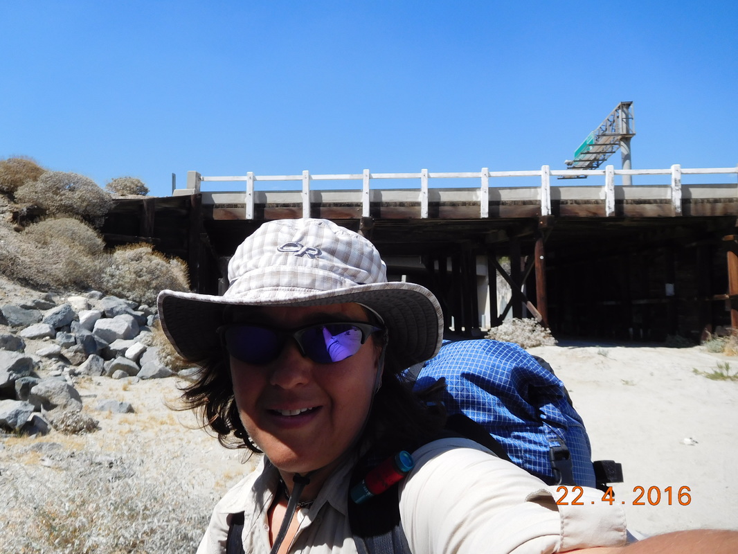
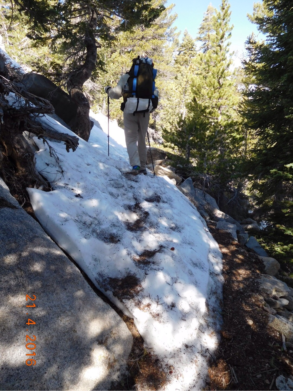
The hike today continued along Deep Creek, mostly staying high above, but occasionally coming down to the riverfront.  Here I am crossing a bridge...it is amazing how much effort went into building this trail.
Picture
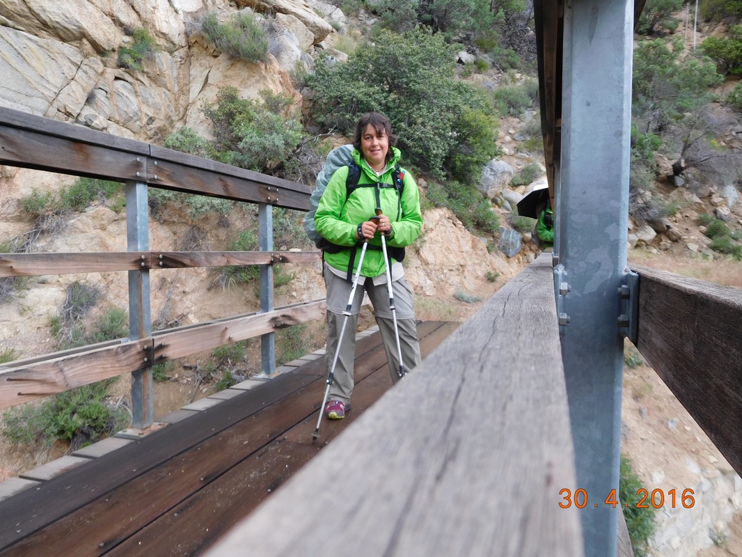
Mighty Mouse crossing a bridge
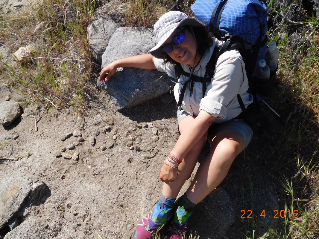
We saw Wildcard on and off all day.  We would stop and she would pass.  She would stop and we would pass.  Here she is on the other side of the trail.
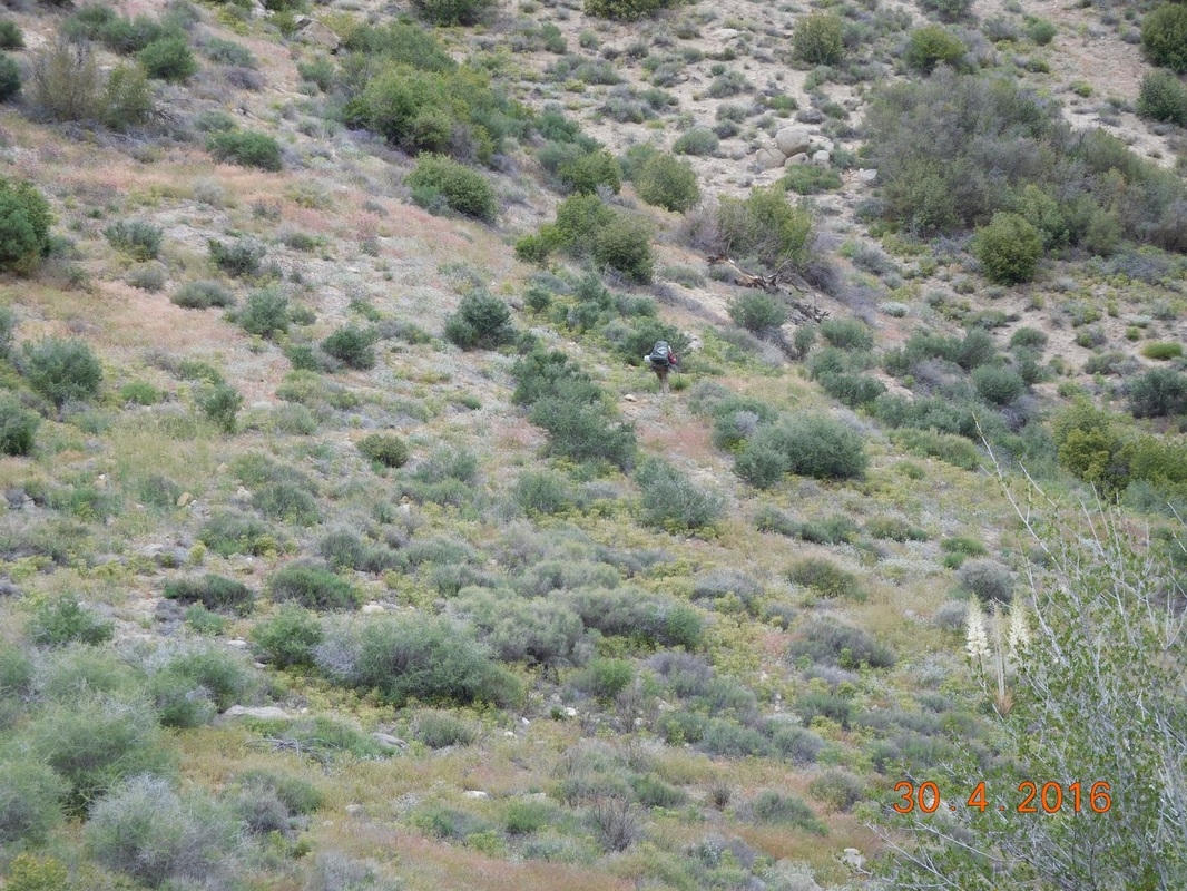
Picture
Find Wildcard.
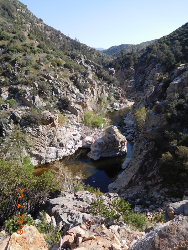
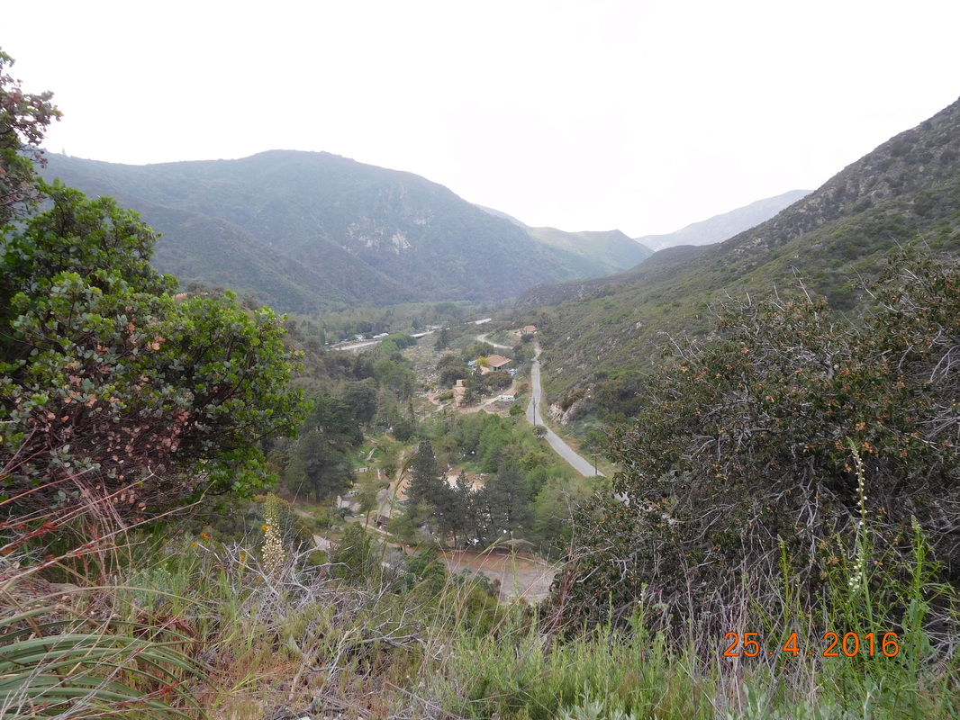
I could have taken a hundred pictures all day of Deep Creek below us, but I knew pictures can't do it justice.  Here is a try anyway.
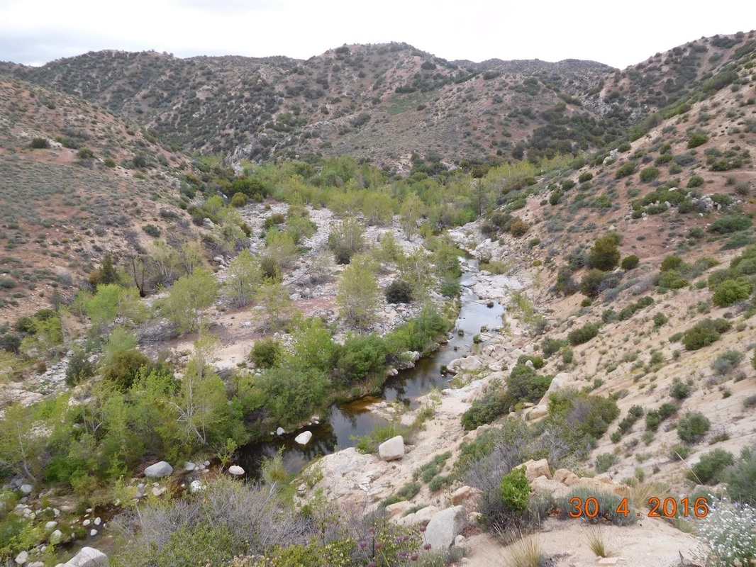
Picture
Amazing Deep Creek
It was such a treat for Ron to join us today.  Here is my view of Ron for the day.
Picture
Ron hikes.
Today we had a special treat.  At mile marker 307.95 is Deep Creek Hot Springs.  This is a hot springs in the middle of nowhere that locals make a weekly pilgrimage to, to spend the weekend.  We happen to hit it on a Saturday when the parties were in full swing.

As soon as pulling up to the hot spring, a local welcomed me to the spring and offered and handed me a beer.  How incredibly cool.  Especially since he had to carry it down here along with all his other stuff including tent, food, drinks, blankets, etc to make it through the weekend.

Of course Ron, Brad, and I jumped right into the hot spring.  Wow, did it feel great.  We stayed there for at least 2 hours until we finally had to say our goodbyes and head back out on the trail.  Wildcard was enjoying herself so much, my guess is that she is still there right now spending the night.
Picture
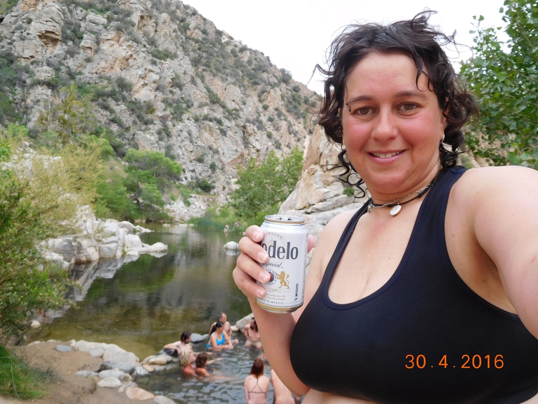
Enjoying a beer with the hot spring behind me.
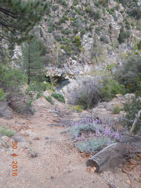
When we left we had one more view of the hot spring from the other side.
Picture
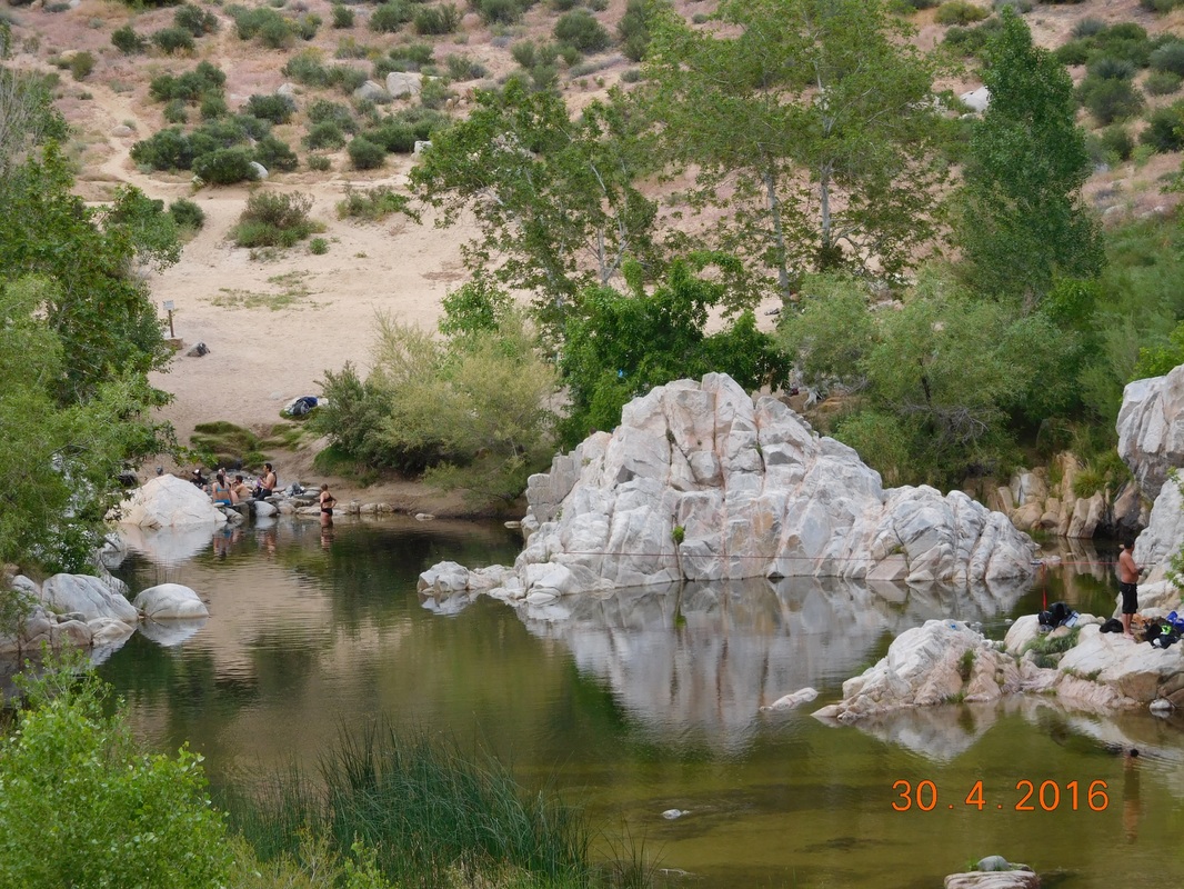
View of Deep Creek Hot Spring
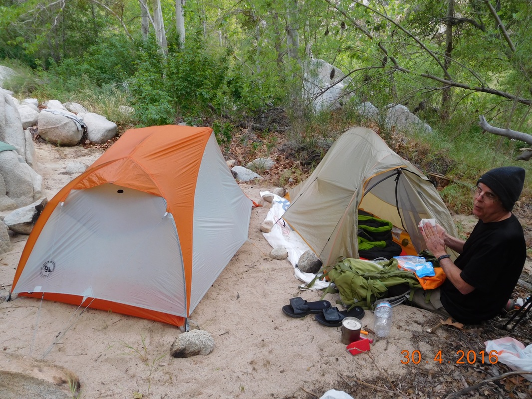
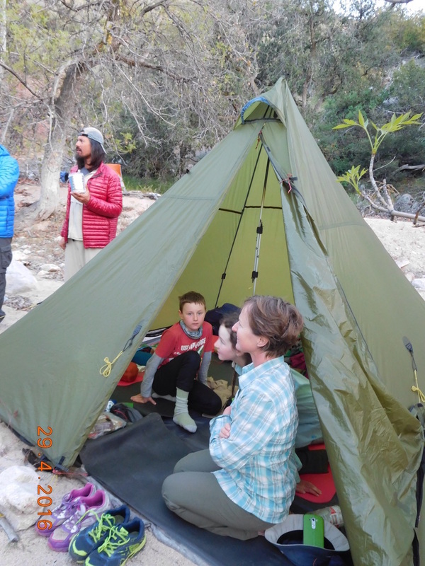
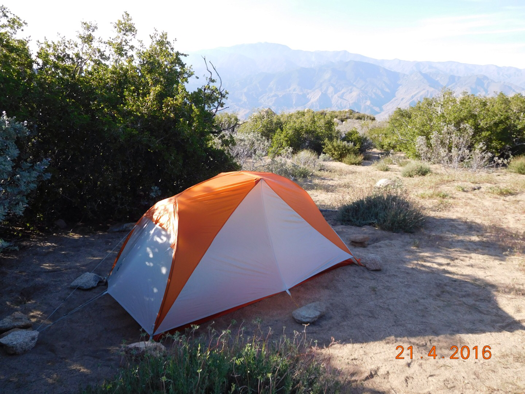
At this point we only had 2 miles to hike until our planned campsite for the night.  We took our time and arrived at camp around 5:30 PM giving us just enough time to set up our tents so that they could dry out before getting into them.  Remember...it rained this morning making us pack away wet tents.

After setting up tents, we ate dinner and were able to hang out longer than usual because it wasn't cold.  We are down to 3,233 feet tonight, more than 1,000 feet lower than last night, so it is a bit warmer.

As I am lying here getting ready to sleep, there is the sound of frogs croaking and water flowing.  The sounds of the PCT...ahhhhh.
Picture
Tight quarters tonight with Ron and I.
0 Comments

Day 28 (29 April) - Mile 289.93 - 301.19

4/29/2016

2 Comments


Campsite on Crest to Deep Creek Campsite

It was cold last night, but I feel like I slept pretty good.  The tent site was nice and flat which is always a plus.  I awoke around 7:20 AM and crawled out of my tent and sat on a nearby rock to absorb the morning sun like a lizard.  Yesterday was cold and dreary all day, so the blue skies this morning was more than welcome.

As usual, we took over 2 hours to get ready to leave and were on the trail by 9:30 AM.
Picture
Ready to start the day
Today's hike was fairly easy.  We spent much of the morning following Holcomb Creek.  We then wondered through a deserty burn area, and finished up following Deep Creek.  There weren't many ups or downs, just a nice, casual hike allowing us to enjoy the scenery.
Picture
Very cool large tree
Picture
Self-portrait "Happy on the Trail"
Picture
PCT cutting through a meadow.
Brad and I stopped to filter water for about 40 minutes and headed back on the trail when we saw someone stopped just ahead.  As we got closer we realized it was Wildcard!  How cool.  We haven't seen here since Idyllwild.

I know most of you may not care too much, but for Barbra's sake...Wildcard is doing really well.  She took 5 days off in Idyllwild to rest her two sprained ankles.  She did see a doctor there to confirm that there were no breaks and it was just a bad sprain.  Her bag has gotten heavier since you last saw her.  Her mom sent her some oil pastels so she can do some painting in her journal.

Anyway...we hiked with her for a few miles.  She is definitely walking much better than she had been.  We stopped for lunch and she went on.
Picture
Wildcard hiking away
Picture
PCT sign of the day.
Picture
Using the camera timer
Picture
Cool burned tree
This is a large bridge that crosses Deep Creek and where we met up with Brad's friend Ron.  Ron is going to hike with us the next day and a half (15 miles) with us.  I don't know if you can see on a bigger computer screen, but that is Ron talking with Wildcard at the end of the bridge.
Picture
Bridge over Deep Creek
Ron is 72-years-old and is trying to section hike the entire PCT.  He is a retired professor and is very knowledgeable on the local fauna, so it is very interesting to hike with him.
Picture
Brad watching Ron looking at fauna.
While hiking and talking away, I noticed that we had passed the 300 mile point by 0.21 miles.  We considered pretending we were there and take a picture, but Ron talked us out of it.  So, Brad and I walked back the 0.21 miles to the exact spot.
Picture
300 miles of the PCT completed!!!
Picture
Proof we are standing at mile 300.
The trail that follows Deep Creek mostly stays way above the creek allowing for amazing views down below.
Picture
Deep Creek way down below
The biggest issue with hiking way above the creek is trying to find a place to camp for the night.  Another issue is that you really aren't supposed to camp within one mile of Deep Creek.  And yet another issue is that this is a 15 mile stretch of an area you are not supposed to camp at all.

Needless to say, we don't have a choice and found a really nice area on a sandy bed down by the creek.  While setting up, one guy showed up, and then another guy, and then a family of four.  Wow...this is the most hikers we've seen together for a while.

This is Dave from Tulsa, Oklahoma.  He just graduated with a degree in exercise and fitness...or something like that...and is doing the PCT before looking for his first job.  He started the trail on 17 April...just 12 days ago.  That is a 25 mile a day average!!!  Today he hiked 28 miles to get here.  His goal is to poop as little as possible on the trail.  He holds it in until he finds a bathroom, thus the long hiking days.  Although he won't accept it, we have named him "Porcelain King."
Picture
David
Behind Ron is Peter from Ireland.  He doesn't talk much so I don't know anything about him except his name.
Picture
Ron with Peter in the background
Lastly, we are camping with a family from the UK.  Christoper and his wife, daughter Josie (12), and Jack (10).  Jack goes by the trail name Captain Obvious.  Christopher made this impressive tent himself using plans and pictures online.  They are hiking about 15 miles a day and hope to make it all the way to Canada...impressive.  Josie and Jack are keeping a blog if you are interested in checking it out:  reallylongwalk.wordpress.com.
Picture
The Grist family
And here is my boring, store-bought tent that I call home...pitched and ready for the the night.  We are down at 4,215 feet...down almost 2,000 feet from last night, so it should be a bit warmer.  It should be perfect for sleeping.
Picture
Tonight's home.
2 Comments

Day 27 (28 April) - Mile 277.73 - 289.93

4/28/2016

0 Comments


Cougar Crest Trailhead to Campsite on Crest

Waking up in a cabin is always nice.  Even when the 7:00 AM alarm wakes me from a deep sleep.  I get out of bed and look out the window.  What the ?!?  SNOW!  It was snowing.  If Brad wasn't on the trail waiting for me to meet him, i probably would have gone back into the bed and took another zero day.  But I couldn't.  At least I could take a nice hot shower before heading out today.

We left the cabin after 8:00 AM, about 20 minutes late, and arrived at the trailhead at 8:30 AM.  I told Brad that I would meet him at his campsite, which is 3 miles away and 1000 feet up, around 9:30 AM.  Hum...there is no way i was going to make it there in 1 hour.  Then a message came in from Brad asking if I was on time, because he didn't want to get out of his tent yet.  Brad was camped up on the trail where it snowed on him all night.  I told him it would be more like 10:00 than 9:30.  He was quite happy that he could stay in the sleeping bag an extra 30 minutes.

So, I said goodbye to Tim.  I won't be seeing him till Sunday afternoon, 3 days away, but he still did't want to come out of the truck for the daily picture, but I got him in it anyway.
Picture
Cold start for today's hike.
To get to the PCT I have to hike 2 miles up Cougar Crest Trail.
Picture
Trailhead sign.
As you can see, it snowed pretty good last night.  Although I can definitely do without the snow, it sure makes for beautiful scenery.
Picture
Snow on Cougar Crest Trail.
Finally, after 1 hour and 1000 feet of climbing, I made it back to the Pacific Crest Trail.  Because of the detour I had to walk, I haven't been on the trail since last Friday, 6 days ago.  I was so happy to be back.
Picture
It's nice to be back!
I was also happy to see the footprints of other hikers.  This is another thing I haven't seen in 6 days.
Picture
Thru-hiker footprints.
Ah...the beauty of the PCT with snowfall.
Picture
PCT wonderland.
Finally, at 10:15 AM, Brad and I were reunited and started our hike for the day.
Picture
Brad and Mighty Mouse back together.
Today's hike took us through wonderful pine forests and a burn area that must have been at least 5 years old by looking at the size of some of the living bushes.
Picture
I love the massive pine trees.
Picture
Burned trees with mountains.
We also came across a beautiful meadow.
Picture
PCT sign with outhouse
Picture
Brad contemplating the meadow
Picture
Lonely burned tree.
Time for a selfie.  Wow...this one seems really close.
Picture
Self-portrait "A bit close"
We made it to our campsite goal by 4:00 PM.  Could we have hiked a few more miles?  Yes.  Did we walk a few more miles?  No way.  We set up camp and just relaxed.  This cool bird stopped by for a while on a rock just yonder.  i zoomed in pretty good to capture it.  Check out the cool long feather off the back of the head.
Picture
Cool bird on rock.
Wow.  Today's blog is kind of short.  Probably because Brad and I did a lot of talking to catch up so I didn't take as many pictures as I usually do.  Also, as I lie here in my tent I am pretty chilly and just want to tuck my head and hands into the sleeping bag.

So, I will leave you as usual with y awesome campsite picture.
Picture
Home for the night.
0 Comments

Day 26 (27 April) - Mile 277.73

4/27/2016

2 Comments


Big Bear Lake, CA

A zero day in Big Bear Lake.  My first zero day since 19 April at Mile 179.39.  After all the road walking I had to do the past week, my feet really need the break.

We stayed in bed until 11:00 AM and got up mostly because I was hungry but also because I had many things to do.
  • This is how the day went:
  • We went to Japanese for lunch.
  • I did and completed laundry.
  • I shopped for some groceries.
  • I returned to the cabin.
  • I prepared meals for the next 6 days.
  • I repacked my bag.
  • We ate dinner in the cabin (frozen pizza & salad).
  • Watched TV & movies in front of the fire.

Tomorrow I head back on the trail.  I am supposed to meet Brad who is right now up on the PCT right where Cougar Crest Trail intercepts it.  I told him I would be there around 9:30 AM so I have to be at the trailhead by 8:15 AM to hike the 3 miles to him.  Until then I will not leave this bed.
2 Comments

Day 25 (26 April) - Lake Fire Detour Mile 50 - 65

4/27/2016

1 Comment


Campsite on Clarks Grade to Cougar Crest Trailhead

It was a cold and windy night.  The wind seemed to pick up around 11:00 PM and continued through the night.  I kept huddled in the tent and slept on and off all night waiting for morning.  Finally I opened my eyes and there was sun coming into the tent.  I looked out the rain flap and it seemed that most of the snow has melted.  I finally left the tent at around 7:15 AM after being in it for 14 hours.

Here is the promised picture of my campsite from last night:
Picture
Wow...an awesome spot if it wasn't for the snow and wind and cold.
I took my time to break camp.  I figured there was more snow at the higher altitude and I was waiting for it to melt some.  I finally started hiking just before 9:00 AM. 
Picture
Start of the last day of detour.
Somehow I managed to hike 13 miles yesterday, leaving 14 miles for today.  The 14 miles shouldn't be too bad since once I get to the top of Clarks Grade, it should be downhill from there.  So, I have only 5 miles left of up and the road I hiking up looks beautiful today:
Picture
Beautiful Clarks Grade
Yesterday climbing felt pretty good.  Today it is kicking my butt.  So, I took a lot of breaks and many pictures.
Picture
Self-portrait "One of many rest stops"
Picture
Clarks Grade
Picture
View from Clarks Grade
Picture
Majestic views.
Picture
Snow covered trail.
Finally, after 2.5 hours of hiking, I made it to the top of Clarks Grade at an altitude of 7,816 feet.  No wonder the hike was kicking my butt.  This is high....almost 1.5 miles high.  OK...I feel better now about my performance.
Picture
The top of Clarks Grade.
Next turn is onto Skyline Road.
Picture
Finally off Clarks Grade.
I figured it was all going to be down from here, but I was wrong.  Skyline Road is a meandering up and down road that fluctuates between 7,500 and 8,000 feet.
Picture
Skyline Road.
A little ways up Skyline Road I finally got my first glimpse of Big Bear Lake.
Picture
Almost there!
But first, a bite to eat.  How about tuna salad on a bagel...yum.
Picture
Taking a lunch break on Skyline Road.
After 4 miles, Google map told me to make a left turn onto an unnamed forest road.  I crossed a gate stating that vehicles are prohibited and hikers are allowed, but must stay on the trail.  I took the trail about 100 yards and then glimpsed this:
Picture
What the?!?
I wound up close to the summit of Snow Summit Mountain Resort which is 8,200 feet.  I guess the only thing left now is to hike down to Big Bear below.
Picture
Looking down at Big Bear Lake from Snow Summit.
It wasn't an easy hike down the approximate 1 mile I had to hike.  Give me a set of skis and I would have tore this mountain apart, but on foot, it is pretty difficult to walk down the slopes.  Especially since the snow recently melted and there was plenty of mud.  But, I made it and at 2:45 PM I was finally in Big Bear Lake.
Picture
The bottom of the mountain and into Big Bear.
Now, all I had left is the 3.8 mile walk through the streets of Big Bear Lake to the Cougar Crest Trailhead.  This trail will lead me back onto the Pacific Crest Trail.  To get there I walked by Big Bear Lake:
Picture
Big Bear Lake.
And then finally, just after 4:00 PM I made it to Cougar Crest Trailhead.  Tomorrow I take a zero day in Big Bear Lake and then start right back here on Thursday morning to finally get back on the PCT.
Picture
I will see you back here on Thursday.
But first, a visit to Big Bear Lake Brewery.  Two years ago when we attempted this hike we were in Big Bear Lake walking around and just happened upon the grand opening of this brewery.  Today we sit here an drink the Second Anniversary Double IPA...YUMMY!
Picture
I earned this beer!
Tim got to Big Bear Lake a night before me and found an awesome deal on this cabin.  This will be a great place to relax.
Picture
Embers Lodge and Cabins.
What better way to end a 60 mile detour than a nice, hot fire.
Picture
Ahhhhhhhh
1 Comment

Day 24 (25 April) - Lake Fire Detour Mile 35 - 50

4/27/2016

0 Comments


Lock Leven Camp to Campsite on Clarks Grade

Wow...it poured last night but we were able to get some sleep.  I awoke at 7:30 AM and needed to charge my phone since it was cloudy and my solar panel will do no good today.  Luckily we had access to the building so I went up there to plug it in. My phone is very important to help me navigate the next 2 days.  I know that it is not good to rely on electronics, so I hand drew a map and hoped that I wouldn't have to use it. 

It took 2 hours to fully charge the phone and then I was ready to hit the road...dirt road that is.  Tim is a bit worried because I don't have good maps of the area and also because chances are I won't see many people out there.  Don't worry Tim...all will be fine.
Picture
The start of a 2 day adventure.
Of course, how all good days start, I walked up and up and up from Lock Leven Camp. Unfortunately, what I thought was going to be a dirt road wound up being a really old, unmaintained paved road, although there were many parts that were dirt.
Picture
A "paved" road.
As I climbed I got s good view of the camp we stayed at last night. If you look real close you can see our motorcycle trailer parked down there.
Picture
A long way down.
As I kept going up I found this great place to rest...I mean, take a selfie.
Picture
Self-portrait "Rest stop"
After 7 miles of climbing I arrived at Angeles Oaks. I had climbed from 4,518 feet in Mountain Center Village to 5,800 feet. I still have a bunch of feet to go.
Picture
I made it to Angeles Oaks.
There was a restaurant here that I had refill my water bottle. I didn't want to eat food here because I wanted to eat the food I'm carrying on my back to lighten the load as I go. But oh, how I wanted to eat here.
Picture
Can't eat here...boohoo.
But look at the view from up here. Wow. The mountains are just so cool.
Picture
Great view.
I walked less than 1/2 mile on the highway abs then turned down Mill Creek Road. This is where I got a big sad, because the road continued down for 3.8 miles. All that climbing to get to 5,800 feet and now I went down to under 4,802 feet.
Picture
Nice dirt road, but never stopped declining.
I finally arrived at the bottom of the road and spotted my next turn. Forest Road 1N54 also know as a Clarks Grade. This road goes for 6.6 miles and climbs from 4,802 feet to 7,816 feet. That's over a 3,000 foot climb, but I am ready.
Picture
Hello Clarks Grade.
This road is amazing. The views, the scenery...just breathtaking.
Picture
Wow.
Picture
Beautiful
Just when I thought I was doing well, the steepness of the climb increased.
Picture
More difficult. Oh no.
Actually, I was doing well. It was a bit chilly and overcast, so I wasn't overheating with this long climb. As a matter of fact, I passed a couple of forest rangers at the bottom and they said that the current temperature was 41 degrees, but it didn't feel that cold to me thanks to the 30 pound pack I was carrying on my back.

I set set a goal to hike until 5:00 PM and then set up camp. The more miles I put in today, the less are left tomorrow for my arrival into Big Bear Lake.

It got to about 4:45 PM and it started flurrying. I thought that even though it want 5 yet, I probably should start looking for a campsite. Let me tell you, campsites are hard to come by on the side of a steep dirt road.

I saw a spot but thought that maybe around the next corner there will be a better spot, so onward I walked.  All of a sudden the snow started picking up.  Luckily around the corner was another spot, so I immediately began to pitch the tent.  Somehow I figured out a way to get it up and keep the inside of the tent fairly dry.  Me on the other hand was pretty wet.  I gathered all my stuff, got it in the alcove of the tent, and then I jumped in.

I through on my night clothes and got into the sleeping bag as soon as I could.  I was hungry but decided to skip dinner since I didn't want to drink any water because that may make me have to leave to tent to...well...you know.

As I hunkered down in the tent, the snow was very heavy and the wind picked up as well.  This is a picture i took about 30 minutes after getting in the tent.
Picture
That's a lot of snow.
Between wind gust, I opened the rain flap and got this picture:
Picture
Stuck in a small blizzard.
Then, at 6:45 there was finally calm.  Here is the final aftermath, probably just two inches or so, but it remained calm.
Picture
The calm after the storm.
Needless to say, I didn't get a picture of my campsite tonight.  I will take a picture in the morning and post in tomorrow's blog entry.  Until then, wish me luck getting through this cold, windy night.
0 Comments

Day 23 (24 April) - Lake Fire Detour Mile 20 - 35

4/25/2016

0 Comments


Cherry Valley, CA to Lock Leven Camp

I awake again to another dreaded road walking day.  I know...I did this to myself so I shouldn't complain.  The good news is that by the end of today I will be back in the mountains and walking on dirt roads and trails instead of hiking the yellow dashes of the streets.

Tim dropped me off at 10:00 AM at the same spot he picked me up yesterday.  As you can see, I am more than thrilled to the walk I have in front of me today.
Picture
Let's get this day over with.
Today's walk started climbing up for the first three hours that remarkably only took me 1 hour to complete.  I must be getting stronger...cool.  During this climb, I looked back and spotted San Jacinto for the last time.  I can't believe I was close to the top of that mountain just a few days ago.  I am really making progress.
Picture
One last view of San Jacinto
I then turned left and walked more than 4 miles down into a canyon to the town of Yucaipa.  I can't believe I spent a hard hour climbing only to loose it all.  Finally, around 3:00 PM and almost 12 miles I arrived at my one goal of the day, the Mill Creek Forest Ranger Station.  I met my goal of getting here before they closed at 3:30 PM.  More than a time goal, it is also where I finally enter back into the mountains.  And to make things even better, Tim met me here as well. This is my happy face:
Picture
Happy to be back into the mountains.
Now all I have to do is climb up Highway 38 for 4 miles to end the road walking and begin walking on dirt roads into Big Bear Lake.  Although the 4 miles were a grueling climb, the scenery made it enjoyable.
Picture
Great mountain views.
Finally, after 1 1/4 hours I made it up to Mountain Home Village that marks the end of my road walking and where I start walking on dirt roads.
Picture
Mountain Home Village...I have been looking forward to you for 2 days.
Just up the road was a mileage sign that stated that Big Bear Lake is 42 miles away.  Not the way I'm getting there.  My route is a much shorter 25 miles. It is shorter if you go up and over a mountain than to drive around it.
Picture
42 miles...NOT!
Then, just around the bend was Tim waiting for me.  He arrived at Lock Leven camp just before me and arranged for us to sleep on the premises.  Although we would sleep in a tent, they said we had access to the indoor bathroom and a hot chocolate machine...cool!
Picture
Tim meeting me at Loch Leven camp.
We pitched the tent on a nice, flat grassy area and called it a night.  Tomorrow is when my real adventure begins.  Two days of being on my figuring out forest roads for the last 25 miles of this detour.
Picture
Great place for a tent.
0 Comments

Day 22 (23 April) - Lake Fire Detour Mile 0-20

4/23/2016

0 Comments


PCT Mile 208.49 to Cherry Valley, CA

We stayed in a hotel last night in Banning which is always nice.  However, I had a hard time sleeping because I was thinking about this crappy road walk that is in front of me for the next 2 days.  There was a fire last year that closed 15 miles of the PCT.  The problem is that there isn't any good detour around it.  Officially, thru-hikers are supposed to get a ride from the I-10 / PCT intersection up to Big Bear and avoid the closed section.  Me being stubborn me wants to keep a continuous footpath from Mexico to Canada so I have to walk.  The walk we came up with is a 60 mile detour with about 45 of it being roads and the rest being truck/jeep trails.

Tim dropped me off at the intersection of I-10 and the PCT.  This first part of the detour will not be fun.  I will be walking the I-10 service road that goes between the interstate and a wind farm.  I can tell you first hand that this is a perfect place for a wind farm as I walked head on into very, very strong and gusty winds.
Picture
The start of the detour on the I-10 service road.
Picture
Walking by a wind farm.
In case the actual wind wasn't bad enough, the trucks and cars going by on the interstate created their own gusts.
Picture
Walking along an interstate is breezy.
Just when I thought that I must be crazy, I noticed some footprints in the dirt.  Could this print be that of another thru-hiker crazy enough to walk this detour.  I liked the thought and embraced it all day.
Picture
Footprint of another thru-hiker?!?
After 1.5 hours of walking the service road, I finally arrived to my first waypoint, the city of Cabazon.
Picture
Thank you for the welcome Cabazon!
Just 20 minutes later I arrived at my next waypoint.  This one was a big one, the Morongo Casino.  It was big because I could see it in the distance right when I started walking today.  I knew that it was 6.5 miles away and i watched it grow slowly.
Picture
The Morongo Casino, 6.5 miles into my walk.
After 1 more hour the service road I was walking ended.  Across the street was a small, close road that I continued on.  It was like "Life After People."  An old abandoned road with grass growing in the middle and trees and shrubs overtaking the side.  I kind of liked it because I could walk right down the middle and not worry about cars.
Picture
Abandoned road.
Next came the adventure of exiting the abandoned road and getting to the other side of I-10.  I won't go into detail, but it involved walking along an entrance ramp and into a tunnel and climbing up an embankment...not fun.  But now I am away from the interstate and walking through city streets.  First city is Banning:
Picture
Thanks Banning for the welcome.
Not long after entering Banning, an SUV pulled up to me and asked if I was a PCT hiker.  "Yes" I said.  They then said that they saw me around I-10 and figured I was a PCT hiker and followed me here to offer me a ride to the bus depot where most PCT hikers were headed to get a ride to Big Bear.  I then explained to them that I was walking the detour and they looked at me like I was crazy and told me good luck.  It was way cool that they went out of the way to hep me.  I continued through Banning and then, at 12:39 PM arrived back to the hotel we stayed in last night after over 4 hours of walking...I did say I was crazy...right?!?
Picture
Hello again Quality Inn.
After walking the entire length of Cabazon and now Banning, I arrived in Beaumont at 1:30 PM.  This is the last city I have to walk through today...so let's go.
Picture
Thanks for the welcome Beaumont.
Finally, after walking west all day, I made a right turn to head north toward the mountains I have to get through.
Picture
The mountains look so far away,
After just 3.5 miles walking north, I hit the end of the Beaumont city limits and entered Cherry Valley which just happens to be the end of my 20 mile walk today.  Yes...20 MILES!!!  I am beat.
Picture
Goodbye Beaumont
Tomorrow I pick up right here where the mountains seem a bit closer.
Picture
The mountains look closer.
Tim arrived just as I was done.  We drove to Redlands to stay at another hotel.  When we arrived i notice a pool, so I jumped in.  It was freezing, but the cold made my legs and and feet feel better, so I dealt with it.  Afterwards a shower and dinner at The Old Spaghetti Warehouse and then to bed.  Tomorrow I have another "wonderful" road walk to enjoy.
0 Comments

Day 21 (22 April) - Mile 197.18 - 210.80

4/22/2016

1 Comment


Campsite on Fuller Ridge to Ziggy and the Bear

Last night was almost a perfect night.  It was warm enough that I didn't have to wear my hat to sleep for the first time on the trail.  The not so perfect part is that the site I pitched the tent on wasn't the flattest spot.  I woke multiple times in the night with my back hurting, but was able to get back to sleep.  I finally awoke around 7:00 AM and got up.

We were anxious to start hiking since we had almost 14 miles to hike.  We were somehow able to break camp and start hiking just after 8:00 AM...just over one hour from when we awoke.
Picture
Getting an early start today.
From leaving camp we had 8.56 miles to get to the water fountain at the bottom of Fuller Ridge.  We each had only 2 liters of water, so it was pretty important to get down there as soon as possible.  In these 8.56 miles we have to descend 3,519 feet...not an easy task.  But luckily, we had some nice landscape to enjoy.
Picture
The beautiful trail
Picture
A great view down the canyon
1 1/2 hours from leaving this morning we hit a milestone...the 200 mile point on the trail.  WOOHOO!!!
Picture
Picture
Proof of me standing at mile 200.
It was weird.  Just over 1/2 mile from the 200 mile point, there was a sign pointing out 200 miles.  Since the sign was placed the PCT must have been lengthened.  If you look closely you will see a lizardy creature hanging out on top of the sign.
Picture
PCT sign with lizard on top.
At just about 10:00 AM we reached the dreaded campsite that Tim and I shared 2 years ago on our PCT quest.  That night was the worst night we spent on the trail during a serious windstorm that kept us up all night.  BLAH.
Picture
The site of a nightmare 2 years ago.
We continued down and down and down.  The hike was dragging on, especially since we could see our destination just below us all day...and all of yesterday.  I did however manage to get a nice picture of myself:
Picture
Self-portrait "Done with the down already"
We had 2 miles to go and it was 11:30 AM.  We were both short on water and hungry because we didn't have enough water to drink with lunch, so we had to wait.  We sped up the hike and then finally, the fountain came into view.
Picture
Finally, a view of the fountain.
We made it down to that fountain, 2 miles, in 45 minutes...yes we were motivated!
Picture
FINALLY!!
We filled up on water and was about to eat lunch when we noticed a note taped to the fountain that said "Coppertone is  just 1 mile down the road with shade and ..."  We knew that we had to make it there to eat since the little shade the rock gave us was really not enough.  So off we went, down the road that at this point is the PCT.
Picture
Feeling better now that I have water.
Sure enough, after 1 mile we came across a truck-like, camper-like vehicle and Coppertone.  As promised he had shade, but he also had cookies, doughnuts, cupcakes, and fruit...we just missed the ice cream.

Coppertone (seen below in the red baseball hat and no shirt) thru-hiked the PCT back in 2007.  During the hiking season he drives his vehicle to various spots on the trail to give back the the trail that he loves.  He was at this location just yesterday and today, so we timed it just perfectly.
Picture
Coppertone providing magic to PCT hikers.
After eating our lunch and being forced to eat a doughnut we had to go.  Although we made it to the fountain, we still had 4 miles of desert hiking to make it to our finally destination of the day were Tim and Brad's girlfriend is going to meet us.

So, off we went onto the desert floor, walking through beach-like sand.
Picture
PCT cutting across the desert floor.
This part of the trail is easy to loose since it is a sandy trail through the sandy desert.  Because of this, the trail is marked by tall poles with yellow tops.  When you get to one, you look into the distance to find the next one to aim for.
Picture
Desert pole marking of PCT.
We finally made it to another landmark I-10.  Now we just have 1.5 miles to the final destination.
Picture
Crossing under I-10.
After walking under I-10 I turned around and looked at awe at how far we have come since yesterday.  Just yesterday we stood pretty close to the top of that snow-covered peak on San Jacinto.
Picture
We were way up there yesterday.
Finally, Tim appeared to lead us to the trail magic of Ziggy and the Bear:
Picture
Hi Tim.
Then, at 3:20 PM, after almost 14 miles and 7 hours of hiking we made it to the Whitewater Trail House run by Ziggy and the Bear.  They are an elderly couple that have been providing trail magic since 1994.  They purchased this house 4 years ago because of its proximity to the PCT so they can help out hikers.  When I signed in I was guest number 285.  That's a lot of hikers in just the 3 weeks of hiker season.
Picture
A very warm welcome.
Now comes the hard part of the trail.  This is where the trail closes just north of here.  The official detour is to drive to Big Bear 60 miles away.  But me being me has to walk.  So right now I am in a hotel in Banning, CA with Tim ready to start my 60 mile road walk tomorrow.  Many parts of this road walk will be along dirt roads, but first I have to get though a 20 mile hike along an I-10 service road.

Tomorrow I will let you know how it goes.
1 Comment

Day 20 (21 April) - Mile 186.61 - 197.18

4/22/2016

1 Comment


San Jacinto State Park Wilderness to Campsite on Fuller Ridge

It was a breeze and chilly night, but not as cold as I expected. The biggest issue was that I didn't pitch the tent in a flat spot. I seem to have a problem seeing if the ground is level. I guess I will never be a good at putting in golf.

I actually slept in till 7:30 AM. I guess my body needed more rest after all the climbing yesterday, plus we didn't get into the tents until 9:00 PM last night because we were talking with Linda; plus, I stayed up another hour to blog. When I popped out of the tent Linda and the German couple was gone and Brad was just getting up as well, so no foul.

We were able to get on the trail by 9:10 AM, proving I can get ready in under 2 hours.
Picture
Ready to hike.
As soon as we hit the trail, we started running into snow. Yesterday there was snow on the trail, but we were going up so it didn't seem as bad. Today we are going down making the snow traversing more difficult because it felt like I would slip down the trail. I am so happy i hike with poles. They really help with the snow. I don't know how some people hike this trail without them.

Here are some pictures of the harder snow crossings:
Picture
Brad negotiating the snow.
Picture
A slippery downhill.
Regardless of the slippery snow, the trail did not disappoint. For all of the morning we had views of mountains beyond the pine forest we were hiking through.
Picture
Beautiful mountain view.
Picture
Awesome.
Picture
Wow.
Picture
Self-portrait "Taking a break on a rock"
Picture
Incredible view of San Jacinto.
Picture
Cool tree beside the PCT.
Picture
Pine cones on the PCT.
By lunch we made it to the start of the Fuller Ridge trailhead. At this point we hiked down from 8,678 feet to 7,746 in under 4 miles. Now. The down really begins. As the crow flies, it's 4.3 miles from the Fuller Ridge Trailhead north to the bottom of the ridge at mile 206. Hiking on the PCT it takes 15.2 miles while descending 6,040 feet. Four miles beyond that is I-10, our goal for tomorrow where Tim and Brad's girlfriend will be meeting. All that stands between us and them is a 7,041 foot drop in 19 miles.
Picture
I-10, our goal, is down the trail.
Picture
Pointing way down to I-10.
At mile 193 we came across a lookout at 6,847 feet. What a view.
Picture
PCT sign of the day.
Picture
Self-portrait "At the overlook"
Throughout the day our view of San Jacinto got further and further away.
Picture
San Jacinto Peak.
Even though we were going down all afternoon, it didn't seem too bad on the feet and joints. It was probably the views and beauty of the trail that made the constant down bearable.
Picture
The beautiful PCT.
We made it to camp by 5:00 PM. We were glad when we got here that there wasn't anyone here since the next noted campsite was another 4 miles ahead. We made up camp and cooked and ate dinner. We were done by 7:00 PM and decided to hit the tents early since the temperature began to drop once the sun went behind the mountain. The good news is that we are camping at 4,908 feet, so the temperature should be warmer tonight.

While in the tent blogging I heard a group of 4 guys pulling into the area to camp for the night. They somehow found sites for 4 tents, probably not very flat ones, because they didn't have 4 more miles in them. It does pay to stop hiking earlier because then we have a choice of tent sites.

Check out my tent site for the night. Perfectly guarded from wind from the bushes, but still a spectacular view of San Gorgonio Peak to the north of I-10.

To make things a little better, there is now an owl hooting nearby...I love this trail.
Picture
1 Comment
<<Previous

    Archives

    October 2016
    September 2016
    August 2016
    July 2016
    June 2016
    May 2016
    April 2016

    RSS Feed

Powered by Create your own unique website with customizable templates.