Tim & Gerri's Wild Ride
Email & Facebook Gerri:
  • Home
  • Worldwide Travel
    • Everest 2025 >
      • 2025 Everest Packing List
      • Everest Blog Summary
    • 2024 Europe Tour >
      • 2024 Europe Tour Packing List
      • Europe 2024 Blog Summary
    • Asia 2023 >
      • Asia 2022 Packing List
      • Asia 2023 Blog Summary
    • Eastern Europe 2022 >
      • Eastern Europe 2022 Blog Summary
      • Eastern Europe 2022 Packing List
    • Narrowboat Holiday 2022 >
      • Narrowboat 2022 Blog
      • Narrowboat 2022 Packing List
    • Ireland & UK 2019 >
      • Ireland & UK Itineray
      • Ireland & UK Blog Summary
      • Ireland & UK Packing List
    • France 2018 >
      • France Itinerary
      • Blog Summary
    • European Tour 2017 >
      • European Vacation Blog
      • Blog Summary
    • Southeast Asia 2014-15 >
      • Southeast Asia Blog
      • Packing List
      • Blog Summary
    • Afghanistan 2011-12
  • United States Travel
    • Great Lakes Sail 2020 >
      • Great Lakes Sail 2020 Blog
      • Blog Summary
    • Trans-America Bicycle Ride >
      • Blog Summary
      • Our Team
      • Equipment
      • Breweries Along Route
    • Pacific Crest Trail >
      • Pacific Crest Trail 2016 >
        • What is the PCT? - 2016
        • Why Hike the PCT? - 2016
        • Gear - 2016
        • Itinerary - 2016
        • PCT Blog Summary - 2016
        • Where are we now? - 2016
      • Pacific Crest Trail 2014 >
        • What is the PCT?
        • Why Hike the PCT?
        • Gear
        • Food
        • Itinerary
        • Blog Summary
        • Where are we now?
    • Motorcycle Ride 2014 >
      • Motorcycle Blog
  • Brewery Visits
    • 2025 Breweries
    • 2024 Breweries
    • 2023 Breweries
    • 2022 Breweries
    • 2021 Breweries
    • 2020 Breweries
    • 2019 Breweries
    • 2018 Breweries
    • 2017 Breweries
    • 2016 Breweries
    • 2015 Breweries
    • 2014 Breweries
    • 2013 Breweries
    • 2012 Breweries
    • 2011 Breweries
    • 2010 Breweries
    • 2009 Breweries
    • 2008 Breweries
    • 2007 Breweries
    • 2006 Breweries
    • 2005 Breweries
    • 2004 Breweries
    • 2003 Breweries
    • 2002 Breweries

Day 6 (7 April) - Mile 47.21 - 59.47

4/7/2014

4 Comments


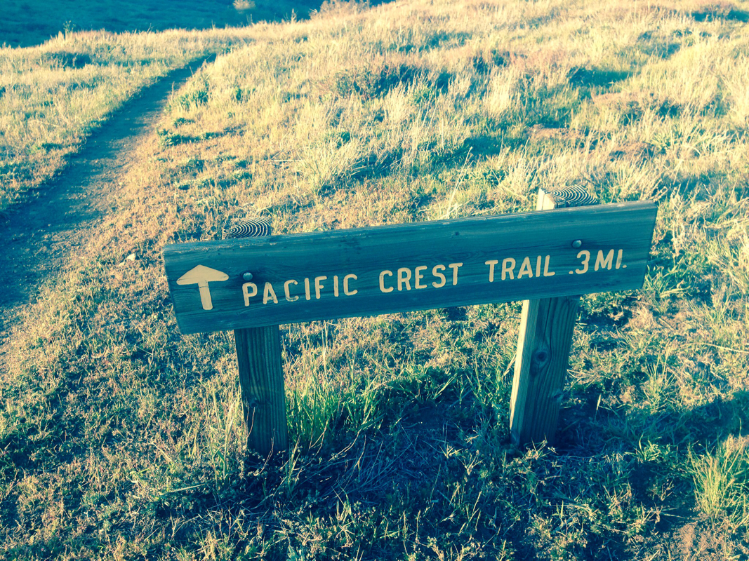
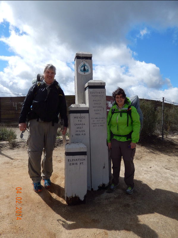
Mt Laguna Campground to Sunrise Trailhead, CA


Today we woke up at 6:45, which should be early enough, but it took us 2.5 hours until we were ready to leave. What the heck is our problem. Maybe the issue is we woke to a campsite with a picnic bench and a bathroom so we weren't in a hurry to leave, especially knowing that the next time we get to stay at an established campground will be at mile 100.

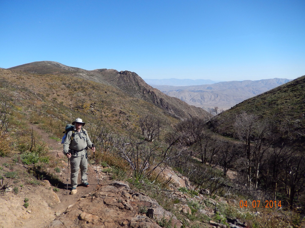
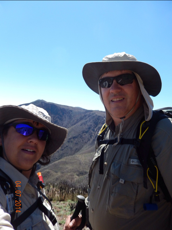
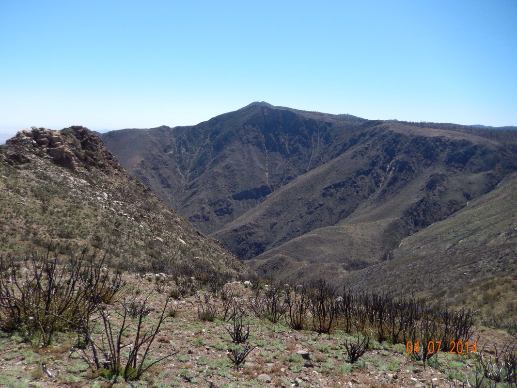
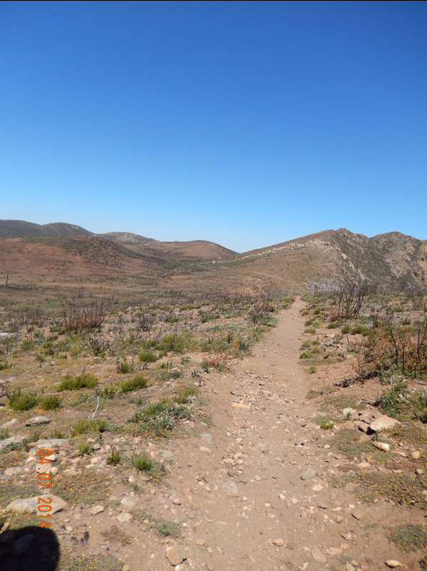
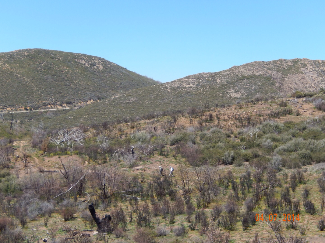
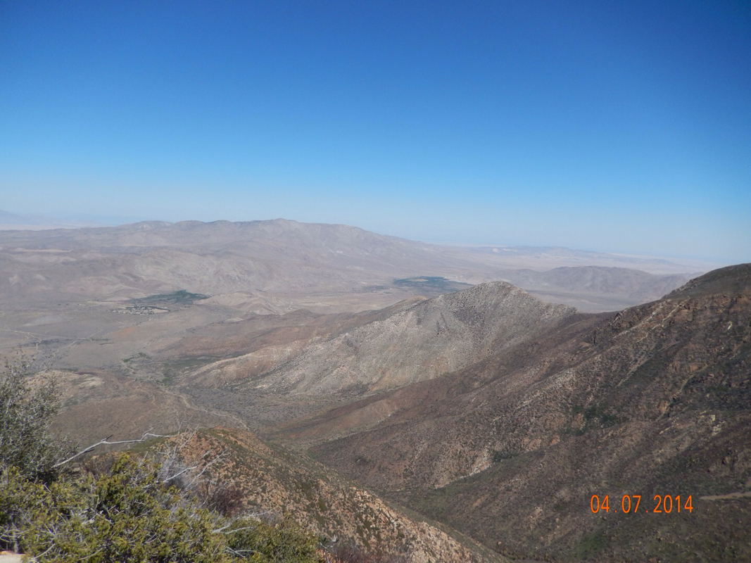
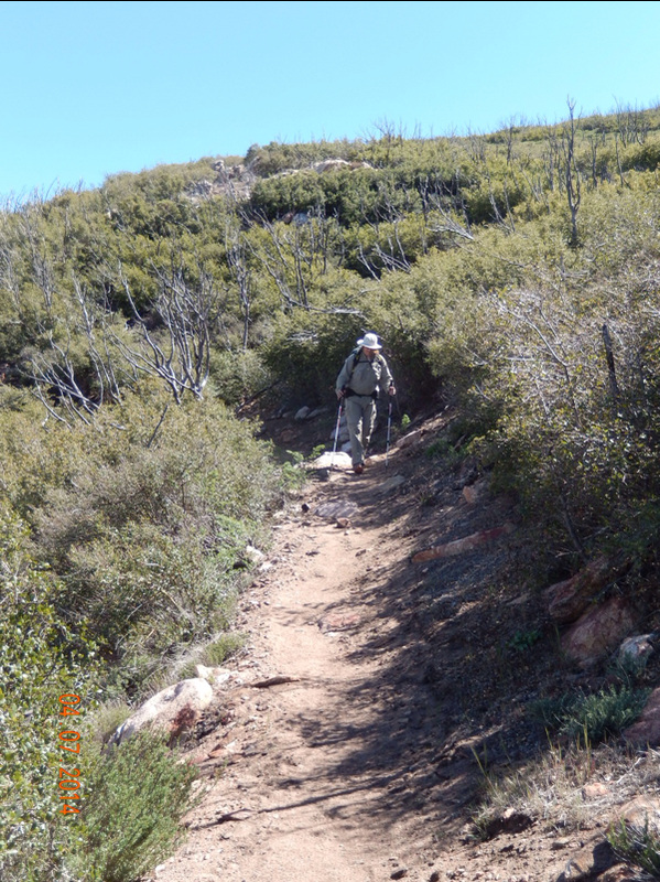
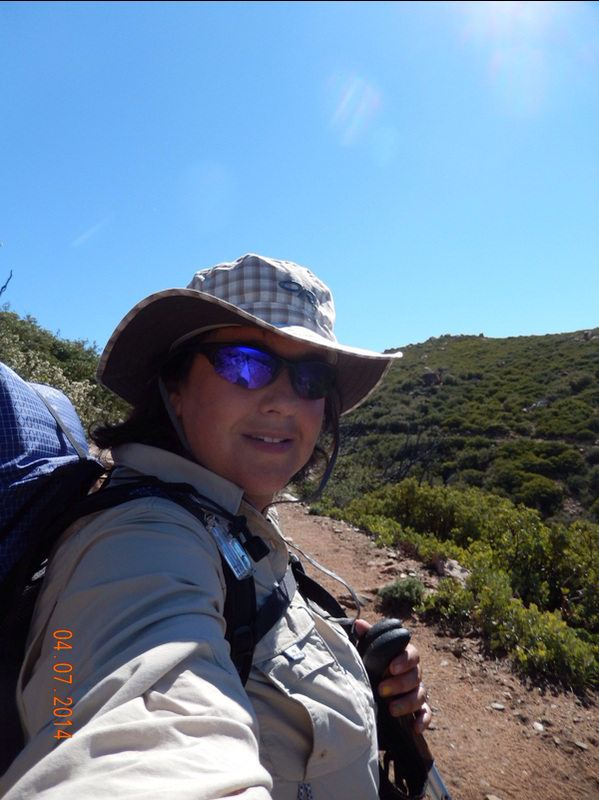
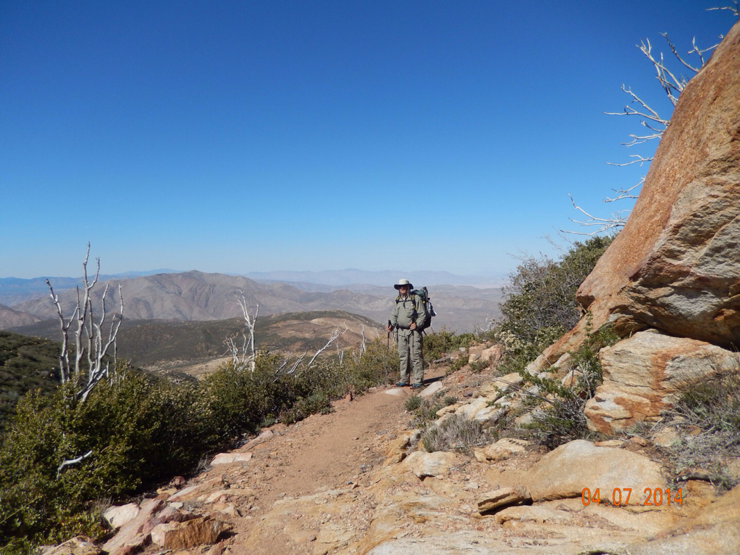
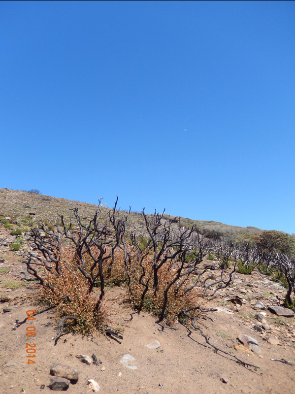
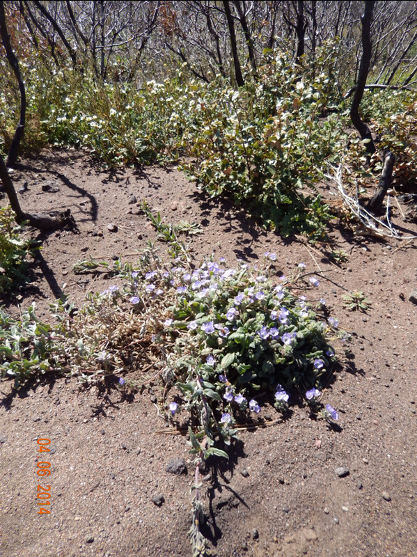
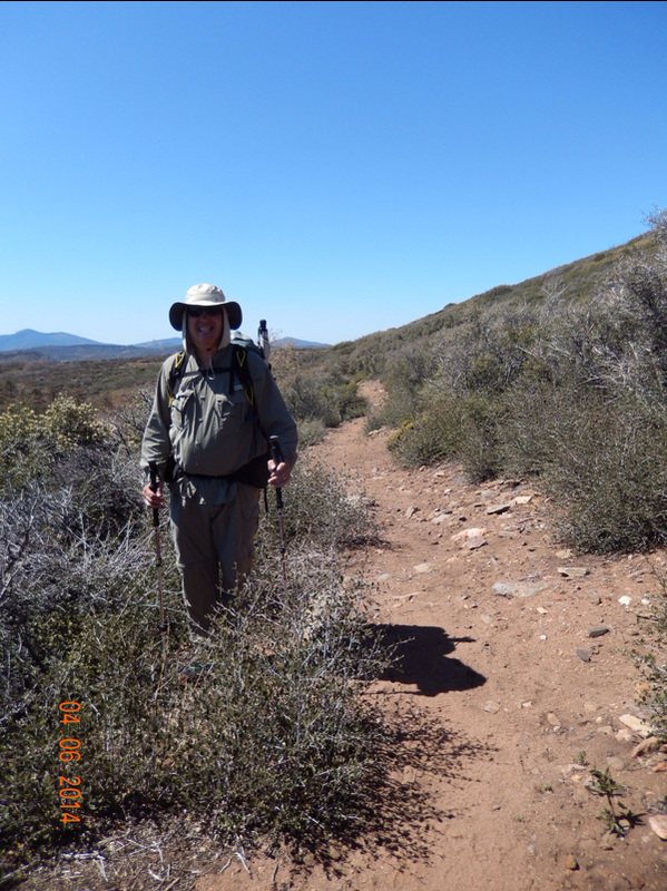
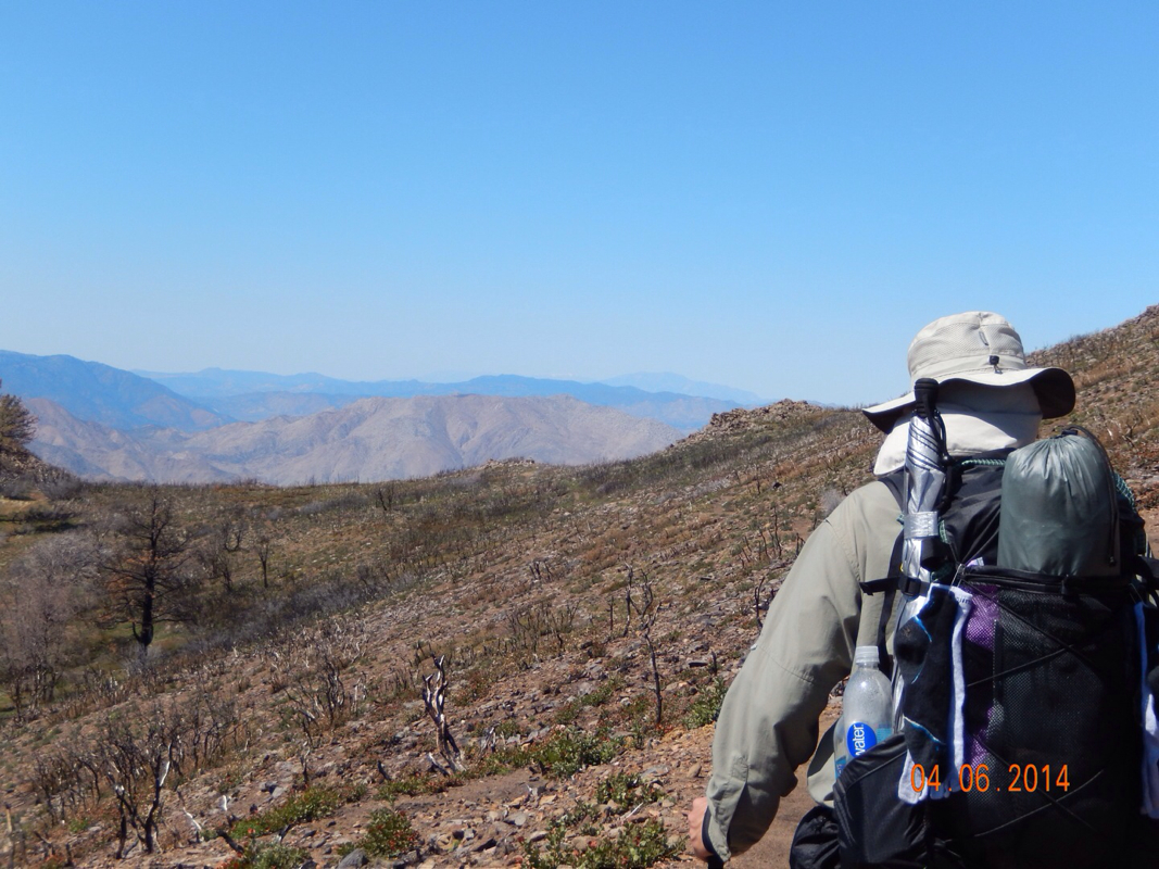
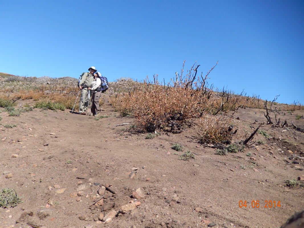
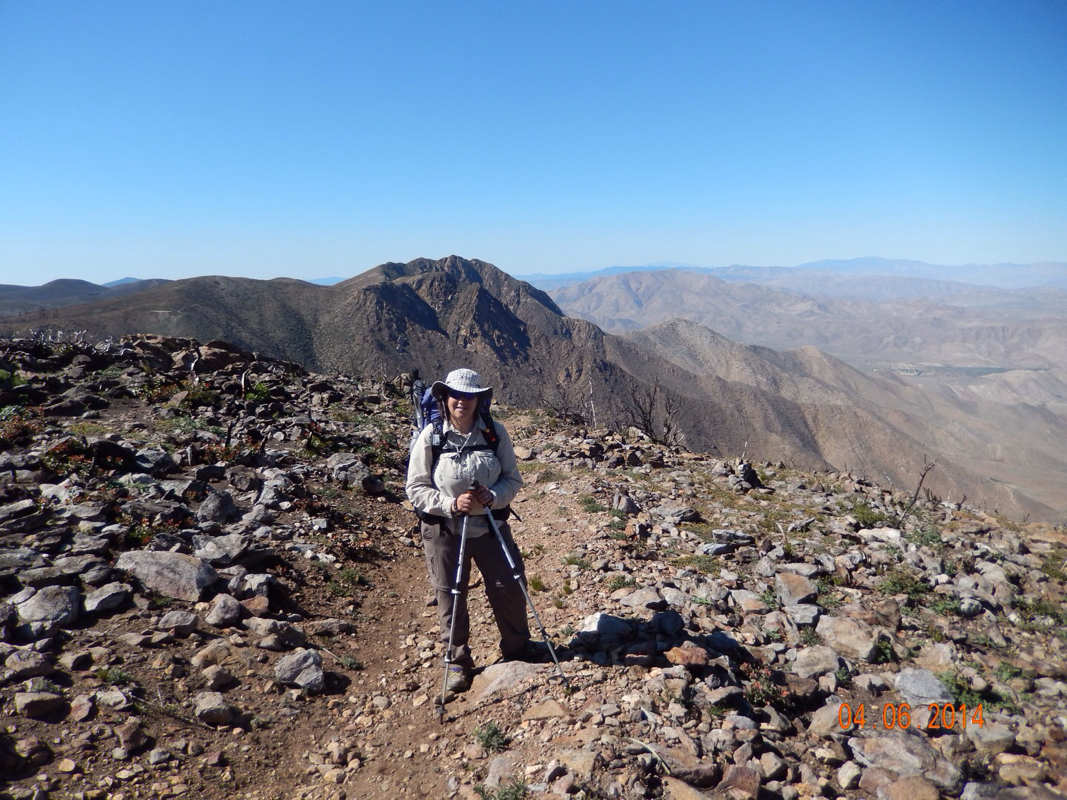
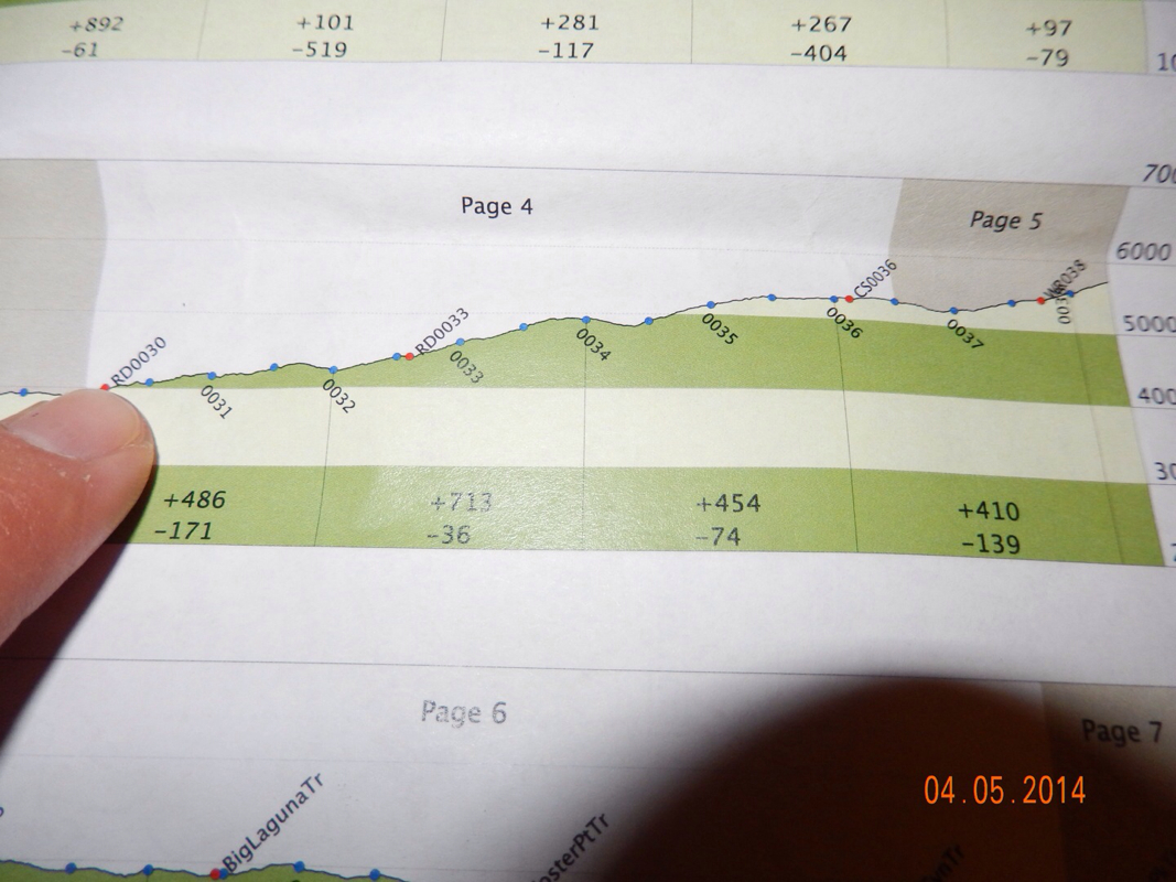
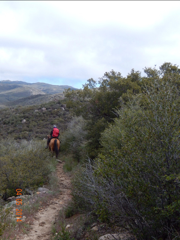
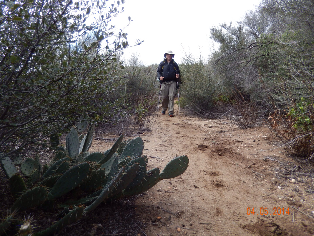
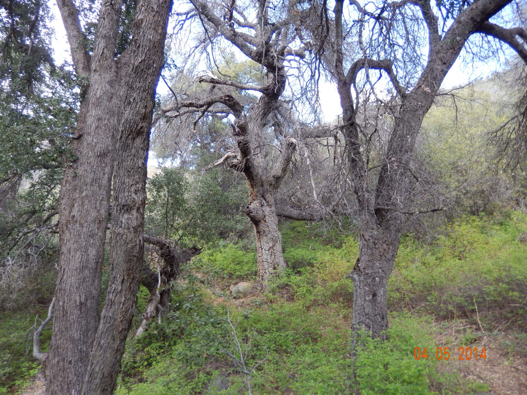
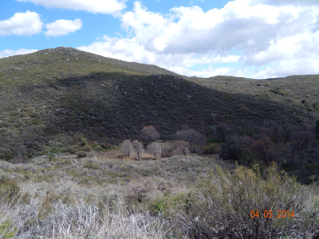
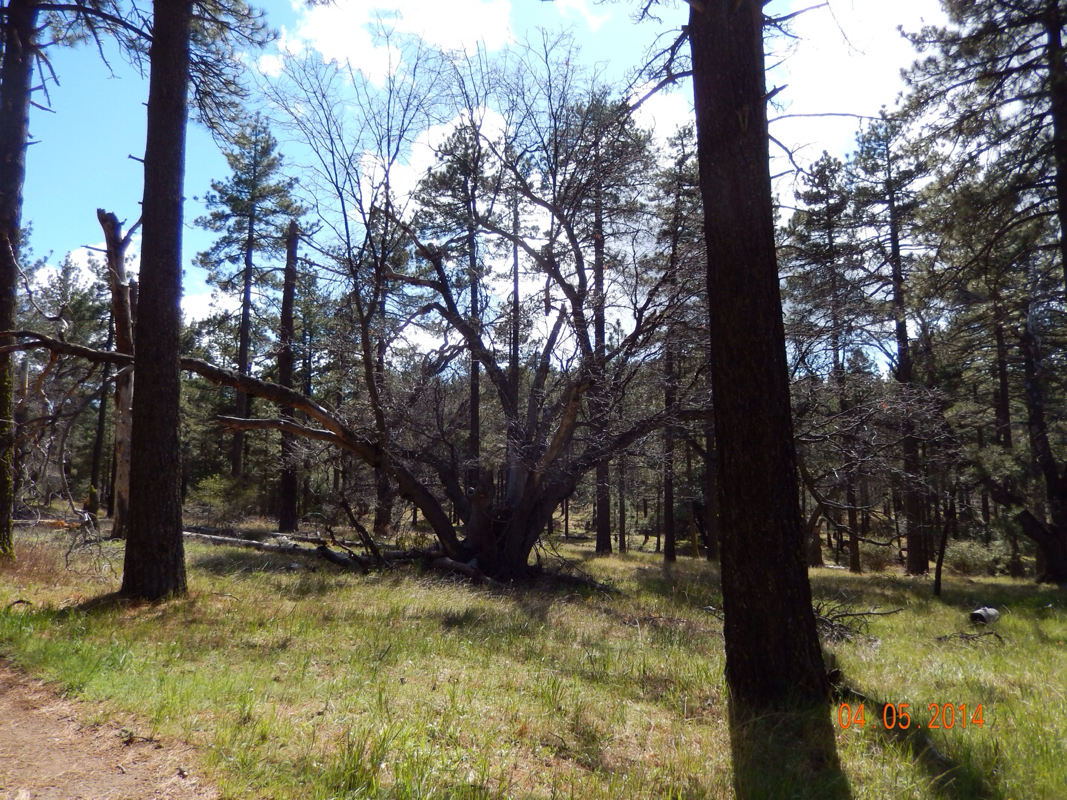
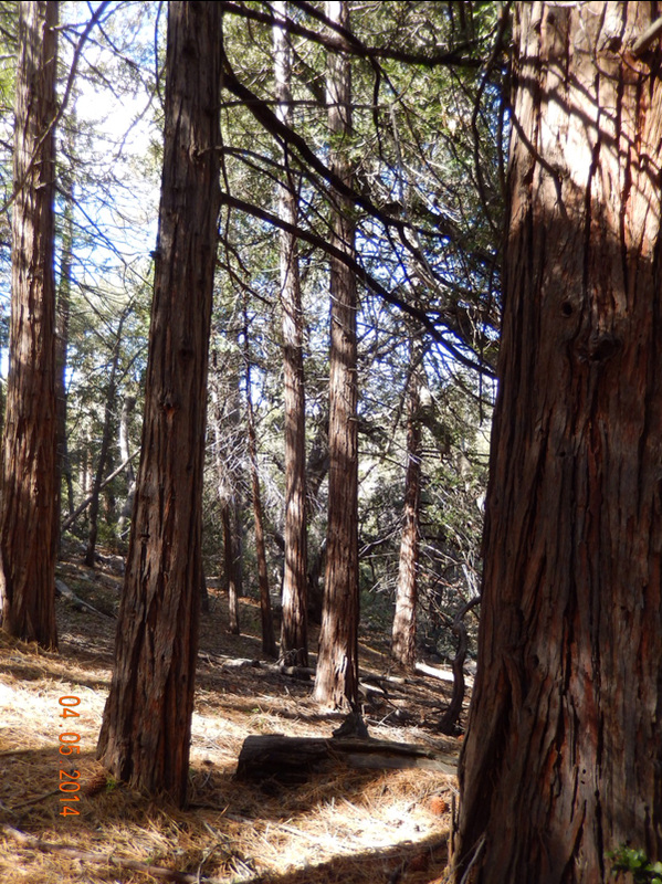
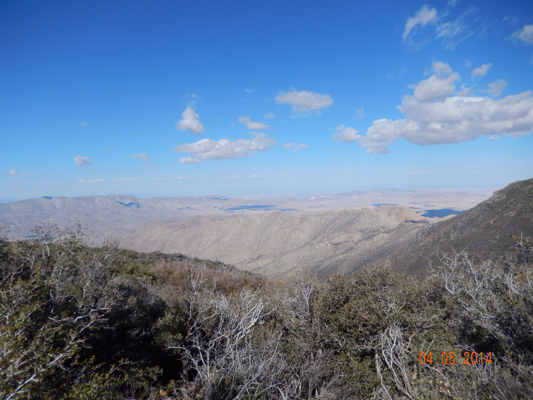
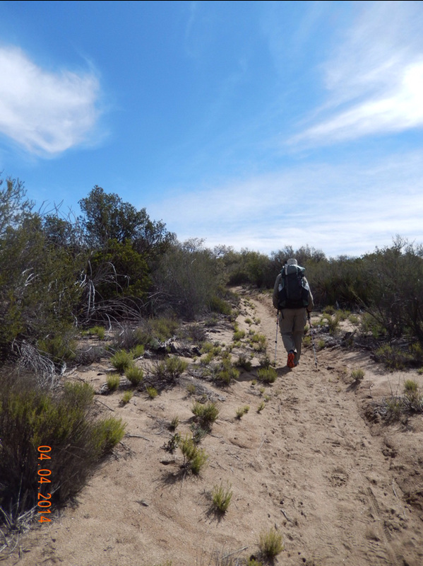
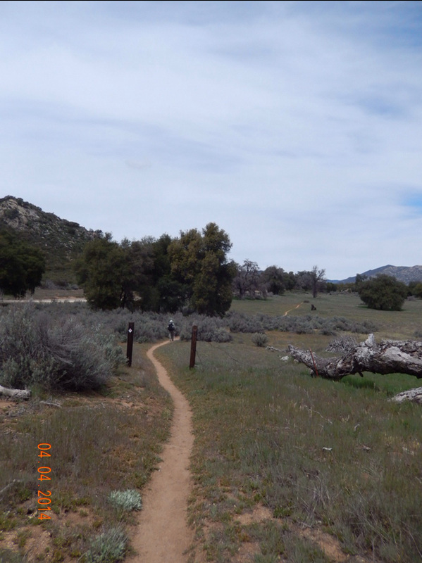
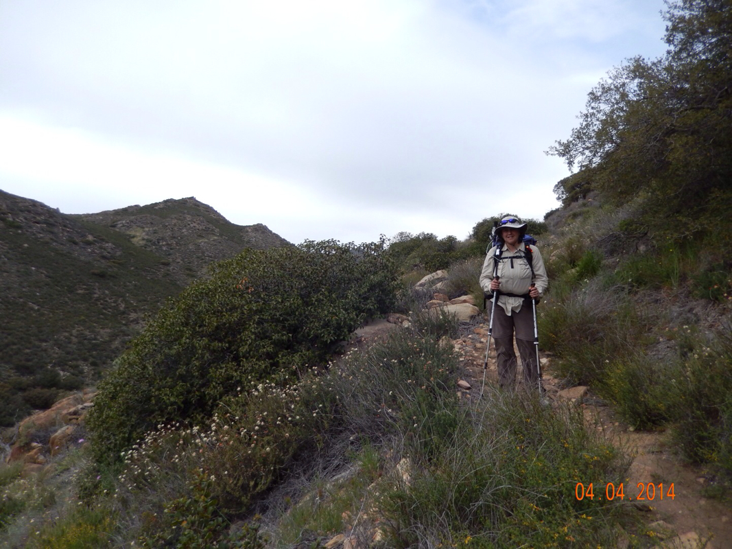
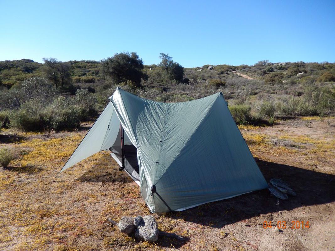
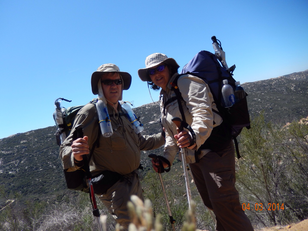
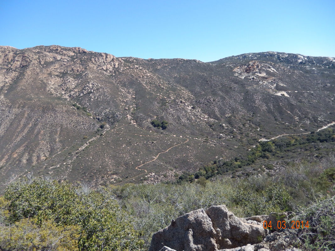
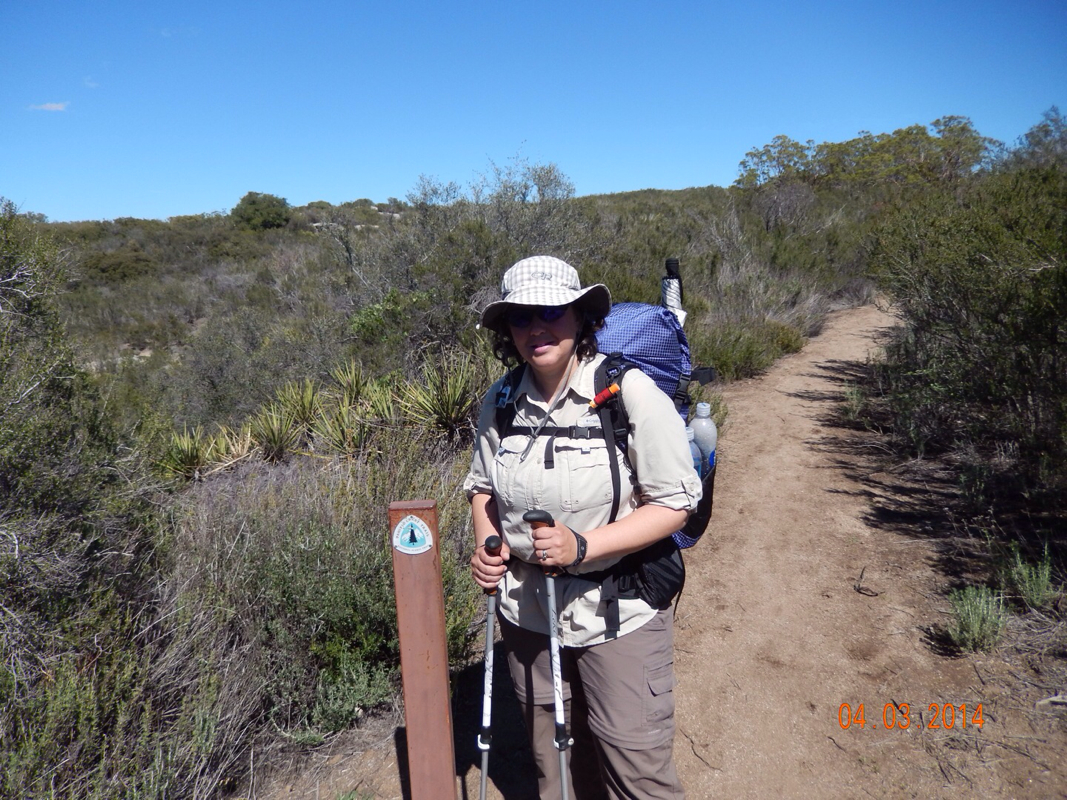
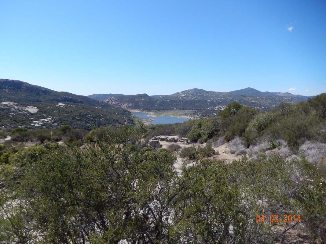
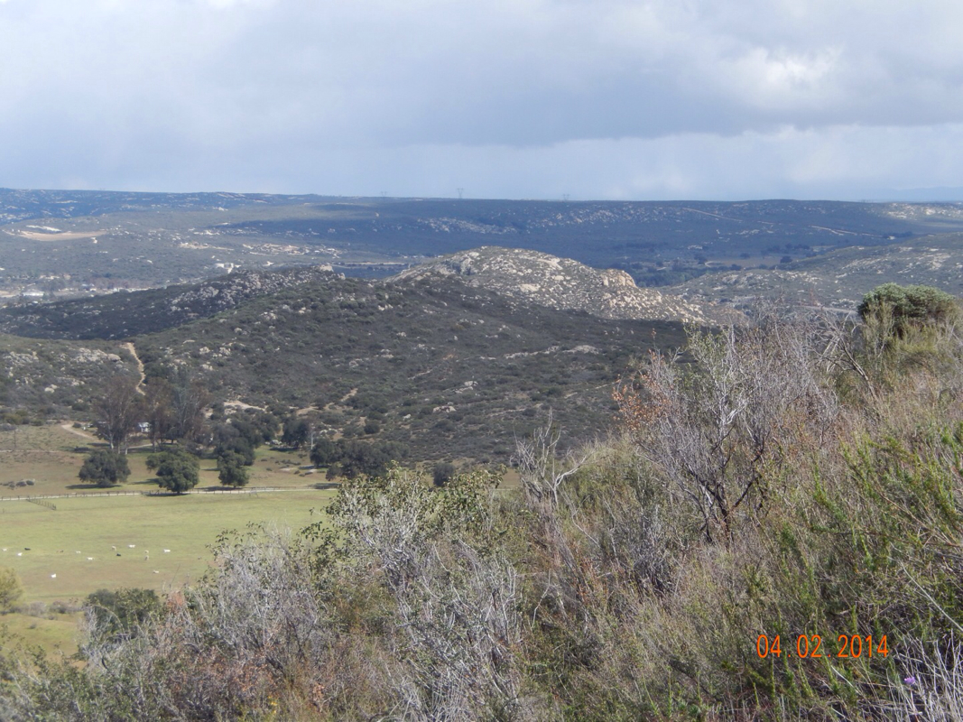
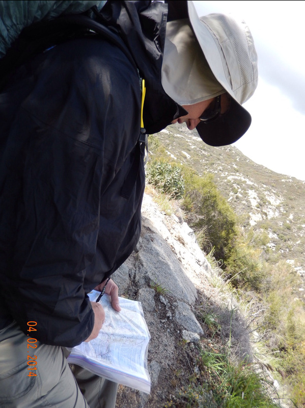
We finally got going on what will be a long mile day (13 miles for Tim and 13.6 miles for me...explanation to come later) and the hottest day yet. I already feel like a broken record, but what an awesome day. The terrain was perfect with nice easy ups and not too steep downs. Here are some great pictures from today:

Picture
Picture
Picture
Picture
Picture
Other hikers on the trail ahead.
Picture
Picture
Picture
Picture

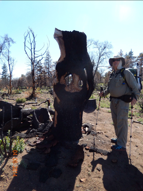
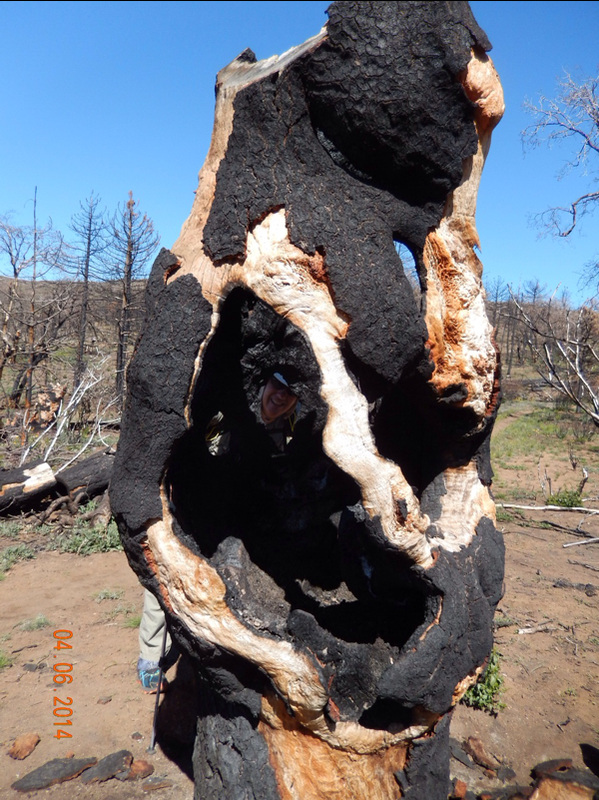
After lunch we came across this monument that people seem to have turned into a memorial for people that have died. It was pretty high up, so we figured people probably throw the ashes over the edge.

Picture
Memorial Monument.

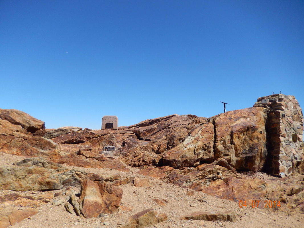
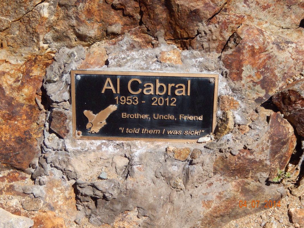
There where lots of plaques for motorcycle riders (maybe because the road we came to just past the monument looks like an awesome road to ride).  The best plaques had to be this one:

Picture
"I told them I was sick!"

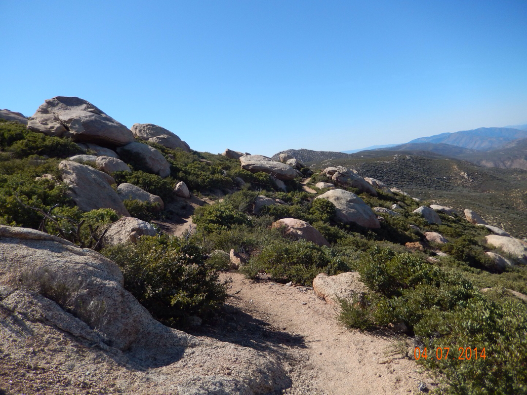
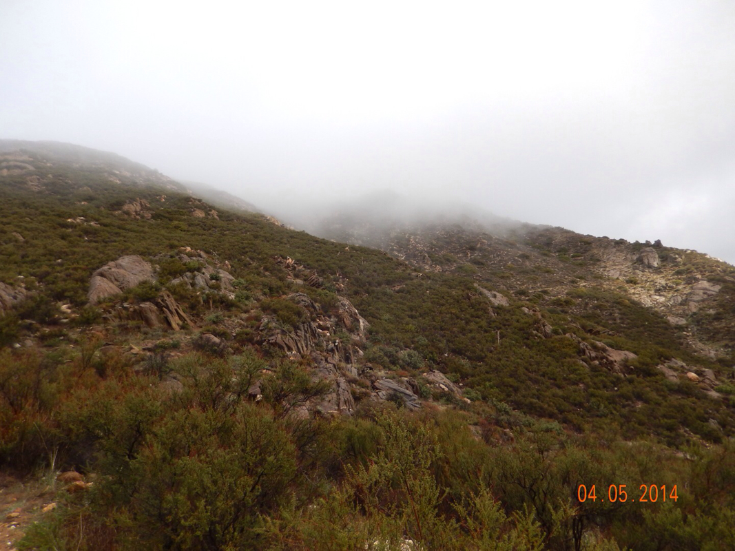
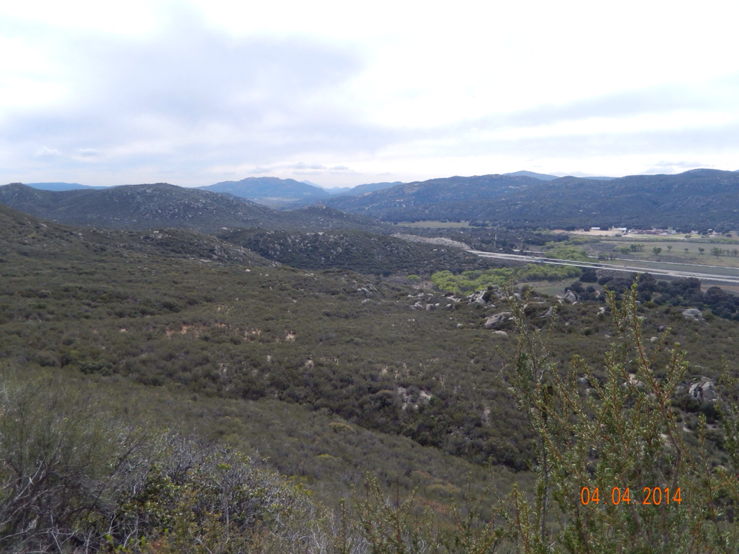
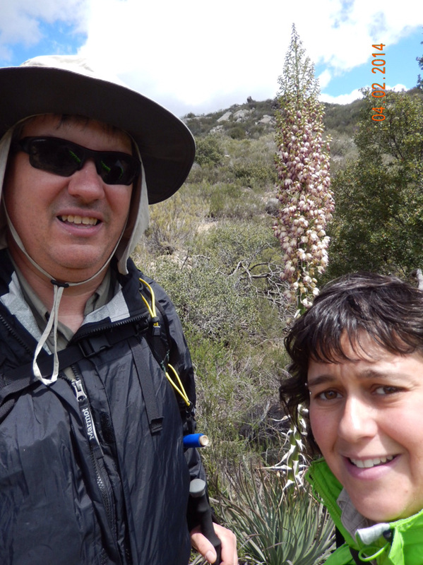
Around. 3:30 we came across this boulder field. It was the first time we saw this kind of scenery.

Picture
Boulders...nice!

And then, around the corner there are 3 women making camp amongst these boulders.

Picture

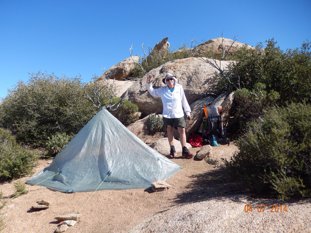
They invited us to stay the night, but we needed to get in some miles to make up for yesterday's 5 mile day. So off we went.

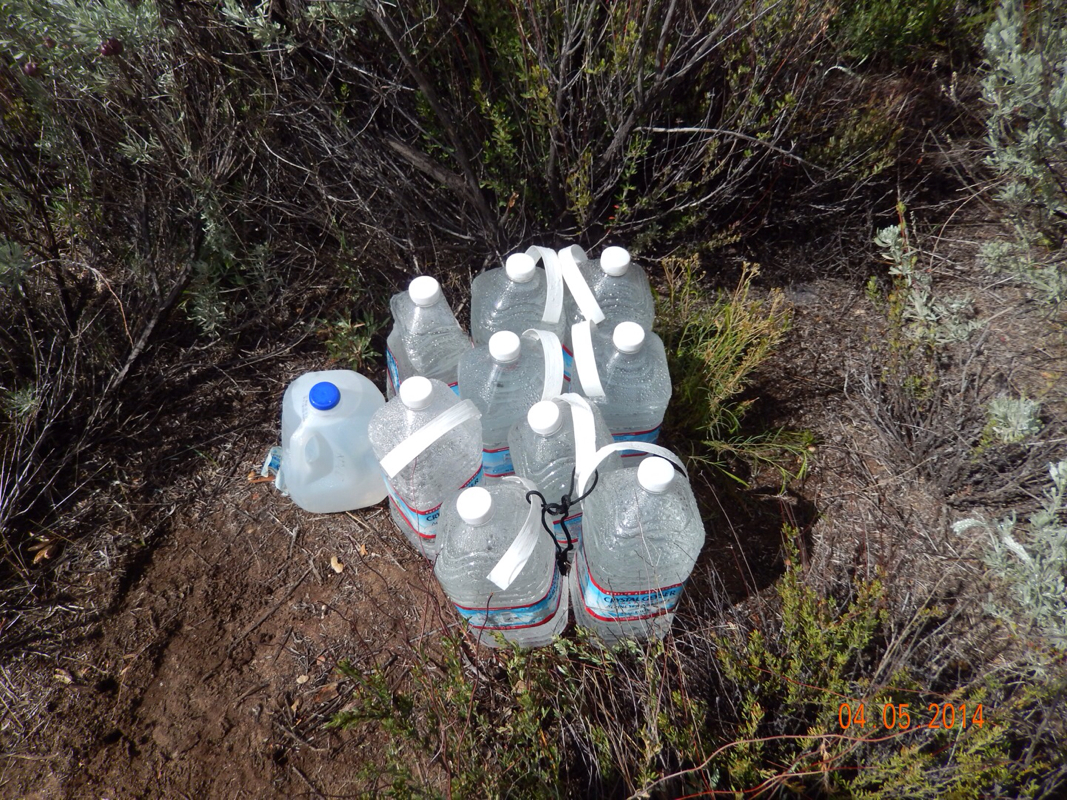
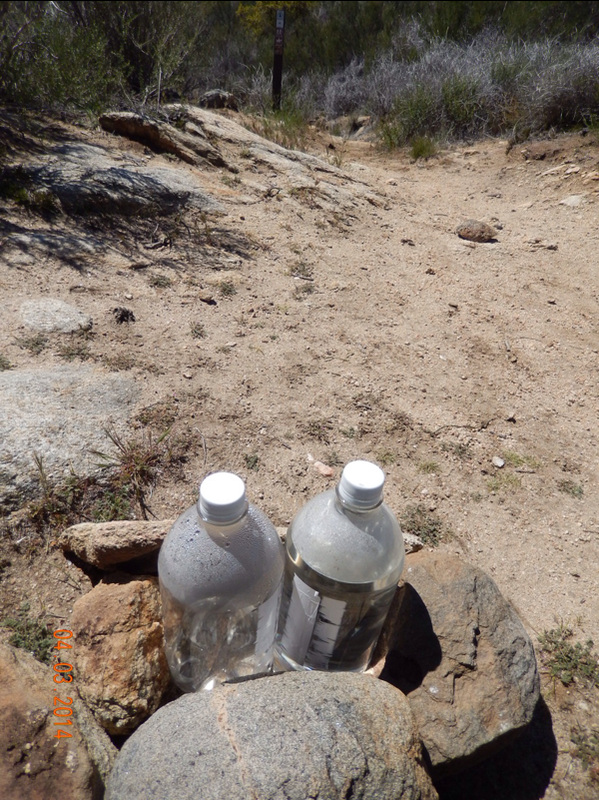
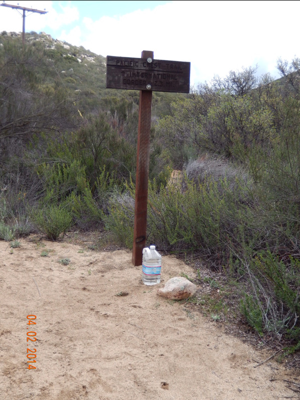
We were getting pretty tired when we had about 2 miles to go, but onward we pushed until we got to the turnoff for where we were camping. Right at the turn was a water cache. Tim said we should fill a couple of our liters, but the hiking notes said there was water available where we were planning on camping, so I said, "No, let the hikers passing by use that water so they don't have to walk the 0.3 miles to the other water source."  "Fine," said Tim. So off we went 0.3 miles to our campsite.

Picture
Nice, clean bottled water that we passed up.

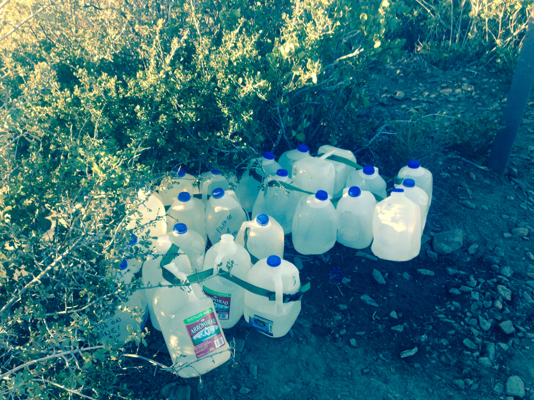
We finally get to the camp area and find the water source that is really a horse trough and it looked disgusting. Yes we could filter it, but do we really need to when just 0.3 miles back there is that yummy bottled water. Tim says, "I told you we should have filled a couple of our bottles."  So...I think you all know where this is headed...off I go, back 0.3 miles to get the water we never should have passed up.

Picture
Oy! Tim was right and I was wrong, so off I go.

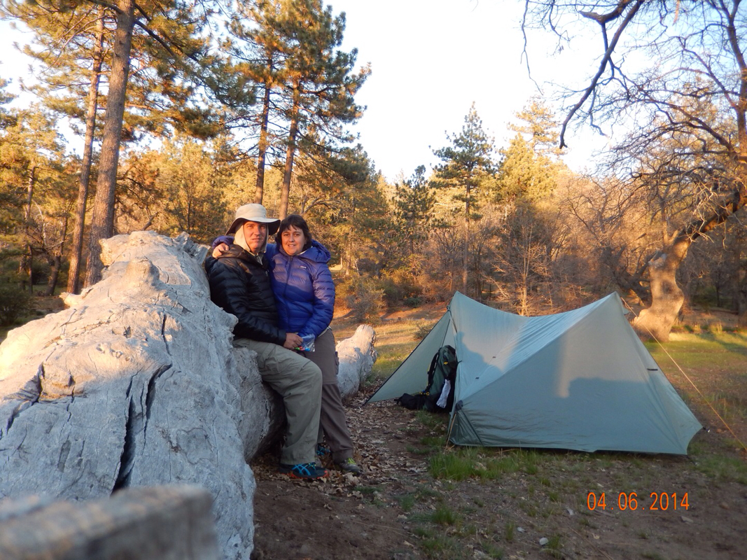
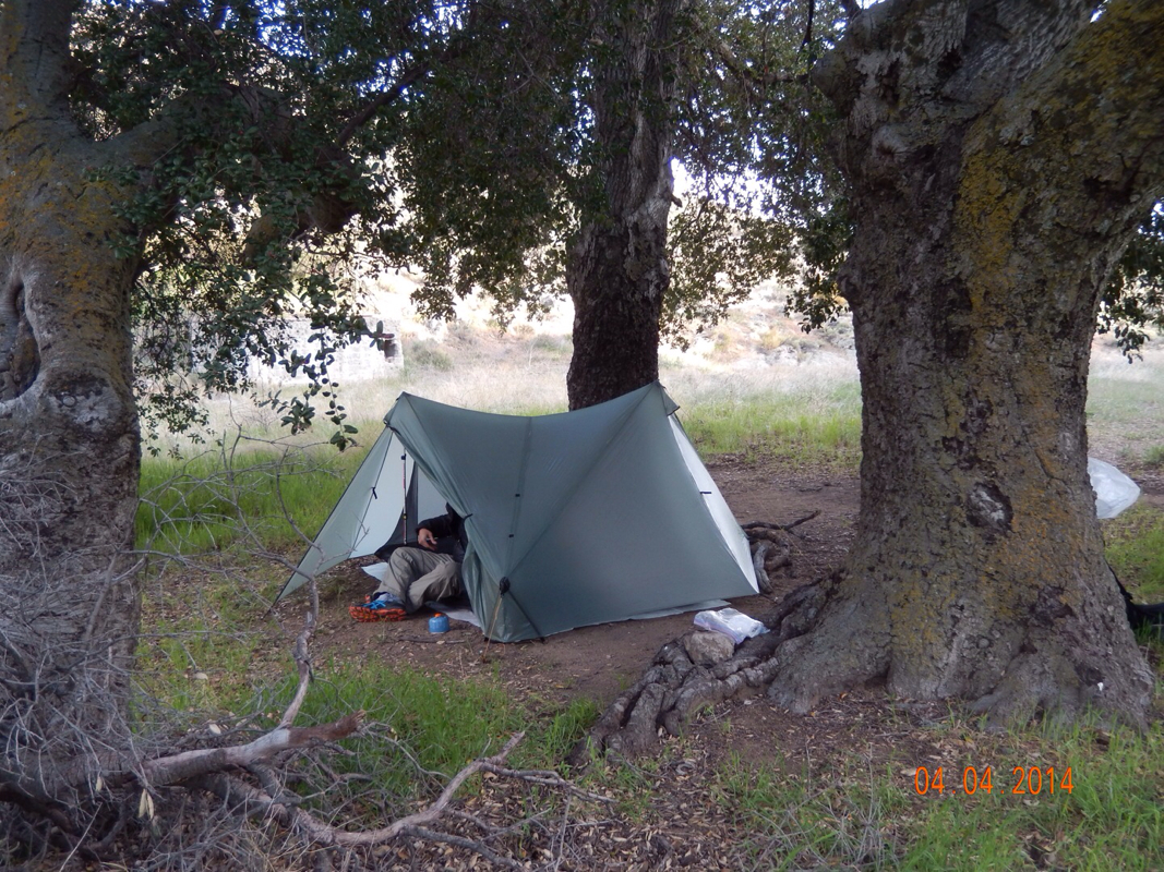
The only nice part of all this is that I got back to a tent set up and looking quite inviting.

Picture

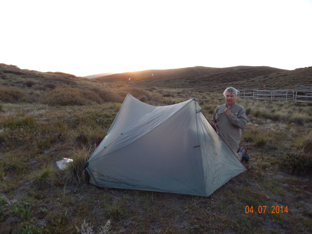
Tomorrow we should be back to 10 miles so we don't have to rush in the morning...not that we could even if we wanted to!

4 Comments

Day 5 (6 April) - Mile 42.6 - 47.21

4/7/2014

0 Comments


Mt Laguna to Mt Laguna Campground, CA

What a great morning waking up in a hotel room at 9am. We took our time and even took another shower just because we could. 

There was a hiking supply store that we went down to check out.  They had a scale where we can weigh our packs. With 6 days of food and 2 liters of water, mine weighed 28 pounds and Tim's weighed 32 pounds. Not bad...I was pretty happy. Six months of research and many thousand dollars spent on gear paid off. There where plenty of people there buying new gear and new shoes because they didn't research properly. We came across a girl the had a 65 pound pack!  What?!?  She bought some new gear and lost 20 pounds. She could have lost more, but she was young and didn't have the funds. 


Today as planned we only went around 5 miles. It was fairly easy terrain but very different from what we have been walking through the past 40 miles.  We spent many miles walking through a burned out area. I don't know how long ago the fire was, but there were nice signs of rebirth including many colorful flowers (pictures are for you Gary).

Picture
Eerie looking burned out bushes.
Picture
Pretty flowers along the burned area.

We came across this burnt trunk that looked like a bear from one angle. From another angle it was like a modern art sculpture.

Picture
It's a bear!
Picture
It's a sculpture!

I don't know why people say the beginning of the trail is boring. We are thoroughly enjoying the scenery.

Picture
Picture
Picture
Picture

After the short 5 miles we felt that we could do more, but decided to stick to the plan so we made our way to Mt Laguna Campground to spend the night. Our tent site is pretty nice and it is only steps to a flush toilet which makes it even nicer.

Picture

The plan for tomorrow is 12 miles, so again we should get an earlier start so we can take our time and enjoy the walk.

0 Comments

Day 4 (5 April) - Mile 30.2 - 42.6

4/5/2014

1 Comment


Kitchen Creek, Yellow Rose Spring to Mt. Laguna, CA

Today we actually were able to to get out of camp at a reasonable time. We woke at 6:20 and started hiking at 8:30. Between the light rain this morning, knowing that we had to hike 13 miles, and knowing there was a hotel room at the end of the day motivated us to get moving. 

As soon as we left the campsite we started climbing. We knew from studying thesis last night that today was going to be all about the up up up.

Picture
Profile of today's hike. I pointing at the start. We go all the way to the end of the profile graph.

The start of the day was drizzly and cold. The clouds were passing through the area we were hiking.

Picture
Cool clouds.

As we were climbing we realized that we had just enough water to get us all the way to Mt Laguna. This meant we had to conserve a bit and not guzzle it down. Then, not more than 5 minutes later, we came across another Trail Angel water cache...the first that we needed to take advantage of. We guzzled as much as we could and refilled our bottles. No more concern.

Picture
Thanks Trail Angels!

Another cool thing we saw today was this girl riding a horse on the trail. Not only do people thru-hike the PCT, they also thru-ride horses along the same route. I'm sure we will see more horses as we go along our journey.

Picture
Thru-riding the PCT...how cool.

Overall today, although it was a constant climb, we had a great time and there was beautiful scenery. Climbs led to wonderful views of high-altitude meadows, canyons, and desert landscape.

Picture
Tim strolling through the desert.
Picture
Cool trees we came across.
Picture
A view above Long Canyon that we just climbed out of.
Picture
Nifty old trees in a 6000 ft high landscape.
Picture
More cool trees.
Picture
The first snow we have seen on the PCT.
Picture
Low desert way below us. We will be heading down to the low desert in Mojave (Mile 270).

Finally, after our longest day so far, we made it to Laguna Mountain Lodge and our first resupply boxes we mailed to ourselves before we left. Notice the bucket in our room. We were told it was for doing our laundry and soaking our feet...talk about catering to the thru-hiker. 

Picture
Picture
Our room for the night. Bucket included.

After checking in we waddled our way down the hill to the Pine House Cafe for dinner and...you guessed it...a nice cold microbrew.

Picture
Yummy beer.

Tomorrow is going to be a fairly easy day. Sleep in till whenever and check out around noon. Then we will hike under 5 miles to a campground and stop for the night. Who ever thought hiking 5 miles constitutes an easy day!?!

1 Comment

Day 3 (4 April) - Mile 20 - 30.2

4/5/2014

0 Comments


Lake Morena County Park to Kitchen Creek, Yellow Rose Spring

We surprisingly got a pretty good nights sleep even with all those people around. The earlier risers stayed fairly quiet and we were able to stay in the tent until around 6:45. The only bad thing...it was freezing. There was literally a thin layer of ice on the outside of out tent. The only thing that really got us out of the tent is knowing that there were bathrooms where we could enjoy sitting instead of squating. 

The cold did slow us down. We didn't leave the campground till almost 10:00. I don't know what we did for over 3 hours standing around in the cold, but we have to start getting a bit faster in the morning. 

The hike started out nice and easy. Flat terrain with a bit of loose sand that actually helped loosen my tight calf muscles (the only real issue I am having so far).

Picture
Nice level terrain to start the day.

This sandy terrain then turned into a beautiful meadow. Again, a nice easy walk.

Picture
Tim walking a bit ahead.

We then crossed under Interstate 8 and then, out of nowhere we started climbing, and climbing, and climbing until we were way above the Interstate.  Luckily the scenery was beautiful.

Picture
High above Interstate 8.
Picture
Gerri taking a little break from climbing.
Picture
Finally made it to the top of the last climb of the day.

Throughout the day we saw many other hikers including a couple that told us about a nice place to stop for the night. They went ahead and we told them we would see them there. 

When we made it to the campsite another guy was there as well and he mentioned to the guy that told us about this place that he really appreciates his maps. I was like, "What!?!  Huh?!!  Are you Halfmile?!?"  "Why yes I am," he said. 

So who is Halfmile you may ask. He is only of the most important people in the PCT community. He creates the maps and trail notes everyone on the trail uses. Plus, this year he added an app that tells you exactly where you are on the trail and how far the next point of interest is.  The crazy thing is that when I was using his app to find tonight's campsite I thought of some improvements that the app could use and now here his is to share the ideas with (which he actually liked). 

After all that, we let him be and set up our tent on a marvelous spot. It is chilly again tonight, but if all goes well with tomorrow's hike, we will make it into Mount Laguna were we will have our first stay in a hotel room. All that is between us and a hot shower is about 13 miles. We are getting to sleep early tonight and am hoping for a 9am start (breath NOT being held). 

Picture
Wonderful campsite for the night.
0 Comments

Day 2 (3 April) - Mile 10.9 -20

4/3/2014

2 Comments


Last night was quite cold. We woke up to frost on our tent fly. I woke with the

sun around 6:30, but it was way too cold to get up, so went back to sleep and woke

at 7:30 with the warm sun hitting the tent...it felt great. We got on the trail 2 hours later and started the 9 mile hike to Mount Morena, our planned campsite for the night. By the way...here is a picture of our first nights campsite.

Picture
Nice flat campsite. Great, but cold night.

Today's hike was more ups and downs with a big down followed by a big up with many false peaks. We would reach what we thought was the top and then we would start heading back up again. Here are a few pictures to show you the terrain we are dealing with.

Picture
Taking a break on one of the ups.
Picture
We came down that trail seen in the center of the picture and are now going up the other side.
Picture
A gentler part of today's hike.

We met many other hikers today on the trail and hike with a few for a couple of miles. We also experienced another trail angel gift when we came across this water stash on the top of a peak in the middle of nowhere.

Picture
More trail angel magic!

Later in the day we actually came across the guy (Mr. Clean) who provide this magic. He hiked the PCT last year and wanted to give back to this years hikers. How cool is that?!?

After we finally hit the actual peak of the day we were rewarded with a view of our stop for the night... Lake Morena Campground.

Picture
Tonight's stop (Lake Morena)

After a couple more miles we finally made it there and was greeted with a bathroom with flushable toilets...luxurious!  TheY have a section here where all the PCT hikers can pitch a tent for only $5 and it seems that everyone hiking the trail is here. There must be at least 20 hikers staying here tonight.   Hopefully we are going slower then most and will have a quieter place to stay tomorrow night. There is a snorer a few tents away and I am quite worried about the earlier risers tomorrow. At least it is before 9pm so we should be able to get plenty of sleep. 

I will leave you tonight with some awesome words my dear friend Cathy sent me:

May the road rise to meet you.
May the wind be always at your back
May the sun shine warmly upon your face
and the rains fall softly on your tent!

2 Comments

Day 1 (2 April) - Mile 0 - 10.9

4/3/2014

3 Comments


This is it...my 44th birthday and our start of the Pacific Crest Trail.  We spent last night in El Cajon not far from the bus station where we needed to catch the bus to Campo where the southern terminus of the PCT is. We got to the station and there were 5 other thru-hikers waiting for the bus as well...no, we are not the only crazy ones out here! After a 2 hour bus ride and a 1.5 mile road walk we made it to the official start of the trail. 

Picture
The official start of the Pacific Crest Trail, the Southern Terminus.

Anyway, we left the terminus and began our hike north right at 11 am. This seemed fine since we planned on hiking only 10 miles today which should only take us 3-4 hours...right?  Well, not so right. First, we are carrying 6 liters of water each since our next water supply isn't for 20 miles (2 days hike). Water weighs 2.2 pounds per liter, so we are each carrying over 13 pounds of water.  Second, the terrain is not what I was expecting. I expected a nice flat easy walk through the desert, not the ups and downs through high desert hills we experienced. Third, the weather today was sunny and then rainy and then it hailed and then it did it all again all day long. Fourth, you can't just stop wherever you want to camp. This trail is narrow and hilly with no flat camping area. We had to go an extra mile to get to a campsite designated on the map. Add this to the 1.5 mile walk to the start and our 10 miles that we wanted to hike today turned into 12.5 miles. 

Picture
Yes! Made it to Mile 1!
Picture
Our first water source from start is 19.5 miles!!!
Picture
Hilly terrain with the border wall in the top right corner.
Picture
A little rest in the desert.
Picture
Looking for a campsite on the map.

We made it to camp at around 6:30 giving us 1 hour before sunset. Tent pitched well, dinner was yummy (Knorr Pasta Alfredo with salmon), and then the sun set and temperature keeps dropping. I guess it is supposed to be around 34 degrees tonight...in the desert!  This cold weather just means we get to jump in our warm sleeping bags earlier and get a bit more sleep. 

Oh yeah. One more cool thing we saw today. Check out the picture below. What we call a "trail angel" put out some water we can use to replenish what we had already drank. These trail angels are awesome people, but more about them another time. I keeps getting colder so I need to go to sleep. 

Picture
Our first Trail Angel experience.
3 Comments

Day 0 (1 April 2014) - Cleveland, OH to El Cajon,CA

4/1/2014

2 Comments


Here we are flying out to San Diego with many questions going through our heads. Did we bring everything we need?  Did we bring enough?  Are out packs too heavy?  Will we have enough food and water? But the scariest question of all is "Will our bodies and minds allow us to complete this adventure?"

Picture
Flying into San Diego.

From everything I've read, the two biggest reasons people do not complete the thru-hike is injury and mindgames.   Injury is something we just have to hope against.  We will be starting at a comfortable pace and building up miles slowly and carefully. This should help us avoid injury. This should help us avoid injury. But how do we prepare our minds? 

You know when you go out for a jog and you want to keep running, but the voice in your head keeps telling you that you are tired and why are you doing this and why don't you just stop running. Well, imagine that for 2,700 miles. There will be good days where the sun is shining and we feel great, but what about those days where it is raining and our feet hurt and the mosquitos are ridiculous. Those are the days where we need to fight, fight, fight. 

Here's to that voice in our heads and may we be strong enough to win!

Picture
Hotel stay in El Cajon, CA.
2 Comments

This is about to happen!

3/31/2014

5 Comments

 
The time has actually come.  We are flying out to San Diego tomorrow morning and making our way to Campo, California on Wednesday morning to start the hike.  As promised, here is a picture of all our boxes packed and pretty much ready to go.  There are 33 total boxes going to 21 different locations along the trail.  The polka dots on the side of boxes is our way to try to distinguish our boxes from the other hundreds of boxes that will be sitting at the mail drop locations.
Picture
Along with this blog, don't forget to check out our "Where are We Now" link on our website (http://www.timandgerri.com/where-are-we-now.html).  Here you will be able to see a map of where we spent each night on the trail and watch our progress.  Our progress will be slow going to start since we are planning on only going 10 miles per day (relative to others who start out in better shape who'll do 20 miles to start - we'll get there eventually).
5 Comments

Final Planning & Preperation

3/24/2014

2 Comments

 
We are in the final day of planning & preparation and everything has fallen into place as planned.  We purchased our one-way airline tickets to San Diego (flying out April 1). Also, our house is under contract and is scheduled to close on April 4.  We planned on getting rid of as much stuff as possible, but it got harder and harder, so we had the Air Force put all our household goods into non-temperary storage.  We plan on it leaving it all in storage as long as the Air Force allows it.

We were also able to sell the sailboat which we trailered up to New Jersey to complete the sale.  The new owners were very excited as we drove into their driveway.  The best part of driving to New Jersey was we were able to get together with family before heading out for 6 months.  Jodie and Troy (sister & nephew) drove down from Connecticut and my uncle, aunt, and cousins (Larry, Pat, Marc, & Ethan) drove over and we all got to eat dinner together and catch up after many years of not being able to see each other.

Now we are in Collins, Ohio where we are busy packing up all our resupply boxes.  It is a lot more work than expected, but it will be worth it when we get to town and our box is sitting there with 1 weeks worth of food, maps, and toiletries.  Here is what over 100 days of food looks like before being boxed up into 21 individual packages.  Yes it is as overwhelming as it looks!  I got quite sick of bagging up dry milk into 419 1/3 cup individual servings for hot chocolate, carnation instant breakfast, and cereal...OY!

More important than boxing up all these goodies is that my wonderful sister-in-law Mary has volunteered to support our hike by mailing out our resupply boxes as we need them.  Thanks Mary!

Look for the next blog posting in a few days where all this food will be boxed and ready to go.
Picture
Picture
Picture
Picture
Picture
2 Comments

Food prep needs to begin!

2/13/2014

7 Comments

 
Now that all the equipment is in place it is time to concentrate on food.  Obviously you can't carry 6 months worth of food on your back, so you have to plan on getting food on the route.  There are 3 main ways that people resupply food:

   1.  Buy - Buy all food in towns along the trail.
   2.  Mail - Send packages to yourself along the trail with enough food to get you to the next
   mail drop.
   3.  Hybrid - Use mail drops and buy food in towns along the trail.

Since I don't eat meat it would be hard for me to rely on stores along the route for all my food, so I am leaning toward the hybrid route.  I will send full mail drops to towns that do not have a significant market, and those towns that do, I will send a mail drop that has breakfast and dinner and then buy lunch items in the markets.

Now, what do we eat?  For basic breakfasts we are planning on protein bars, oatmeal, and cold cereal.  For lunch we are planning on eating fresher items that do not require any cooking.  These meals could include tortillas, bagels, cheese, avocados, crackers, peanut butter, and fresh fruit & vegetables.  Dinner will be a more significant meal including pasta, rice, couscous, and tuna & salmon packets.  Of course, there will be snacks (granola bars, nuts, dried fruit, candy bars, etc) and after dinner hot drinks such as tea and hot chocolate.

All these meals and food need thought and planning.  At first I was planning on relying on Quaker instant oatmeal packets for breakfast and Knorr Noodles/Rice & Sauce packages for dinner.  But, the more I thought about it, the more I realized that these pre-packaged food items would be OK to eat once in a while, but would get pretty unhealthy if we ate it every day for 6 months.  Wouldn't it be better if I put together my own oatmeal and noodle/rice & sauce meals using healthier ingredients with less salt and preservatives.  So here I am trying to figure out how to do this.  After a trip to a health food store and Trader Joe's this is what I bought to experiment with:
Picture
My thoughts for breakfast is to make my own instant oatmeal using rolled oats, almonds, dry milk, brown sugar, and freeze-dried fruit.  I will also try to make breakfast quinoa using quinoa flakes, brown sugar, and cinnamon, and maybe a hot cereal using couscous, dry milk, brown sugar, chopped almonds, and freeze-dried fruit.

For dinner I am also going to try playing with quick cook pasta and all natural cheese sauce mixes instead of the kraft macaroni and cheese junk.  I also bought Simply Organic dressings and sauces to play with and see how they mix with rice, pasta, and tuna/salmon.  One of the more interesting items I found is Ova Easy Egg Crystals.  I will try this as another possible protein source, maybe eggs an egg and refried bean burrito?

Bottom line is that I have to get started working with these ingredients and testing them out for the trip, or else I will wind up going the easy but unhealthy route of ramen noodles and Kraft macaroni and cheese.  I better get going!
7 Comments
<<Previous
Forward>>

    Archives

    May 2014
    April 2014
    March 2014
    February 2014
    October 2013

    RSS Feed

Powered by Create your own unique website with customizable templates.