Tim & Gerri's Wild Ride
Email & Facebook Gerri:
  • Home
  • Worldwide Travel
    • Everest 2025 >
      • 2025 Everest Packing List
      • Everest Blog Summary
    • 2024 Europe Tour >
      • 2024 Europe Tour Packing List
      • Europe 2024 Blog Summary
    • Asia 2023 >
      • Asia 2022 Packing List
      • Asia 2023 Blog Summary
    • Eastern Europe 2022 >
      • Eastern Europe 2022 Blog Summary
      • Eastern Europe 2022 Packing List
    • Narrowboat Holiday 2022 >
      • Narrowboat 2022 Blog
      • Narrowboat 2022 Packing List
    • Ireland & UK 2019 >
      • Ireland & UK Itineray
      • Ireland & UK Blog Summary
      • Ireland & UK Packing List
    • France 2018 >
      • France Itinerary
      • Blog Summary
    • European Tour 2017 >
      • European Vacation Blog
      • Blog Summary
    • Southeast Asia 2014-15 >
      • Southeast Asia Blog
      • Packing List
      • Blog Summary
    • Afghanistan 2011-12
  • United States Travel
    • Great Lakes Sail 2020 >
      • Great Lakes Sail 2020 Blog
      • Blog Summary
    • Trans-America Bicycle Ride >
      • Blog Summary
      • Our Team
      • Equipment
      • Breweries Along Route
    • Pacific Crest Trail >
      • Pacific Crest Trail 2016 >
        • What is the PCT? - 2016
        • Why Hike the PCT? - 2016
        • Gear - 2016
        • Itinerary - 2016
        • PCT Blog Summary - 2016
        • Where are we now? - 2016
      • Pacific Crest Trail 2014 >
        • What is the PCT?
        • Why Hike the PCT?
        • Gear
        • Food
        • Itinerary
        • Blog Summary
        • Where are we now?
    • Motorcycle Ride 2014 >
      • Motorcycle Blog
  • Brewery Visits
    • 2025 Breweries
    • 2024 Breweries
    • 2023 Breweries
    • 2022 Breweries
    • 2021 Breweries
    • 2020 Breweries
    • 2019 Breweries
    • 2018 Breweries
    • 2017 Breweries
    • 2016 Breweries
    • 2015 Breweries
    • 2014 Breweries
    • 2013 Breweries
    • 2012 Breweries
    • 2011 Breweries
    • 2010 Breweries
    • 2009 Breweries
    • 2008 Breweries
    • 2007 Breweries
    • 2006 Breweries
    • 2005 Breweries
    • 2004 Breweries
    • 2003 Breweries
    • 2002 Breweries

Durham via Hadrian's Wall

9/30/2019

0 Comments

 
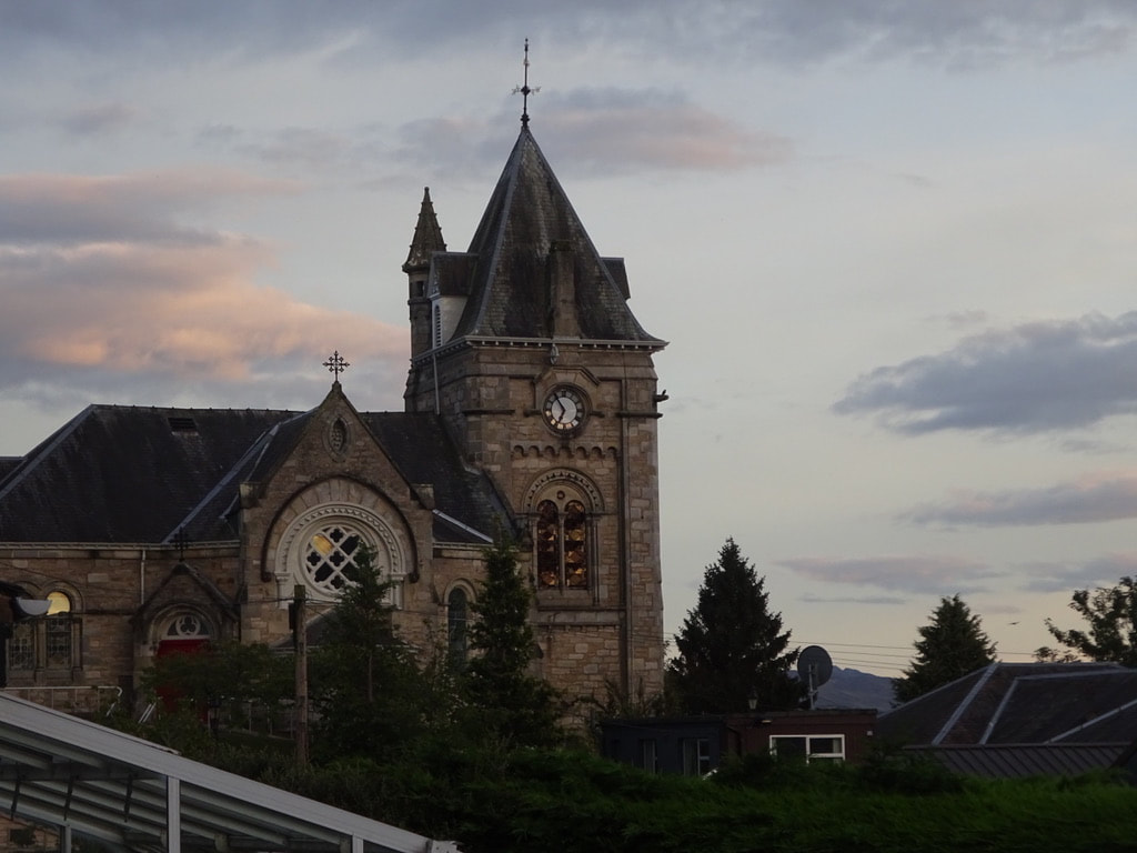
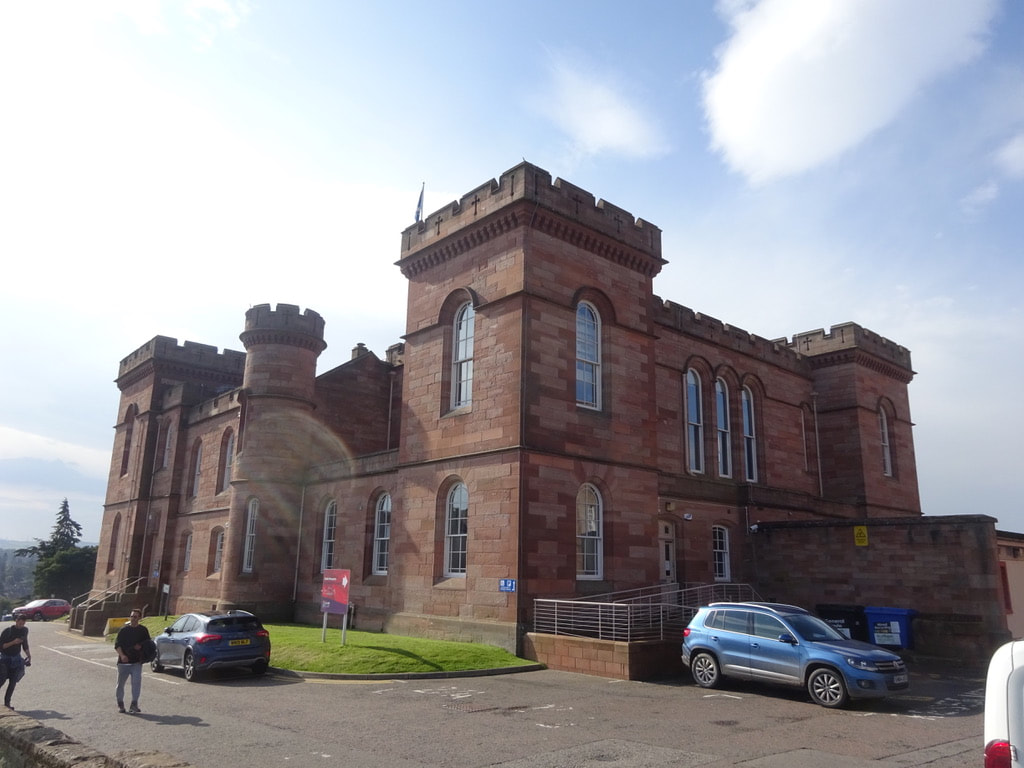
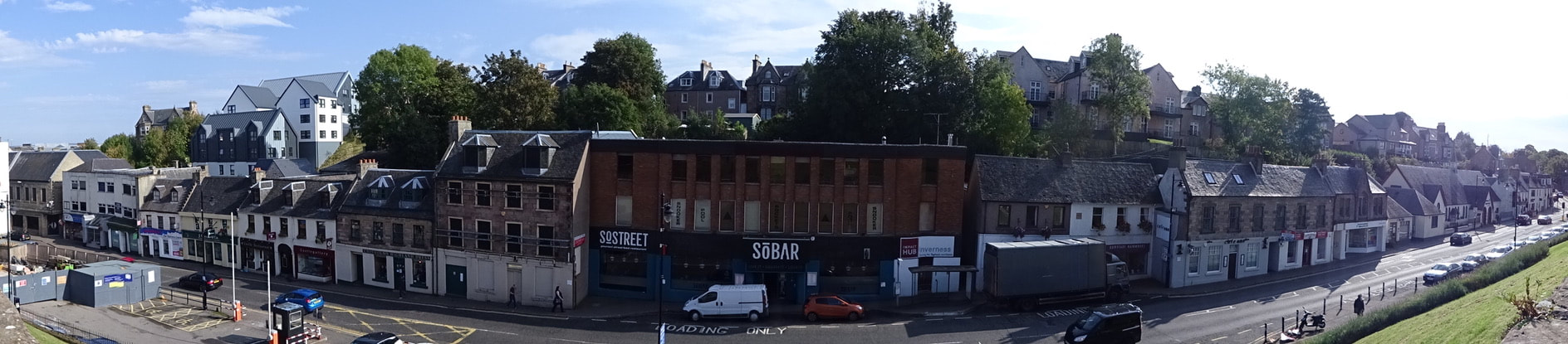
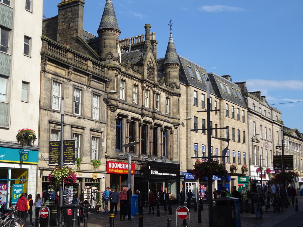
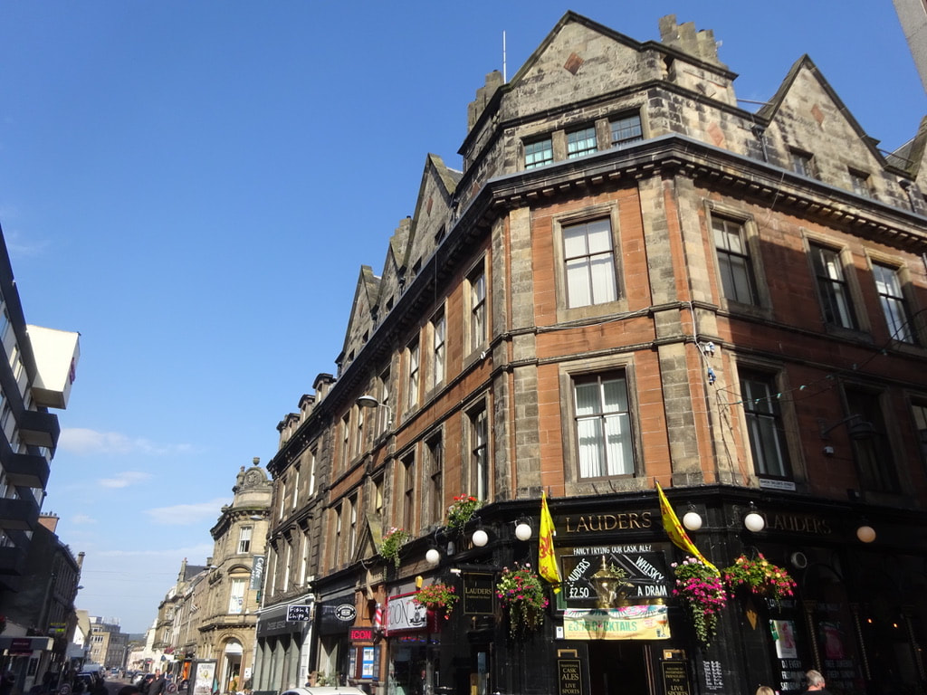
Monday, 30 September 2019

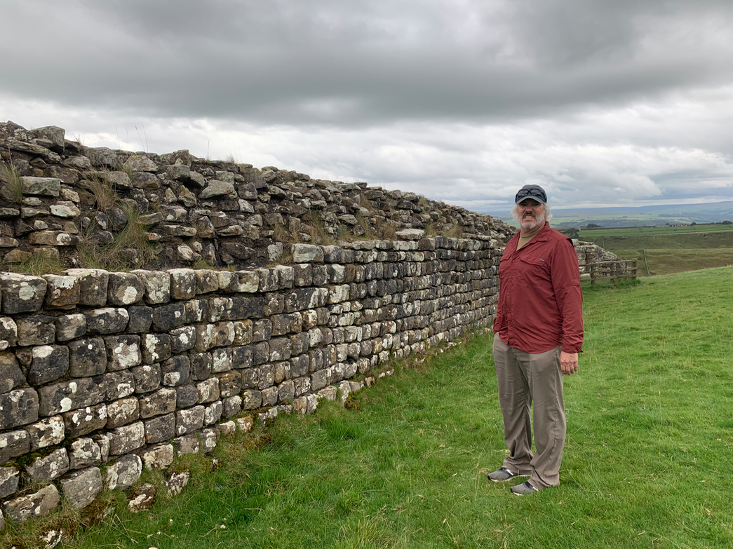
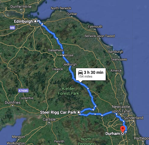
Today we drive south from Edinburgh and cross back into Northern England to Steel Rigg Car Park at Hadrian's Wall.

Picture
Picture
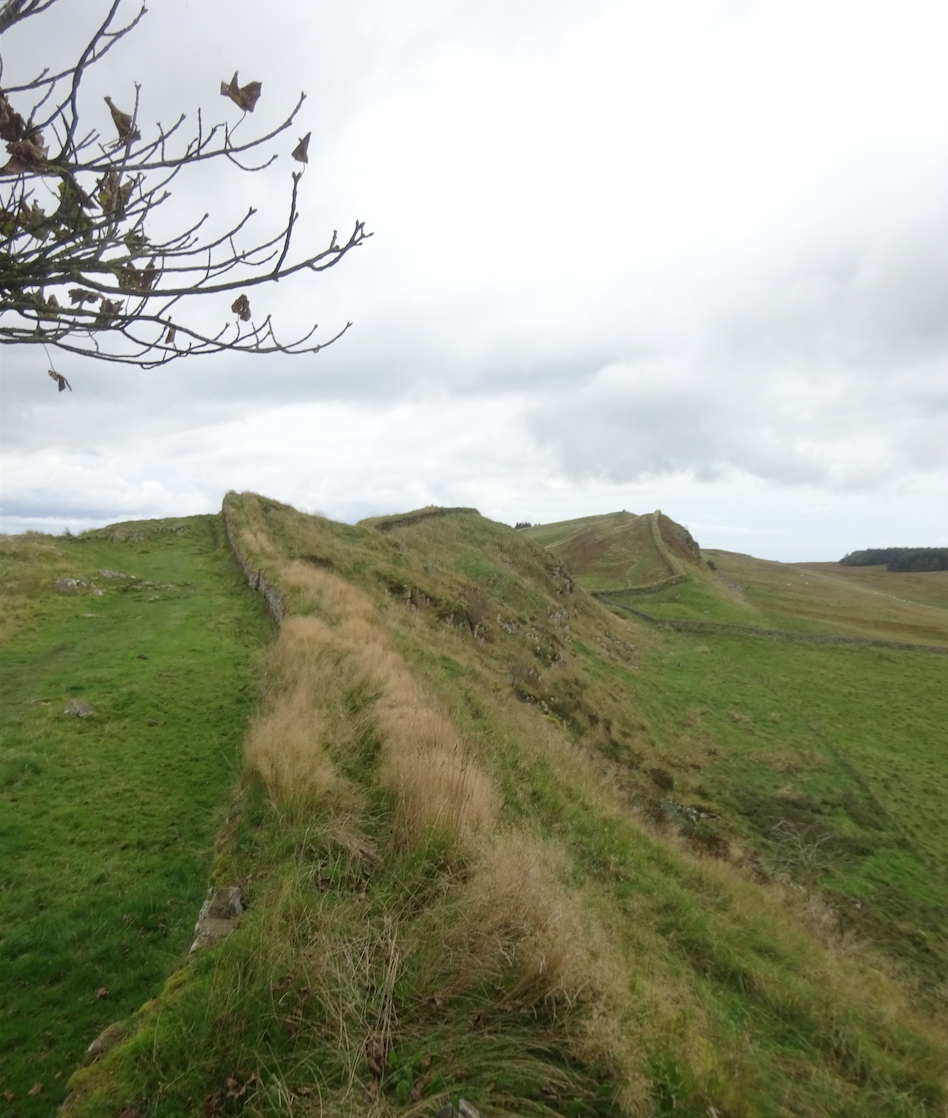
Hadrian's Wall is a former defensive fortification of the Roman province of Britannia, begun in AD 122 in the reign of the emperor Hadrian. It ran from the banks of the River Tyne near the North Sea to the Solway Firth on the Irish Sea, and was the northern limit of the Roman Empire, immediately north of which were the lands of the northern Ancient Britons, including the Picts.

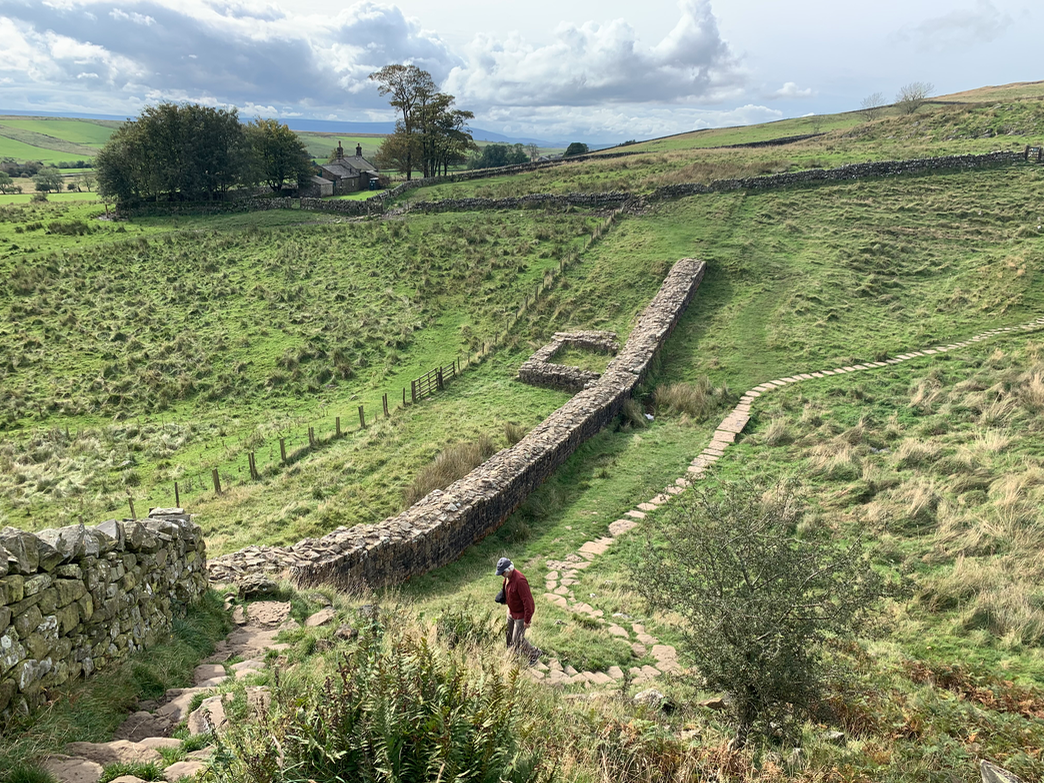
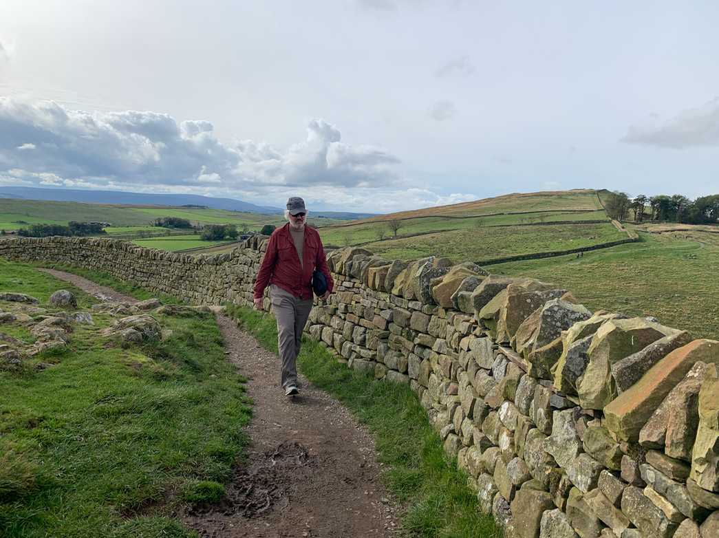
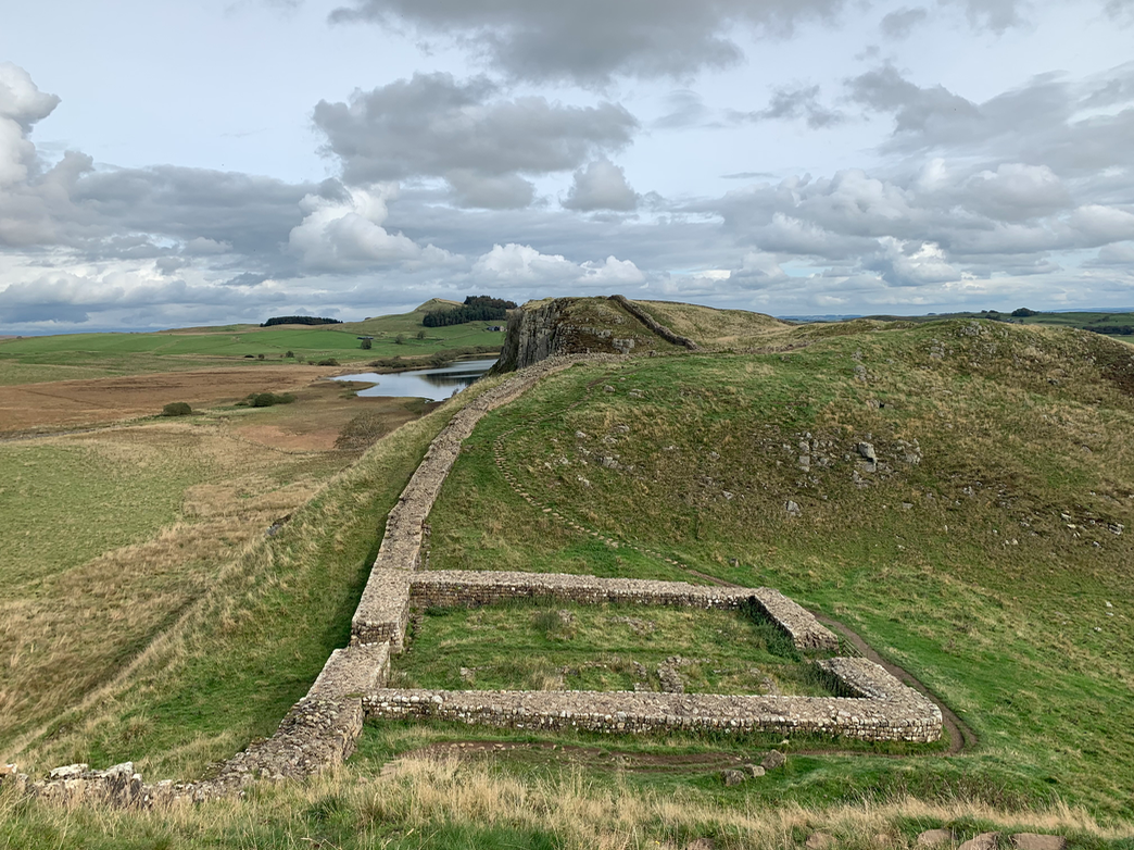
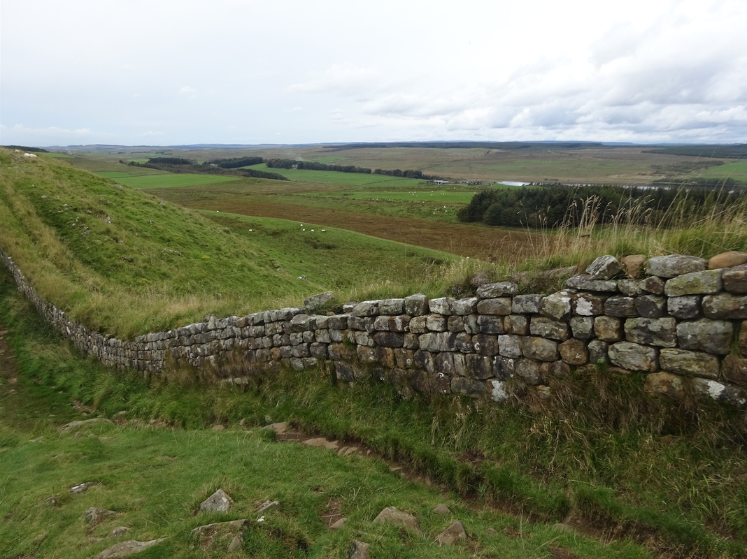
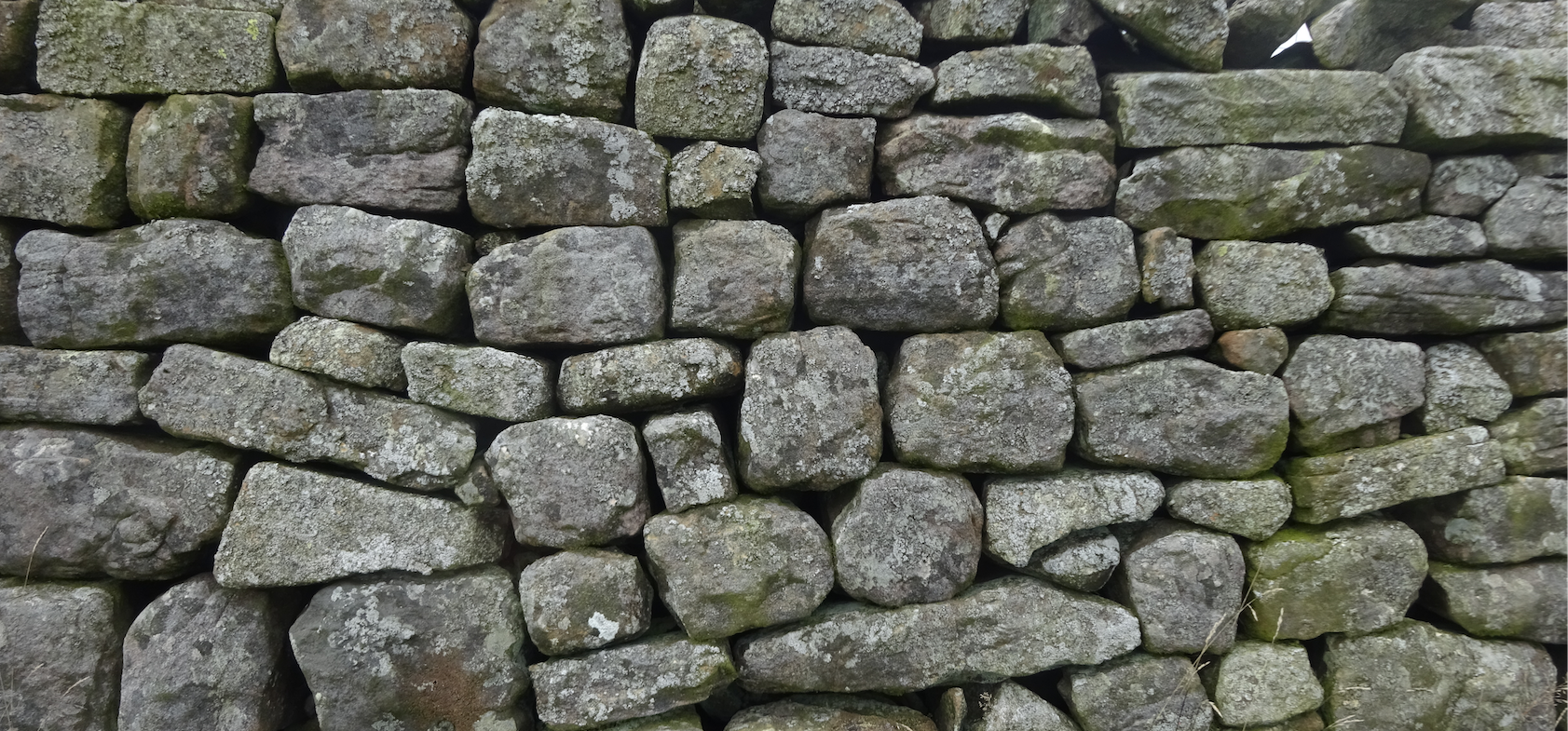
It had a stone base and a stone wall. There were milecastles, small forts with two turrets, every mile.  There was a fort about every five Roman miles. It is thought the milecastles were staffed with static garrisons, whereas the forts had fighting garrisons of infantry and cavalry. In addition to the wall's defensive military role, its gates may have been customs posts.

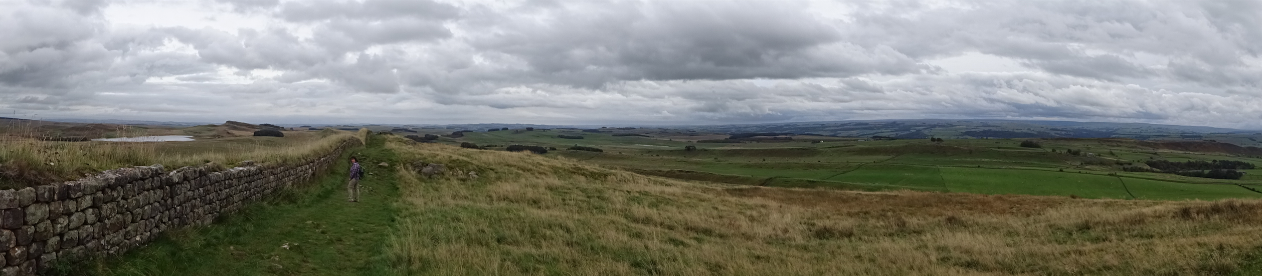
Remnants of the wall still stand and can be followed on foot along the adjoining Hadrian's Wall Path. The largest Roman archaeological feature in Britain, it runs a total of 73 miles (117.5 kilometres) in northern England.  Regarded as a British cultural icon, Hadrian's Wall is one of Britain's major ancient tourist attractions.

Hadrian’s Wall marked the boundary between Roman Britannia and unconquered Caledonia to the north. The wall lies entirely within England and has never formed the Anglo-Scottish border.  While it is less than 0.6 mi (1.0 km) south of the border with Scotland in the west at Bowness-on-Solway, in the east at Wallsend it is as much as 68 miles (109 km) away.

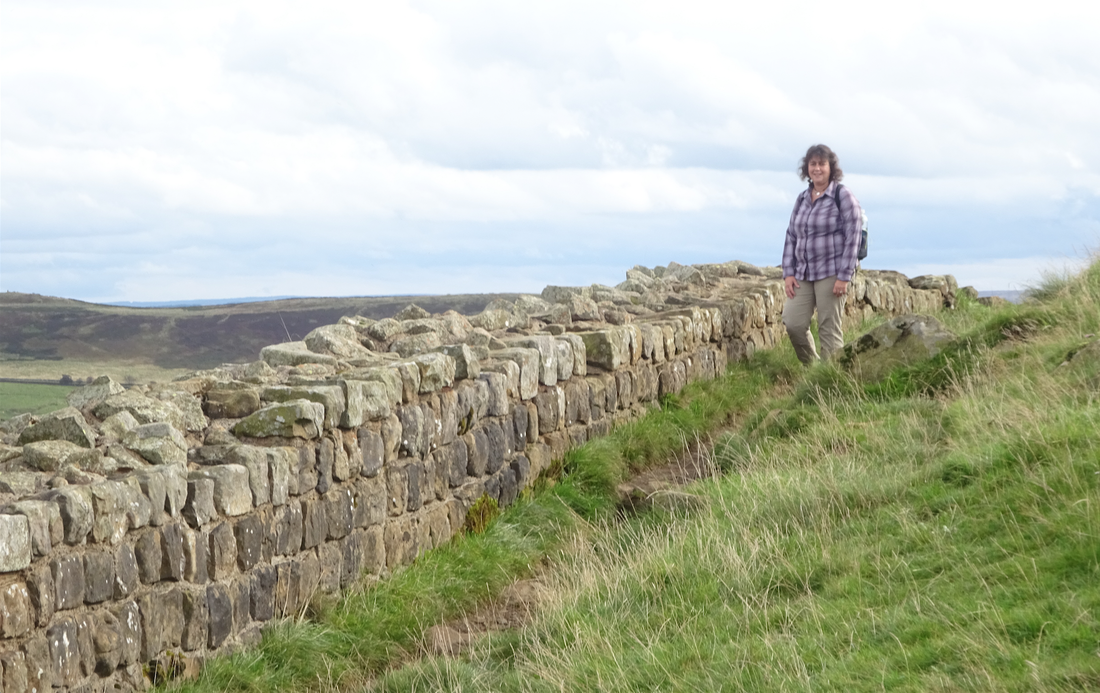
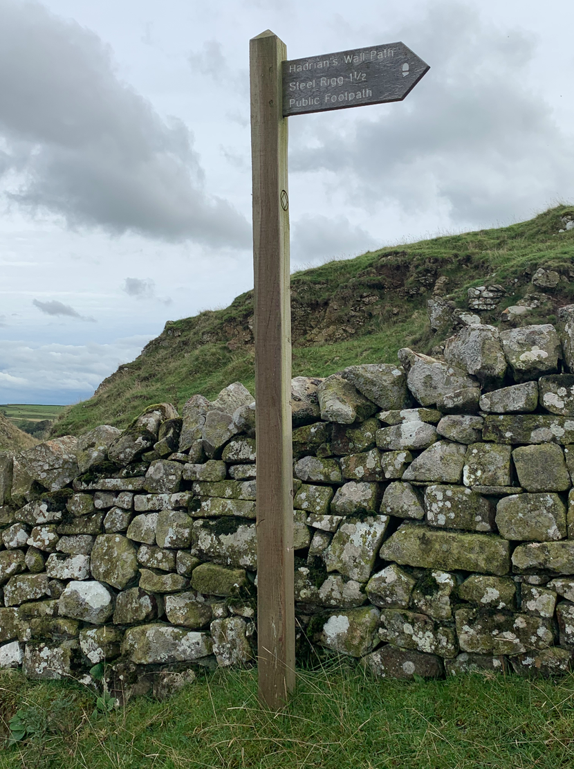
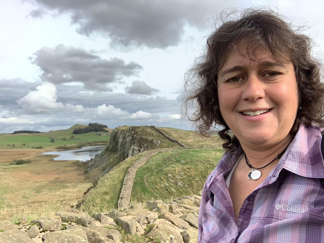
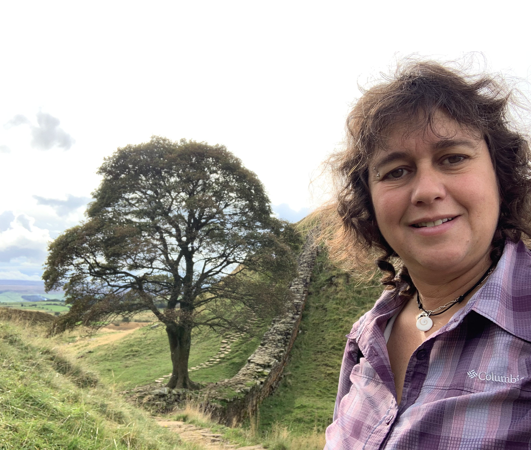
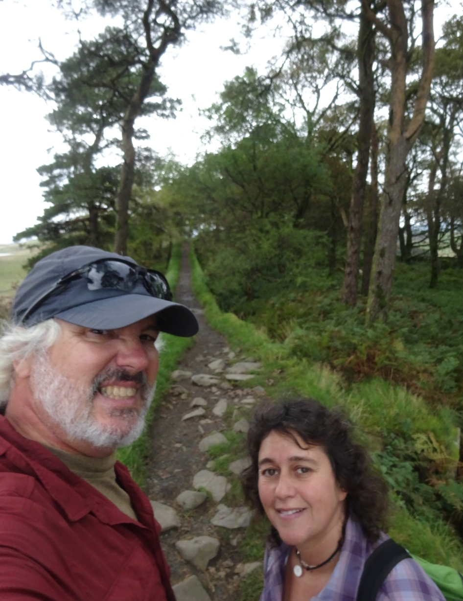
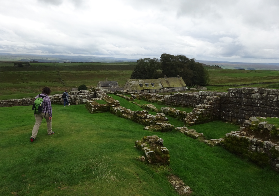
On Rick Steves' suggestion, we took the brief ridge walk next to the wall from Stell Rigg to Sycamore Gap to Housesteads Roman Fort to get what he calls the perfect taste of the scenery and history.


Picture
Picture
Picture
Picture
Picture
Picture
Picture
Picture
Picture
Picture


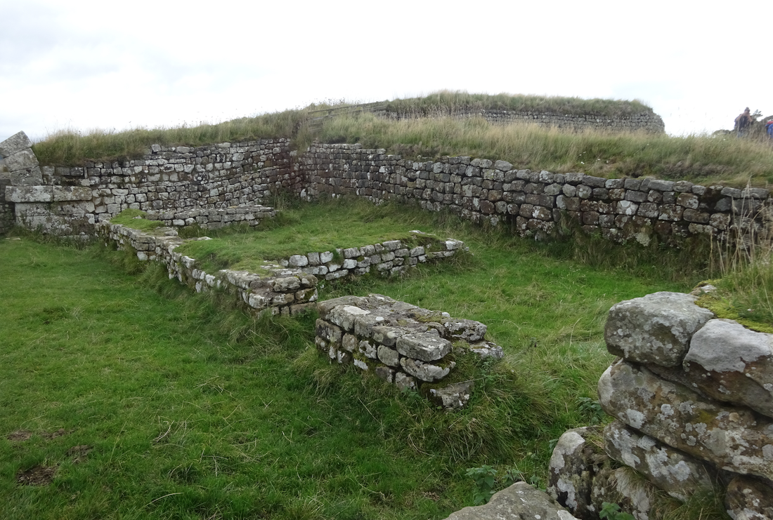
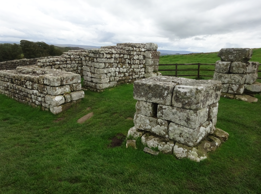
Roman milecastle in below two photos.

Picture
Picture
Picture
Picture

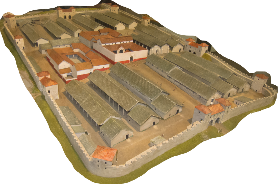
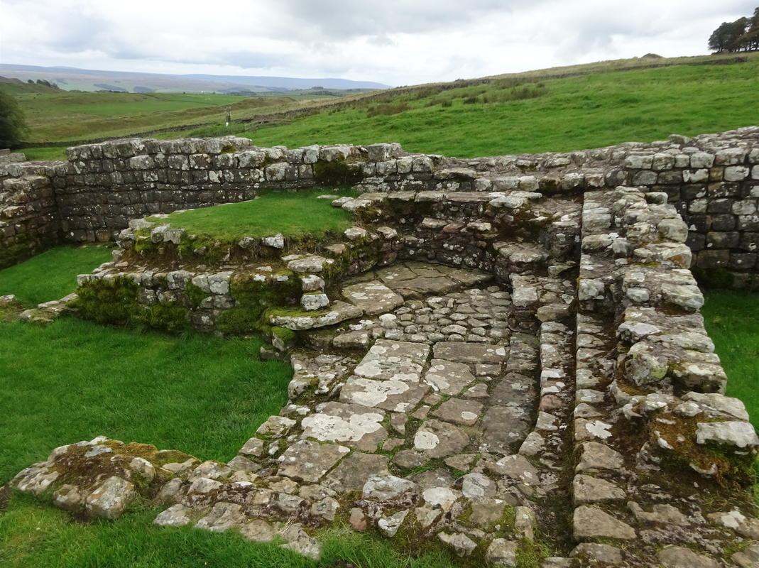
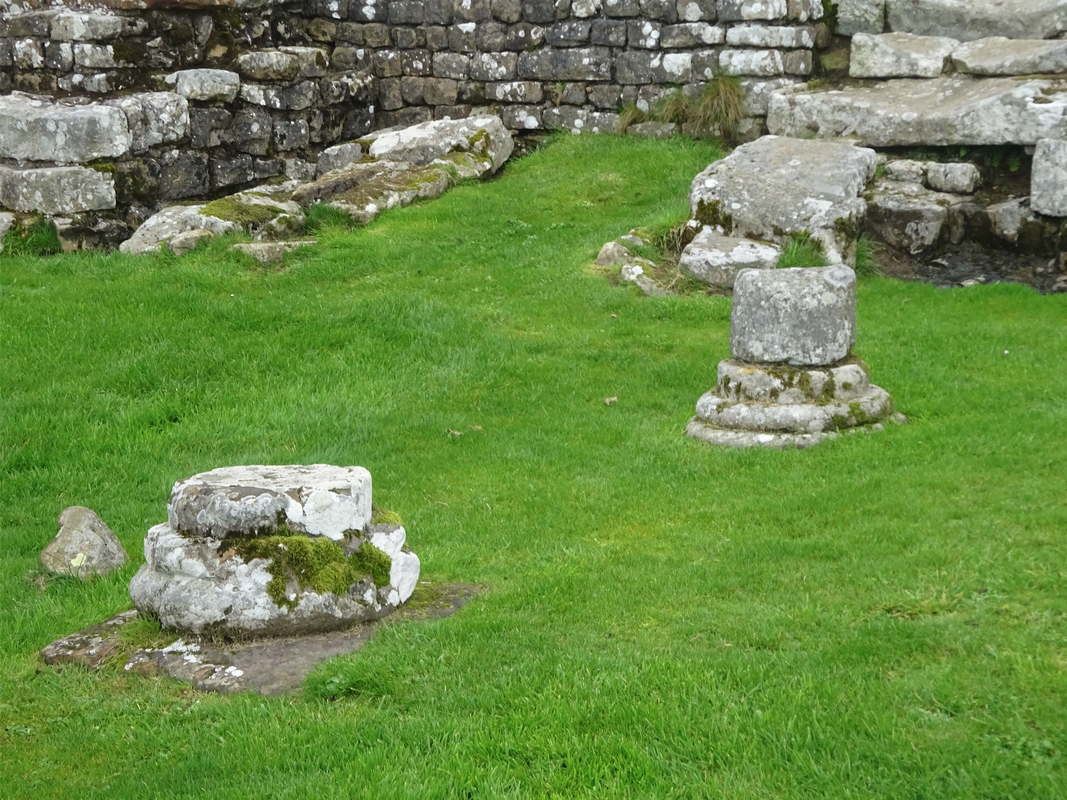
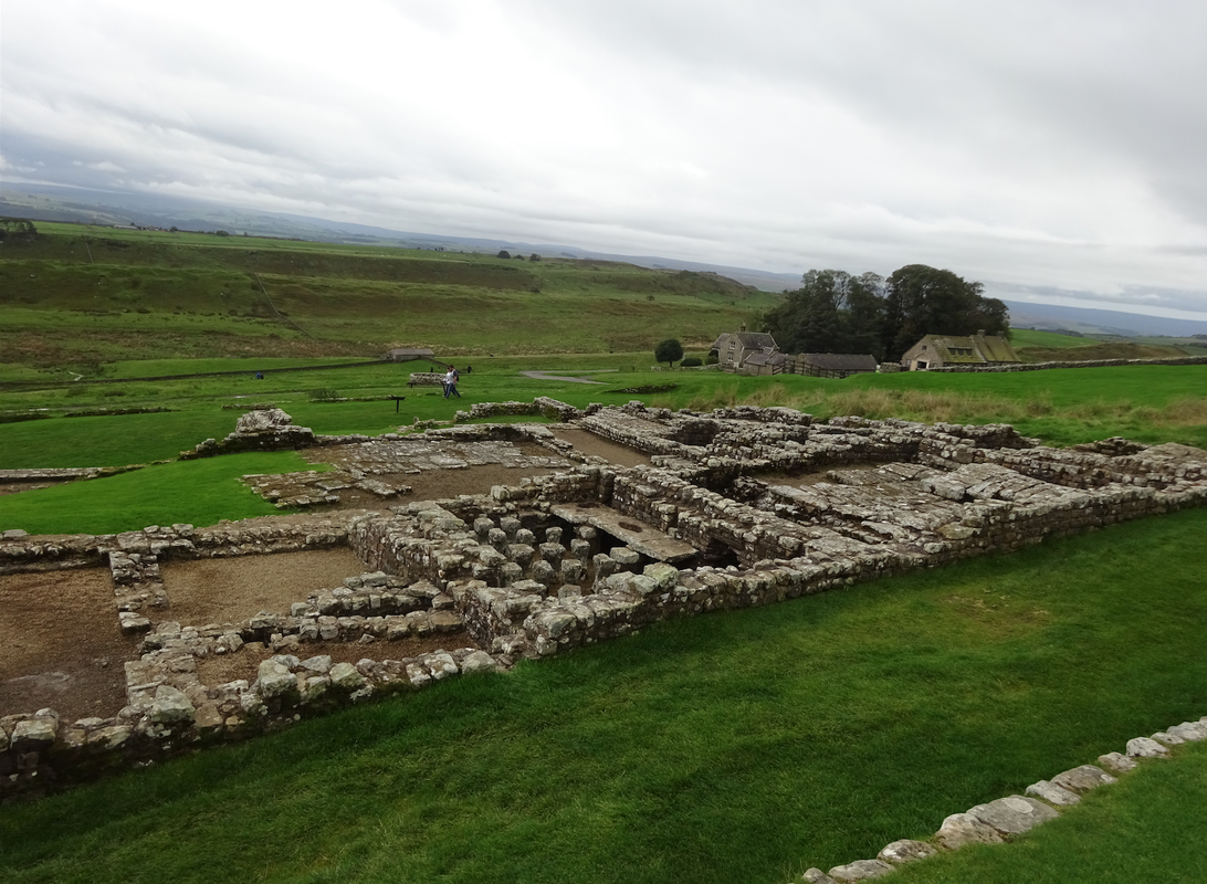
Housesteads Roman Fort is the remains of a fort on Hadrian's Wall. The fort was built in stone around AD 124, soon after the construction of the wall began in AD 122. The name of the 18th-century farmhouse of Housesteads gives the modern name.  The site is owned by the National Trust.
Picture
Picture
Picture
Picture
Picture
Picture
Picture

And then we drive on to Durham.  An unusually long drive for us in our tour of Ireland/United Kingdom.
Picture
0 Comments

Edinburgh Tour Day 2

9/29/2019

1 Comment

 
Sunday, 29 September 2019

On the way to the Gallery...
Picture
Picture
Picture
Picture
Picture


The Scottish National Gallery is located on The Mound in central Edinburgh and designed in a neoclassical style by William Henry Playfair, and first opened to the public in 1859.
Picture
Picture
Picture
Picture
Picture
Picture
Picture
Picture
Picture
Picture
Picture
Picture


Picture


We happened upon a mysterious meeting of antique public bus transport.
Picture
Picture
Picture


Picture
Picture
"Hey Iowa, I found your missing tractors!"


Wojtek (1942–1963) was a Syrian brown bear bought, as a young cub, at a railway station in Hamadan, Iran, by Polish soldiers evacuated from the Soviet Union. In order to provide for his rations and transportation, he was eventually enlisted officially as a soldier with the rank of private, and was subsequently promoted to corporal.  During the Battle of Monte Cassino, in Italy in 1944, Wojtek helped move crates of ammunition. After the war, lived out the rest of his life at the Edinburgh Zoo.


Picture
Picture
                                                 Tim is enamored by these construction lifts.
Picture
Picture

Now entering Edinburgh Castle.   "The fortified birthplace of the city 1,300 years ago, this imposing symbol of the city sits proudly on a rock high above the rest of Edinburgh.  The home of Scotland's kings and queens for centuries, the castle has witnessed royal births, medieval pageantry, and bloody sieges.  Today it's  a complex of various buildings, the oldest dating from the 12th century, linked by cobbled roads that survive from its more recent use as a military garrison.  The castle - with expansive views, plenty of history, and the stunning crown jewels of Scotland - is a fascinating and multifaceted sight that deserves several hours of your time."  Rick Steves
Picture
Picture
Picture
Picture
Picture
Picture

"'Mons Meg' is huge and once-upon-a-time frightening 15th century siege cannon that fired 330-pound stones nearly two miles. Imagine. "  Rick Steves
Picture
Picture
Left below, a cemetery of dearly departed garrison hounds.
Picture
Picture
Picture
Picture
Picture
Picture
Picture
Picture


Picture
Picture

Occupying part of the castle, the National War Museum Scotland.

Picture
Picture
Picture
Picture
Picture
HMS Edinburgh was a light cruiser of the Royal Navy, which served during the World War II.  Edinburgh saw a great deal of combat service during the Second World War, especially in the North Sea and the Arctic Sea, where she was sunk by torpedoes in 1942.  Her sister ship, HMS Belfast is moored on display near Tower Bridge.
Picture

                                                Enjoying some craft brew to finish the evening.
Picture
Picture
1 Comment

Edinburgh Tour Day 1

9/28/2019

0 Comments

 
Saturday, 28 September 2019
Pronounce it "Ed-in-burr-ah".

Rick Steves:  "Edinburgh is the historical, cultural, and political capital of Scotland.  For nearly a thousand years, Scotland's kings, parliaments, writers, thinkers, and bankers have called it home.  Today, it remains Scotland's most sophisticated city."

Today we walk the Royal Mile. 
The Royal Mile is a succession of streets forming the main thoroughfare of the Old Town. The term was first used descriptively in W M Gilbert's Edinburgh in the Nineteenth Century (1901), "...with its Castle and Palace and the royal mile between", and was further popularized as the title of a guidebook, published in 1920.

From the Castle gates to the Palace gates the street is almost exactly a mile (1.6 km) long and runs downhill between two significant locations in the royal history of Scotland, namely Edinburgh Castle and Holyrood Palace (he official residence of the British monarch in Scotland), hence its name the "Royal Mile". 

The Sun is back!  But don't let Gerri's clothing choice fool you, it's a bit short of 60F at this point, and will only get to about 62F.


Picture
Picture
Picture
Picture
Picture

Crap, we don't relish these crowds.  But we persevered, and found open space enough to press on.

Picture
Picture

Interesting things along the way.
Picture
Picture
Picture
Picture
If you were walking, you wouldn't have interested my camera - ha!
Picture
Picture
Picture
Picture
Picture
Picture
Picture
Picture
The final resting place of John Knox - or as best as can be established.
                                                                                                        Inlet of the North Sea in the distance.
Picture
Picture
Picture
Picture
Picture
Picture
Picture
Adam Smith (1723 – 1790) was a British economist, philosopher, and author born in Scotland, as well as a moral philosopher, a pioneer of political economy, and a key figure during the Scottish Enlightenment, also known as ''The Father of Economics'' or ''The Father of Capitalism''. Smith wrote two classic works, The Theory of Moral Sentiments (1759) and An Inquiry into the Nature and Causes of the Wealth of Nations (1776). The latter, often abbreviated as The Wealth of Nations, is considered his magnum opus and the first modern work of economics.


Picture
Picture
Picture
Picture

                                              Lots to see at the National Museum of Scotland

Picture
Picture
                                                                     Dolly (5 July 1996 – 14 February 2003) - the first mammal cloned
Picture
Picture


Picture


              It's "Miller Time"!

Picture


Picture
Picture
0 Comments

Edinburgh via Falkirk Wheel & The Kelpies

9/27/2019

0 Comments

 
Friday, 27 September 2019
Picture
Wikipedia:
The Falkirk Wheel is a rotating boat lift in central Scotland, connecting the Forth and Clyde Canal with the Union Canal. The lift is named after Falkirk, the town in which it is located. In 2002 it reconnected the two canals for the first time since the 1930s.


The plan to regenerate central Scotland's canals and reconnect Glasgow with Edinburgh was led by British Waterways. Planners decided early on to create a dramatic 21st-century landmark structure to reconnect the canals, instead of simply recreating the historic 11-lock flight that would take at least a half-day to traverse.

The wheel raises boats by 24 metres (79 ft), but the Union Canal is still 11 metres (36 ft) higher than the aqueduct which meets the wheel. Boats must also pass through a pair of locks between the top of the wheel and the Union Canal. The Falkirk Wheel is the only rotating boat lift of its kind in the world, and one of two working boat lifts in the United Kingdom, the other being the Anderton Boat Lift.
                                                    ___________________________________

In a few short weeks we would do the Anderton in our own boat (a rental).


Picture


Our timing was good, we were able to watch a canal boat (in this case the multi-passenger boat from the visitor center) be carried the 79 ft up, completing the process in about 15 minutes.
Picture
Picture
Picture
Picture
Picture
Picture

Finally, the boat moves out of the caisson, and onto the aqueduct, then onto the canal.

Picture
Picture

A pair of narrowboats enter the lift going "down" canal.  And into a traditional lock at the bottom.

Picture
Picture
                                           ________________________________________________

We drive on to see The Kelpies.


The Kelpies are 30-metre-high horse-head sculptures depicting kelpies (shape-shifting water spirits), located in Grangemouth, near Falkirk, standing next to a new extension to the Forth and Clyde Canal.  The sculptures were designed by sculptor Andy Scott and were completed in October 2013.  The sculptures form a gateway at the eastern entrance to the Forth and Clyde canal, and the new canal extension built as part of The Helix land transformation project. The Kelpies are a monument to horse-powered heritage across Scotland.
Picture
                                           ________________________________________________ 

Picture
Picture


Now heading to Edinburgh, we find a really big bridge and some more good beer.


Picture
Picture
Picture


We end the day In Edinburgh and settle in for a few days.  Back in a really big town once again.
Picture
Picture
Picture
Picture
Picture
Picture


Picture
Picture
Picture
Picture
0 Comments

Stirling

9/26/2019

0 Comments

 
Thursday, 26 September 2019
After waking up in Stirling, we head up to Wallace Monument.  The National Wallace Monument is a tower standing on the shoulder of the Abbey Craig, a hilltop overlooking Stirling in Scotland.  It commemorates Sir William Wallace, a 13th-century Scottish hero - Hollywood calls him Braveheart.

Excerpted from Wikipedia:
The tower was constructed following a fundraising campaign, which accompanied a resurgence of Scottish national identity in the 19th century.  The foundation stone was laid in 1861 and completed in 1869 at a cost of £18,000, the monument is a 67-metre (220-foot) sandstone tower, built in the Victorian Gothic style.

The tower stands on the Abbey Craig, a volcanic knob above Cambuskenneth Abbey, from which Wallace was said to have watched the gathering of the army of King Edward I of England, just before the Battle of Stirling Bridge in 1297. Visitors climb the 246-step spiral staircase to the viewing gallery inside the monument's crown, which provides expansive views of the Ochil Hills and the Forth Valley.

Picture
Picture
View from the foot of the Monument, with a look, to the left, of the rain we'll face on and off today.
Picture
Picture
Picture
Picture
Picture
Picture
Picture
Picture
Picture
Picture
Picture
Picture

The Wallace Sword is believed authentic, a 1.63 m (5 ft 4 in) long-sword weighing almost three kilograms (seven pounds).

Picture
Picture
Picture
Picture
  Neat masonry in the form of rope.                                    View of the Great Hall at Stirling Castle:
Picture
Picture

We drive on to "Bridge of Allan" - a quaint little town just a bit up the road north for lunch and a brewery.
Picture
Picture
Picture
Picture
           The beer we sampled was excellent - but no pints could be drained, we had a castle to tour.
Picture
Picture

And then we head back to Stirling to take in Stirling Castle.  And find amazing sights along the way.
Picture
Picture
Picture
                                   Wallace Monument can be seen at the center of this photo below.
Picture


Wikipedia:
Stirling Castle is one of the largest and most important castles in Scotland, both historically and architecturally. The castle sits atop Castle Hill, an intrusive crag, which forms part of the Stirling Sill geological formation. It is surrounded on three sides by steep cliffs, giving it a strong defensive position. Its strategic location has made it an important fortification in the region from the earliest times.

The castle construction began in the early 12th century, but most of the principal buildings of the castle date from the 15th and 16th centuries. A few structures of the fourteenth century remain, while the outer defenses fronting the town date from the early eighteenth century.

Before the union with England, Stirling Castle was also one of the most used of the many Scottish royal residences, very much a palace as well as a fortress. Several Scottish Kings and Queens have been crowned at Stirling, including Mary, Queen of Scots, in 1542, and others were born or died there.

There have been at least eight sieges of Stirling Castle, including several during the Wars of Scottish Independence, with the last being in 1746, when Bonnie Prince Charlie unsuccessfully tried to take the castle.

Aerial view as posted in Wikipedia by Andrew Shiva:

Picture
Our view from the castle ramparts:
Picture
The Great Hall, from about 1500, restored 500 years later at the end of the 20th century.
Picture
Picture
Picture

The ceiling of the Great Hall, and a tapestry wall hanging.
Picture
Picture
Picture
We continue our tour, of the living spaces elsewhere in the castle.
Picture
Picture
Picture
Picture
Picture
Picture
Picture
Picture
Picture
Picture
We were able to get a short guided tour of the grounds, with another rainbow thrown in for effect.
Picture
Picture
Display of restoration work - the original is on the right, with a demonstration of creating a replica and illustrating how these medallions originally appeared.
Picture
Picture
Picture
Picture
Kitchen displays staged within the original facilities.
Picture
Picture

Restoration/conservation continues on the castle.
Picture

The castle's north gate is probably the oldest part of the surviving castle, dating partly from the 1380s.

Picture
We get one final long view, and then descend out of the castle into a cemetery and church, before reentering town.
Picture
Picture
Picture
Picture
Picture
Picture
And then we tried out a Scottish pub with massive character.
Picture
Picture
Picture
0 Comments

Stirling via St. Andrews and Anstruther

9/25/2019

0 Comments


Wednesday, 25 September 2019

Our B&B room is very small, but we were able to get a good night sleep.  Even though it is a Bed & Breakfast, the breakfast is not included in the price and they want £15 per person, so we decided against it.  Today we have a Rick Steves walking tour of St. Andrews to follow, so we will just grab something to eat along the way.

The walk starts at "The Old Course"of the St. Andrews Golf Course where golf has been played since the 15th century, and is considered the oldest course in the world.
Picture
The Royal and Ancient Golf Club (R&A) is the oldest and most prestigious golf clubs in the world, founded in 1754.  It sits close to the 18th green as can be seen in the second photo.
Picture
Picture
Just across the street from the 18th green and the R&A golf club is the Hamilton Grand.  It is rumored that Samuel L. Jackson has an apartment here.
Picture
We continued our walk and was about to arrive at St. Andrews University, but first we passed this ridiculous name for a street.
Picture
Right in front of the gateway into the campus is the initials "PH".  This is where Patrick Hamilton, a student at the university, was burned at the stake on 29 February 1528 at the age of 24.  He was found guilty of heresy and sentenced to death for teaching Lutheran doctrines he had learned from Martin Luther.  This made him the first martyr of the Scottish Reformation.

According to student legend, if you step on the initials, you will fail your exams.
Picture
We entered under the clock tower into this beautiful quad surrounded by building dating back to the 1400's.
Picture
Here is a crazy student tradition as stated in Wikipedia "When wearing their traditional red gowns, students in each year may be identified according to the way they wear their gowns. In the first year, the gown is worn on the shoulders, in the second year it is worn slightly off the shoulders. In the third year arts students wear their gowns off their left shoulders, and science students off their right shoulders. Finally, fourth years wear their gowns right down to their elbows, ready to shed their scarlet gowns for the black graduation gown."

We were lucky enough to visit the campus while students were providing tours, so we saw this gown wearing tradition.
Picture
Here is the campus chapel that dates back to 1450.  This is where the famous alums Prince William and Kate Middletown wed.
Picture
We left the campus and walked by the ruins of St. Andrews castle that was destroyed during the Scottish Reformation.
Picture
Next came the ruins of St. Andrews Cathedral built in 1158 and yet another casualty of the Scottish Reformation.
Picture
After the walk we were supposed to play a round of putting at the putting greens that are open to the public, but I misread the hours and we missed it. So, we walked back to the 18th hole of the Old Course at St. Andrews to have one more look.

This morning when we were there, we noticed that they were setting up for the Alfred Dunhill Championship that begins tomorrow.
Picture
Picture
When we looked up to the tee area, we noticed camera around someone getting ready to drive.  We figured it was someone famous so we took a few photos.  We found out later that it was Jon Rahm, a professional golfer.  I guess they are playing a practice round today.
Picture
Picture
The next player on the tee was Rory McIlroy.
Picture
After watching these pros hit a few balls we were ready to get on the road.  The guidebook mentioned a town called Anstruther with a great fish and chips place.  Come to think of it, we met a couple at a bar and they mentioned this same place, so we drove the 45 minutes to Anstruther and walked around the harbor some.
Picture
Picture
We were finally ready to try the fish and chips, so we headed to Anstruther Fish Bar.  They even told us what fishing boat caught today's fish.
Picture
Picture
I have to tell you, the fish was really delicious. By this point we have eaten fish and chips multiple times, and this was definitely one of the best.

After eating, we decided to walk around town a little to work off some of the grease we just digested.  This town really is beautiful.
Picture
Picture
Picture
We got back to the car and drove 2 hours to Stirling.  After getting settled into our apartment we headed into town for dinner.  Oh, did I mention that today is Tim and my 10th anniversary!   Tim picked a really nice place, but when we got there they were booked, so we walked around looking for another place to eat.  We settled on an oriental restaurant that had a little of everything from Japanese to Chinese to Thai to Korean.  We decided to order a bottle of wine and eat sushi for dinner.

After a nice dinner we went back to the apartment and called it a night.  We are in Stirling for two nights, so tomorrow morning we can relax a bit and not rush to get ready and checkout.  That is a nice thing.
0 Comments

St. Andrews via Dundee

9/24/2019

0 Comments


Tuesday, 24 September 2019

Today we are driving to St. Andrews, but Rick Steves suggests we stop in Dundee to visit Discovery Point and the RRS Discovery along with Verdant Works Jute Museum.  Both of these museums are marked in his book with a triangle symbol meaning they are both "worthwhile" to see.  Usually we take his advice, but a jute Museum?  I didn't even know what jute is.  It turns out that these two museums have a combo-ticket and the jute museum has free parking, so what the heck.  We headed there first.

It turns out jute is a plant that grows predominantly in India and can be processed into a fiber that is woven to make such things as burlap.
Picture
Jute harvesting
thIn the 1830's, Dundee businessman developed an industry built around the processing of jute which had a huge market before plastic was invented.  Burlap was used for sacks, rope, sails, canvases, and carpeting.  This lucrative industry made Dundee a thriving metropolis for 70 years until jute factories opened up in India and then eventually the development of plastic.

The cool part of the museum is they had small working models of the actual machines that were used to process the jute from the raw material to woven sheets.  There was a volunteer that demonstrated each step by turning on the machine to let us see it work.
Picture
Picture
Here are some photos Tim took of the facility. 
Picture
Picture
Can you believe that we spent over 2 hours learning about jute?  It was definitely more interesting than we ever thought possible.  Again...Rick Steves was right.

Next stop is the Discovery Point Museum and the RRS Discovery.  This museum tells the story of the Royal Research Ship (RRS), and the research missions to Antarctica.

Below is a representation of the construction of the Discovery.  At the end of the 19th century, ships of any size were pretty much being built of steel, but wood could take the crush of ice and icebergs better than steel, and so they built this ship of sail (and steam powered propellor) specifically for the mission of discovery.
Picture
Displays showing geology (depth soundings) and biology (drawing animals), elements of the first mission of 1901.
Picture
Picture
Here is the RRS Discovery - not a replica! - the actual ship.
Picture
We board - with the top end of the steam engine before us.  Actually the only significant part of the ship that wasn't preserved was the boiler and steam engine - the boiler was scrapped for steel for WWII, and the engine sold off.
Picture
Gerri in a coal hold.  The slots just above her head hold salt which soaks up any leaks from the outer planks, as well as abating rotting of wood from the moisture.
Picture
Crew quarters for the seaman (enlisted).
Picture
Officer's mess, with their quarters surrounding it.
Picture
The bridge - open to the elements.  The structure behind is a "way out there" art museum.
Picture
The sail rigging still standing tall - however, the ship isn't maintained in a 'going to sea' condition.
Picture
That art museum was just around the corner, and free, so we checked it out.  It's called V&A Dundee (Victoria and Albert).
Picture
It's art - a robotic arm creating bubbles.
Picture
An homage to Scotland's eastern seaside cliffs - the exterior look of the building (not ships as we had guessed) - we experienced many of these cliffs in the days just before.
Picture
Onward to St. Andrews, after checking into our little BNB, we took in another brewery...
Picture
...and Gerri followed it with a flight of gin and tonic.
Picture
Tomorrow we continue our tour of St. Andrews - you'll read some things that didn't work out, but some things did.
0 Comments

Pitiochry

9/23/2019

0 Comments


Monday, 23 September 2019

We had our last night in one of the best AirBnB's we have stayed in on this trip.  We packed up the car and were out just before 10 AM.  Today we will start with a history lesson and visit the Culloden Battlefield. 

The Battle of Culloden (16 April 1746) was fought between the Jacobites, with a strong support of Scottish Highland clans, and the currently reigning King George II.  The Jacobites were lead by Charles Edward Stuart (AKA Bonnie Prince Charles) who believed the throne belonged to his family.

Leading up the this battle, the Jacobites were doing well and won many smaller battles.  They even considered marching into London, but turned back and returned to Scotland.  By this time, the Government had time to study and figure out the Jacobites weaknesses.  When the two sides finally met in Culloden, the Jacobites were decimated in under 1 hour losing about 2,000 troops to the Government's 400 troops.

In the aftermath, the Government went after and killed all who sided with the Jacobites to ensure an uprising never happened again.  They also went after the Gaelic culture and pushed to undermine the Highland clan system by taking away land and making it illegal for non-military to wear tartan.
Picture
Picture
This is a memorial erected on the battlefield in 1881 to remember the commemorate the highlander who lost their lives.  There are also headstones marking mass burial sites of clans.
Picture
Picture
Just on the other side of a fence from the battlefield were three highland cows.  They seem to like posing for the camera.
Picture
Picture
Can you believe that we spent over 3 hours at this battlefield?  Wow...I think we now know more about this battle than any other.

We can't have a drive in Scotland without a stop to see at least one Neolithic rock formation.  Here is the Clava Cairns.  This formation consists of 3 Neolithic burial chambers along with stone rings 3,000 - 4,000 years old.
Picture
Burial carain
Picture
Large standing stone
We made it to our overnight town on Pitiochry around 4:30 PM.  We checked into our hotel and then walked down into town. 
Picture
Pitiochry town center
We were quite hungry, so we first ate (me: fish and chips; Tim: donnar kabab) then continued walking around.

Here is a nice display commemorating the 2019 Solheim Cup, a match tournament between the top American and Europe women golfers.  The tournament was just last week...by the way, Europe won.
Picture
Our town walk continued and took us on a pedestrian bridge over the River Tummel.  Tim loves this photo of a tour guide waiting for his group to catch up.
Picture
Picture
After crossing the river, we walked up to and over the Pitiochry Dam.
Picture
View from the top of the dam.
Picture
Tim took this shot as we entered back into town.  This is the Pitiochry Church of Scotland. 
Picture
We made our way back up the hill to our hotel.  We stopped at the bar and had a pint of beer and tried a couple of different gins (Me) and whisky (Tim).  We then went back to our room and called it a night.
0 Comments

Inverness - Day 2

9/22/2019

0 Comments


Sunday, 22 September 2019

We were able to sleep in this morning since we are where we are going today.  Today we walk around Inverness and see what this town has to offer.  We got up and had a casual breakfast.  It was raining outside, so we hung out on the comfy reclining sofa for a couple of hours catching up on the blog and watching TV.  The rain finally stopped, so we left the apartment right at noon.

It is a 15 minute walk to get to the center of town where our walking tour began.  This clock tower was built in 1791.  It was the collection point for local taxes.
Picture
Across the street, is the City Hall (1882).
Picture
Up the hill from the City Hall is the Inverness Castle.  This castle is now the courthouse, but we walked up to it to see the view.
Picture
Picture
Here is the view of the town from the castle above.
Picture
The architecture in Inverness is Victorian from the 1800's.
Picture
Picture
About halfway down this street was the Abertarff House, the oldest house in Inverness.  There was a sign in front of it stating free entry, so Tim and I went in.  It was just a room, but there was a young worker that took the time to tell us the story of lots of kings and queens with numbers after their name.  I don't know how these people keep all these kings and queens straight.  He pretty much built up the story that leads to the Battle of Culloden which is a battlefield we are visiting tomorrow.  He stopped just short of the battle and said the story will continue for us tomorrow ta the battlefield.

This is the Old High Church which dates from the 1000's.  This is where, in the sixth century, the Irish evangelist monk St. Columbra brought Christianity to the Scottish Highlands where he preached to the Picts (pagans).
Picture
That down there is a pedestrian bridge called the "Bouncy Bridge."  As soon as we got on it, we knew why it was called this.  I was so amazed at how much this bridge bounces as you walk along along.
Picture
Picture
Tim took this nice panorama from the bouncy bridge.
Picture
After completing our walking tour around Inverness, Rick Steves suggested walking along the bank of the RIver Ness.  We walked about 1.5 miles.  The trail along the east bank is "Ladies Walk."
Picture
After about 10 minutes we arrived at the WWI memorial.
Picture
What a beautiful walk.  There was actually an island in the river that a pedestrian bridge went to.  We saw lights hanging from trees and posts.  This walk would probably be amazing at night.
Picture
When we got to Bught Park it started raining...as usual.  We walked back on the west bank of the river and stopped at a local pub called Tarry Iie Bar.  I picked it since it looked like a dive on Google maps, and I was right. I felt like this could be a local bar in any small town in the United States.  There was even a birthday cake and singing Happy Birthday to one of the bartenders.  It was a nice pint.

We then walked back the apartment and snacked on food that we have on hand.  TV watching, surfing, and blogging and then to bed.  Tomorrow we have a 2 hour drive to Pitiochry with a couple of stops along the way.
0 Comments

Inverness - Day 1

9/22/2019

0 Comments


Saturday, 21 September 2019

Oy...it was a very early morning.  Tim got out of bed at 5:10 AM which at least gave me another 45 minutes or so to sleep.  We showered, dressed,  packed up the car, and were ready to leave just after 6:30 AM.  We have to check into the 7:45 AM ferry by 7:15 AM.

We made it by 7 AM and loaded onto the ferry just before 7:30 AM.  Unlike the ferry we came over on that had very little people on it, this ferry was filled with teenage boys rugby teams.  We managed to find a seat in an area with only a few of them.  Tim slept while I played with the phone. It was only a 1 hour ride and we arrived back to the main land before 9 AM. 

We disembarked the ferry and headed east 5 miles to John O'Groats that marks the northeastern corner of the Isle of Britain with the other end being Land's End, 874 miles to the southwest in Cornwall.  By the way, we plan on being in Cornwall in about 1 month.  Here at the end, is a signpost that tells you how far places are.  New York is 3,230 miles and Edinburgh is 273 miles.
Picture
Here is another sign near-by that states we are at the end of the Isle of Britain.
Picture
Although this spot has the glitzy sign, the actual end is Duncansby Head Lighthouse, just up that road.
Picture
Here we are...at the actual end.
Picture
Rick Steves mentioned 1 mile hike from here to the Duncansby Stacks.  We had no idea what he was talking about, then we walked over a rise and there they were.
Picture
Getting closer....
Picture
Wow...pretty cool.
Picture
We made it.  It was a bit windy, but well worth the 20 minute walk.
Picture
Here is Tim enjoying the sites.
Picture
We made it back to the car and headed south towards Inverness, the stop for tonight.  The road south wasn't as scenic as the road we took to to get to the north, but it was beautiful plus a two-lane road, so definitely easier to drive.
Picture
Picture
Just before Inverness, we stopped at Black Isle Brewing Company and had some tastes.  It was really good beer, so we bought four of them to take with us.
Picture
Black Isle Brewing Company, Munlochy, Scotland
This brewery is set on a farm where they grow their own ingredients. It was a really nice setting.
Picture
Onward to Inverness.  But, before we check into our AirBnB, we decided to check out Loch Ness and see if we can have a sighting of Nessy.  By coincidence we wound up here on the same day as there was a meetup started on Facebook called "Storm Loch Ness, Nessy Can't Stop Us All."  This was obviously an answer to the Area 51 raid planned in the United States.
Picture
Is this a sighting of Nessy?  Is this one of Nessy's teeth that Tim found on the shore?
Picture
Picture
Who knows...but I do know that Loch Ness, is beautiful and Nessy picked a great place to hang out.
Picture
We then drove a few more miles up Loch Ness to Urquhart Castle.  Like other castles in Scotland, we didn't go inside, we just enjoyed the amazing view.
Picture
We then drove the 25 minutes back to Inverness and checked into our AirBnB.  As soon as we entered Tim loved it.  He said this is his favorite AirBnB we have stayed in during this trip so far.  At this point he only saw the TV and the leather sofa / recliner...ha.  It wound up that this is a really nice place, so I'll give it to him that this is one of the nicer ones.
Picture
After checking in, we walked to town.  It winds up that the brewery we stopped in at the way here has a taproom in town that serves their beer on tap and pizza.  So we went there, had a few pints and a couple of pizza, went next door for gelato, then returned to the AirBnB.

Since we were up just after 5 AM this morning, we made an early night of it.  I went to bed around 9:30 PM and Tim soon followed.  Tomorrow we spend the day exploring Inverness.  No rush to get up, so it should be a relaxing morning.
0 Comments
<<Previous
    Ireland & UK Home
    Blog summary

    Archives

    December 2019
    November 2019
    October 2019
    September 2019
    August 2019

    RSS Feed

Powered by Create your own unique website with customizable templates.